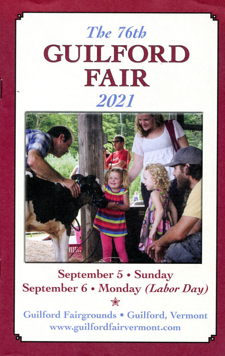
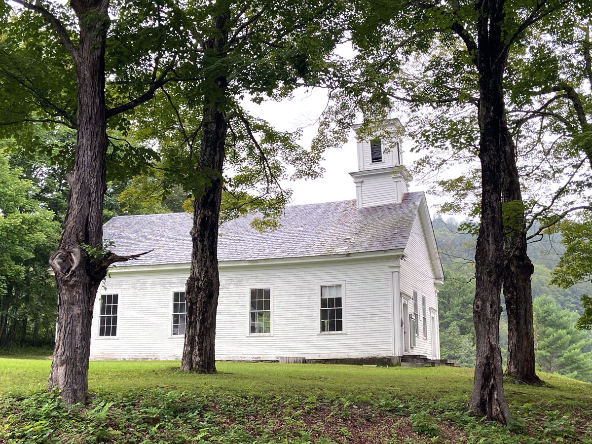
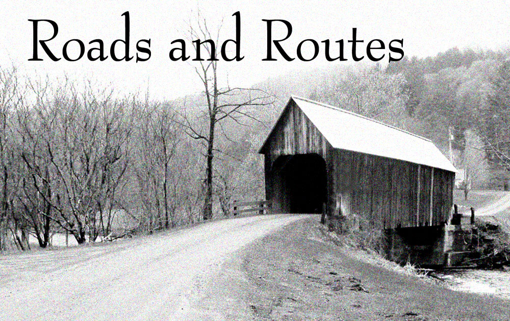
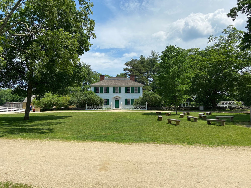
I had a great day today, and am racing with limited time tonight to get this post done and to you to encourage you to visit the Guilford Fair tomorrow, Labor Day. I passed the remote, rural fairgrounds several months ago, and said, “Ray, make sure you experience it.” This morning with friends we headed down I-91 to Exit 1, South on US 5, turned right at the country store, took the first left, meandered, and arrived to park in the fields. Free to park, and $5 admission for seniors, yes I am.
As you look through, remember you can click my galleries for larger views.
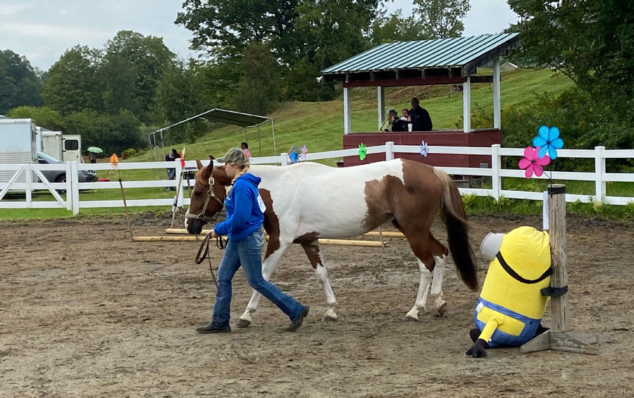
Passing in, at this first ring this young lady was practicing an obstacle course with her horse for a later competition.
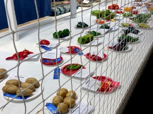
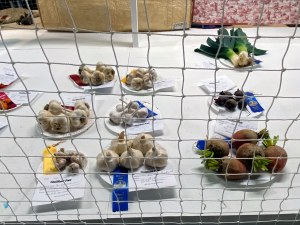
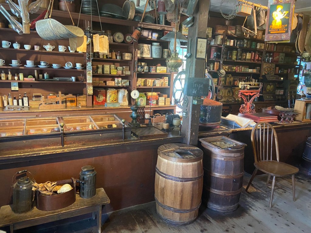
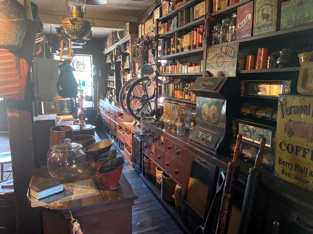
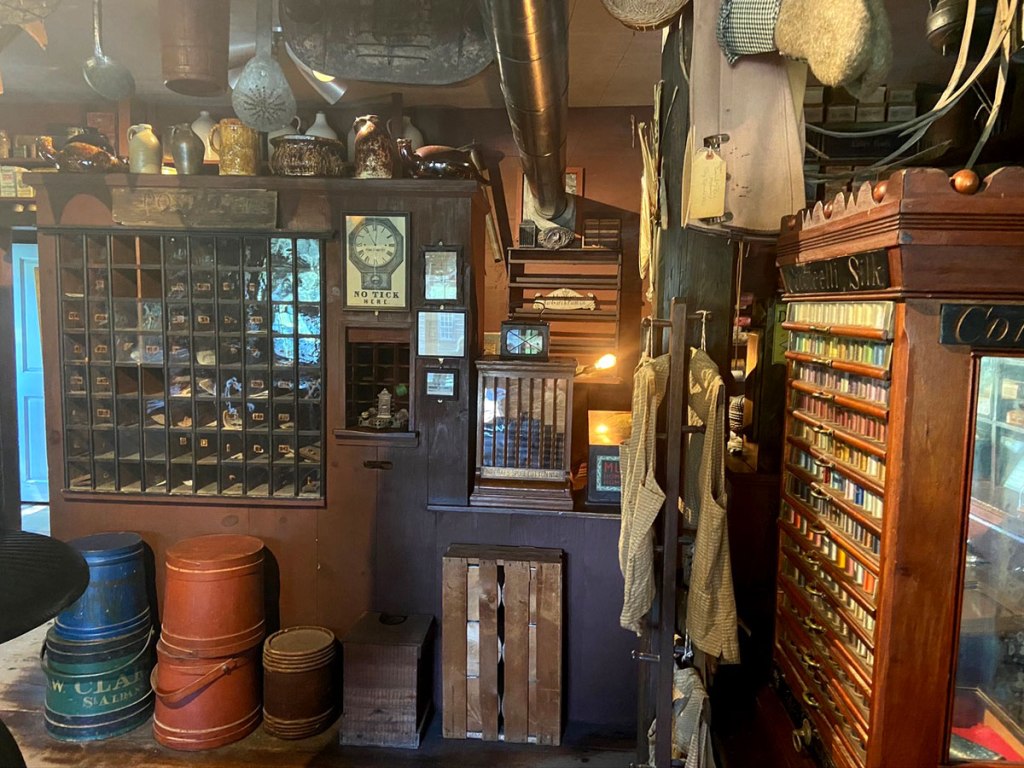
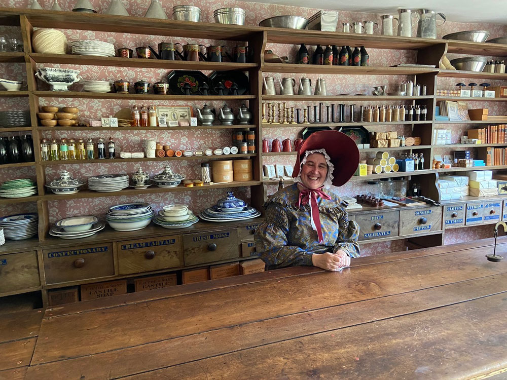
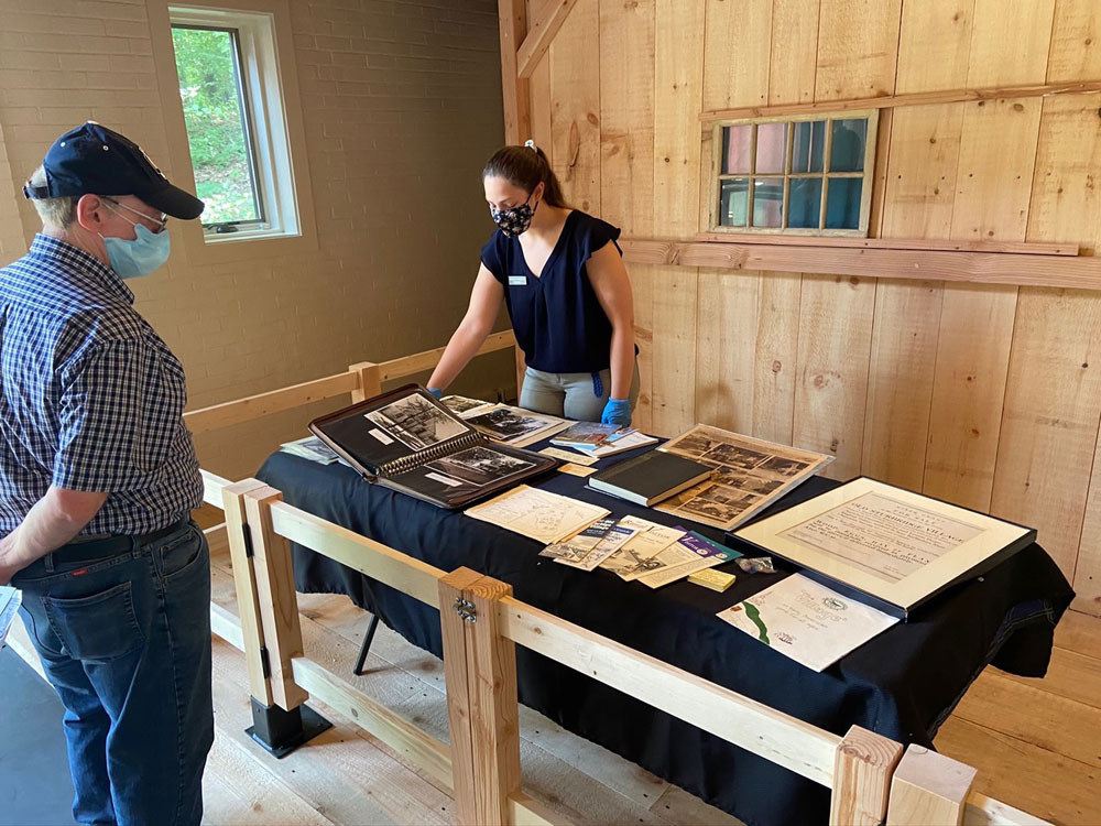
After chatting with the folks at the Guilford Historical Society booth (more on that later) it was into the exhibition hall. The veggies are always colorful.
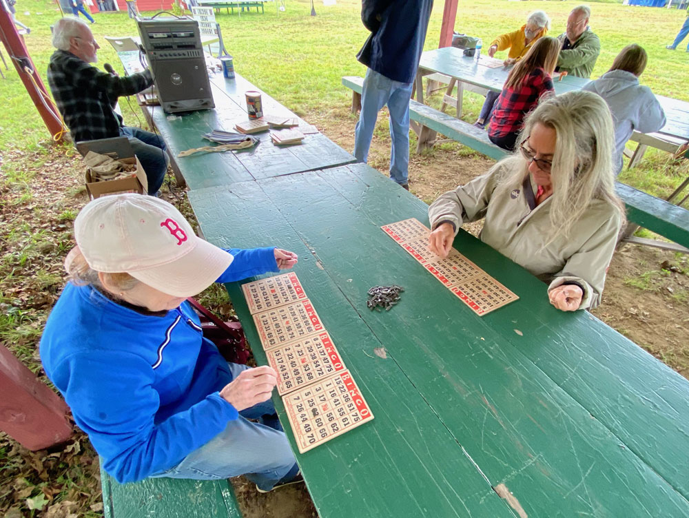
My friends, T and C, plunked down 25 cents a card to gamble with the Guilford Grange. I knew better.
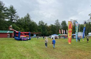
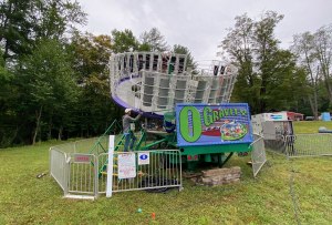
This fair, now its 76th year, is so old fashioned, so classic, so manageable, and just so much fun that I now have it on next year’s calendar. It was fun watching people enjoy the low-key, low-impact midway. And, at the games, everyone won a prize.
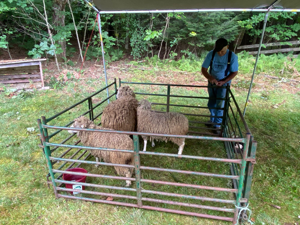
Over at the small display of animals I recognized a voice, and heading just outside was this gentleman with a sheep shearing demonstration. The voice? I asked, “did I see you at Plymouth Notch?” Yes he replied and he lives there. I saw him shear sheep there, and he is the raconteur extraordinaire who gives the wagon rides at Calvin Coolidge’s homestead.
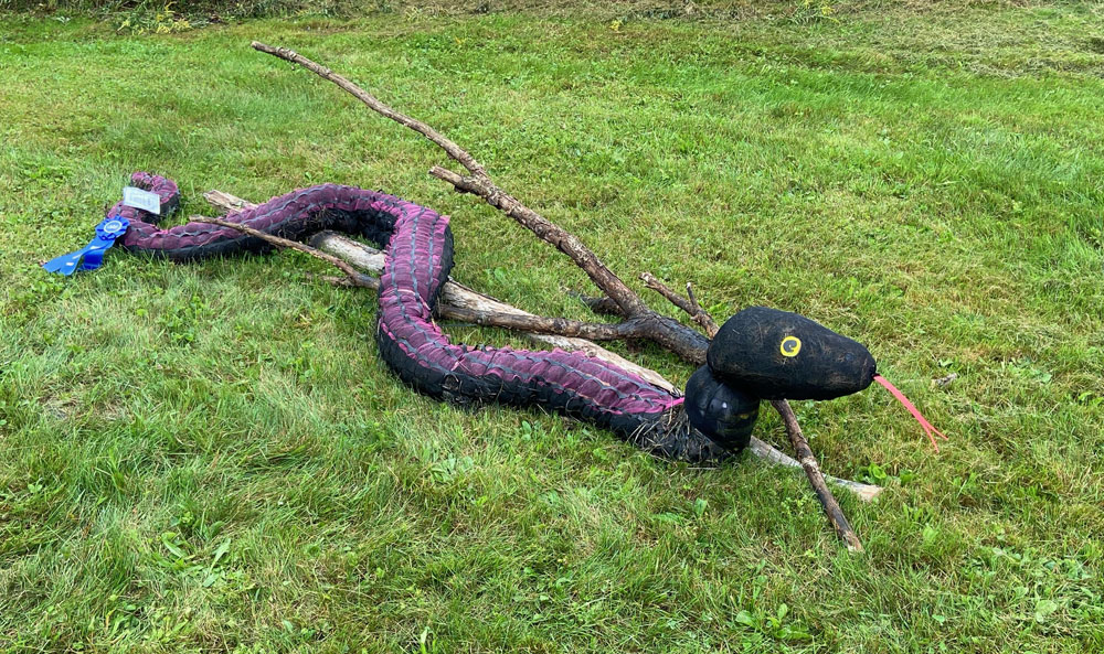
This “snake in the grass” won a blue ribbon.
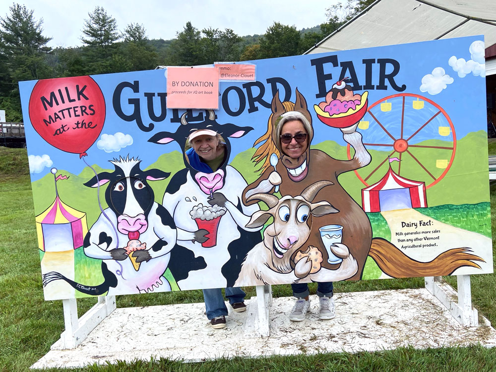
Did I say agricultural fair? Did you know that milk is the top selling Vermont agricultural item? Are these cows or milk maids impersonating cows?
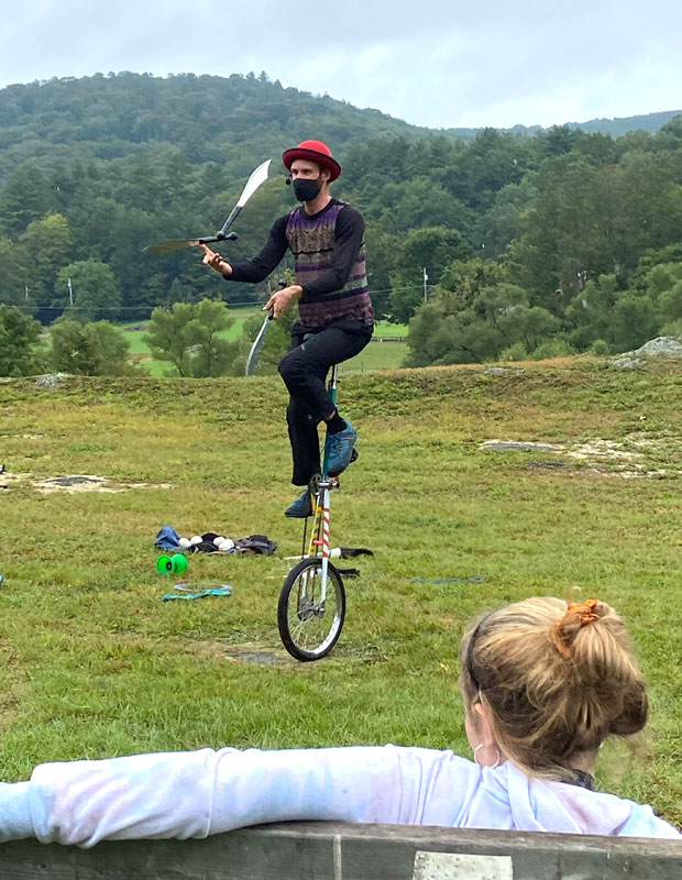
entertainment at every turn, and a daring lady watching the knives carefully.
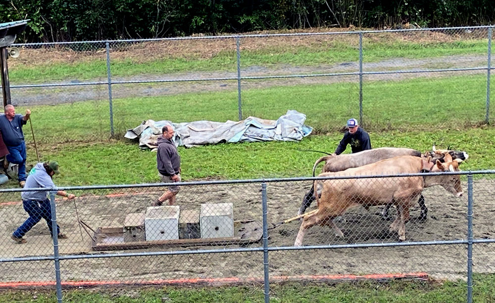
of course you have to spend time watching the oxen pull
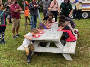
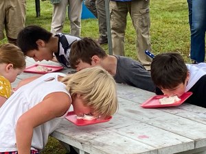
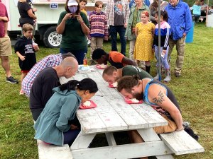
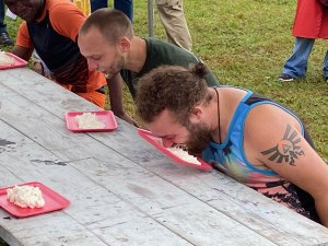
And, there was an ice cream eating contest. It was announced many times over the loud speaker – free ice-cream, and the person who finishes first gets a prize. There were several age groups. I did not sign up. Good thing I didn’t because they neglected to explain one of the rules.
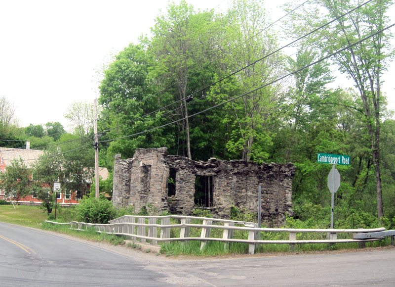
Guilford consists of Guilford, Guilford Center, and West Guilford. At the historical society booth I learned of a 19th century mineral springs and resort hotel in Guilford Center. I did not know about it, but had explored this small (very small) village in the past where Royall Tyler lived in the late 1700s. An important early American writer. Well I have written about him before, and will add links to that in time here, but I have to get this post off to you.
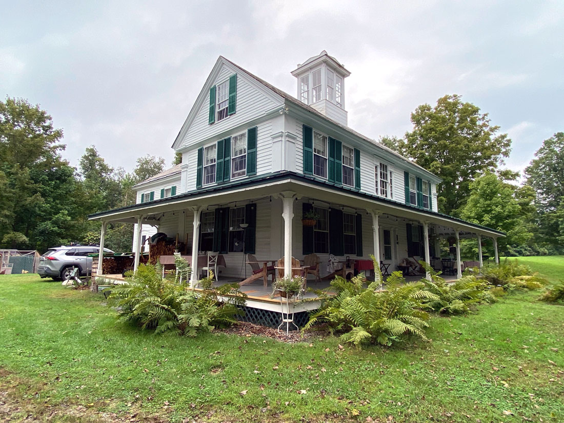
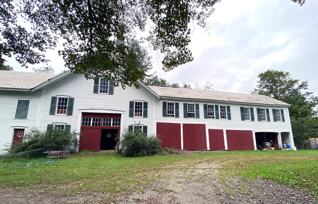
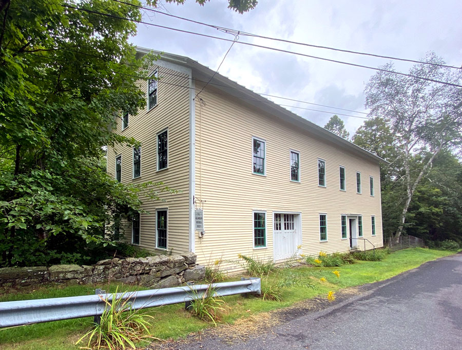
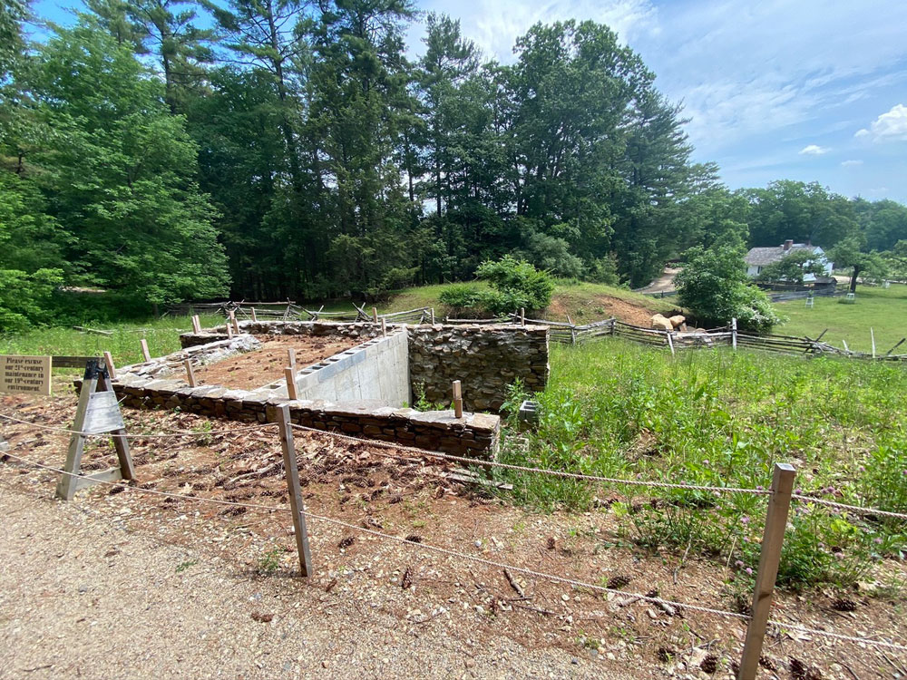
We headed to Guilford Center having completed over three fun filled hours at the fair. The lady at the historical society booth told me where to turn in the village on Carpenter Road. And, we figured which drive to turn into. And, as luck would have it, as folks were coming out the drive (on the way to the fair) they confirmed that this was the original resort, and how to find the springs. The same thing happened to me this past week in Middletown Springs, Vermont. On a dead end private road on private property I met the fellow who shared everything with me – but that post to come next week. Below is the basically unchanged 37 room hotel hotel and the barn.
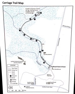
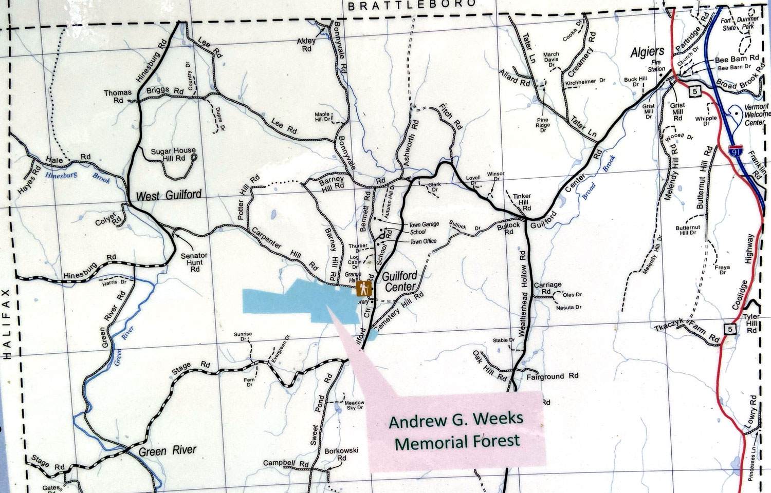
The map below will put into place the village, the hotel, and the trail to the location of the springs and bottling plant.
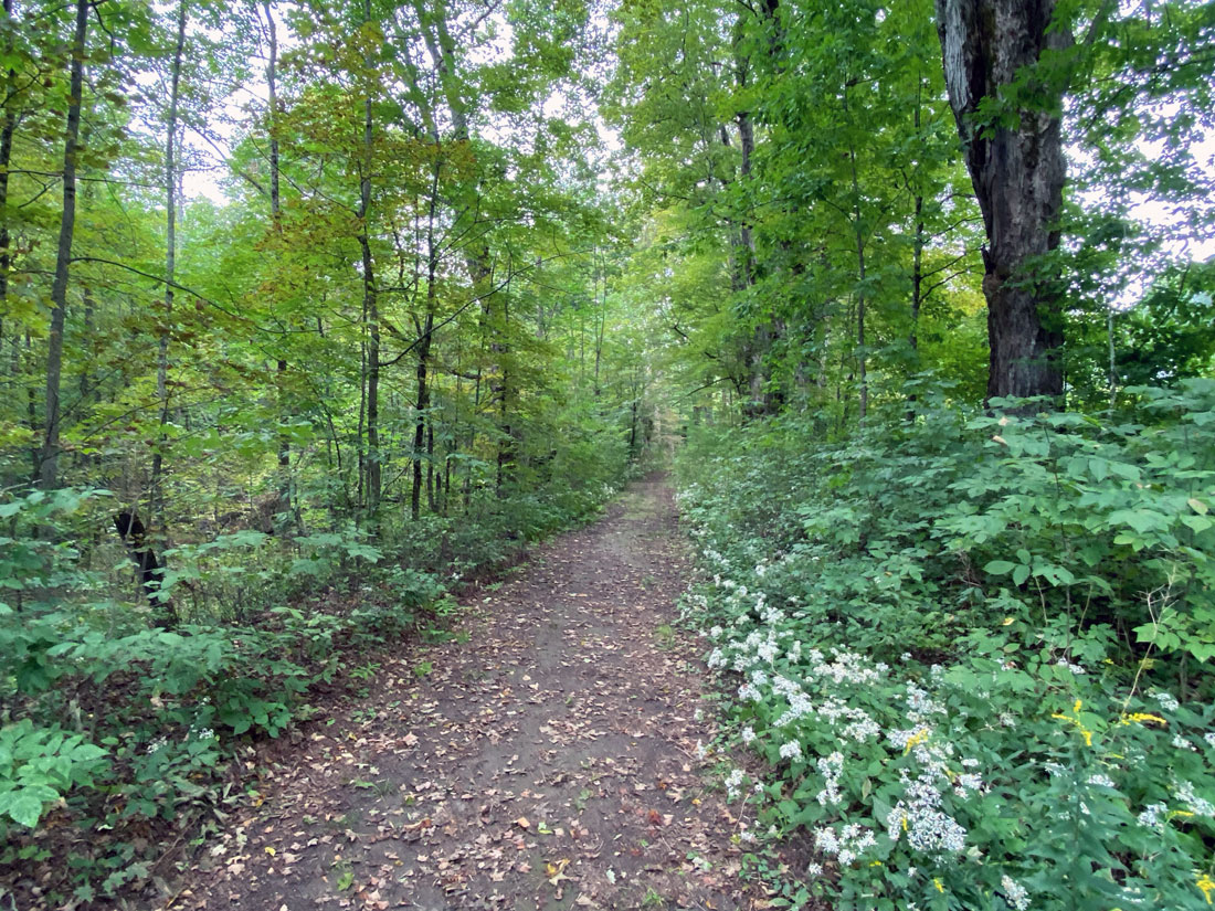
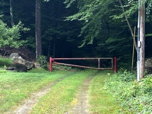
and, here is the beginning of the trail to the springs
and a map of the overall location of today’s adventure.
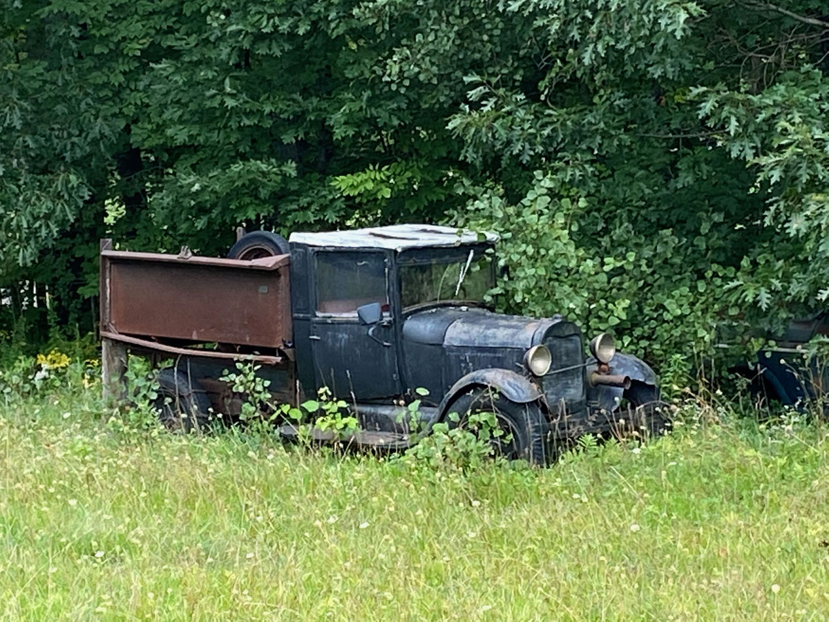
we drove past the springs toward West Guilford, and what an amazing dirt road, trees, and some incredible views. We came out on a paved road, traveled a tad, and I knew where we were – headed toward West Brat. In fact, I turned around on a road BLUE BELLE and I came out of a couple years ago so I could capture this 1928 or ’29 Model AA Ford truck holding down some weeds.
and, when “downtown” West Guilford, you need to take an image to share.
RAY HIGHLY RECOMMENDS 1 – Read this post, plan your trip for Labor Day, get up tomorrow, and go 2 – If you don’t read this in time, mark your calendar for 2022 3 – Make sure to follow my posts for more Mineral Spring history — I am hooked, more is coming.
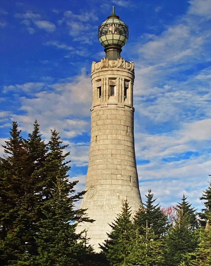
I am sure you remember a trip I planned in 2010, and finally headed off for on August 1, 2017, but sadly only made it half way when BLACK BEAUTY decided to shut down and ask for a piggy-back ride home from Pittsfield, Massachusetts. If you don’t, take a look at SEVEN YEARS “ON THE LIST” – NOW HALF DONE – 1-2 AUGUST 2017 — In fact, I encourage you to look at the images from that trip because this trip to Mount Greylock was obscured by constant rain and fog.
It was BLUE BELLE’s turn to make this trip to Mount Greylock, find where I camped August 5, 1963, and spend some time at the Hancock Shaker Village. I tried to book two nights at Bascom Lodge in July, but everyone was finally getting out, and I could not get a room until 18 and 19 August. That was fine, but I did not know that stormy weather would bring tears to BLUE BELLE’s eyes when I left in modern GiGi (Granite Girl). Oh well, an excuse to go again.
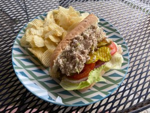
There are still routes through Massachusetts that I have not been on, thus have to see. I planned different routes going and coming. Sorry, I-91 to the Mohawk Trail to Shelburne Falls. Then Route 112 (scenic designation) through Buckland, then west on 116 (also designated scenic) through Spruce Corner (yes couple spruce trees and maybe four houses), Plainfield (not much there) and I stopped at Savoy, and the only spot to grab a bite to eat.
Savoy (Massachusetts) General Store, and my Tuna Salad sandwich
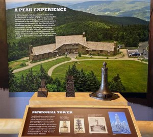
It was then up Route 8 into North Adams, and backroad up the mountain. Did I say fog on the 3,491 foot high mountain, wind and rain? If it were not for the light coming on in the Memorial Tower atop the mountain, I could not gotten an image at all.
and, this is what is beneath the light above – the light is in the globe at the top below (not my photo, but from a panel at the Visitor Center)
Do look at my post of my last visit for some wonderful images of the lodge and area, but how can you resist this CCC Arts and Crafts construction?
My plan to complete my last trip was a visit to the Pittsfield State Forest where I camped in 1963, and find my camping spot. My full day (also in the fog and rain) was to start that quest, and then head to the Hancock Shaker Village. I found the forest, drove around, and am pretty sure I found my camping spot from 59 years ago — but am constantly kicking myself that I did not shoot an image. Oh well, reason for another visit. Then among the raindrops, I arrived at the Hancock Shaker village.
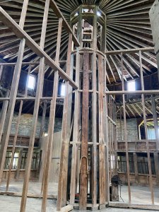
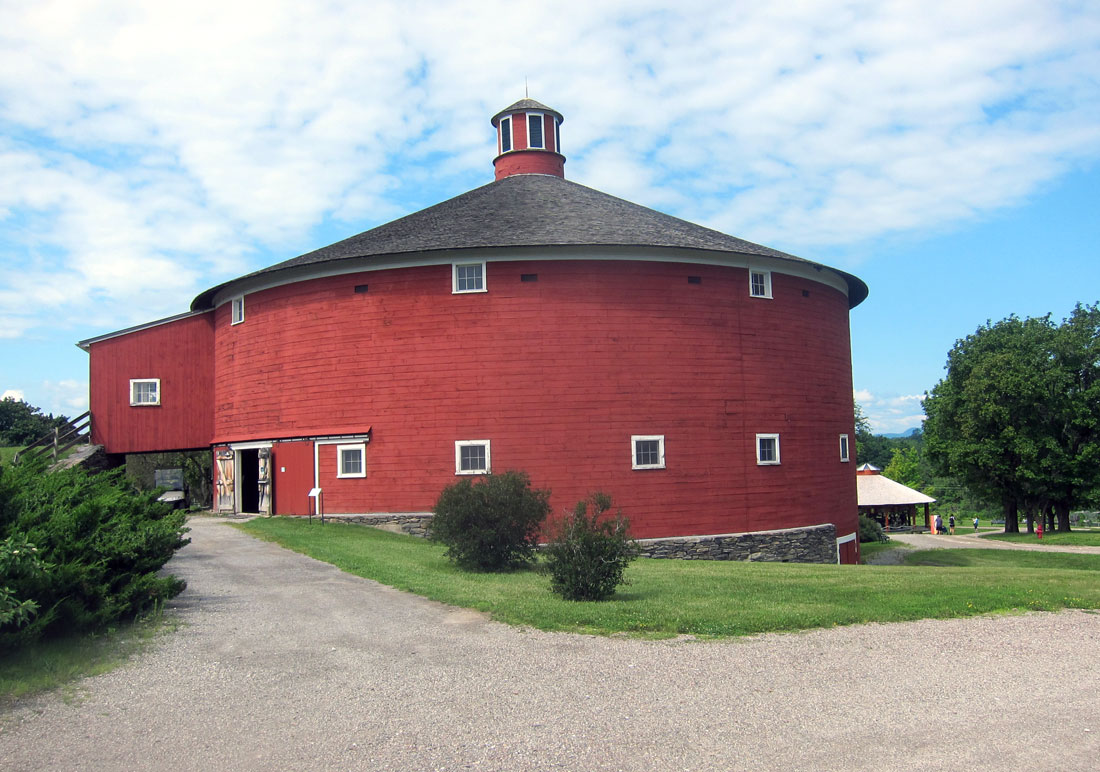
I was not concerned about the weather, nor my walking ability, because I showed the NARM sticker on my OSV membership card, and my visit was free. To do the village you really need more than a day, and I have also been fortunate to already have spent full days at the Canterbury Shaker Village and the Enfield Shaker Museum, both in New Hampshire. I headed over to the round barn (remember I was just at the round barn in Shelburne).
the first view below shows the central part of the barn, and then a view out a door.
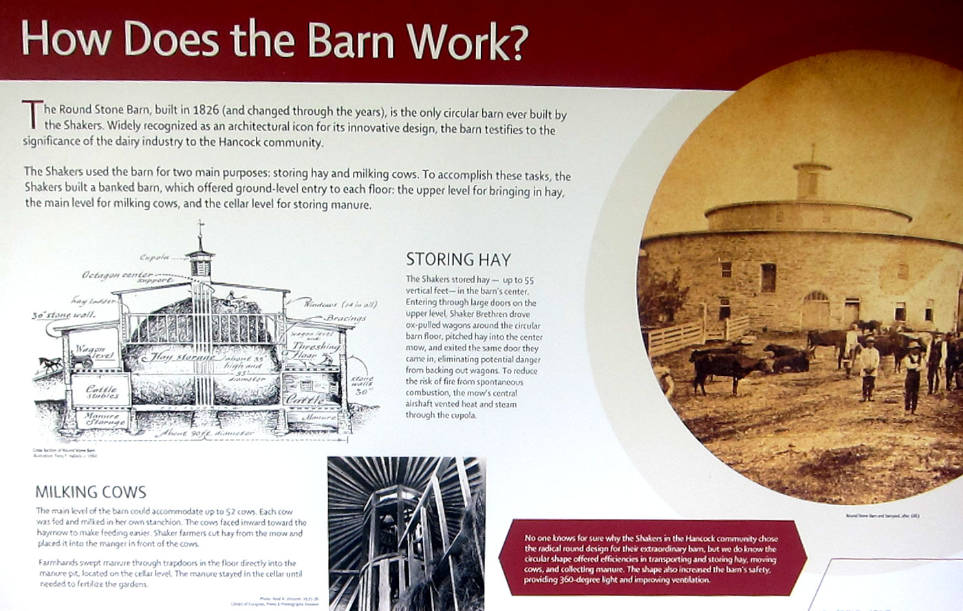
and, below is how the barn “works” -you can click for a larger readable view
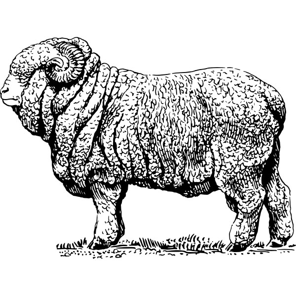
Coming off the barn was a wing for other animals. On the wall was information about Merino Sheep. Awhile ago I wrote about the Sheep Craze in the mid 1800s in New England. But reading the panel, and talking with a great docent (who I chatted with again later) I learned the sheep were bred with those extra folds around the neck so more wool would result. And now you know.
I next headed over to the large brick building, on the map simply as “Brick Dwelling.” A sleeping residence, the rooms had many educational displays.
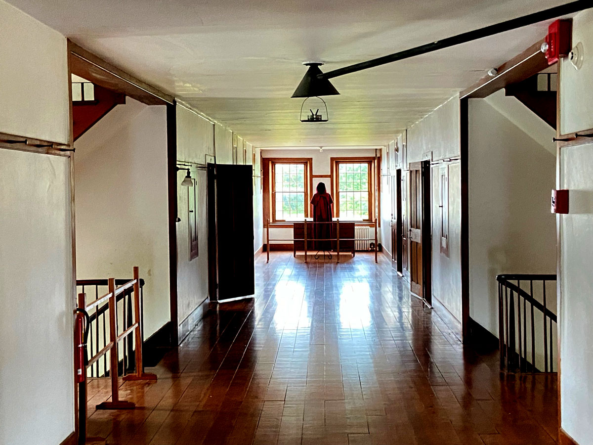
The large hallway got me curious. As I came down the stairs, the young docent I met before was there. So, I asked why so wide.
actually I was fascinated as to how the oil lamp was vented, thus the image. But the width – her answer the men walked on the east side of the hallway, and the women walked on the west side. The wide distance so they didn’t touch each other in anyway. The men slept on the east side of the building because they woke with the sun early and went out to work on the farms etc. The women then, when they got up on the west side, crossed the hall to the men’s rooms and cleaned them up for the day. This young lady was well versed, and in our chat I learned she just graduated in museum related work, had worked here as an intern before, and full time this summer before going to work in a NYC museum. Further asking her why the interpreters were not costumed she explained the Shakers asked they not wear traditional clothing, and also no particular time period is being represented, unlike OSV, which portrays New England in the 1830s, thus costuming is focused to that time period.
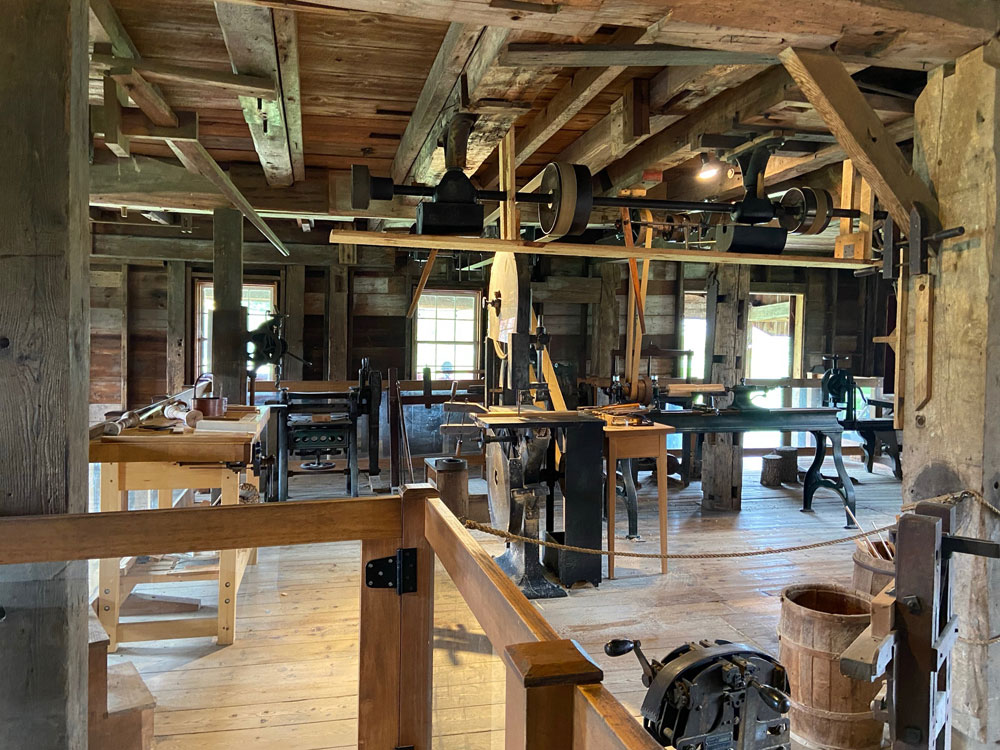
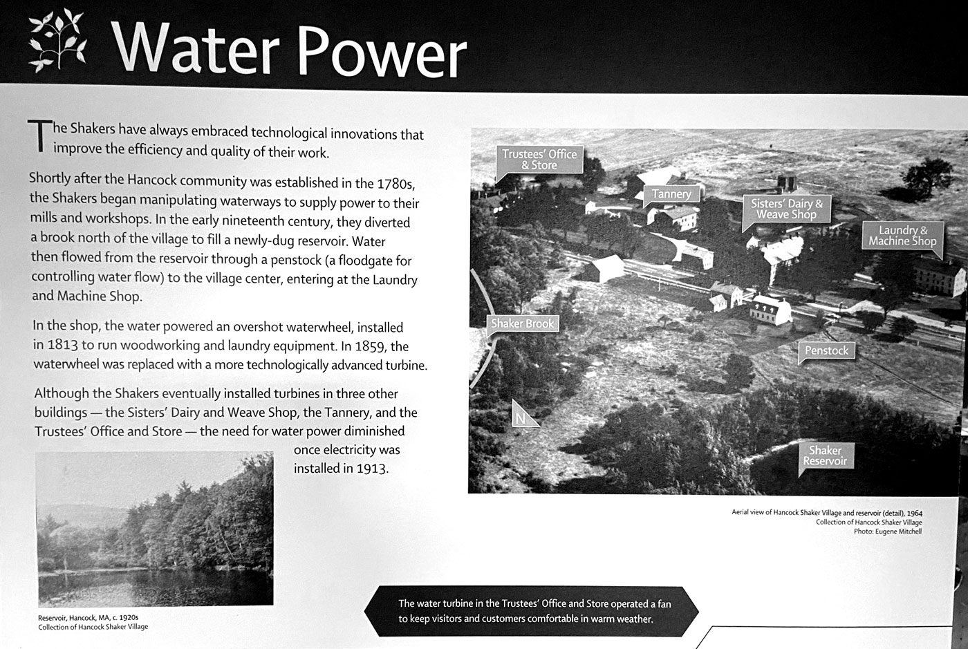
On the daily schedule at 2 PM was a water turbine demonstration in the Laundry and Machine Shop that I had to see. I have been fascinated with water power since the fifth grade when I built an overshot water wheel for a science fair project. I headed over, and positioned myself in a great spot.
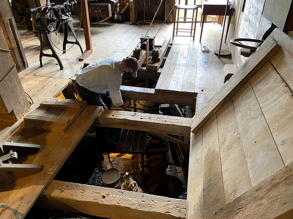
this is the machine shop above, and to my right was this opening in the floor where the 16 inch pipe from their reservoir came into the turbine.
the panel below shows how the Shakers built a reservoir about 50 feet higher in elevation from the village. The water main came down to the village and to several buildings and hydrants for fire fighting and water supply. Click for larger view for easier reading.
When electricity came into use the machine shop was converted over. During a World War II scrap drive the unused water turbine was given to the war effort. In the restoration of the village the original plans for the turbine were found, and the same foundry in Springfield, Massachusetts, that made the original was still in existence, and made a “new” turbine as the original. Here are the molds made for the turbine castings.
and, opening the value, and putting the wheels in motion.
Water Turbine Demonstration – Hancock Shaker Village
The machine shop above was built onto an old residence. The residence portion on the first floor had been turned into the community’s laundry with a washing area, and ironing area.
And, I did not need to do the whole village since I can easily go back (and remember it is no cost for me to get in), so I headed back up into the fog on the mountain to sit and read and visit with strangers. You will not believe the conversation a young nine-year old lady and her mother struck up with me.
I was on the wonderful Arts and Crafts couch with leather cushions made for comfort. “Is that Harry Potter you are reading,” asks the young girl. He mother says,”she is reading one of the books now on her Kindle, and has no idea how thick the books are.” Originally from the area, the mother told me they drove up from Maryland specifically to come to the top of Mount Greylock. You see, unbeknownst to me (and my Potter friends), the Ilvermorny School of Witchcraft and Wizardry, was founded in the 17th century on the summit of Mount Greylock.
Ilvermorny School of Witchcraft and Wizardry – Compare to image in the fog above
What a great mother to drive that distance to share an experience with her daughter, even though being Muggles we could not find the entrance under the War Memorial at the top of the mountain. I had so much fun with them – and complimented the young mother on her daughter’s poise and willingness to have a great conversation and share. The full story and history has been published on J. K.Rowling’s Pottermore website. According to the account, part of the backstory to “Fantastic Beasts and Where to Find Them,” now a film about magic in 1920s America, the school has managed to operate concealed from nonmagical eyes “by a variety of powerful enchantments, which sometimes manifest in a wreath of misty cloud.” This is one of the better articles I found on-line once home, When asked about the school, Governor Charlie Baker’s office reacted to the question that the school has avoided state regulation. In a press release, “The governor believes that small businesses are the backbone of the economy whether they are owned by witches or mortals, and because the institution has operated for nearly 400 years without incident, the administration plans to revisit the matter sometime in the next century or two.” Just remember, you learn and learn with SHUNPIKING WITH RAY.
There is a visitor center to briefly enjoy with maps and nature information. Here are two panels I wanted to share – a view and history. (again, click for large size)
Did you read that it was John Bascom who was head of the reservation’s commission in the early 20th century? Thus the name, Bascom Lodge. You know me and timing. Just so happens a great-grandson of John’s had stayed there the night (from NYC), and we chatted in the morning. And yes, directly connected to the Bascom maple sugar operation in the hills just above me. We chatted area history. “Timing is Everything” be it the real world, or the world of wizardry.
There was a reason also for the route home – roads I had not been on, and I wanted to re-visit Williamsburg, which is just west of Northampton. I had visited years ago, but this winter reread IN THE SHADOW OF THE DAM: THE AFTERMATH OF THE MILL RIVER FLOOD OF 1874. I recommend you sit down with this book, well done. So, down off the mountain on the southern entrance, left turn on dirt on West Mountain Road (tricky in places) to Route 8, and left again on Route 143 in Hinsdale. Through Peru (not Vermont or Maine), and not much there, nor West Worthington, but there is a general store in Worthington Corners. Stopped there once traveling on another road to RLI. Chesterfield, and then into Williamsburg (not Virginia – I do not get that lost). If in the Northampton area sometime, do swing up to Williamsburg and Haydenville. Here are the main buildings on the “new” main street.
Williamsburg Historical Society – old Town Hall (1841) in Williamsburg, MA
Grange Community Hall – Williamsburg, MASS – rebuilt 1859
Above on the left is the Williamsburg General Store, which has been the site of a General Store since 1808. From an “uncommon map” I have of this area, “this store has become an attraction to patrons from far and wide.” Here two views.
I then explored the original Main Street area that was hit by the Mill River Flood when the dam broke. Below is the Grist Mill (now a museum) which was built in 1878 replacing the mill that was swept away in 1874 with its proprietor.
The small former downtown area is a “must explore.” Heading out North Street as you approach Judd Road is a trail (right image below) taking you to the remains of the dam. At then end of Judd Road, the road to the dam is blocked off, with a private property sign stopping me.
I then headed to Northampton and I-91 to slide home. No other stops, I was ready to get home. Rain kept me from doing all I wanted to do, fog kept me from seeing all I wanted to see from atop the mountain, and arthritis and bones slowing me a tad. But I love to get out, see, learn and then share. So, thank you for getting this far.
Ray Recommends 1 – Visit and experience Mount Greylock 2 – Tour the Hancock Shaker Village 3 – Read IN THE SHADOW OF THE DAM: THE AFTERMATH OF THE MILL RIVER FLOOD OF 1874 and visit Williamsburg, Massachusetts 4 – Join one of over 1,000 museums at the level that gives you free access to all the museums under the North American Reciprocal Museum (NARM) Association® network 5 – Stay safe and Stay well, get your shots and booster
And, a final note. I told you I have found my iPhone so much better for images, but fingers do get in the way. Search on Amazon, and I found this grip for fourteen dollars and change. Thrilled, and thrilled.
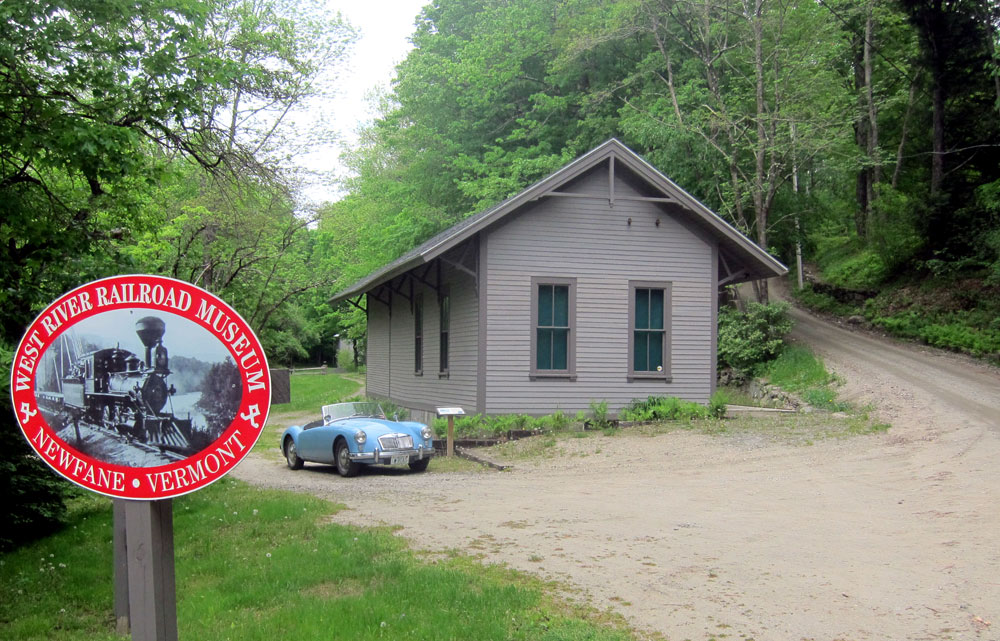
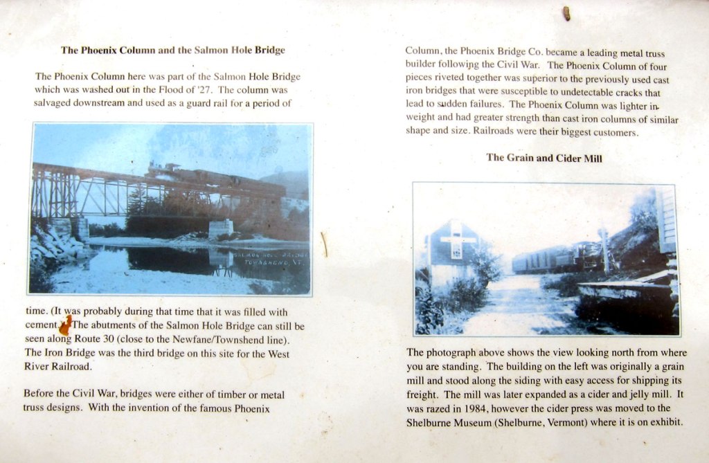
I had much I wanted to explore on Saturday – the weather starting was not looking good, and I delayed departure – but, I checked the weather radar map and decided to just jump in BLUE BELLE and go – and go we did for 105 miles. First stop the Windham County biennial history fair in Newfane, Vermont. Yes I still have to write a story about why I seem to always be in Vermont. Also, I needed to finish touring you up the West River Railroad following the first trip on the route I shared with you on 31 July.
Newfane is a lovely village to visit, and you may enjoy this link for a tour. Nice Common, county seat with court house, train station, general store for a bite to eat, historical society – great place to visit even with nothing going on.
One of the things I decided this morning is that the images with my “older” camera are not exactly what I want compared to my iPhone results. But the iPhone is hard to hold – fingers get in the way. Research this AM, a hand grip hopefully will arrive prior to my next adventure. Below a talk was in progress with the court house in the background.
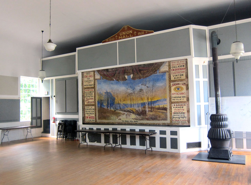
I parked near the Union Hall, built in 1832. Originally a Christian meeting house, after twenty years it was abandoned, then converted to a public hall in 1872. It is now used for meetings, weddings, concerts, movies, auctions, etc.
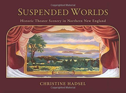
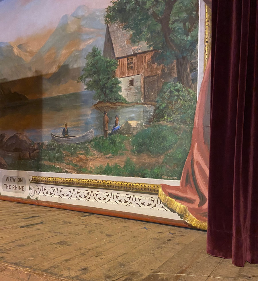
When I walked in Union Hall I was thrilled to experience another hanging painted theater canvas. I first learned of these (and immediately purchased the book – SUSPENDED WORLDS: HISTORIC THEATER SCENERY IN NORTHERN NEW ENGLAND) about six years ago
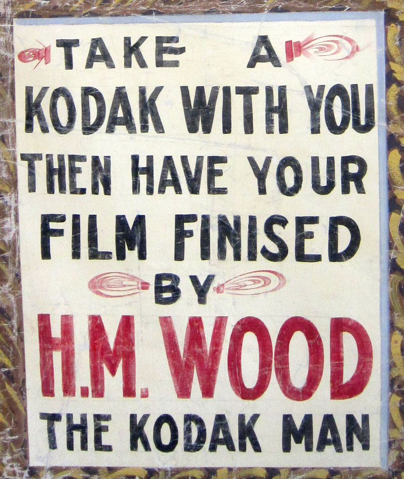
UNION HALL – NEWFANE, VERMONT – PAINTED THEATER CURTAIN
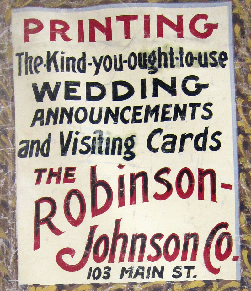
I thought these two advertisements on the curtain deserved close-up views.
In July I attended a lecture at the original 1860 Town Hall in South Londonderry, Vermont, where I was able to see their canvas, but with the podium and projector screen could not get a full view to share “on film.” This is a “View on the Rhine.”
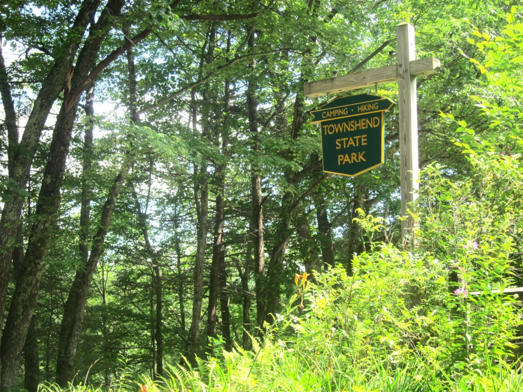
Leaving Newfane I continued north on Route 30, but in a split second decision, before arriving in Harmonyville, turned left on River Road towards the State Forest
TOWNSEND STATE PARK – VERMONT
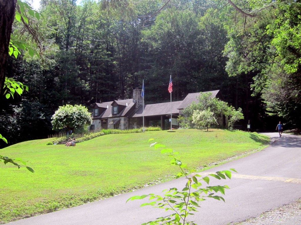
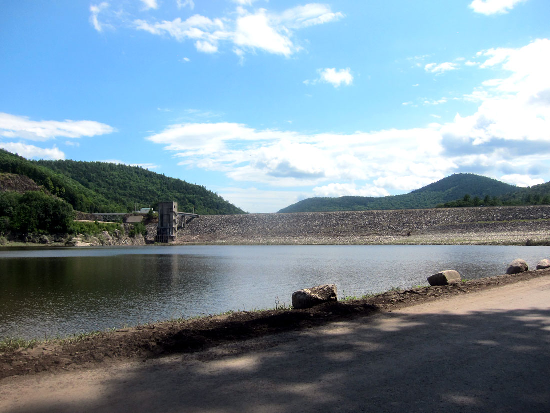
There I chatted with ranger Crystal who confirmed I was on the West River. She said I should continue on towards the Townshend Dam and Lake – which I did, and highly recommend that you do the same.
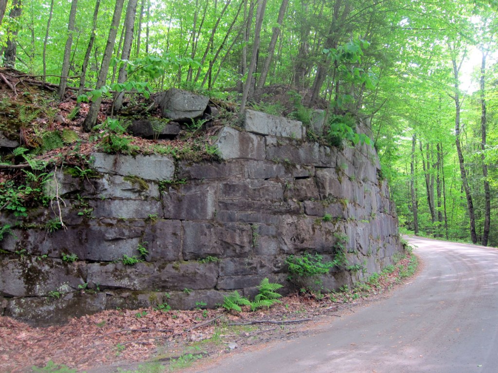
Two dams were built by the Army Corps of Engineers on the West River for flood control. The dam above in 1958-1961, and the Ball Mountain Lake Dam (which you will see later below) built in 1956-1961. The brochures I got on both of these projects have images of the dams filled almost to the top. With the recent rains the road I was on had been underwater, and along side on the bank you can see the silt lines high in the trees along with strewn branches.
I then crossed the dam back to Route 30
and, looped back south a tad to experience the Harmonyville General Store, and the Largest sycamore tree in Vermont while I enjoyed my sandwich at a table under the tree. “The last time it was measured in 2009, its height was 115 feet, it had an average crown spread of 28 feet, and its circumference at breast height was 16 feet 10 inches a diameter of 5.5 feet.” Do stop so you can also say “I was there.”
While “picnicking” there I chatted with two bikers who were discussing tires and how long they last on their bikes. Surprised at what seemed just a few miles (7,500 to maybe 10,000) I had to join in. I learned that the rubber is softer on motorcycle tires for better grip on the road since they are small. I love learning, and also chatting with “new friends.” One of the fellows told me he was on the Puppy Dog Trail which I subsequently learned is a series of connected dirt roads that take you from the Massachusetts border to the Canadian border, the entire length of the state of Vermont. He said it started in Greenfield, and stops short of the Canadian border, laid out by George Washington who did not want it to reach the British settlements. Good story, we need to learn more, but one website says ” It was put together by the good folks of the BMW Motorcycle Owners of Vermont and revised and updated as recently as 2018. It’s about 90% dirt with just enough asphalt to connect the dirt roads. GPX files and turn-by-turn directions are available here.” Road trip anyone? To get you started, here is 650 THUMPER’S blog.
Again I could not find the former station on Depot Road across from the general store, so It was then back north on Route 30 to Jamaica. Again, I could not find the West Townsend station, and I passed by Wardsboro to look for that station at another time (method to that madness). Arriving in Jamaica, I turned right on – of course – Depot St. And, into Jamaica State Park. If my research had been complete, I would have known the tracks ran through here
I was sure I had found the station which is not on the list of the six remaining stations. But this had to be it. Just look at the image complete with a West River Railroad station sign – 24 JAMAICA 12 – 24 miles from Brattleboro and 12 miles to South Londonderry. A park ranger was walking by, and I asked. He said, “no the entrance building was recently built, but the old station is just behind that fence on a drive, you should look there.” I told him the entrance building had a West River Railroad style sign. He asked what the sign meant since people were always asking. He can now share my answer – 24 miles from Brattleboro and 12 miles to South Londonderry. From my collection of information, here is a link to the Vermont State Parks booklet on the railroad going through Jamaica State park – https://vtstateparks.com/assets/pdf/jamaica_36miles.pdf – and the booklet does say where the old station is. I went, talked to the owners, but hard to recognize today comparing to an original photo of the station.
looking to the south from the park entrance, here is the old rail bed, now the West River Trail.
and, looking a tad to the right from above, the bridge on Depot St. over the West River.
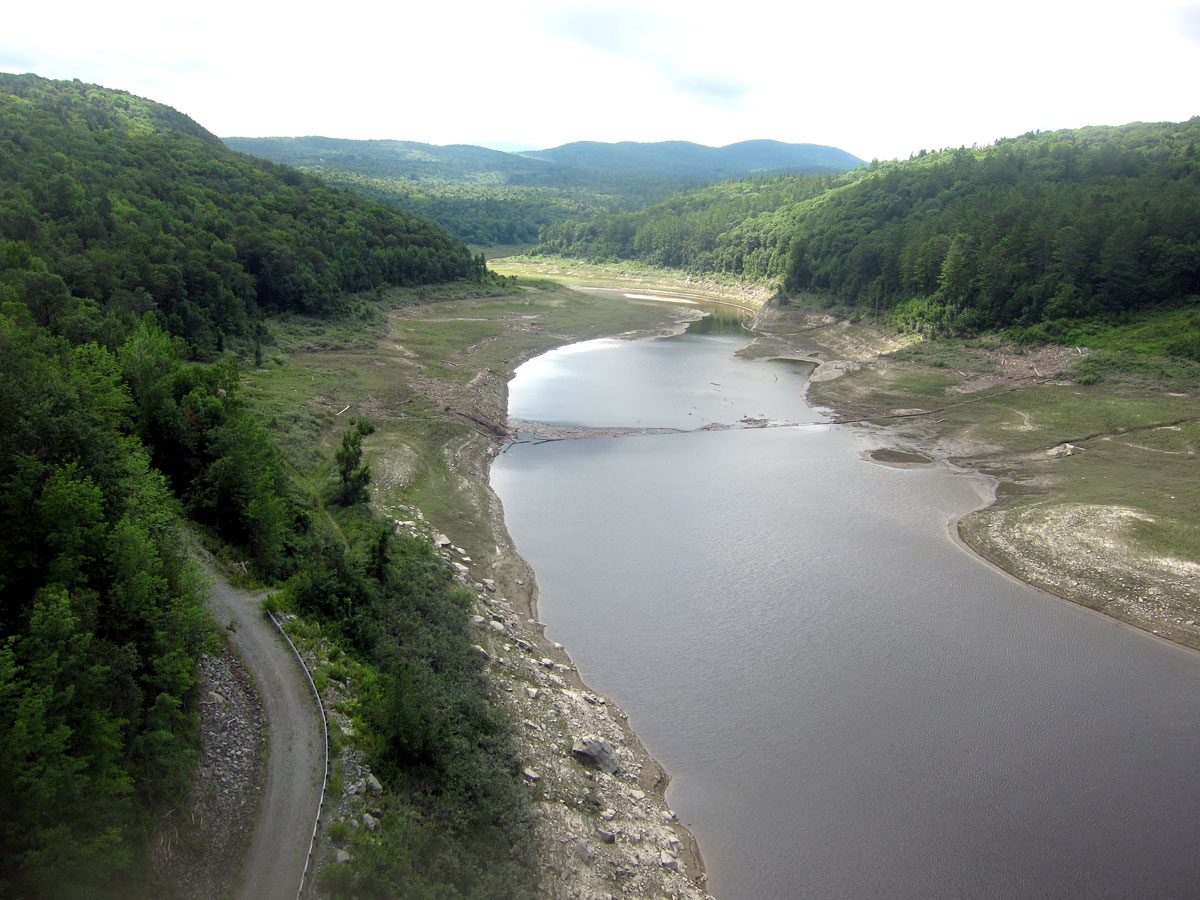
Back out to Route 30, I headed north again on a section I may never had been on before. I turned right onto Ball Mountain Lane traveling a distance to the Ball Mountain Lake and the dam. I walked out to the inlet station which is about as high as the 265 foot high dam.
looking to the north you see the old rail bed following the river on the left. Remember, in the booklet on the lake the level has been all the way to the top of the dam in the past – 265 feet – WOW. You must visit these two dams.
and, looking the other way – south – towards Jamaica
and, back to BLUE BELLE patiently waiting.
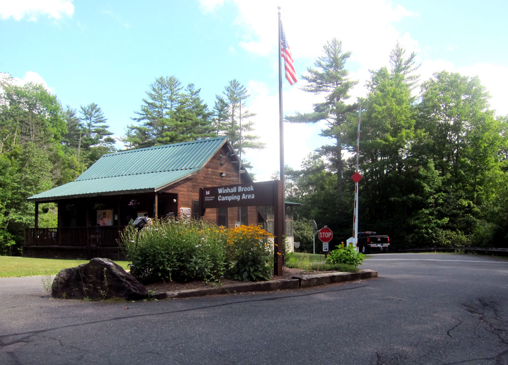
One more location to find – the no longer extant Winhall Station. Off Route 30 I turned on Goodaleville Road, which on my old map should have (at least once was) Winhall Station Road. Took a chance on next road – wrong, but at the end a nice couple said how to get to Winhall Brook Camping Area, and the area where the railroad was. I arrived there, another Army Corp of Engineers project and facility.
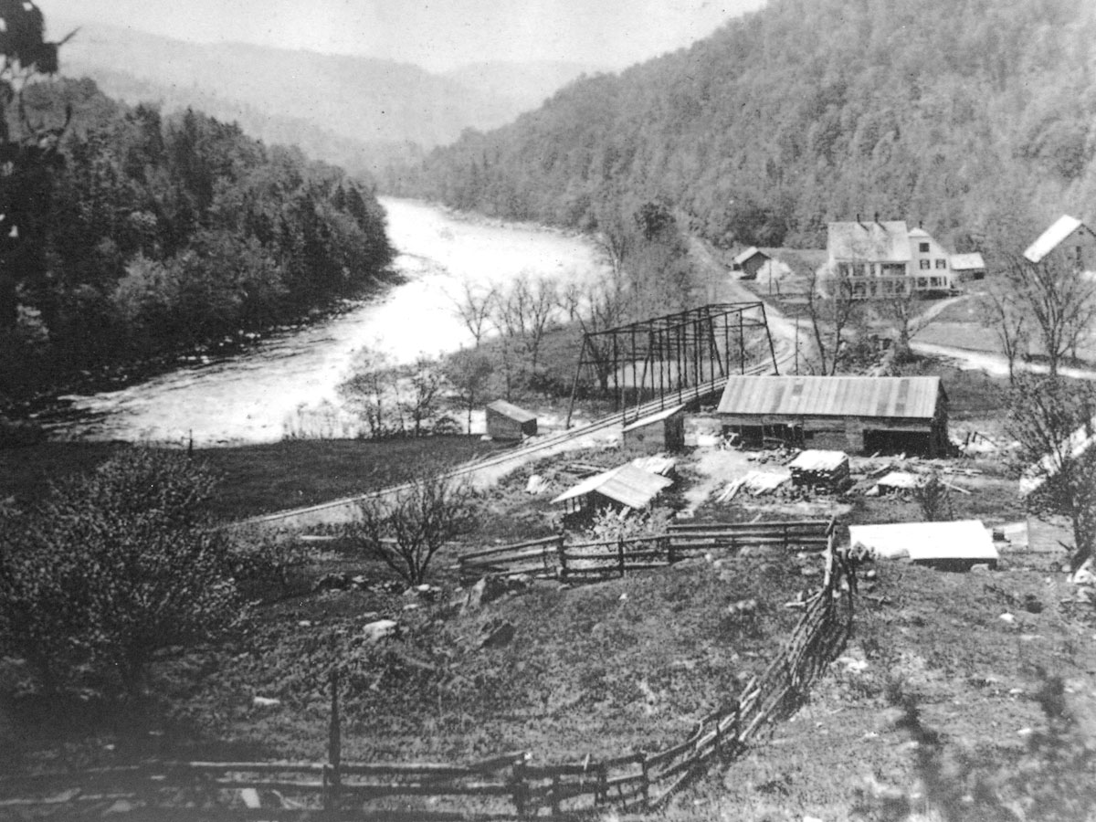
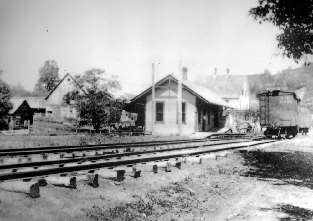
Now this was the greatest stop for me, and again a very helpful couple at the visitor center. I asked if the West River Railroad ran through and where. “Yes it did,” was the reply, “and I have some photos here of what it was like.” He let me copy the three below, and, I was given the map of the campground also. I just had to go down the hill, cross the little bridge over the Winhall River, turn left, and when at the West River turn right. Here is the old photo of that area showing the Winhall River running into the West River.
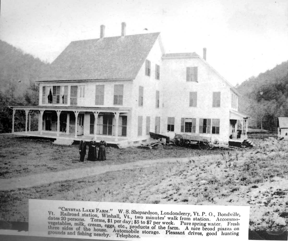
the bridge (no longer there) crosses the Winhall River, and on the rail bed you can see the station just past the large home which served as a hotel. Here is the station, with the hotel in the background.
and the hotel structure itself.
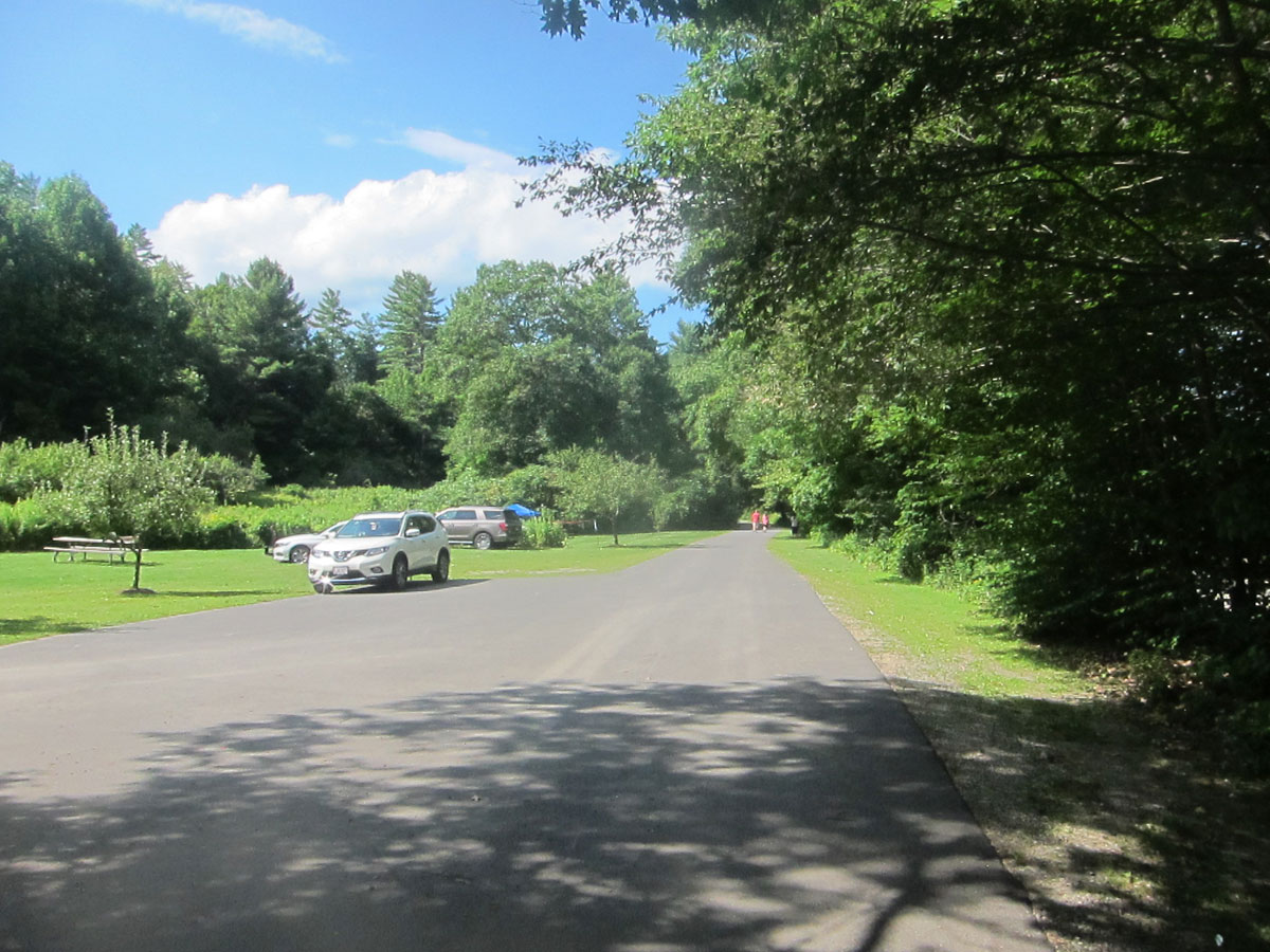
the open area you see in the first image above is still open for camping now. As the forest closes back in the West River Trail continues.
turning around, in the field would have been the station and hotel.
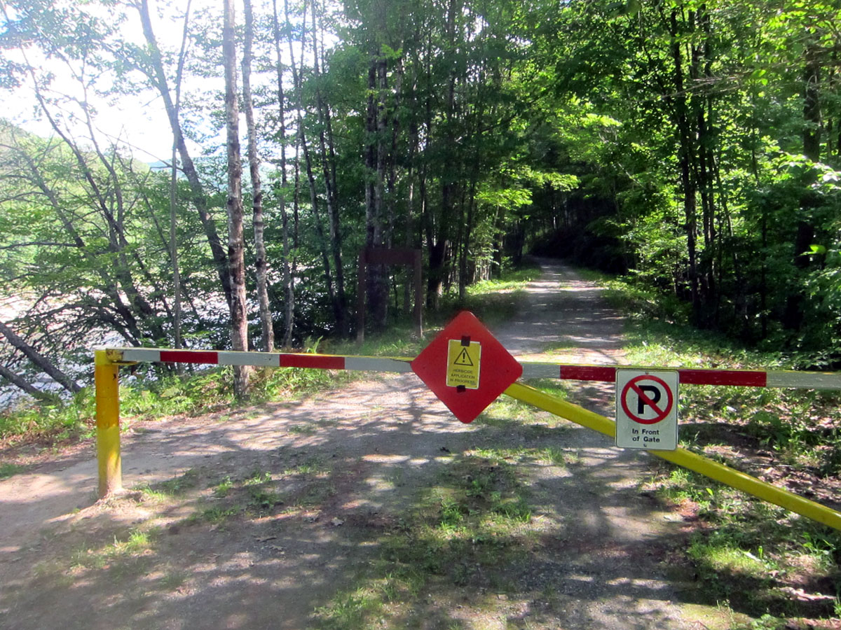
and, a closeup of the beginning of the trail continuing on to South Londonderry with the West River to the left.
this stop was great, and in my research I am showing you what other websites documenting the West River Railroad, particularly in Winhall, have not before shown. I would love to go back and camp, in fact in any of the camping spots I saw and toured on this excursion
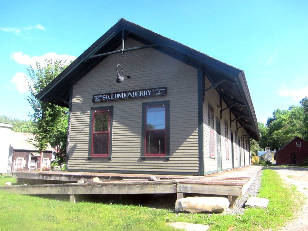
Next stop, the end of the line and the South Londonderry station.
SOUTH LONDONDERRY, VERMONT – WEST RIVER RAILROAD STATION
RAY RECOMMENDS: 1 – Learn what you can of the West River Railroad and the history of this area 2 – Pull off Route 30 and tour the Townshend State Forest, and travel up to the Townshend Dam and cross it 3 – Pull off Route 30 and find the old station next to the Jamaica State Park on the West River 4 – Pull off Route 30 and experience the Ball Mountain Lake and Dam 5 – Stop at the Harmonyville General Store 6 – And, when done, do it again – ENJOY
I still have places “on the list” to explore just across the river in Vermont, and here is an eighty mile round trip that took 120 miles in seven hours. Reading that Rudyard Kipling and his wife would spend time in a hotel at Lake Raponda, and not knowing anything about the lake, or where it was, I had to see it. And, you know I am trying to travel and explore the “36 Miles of Trouble” route of the West River Railroad. Not having been able to travel with all the rain, Saturday 31 July, looked like the day. I don’t trust my gas gauges, so stopped to top off BLUE BELLE. Five weeks since her last feeding, and only 1.7 gallons. No wonder she was so cranky not having had much to eat. Then off to the Flea Market on Route 9 in Wilmington, Vermont. Nothing begged to be purchased, so it was off on explorations. Think I will mark a map to show you where you need to go.
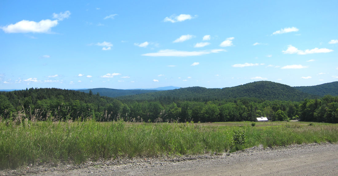
Lake Raponda is north of Route 9 just east of Wilmington. Coming from the east, turn north on Lake Raponda Road, but from the Flea Market I took Ballou Hill Road intersecting at the south end of the lake, which runs north-south. What a beautiful spot, and 120 acres of water surrounded mainly by trees and a mix of residences. Below is the only spot I could get a picture of the lake.
Lake Raponda, Wilmington, Vermont – 31 July 2021
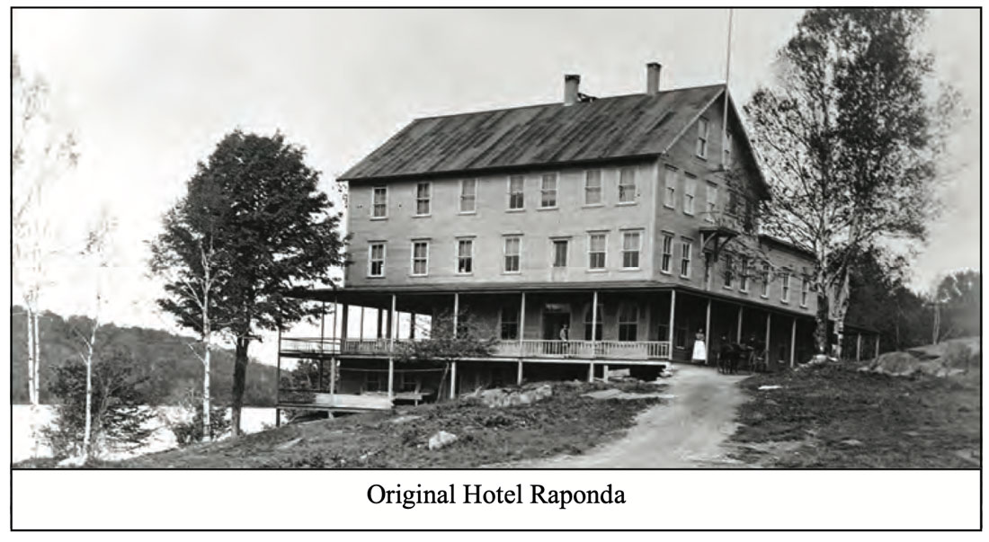
I wanted to find the locations of the hotels, and had no clue. But many people were out walking, and I stopped and chatted with several groups who shared what they knew. The first hotel was at the south end of the lake, near an “outcropping of rocks” I was told, but I did not find that spot (I have subsequently learned it was west of what is now Stearns Avenue – thus another needed trip). The Hotel Raponda opened to visitors in the summer of 1889. Starting as a large cottage with 50 rooms, it was enlarged in 1892. Here Rudyard Kipling and his wife, Carrie stayed coming up from Naulakha in Dummerston. Also visiting, President Theodore Roosevelt proclaimed the “scenic pulchritude of the place”. The hotel burned to the ground in December 1896.
I should digress and tell you the origin of the lake’s name. In 1788 William and Benjamin Ray bought the property. A swampy area with many springs had been damned, and the Ray brothers increased the size of the dam creating what was then called Ray’s Pond. When a lake association was formed and the Hotel built, a more attractive name for Ray’s Pond was needed, it began to be known as Lake Ra(y)ponda.
The other hotel I was told was built on what is now Island Road. There is a small island where a dancing pavilion had been built, and the hotel was constructed on the shore in 1899-1900. Open in July and August it could accommodate 100 guests who were charged a weekly room and board of ten to fourteen dollars. The hotel closed and was torn down in the 1920’s and private cottages were constructed in the area. Here is the entrance to the land today.
Island Road, Lake Raponda
and the hotel as it proudly stood
At the north end of the lake is a boat launch area, but I first circled around and to the end of the road on the west side of the lake. Then it was off to Route 30 for the West River Railroad explorations – on back roads of course. Below is a map of my route from the Flea Market to the Lake and then Route 30 – an X with a CIRCLE around it marks a First For Me. (you can click the map to enlarge).
The lake is on the left where I turned north. I turned right on Higley Hill Road, and some fine dirt road views.
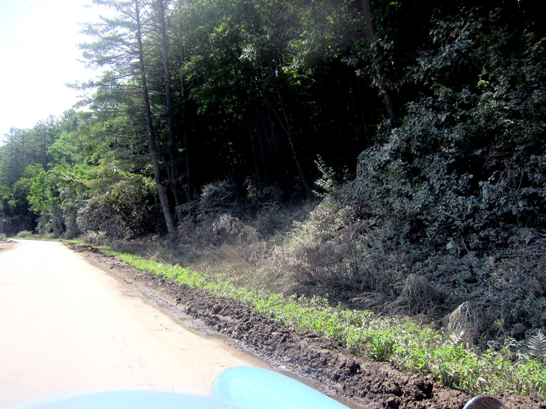
Meandering south on Upper Dover Road, I took a sharp left back north on Lower Dover Road, a smaller dirt road, and then decided to take an even smaller dirt road – Stratton Hill Road – thinking I would short-cut east this way. It was narrow, even for dirt.
BLUE BELLE on Stratton Hill Road, Marlboro, Vermont – Yes It Is a Road
It had rained with major wash outs around Vermont and New Hampshire. As the road even narrowed more I encountered some recent rain ruts crossing the road, but nothing more than 7 or 8 inches across and deep. BLUE BELLE said “I can do it.” But then, she stopped not knowing what to do since THIS WAS A FIRST for both she and I.
See that open space on the left? As luck would have it, the tree came down just on the other side of the greatest width I had seen along the road, just enough to jockey back and forth many times to turn around. But as I started, a car pulled up behind me. “There is a tree down,” I called back. “We know, we live on the other side and had to go out the other way. Coming back now, I am going to hike up for my chain saw.” They backed up, I jockeyed, and waved bye as I headed down the hill. Sharing the photo with a couple friends, in unison they replied, “you are crazy.” But I have adventurous fun! Arriving eventually back on Route 30 and West Dummerston, it was time to search for old train stations.
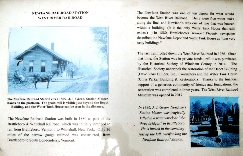
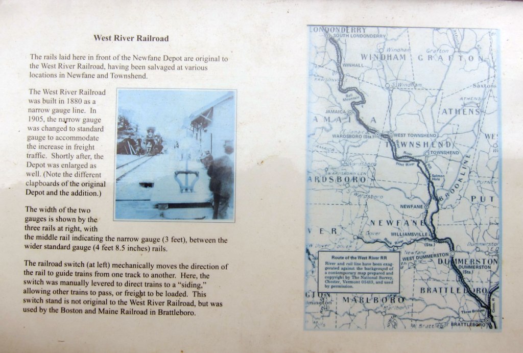
Completed in 1880, the West River Railroad (which underwent many names and ownerships, and affectionately known as “36 Miles of Trouble”) ran from Brattleboro to South Londonderry – never making a connection in Whitehall, NY, as planned. Originally narrow gauge, it was upgraded to standard gauge in 1905. Never earning a profit, the Flood of 1927 signaled its end, followed by the Depression in 1929. It came back in 1931, only to be abandoned in 1936 except for six miles from the quarries to Brattleboro. Six of the ten stations still exist, and sections of the road bed are now trails. What a plan to explore this route which opened up this valley of Vermont to the world.
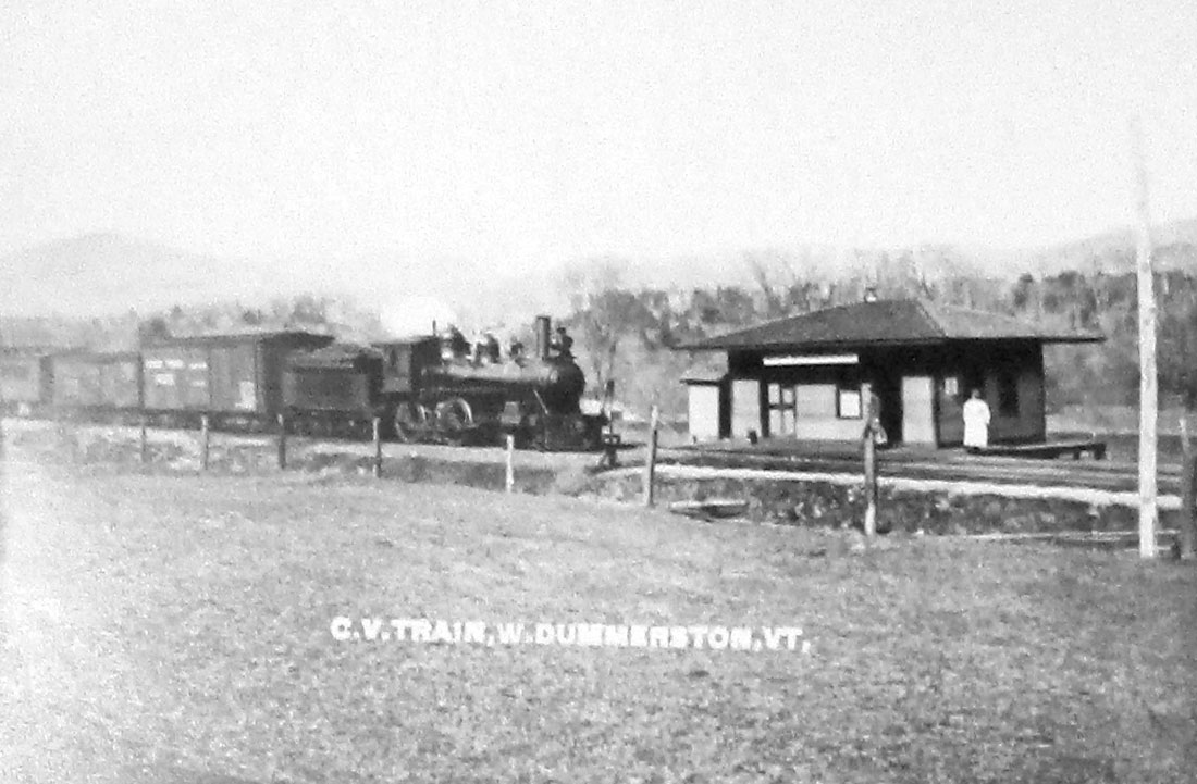
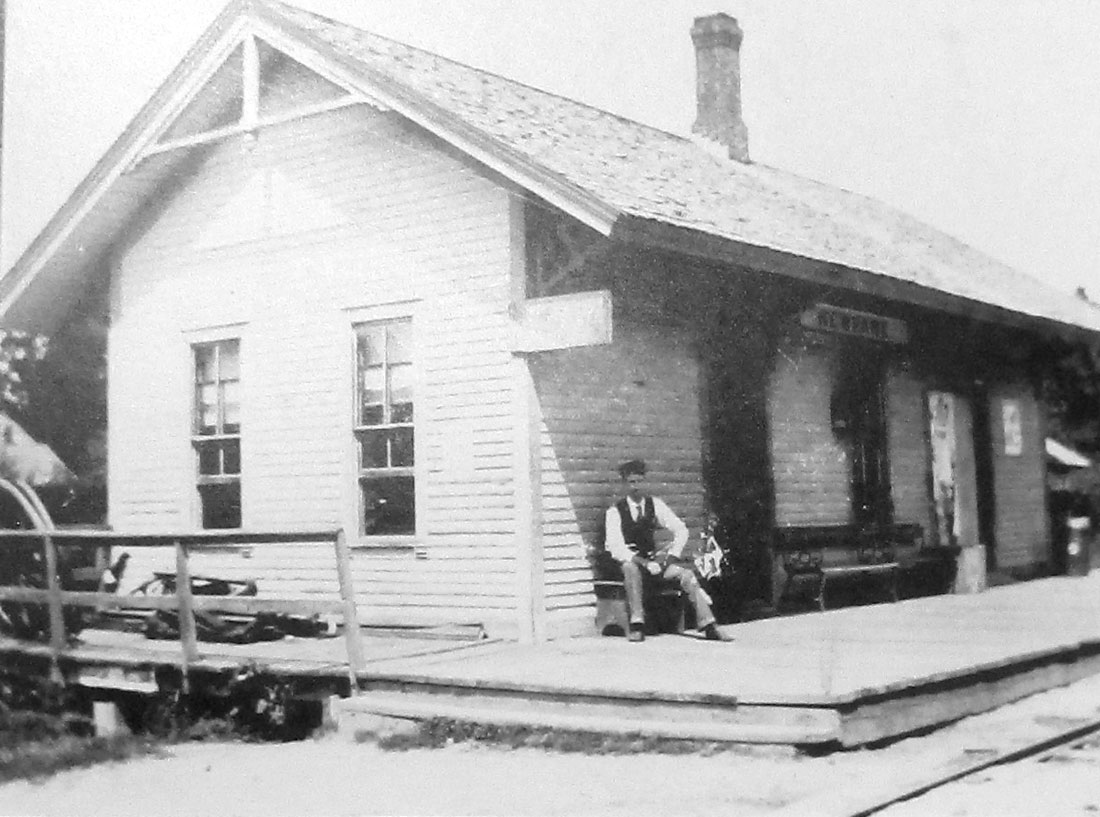
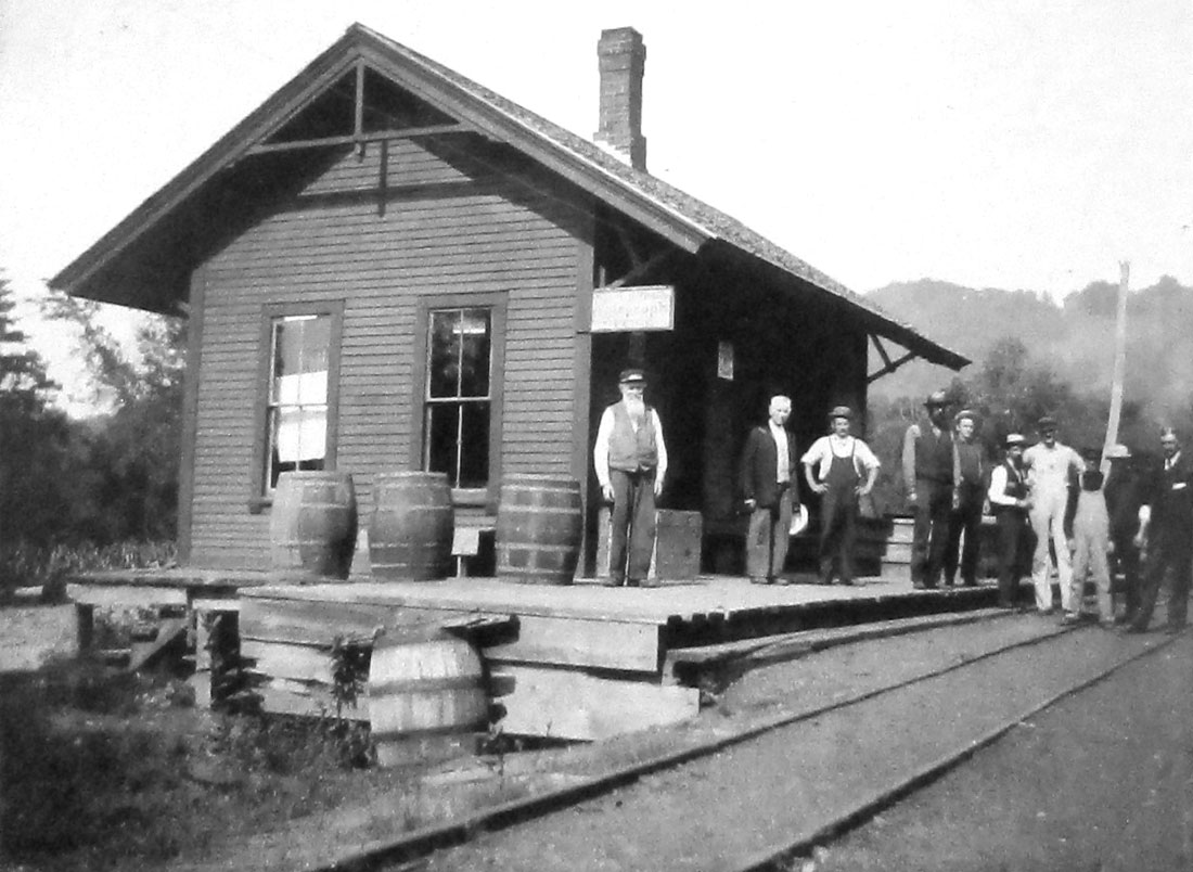
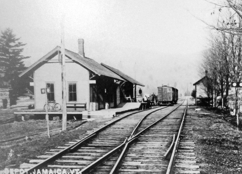
Here is a gallery of images of the ten stations, which you may click to enlarge. Left to right, top to bottom, and traveling south to north are: The original Brattleboro station; West Dummerston; Williamsville; Newfane; Townsend; West Townsend; Wardsboro; Jamaica; Winhall; and, South Londonderry.
Now, for the first three of the remaining six stations. Take the bypass off Route 30 into West Dummerston, and at the northern end of the village is Riverside Drive. May have been a private drive sign, but I may have missed it to see the station as it is today.
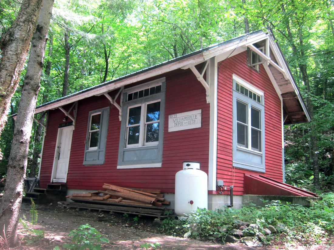
Heading north, just after the busy West River swimming spot, there is a turn (Williamsville Road – also called Depot Rd.) just before the Rock River. Yards down is Station Road where we parked.
Across the street (paved) to the south is where the Williamsville station was moved to (from nearer Rock River) to this high spot as a residence/camp.
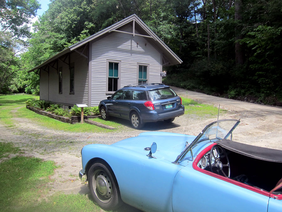
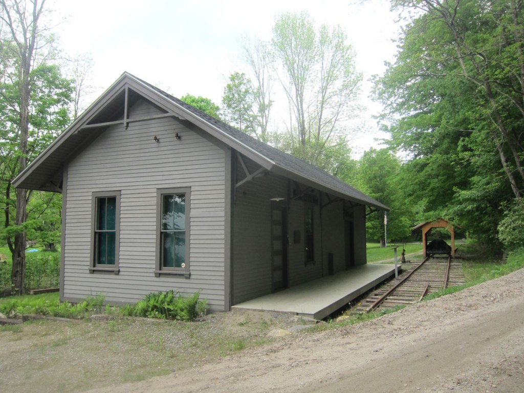
The next station still in existence (and also the next stop on the line) is in Newfane, and you may remember I stopped by in May of this year. But this time when I swung in, the station was open for visitors.
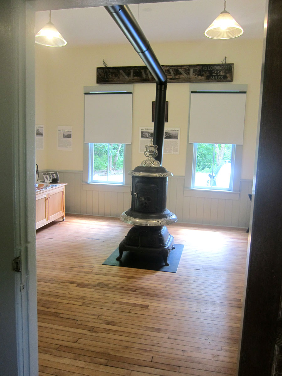
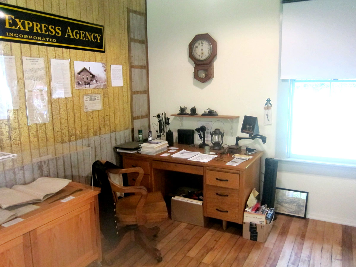
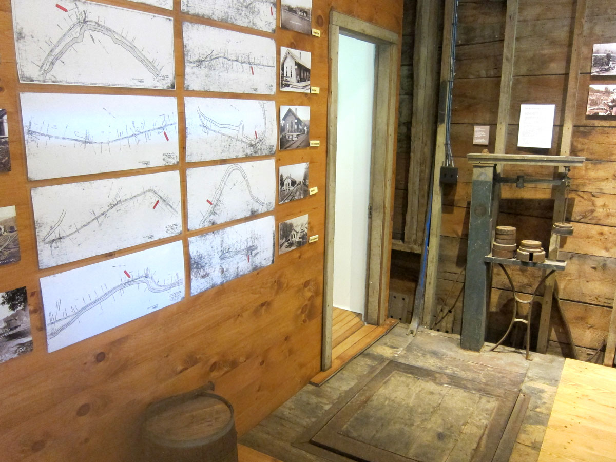
what a treat to get inside this well preserved station that is in its original location. Here is a gallery of interior views.
Upper left is the waiting room, and to the right the station master’s office. The lower images are in the freight room, with the original scale in the right image.
I then continued north on Route 30. In one of the videos a station is mentioned in Harmonyville opposite the General Store. But on the list of stations there was not a stop there – maybe just a flag stop. The road opposite the store was marked Depot St. but I could not find the building pictured in the video. I continued through Townsend (no station remaining) to get a bite to eat at the West Townsend General Store, only to find it no longer in operation – TEARS. Instead of looking for the West Townsend station I headed north up Windham Hill Road. Phase two of the West River Railroad discoveries will begin at this point. There was a permanent barn sale in Windham – a road you must travel up. I chatted for awhile with the gentlemen. He owned The Mill Restaurant in Londonderry for 50 years before closing it recently. He was fun to chat and learn from, and had wonderful antiques. I double checked with him the turn for Grafton, and he replied, “three miles up ahead, turn on 121 – BUT it is dirt,” he warned, “and with our rains it could be washed out.” I know Route 121, and there were no problems as I sped along the two plus lane wide super dirt highway – remember where we were earlier.
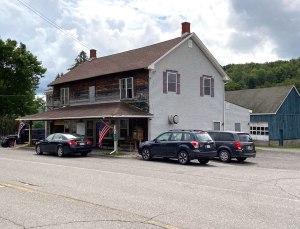
West Townsend store closed, Grafton always a treat to be in, and for the first time I grabbed a wrap at the Grafton General Store – no problem it was almost 4PM – and enjoyed relaxing at one of their tables under the trees.
What can I say? 120 miles — 7 hours — new “finds” nearby — places to explore and re-explore. I will soon get back to the rail route, and I do have some other adventures planned in August – finally — as always, yours, RAY
Recently I have been staying closer to Walpole, but there is still much to see and experience exploring nearby ROADS and ROUTES. The impetus for my trips comes many ways, and there is constant learning that (hopefully) is keeping me young. I started this post on 21 June.
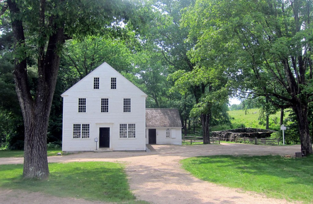
This route had its genesis following my being the first visitor “in the door” on the 75th anniversary of the opening of Old Sturbridge Village (OSV), June 8, 2021. Both the Asa Knight general store, and the Covered Bridge at OSV come from Dummerston, Vermont, just across the river. I enjoy talking with the interpreters at OSV, and my mission that day was to learn the exact original locations of the store and bridge. I was successful, planned a 60 mile round trip, and headed off.
This is an easy trip with picnic and hiking opportunities, not to mention the history. Head south on US Route 5 from Westminster or Bellows Falls (forget the superslab). Turn right on School House Road in Dummerston, or better yet go a tad further and turn on East-West Road. Then you get to pass the VT-NH Veterinary Clinic which originated as a tavern in 1802. East-West Road brings you up to Dummerston Center Common – a nice triangular piece of land – with the Grange Hall, a Church and several houses. It was here I learned Asa Knight’s store stood at the south end of the Common. The home is still there, well hidden now behind trees, but it looks just like my home on the Common here. The store stood to the left, just behind the current picket fence.
To the left is the Asa Knight store today at OSV – and to the right, where it originally stood behind the picket fence.
The house, built in 1810 by Asa Black (and so similar to my home built in 1806) was the home of Rutherford Hayes from 1812 to 1817, father of President Rutherford B. Hayes who was born in Ohio in 1822, but did visit back to his Vermont roots in the area.
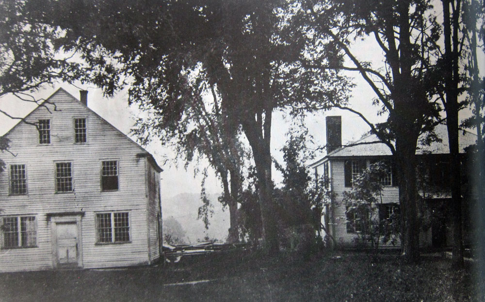
an early image of the Asa Knight store on the Dummerston Center, Vermont, Common
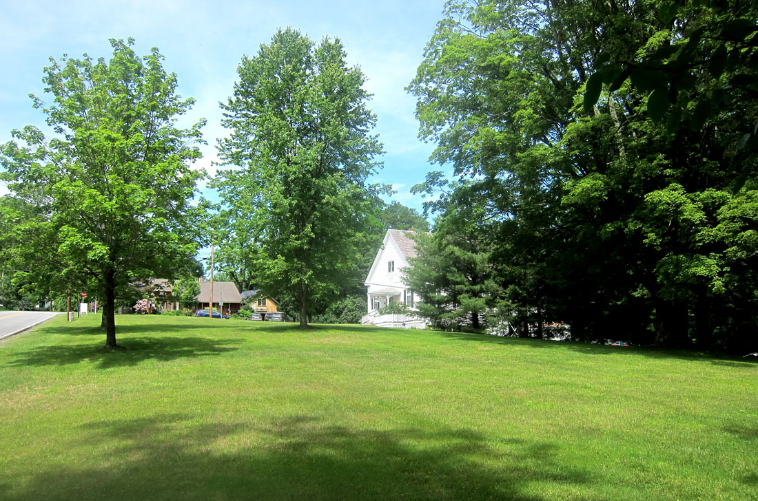
shown below, turning around from this spot, and looking north across the Common to the Grange Hall
Dummerston, Vermont, Common
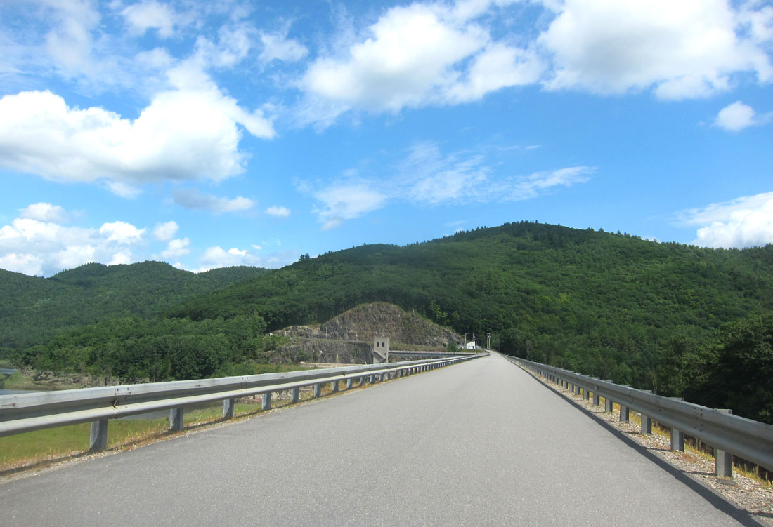
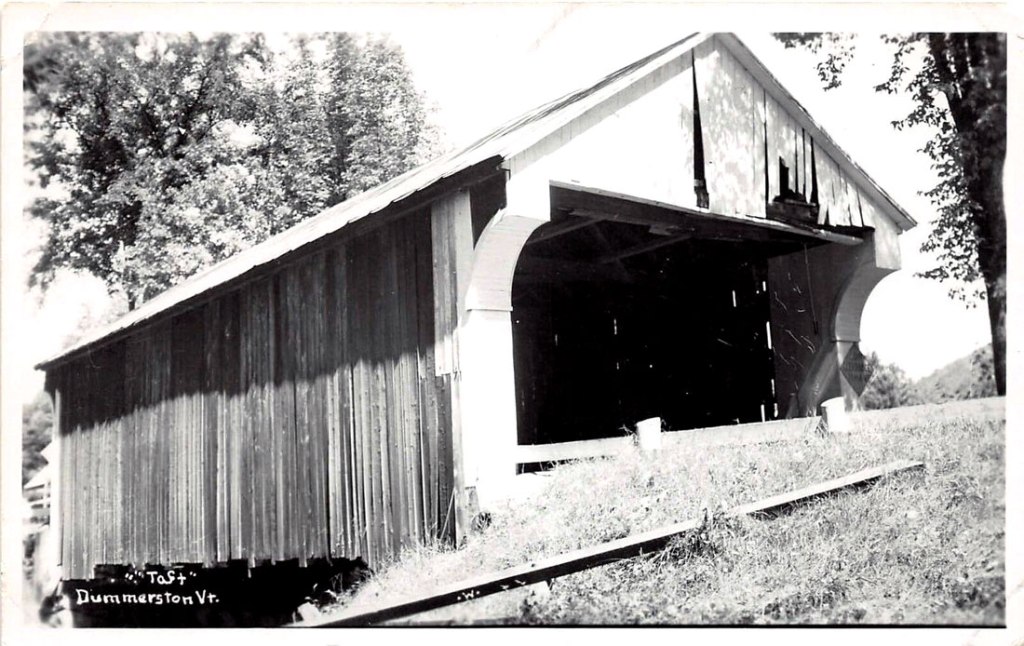
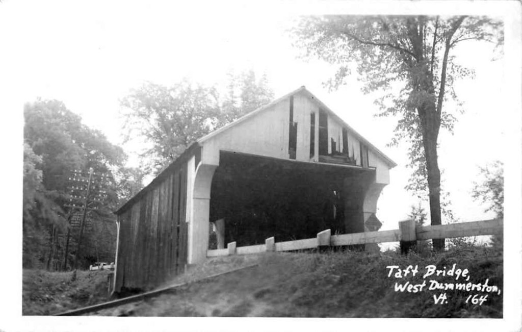
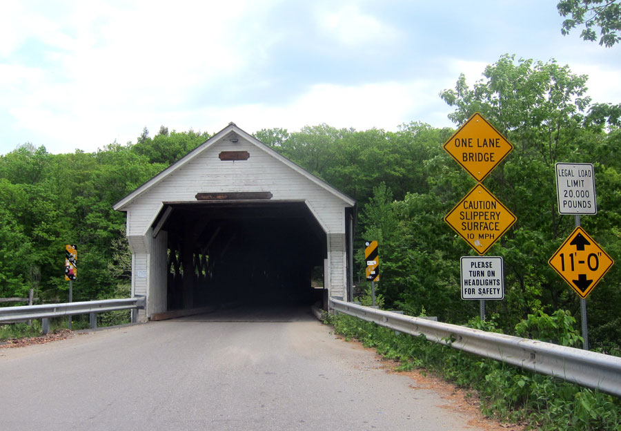
Now continue west on East-West Road, being careful descending, and cross the West River on the covered bridge, the longest covered bridge entirely within the state of Vermont. Head south on VT 30 (if you wish, detour up into West Dummerston saved by the re-routing of Route 30), and watch for the iron bridge. Yards south is the “new bridge,” crossing Stickney Brook, that replaced the covered bridge that was then sold to OSV for $1 and moved in 1951.
Old Iron Bridge in West Dummerston crossing the West River
nothing exciting to look at today, but from the east on the quarry on Black Mountain, this is what you would have seen in the 1880s looking over the stone sheds at the bridge, and the mill on Stickney Brook. The covered bridge is roughly in the center a tad to the left, with the mills on the brook above it to the west.
and, two real photo postcards – RPPC – of the 65 foot covered bridge now at Old Sturbridge Village.
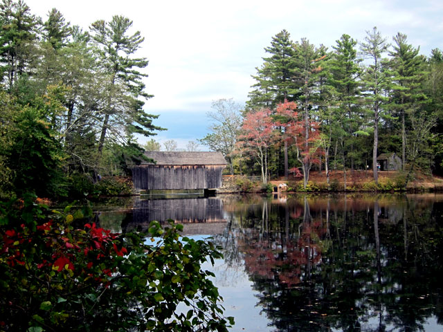
And … Now getting back to this tale on 27 July 2021, the image below is the bridge as it is today at Old Sturbridge Village in Massachusetts.
West Dummerston Covered Bridge at Old Sturbridge Village, Massachussetts
From where the bridge was, below is the little stream the covered bridge would have crossed as it flows east into the West River – barely seen through the trees.
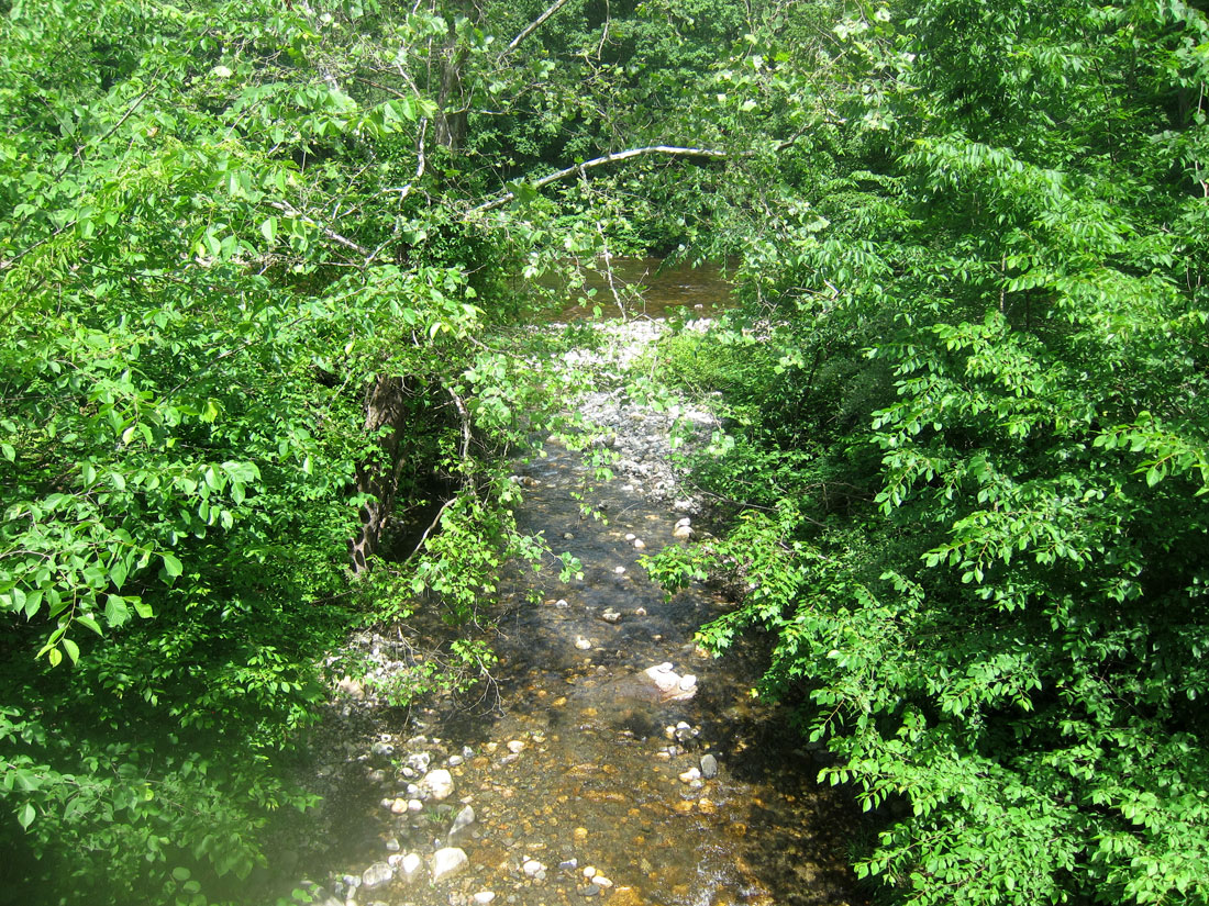
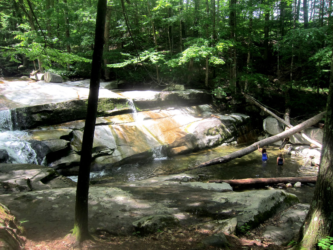
In looking at a real paper map preparing for this trip, just to the west of Route 30, on the stream above, was labeled Old Jelly Mill Falls on Stickney Brook. Now, that I had to see, and I had to learn what a Jelly Mill is. First here is part of this fantastic spot – beautiful falls cascading over slanted granite bedrock, with a number of nice shallow wading pools. The total drop about 30 feet, but no individual fall is greater than 8 feet. A favorite wading and hangout spot of local residents – think picnic spot, and bring your blanket and/or chairs.
A favorite wading and hangout spot of local residentsOld Jelly Mill Falls, West Dummerston, Vermont – June 2021
In my research to understand, there may never have been mills built specifically as a jelly mill. In Brattleboro, L. J. Johnsori, in 1880, built a cider-mill and jelly manufactory. Jelly is not milled. Both jelly and jam are made with fruit mixed with pectin and sugar. The differencebetween them is the form of the fruit that goes into them. Jelly is made from fruit juice and jam uses both the fruit pulp and juice. Jelly is a clear fruit spread made with sweetened fruit juice. Jam has both fruit juice and fruit pieces in the spread. I believe that cider mills often also made apple jelly — thus the term corruption of “jelly mill.” But the falls are named after a “jelly mill” and if you may recall, in Manchester, Vermont, was a grand shop called “The Jelly Mill.” I had to dig deeper.
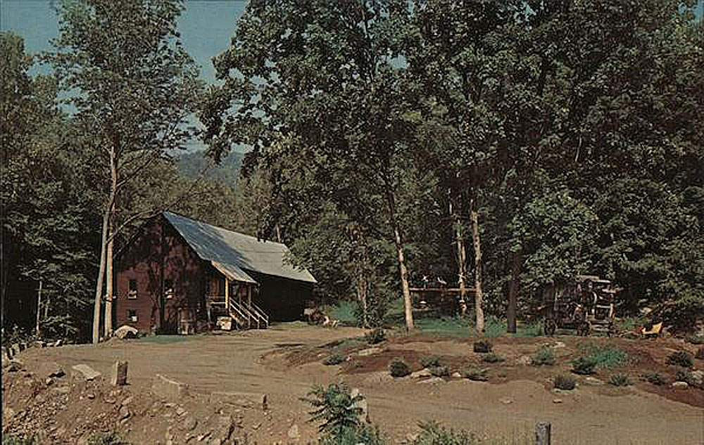
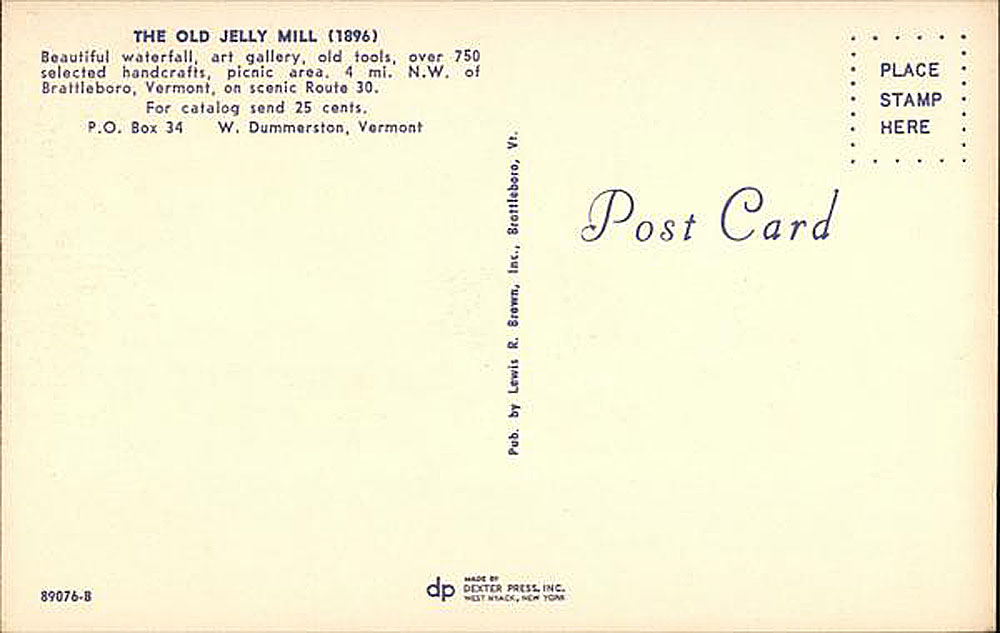
And, in an obituary I learned, “Clinton G. Lewis (1930 – 2009) and his family moved to Vermont in 1964, settling in Brattleboro. He soon established the The Old Jelly Mill, an abandoned jelly and cider mill in Dummerston established by John Taft, and transformed it into a truly unique retail store. The mill burned down in 1969 and they relocated to Manchester the following year and renovated the old Munson farm dairy barn into what was the Jelly Mill on Main Street. Clint operated the business until November 2005 when he had to retire for health reasons.” Below is a postcard from Lewis’ Old Jelly Mill on the falls here, and do click for large views.
The Old Jelly Mill – West Dummerston, Vermont
May I encourage you to visit and picnic. Next on this sojourn I planned to head down Route 30 to US Route 5 in Brattleboro, and then head up to find one of the ferry crossings on the Connecticut River that I have been reading about — and must write about. I wanted to find the old stone building that served the Norcross Ferry behind the C&S complex. It was not until June 7, 1889, that a bridge crossed the Connecticut near here – (now NH Route 9 to Keene). Down a dirt and private road, I quickly snapped this image of Norcross Ferry building.
I crossed over into New Hampshire, and worked my way over to River Road (checking a few more ferry locations to still be studied), onto NH 63, and stopped at Stuart and John’s for an ice cream cone treat. BLUE BELLE jealously looked on as I sat in the shade at a picnic table.
Reading DUMMERSTON” AN “EQUIVALENT LANDS” TOWN 1753-1986, I am finding many more places to explore just across the river in this area which also has the great Landmark Trust USA properties. Additionally, I have several ROADS AND ROUTES explorations planned in following the old West River Railroad from Brattleboro to South Londonderry, Vermont. So, sign up to receive notifications of my posts, gas up, pack a lunch, and get out and “shunpike.”
Enjoy, thank you, yours, RAY
PS – to set your stage for trips focused on the West River Railroad, here are two resource links:
It has been awhile since I have been out. As you know I will head out on a whim, and sometimes have a reason. The past two weekends I had reasons. First to spend two nights in a tent with my son David and grandson Alex while they raced at Canaan, NH, and then I spent two nights in Waterbury, Vermont, to catch a few hours visit with my daughter and her family while dropping their daughter off at camp. So, here are my explorations in Vermont from July 22-24.
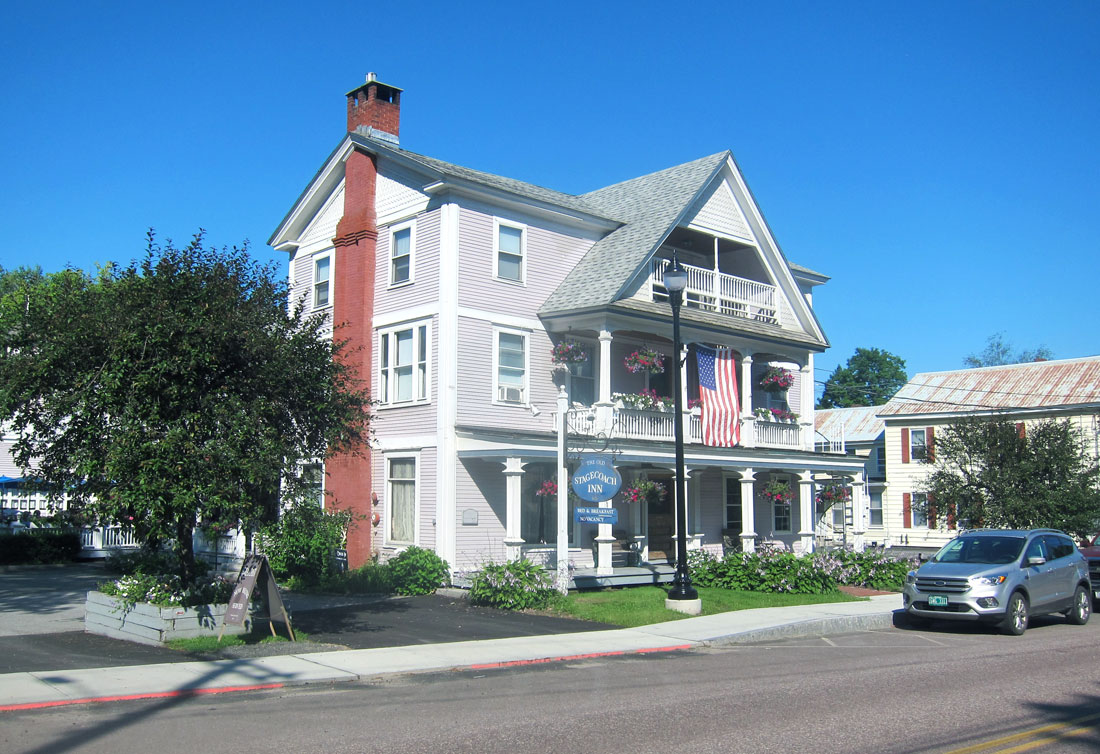
On Thursday, 22 July, I headed up I-91 exiting at Fairlee to visit the Chapman General Store which I had always enjoyed. Operative word here, “had.” New owners, different stock, and sadly no need to stop again. Just one more past enjoyment gone. I continued up US 5 to Wells River to head west on US 302, not having been on that route before. Now that I have, no need to do so again. In Montpelier I continued on US 2 to Waterbury where I was again staying at the Old Stagecoach Inn.
Waterbury is an interesting and vibrant town on both VT 100 (the State’s backbone) and US 2, just south of Stowe. I talked with locals who were visiting friends staying at the Inn and learned this is a town sandwiched between ski areas, and near a 1930s CCC constructed reservoir and mountains for enormous outdoor opportunities for hikers, boaters and mountain bikers. A large group staying at the Inn was up from Lehigh Valley, Pennsylvania biking each day.
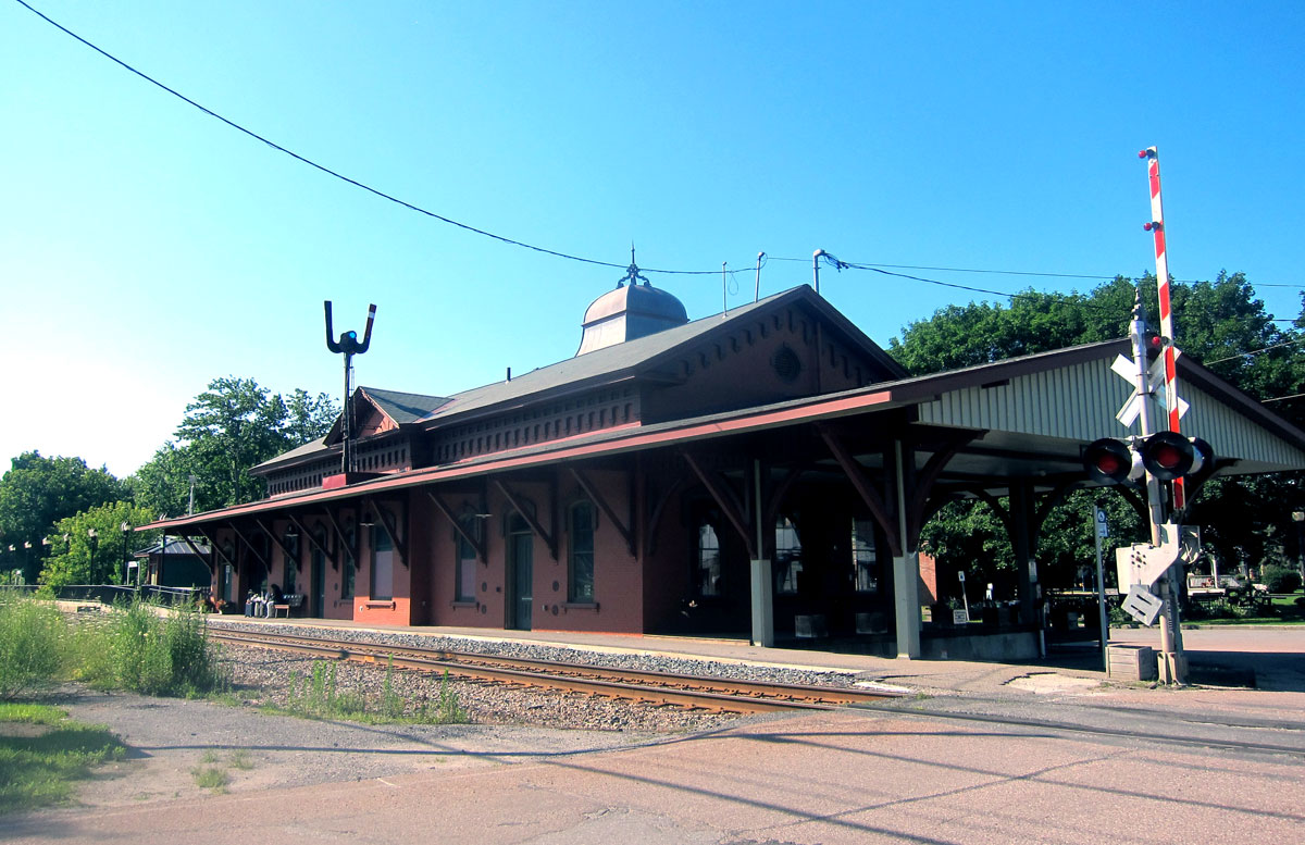
on an early rail route, what a great station.
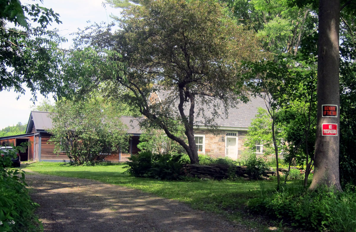
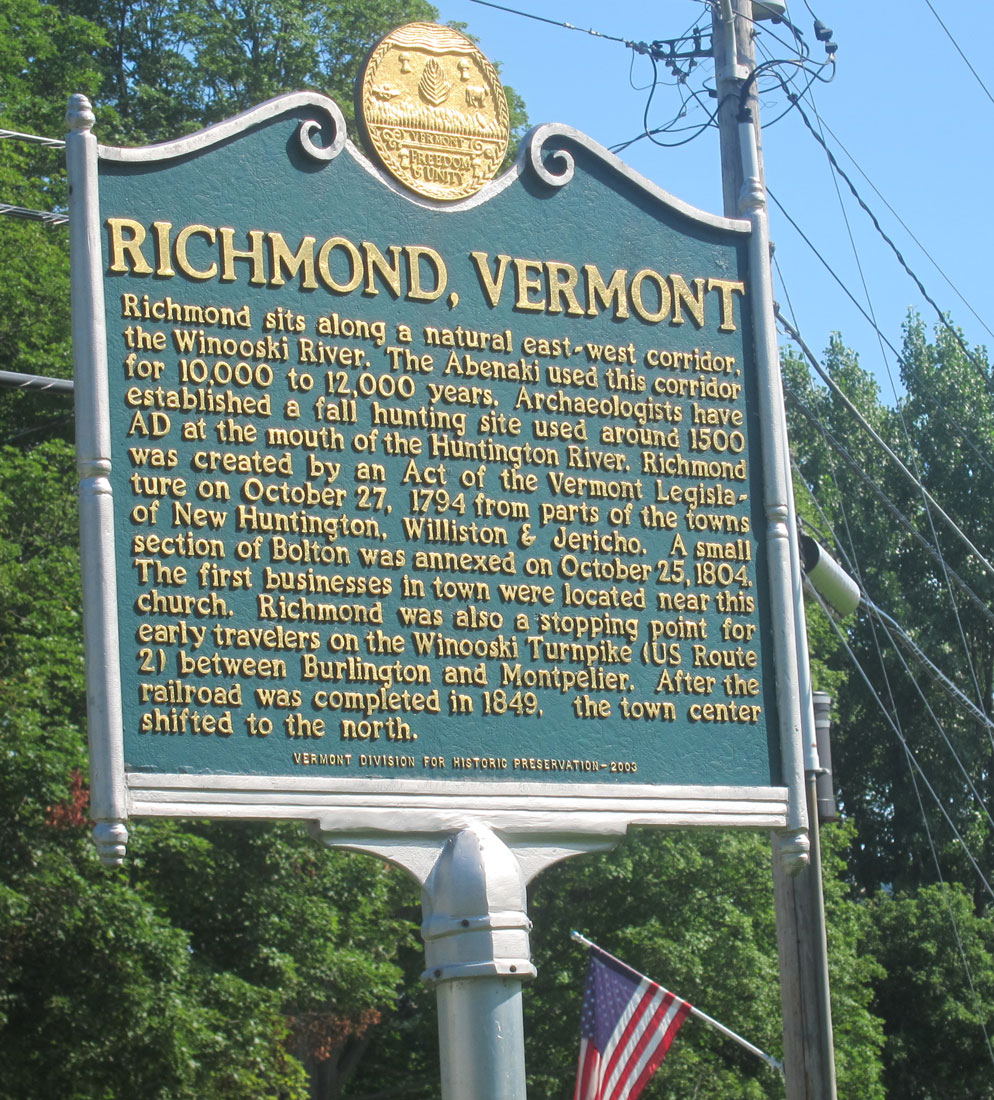
Richmond is a small and interesting village, and I need to stop next time to go back and take the several turn of the century blocks in, but what was amazing (and the only one in the country) is what I discovered south of the Town (where the original settlement was) that I did not know about at all. You may click on the sign for a larger view to read.
Following you will see why I truly love back roading and discoveries on those paths.
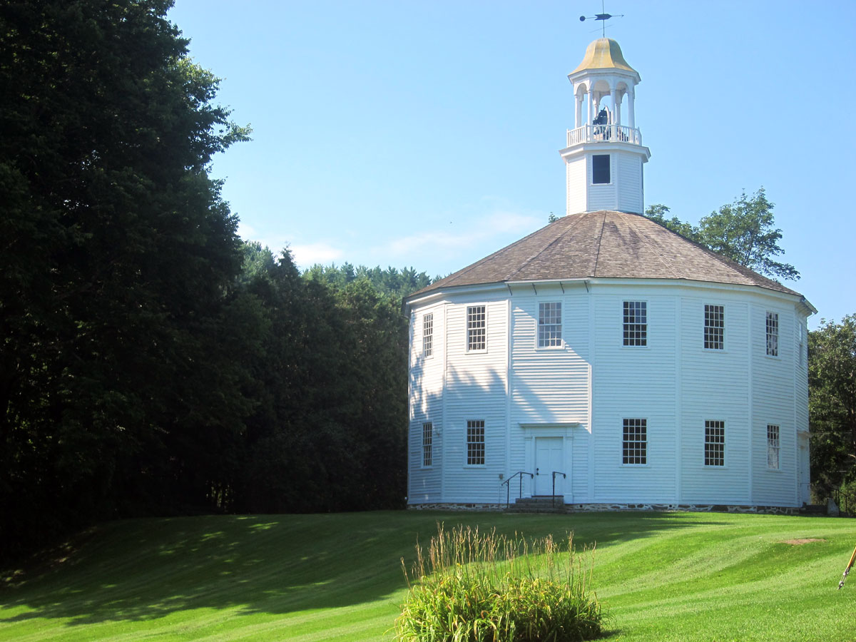
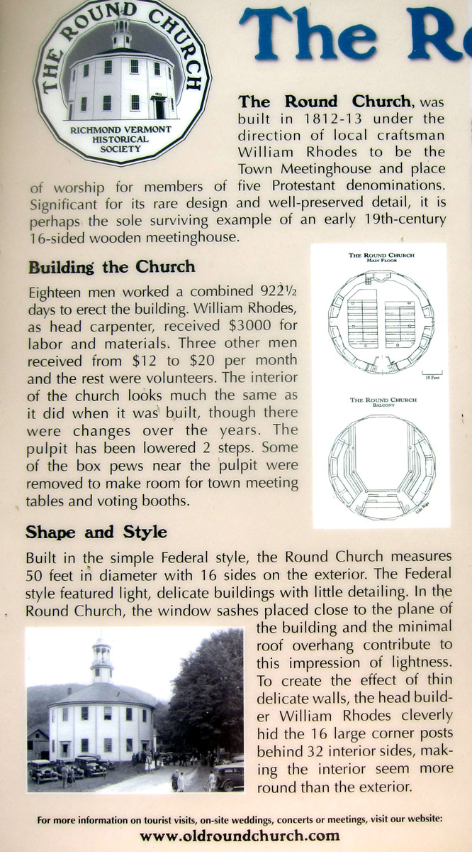
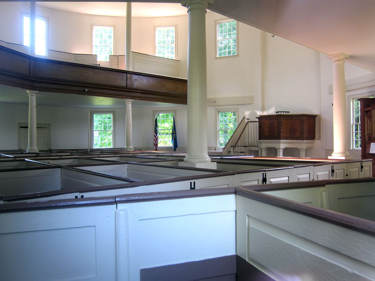
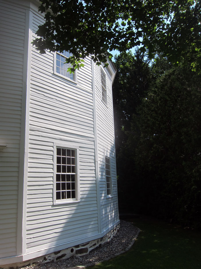
The Old Round Church in Richmond, Vermont
here is the story on the plaque outside
The windows were high up, and I do not know why. But conveniently there were a couple granite stones placed making a step so you could peer inside – and I did so I could share.
The exterior is sixteen sides, but as you read above, the interior was constructed to appear more round. Four years ago I told you about another round building in Brookline, Vermont – A Round Schoolhouse, and the only one in the US. Further below I will share details on round barns. Can it get much better than living in New England? The image below shows a close up of the exterior.
I then arrived at the Shelburne Museum. I have made many visits, and did not have to do it all. Also making it easier to not feel pressure to “do it all” is getting in for “free.” You see, I have a membership level at Old Sturbridge Village that gives me the benefits of the NorthAmerican Reciprocal Museum Association – NARM. The association is network of 1,166 art museums and galleries, historical museums and societies, botanical gardens, children’s museums, zoos and more. Just about anywhere I would want to visit, is a member. Do join your favorite organization at the ARM level — more than worth it, just with this visit here.
The Shelburne Museum is always a nice place to visit, with great art and buildings (some closed due to COVID restrictions) do plan a visit. And, just inside the entrance to the left is the Round Barn.
There are many round barns still in existence, often at Shaker villages. Here is what you want to know about them.
Inside the barn are some horse drawn vehicles. This is an early Popcorn Wagon, and you know about CORNELIA, my popcorn wagon. But I want you to note the “pan” hanging on the front side on the right with the piping coming down.
Now for your history lesson of not so useful information. I would not have known what that was until I found one in 1974 under the eaves of a Victorian cottage I purchased in a Camp Meeting Ground – it is a pan lamp.
Here is mine (right), and below an image I found decades ago showing a group of them being prepared for a show or carnival. Mine was probably used for illumination in the Tabernacle at the camp meeting ground.
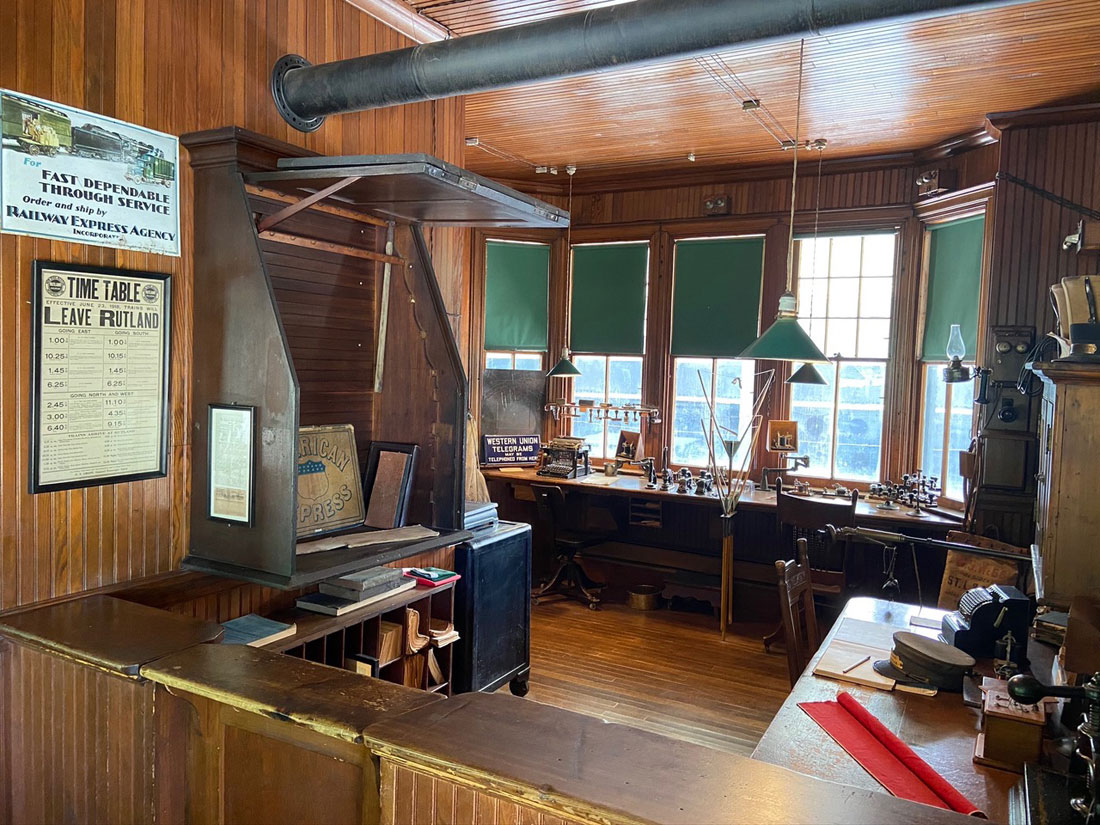
The museum began as founder Electra Havemeyer Webb described it, a “collection of collections.” Her husband was in the Vanderbilt family, thus they had houses, and a lovely life style. She must be praised for her preservation efforts and collections. But, traveling to the city, etc. their private train cars stopped at this elaborate station that Webb built, and was moved to the museum.
you may click these images for larger views to read
and here is the station master’s office – so nicely original and preserved.
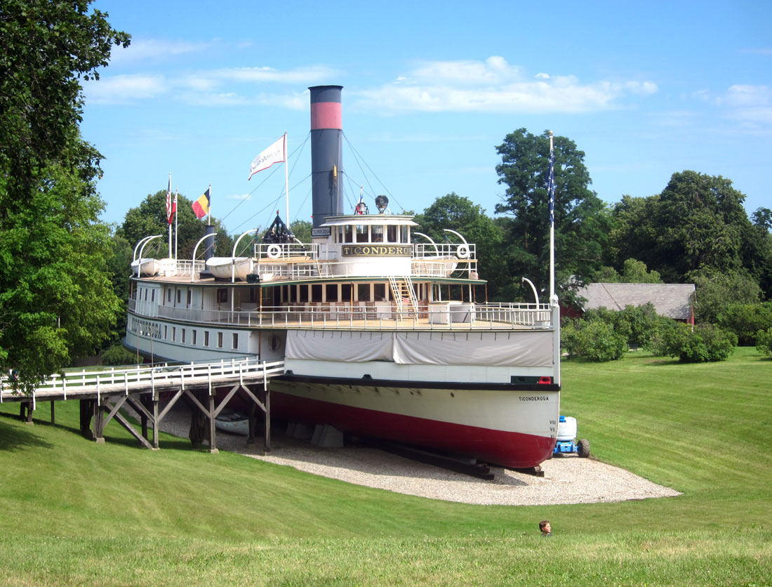
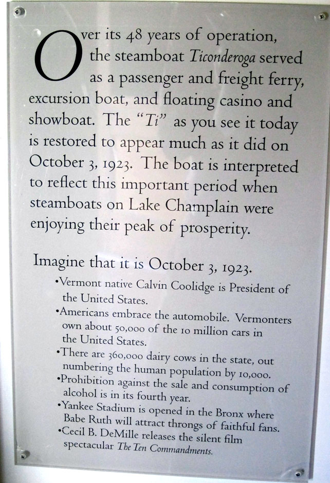
The real prize at the museum is the Ticonderoga – a restored 220-foot steamboat and the last walking beam side-wheel passenger steamer in existence. In was moved in 1955 two miles overland from Lake Champlain.
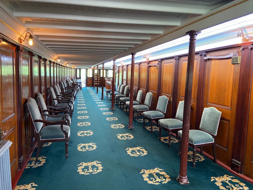
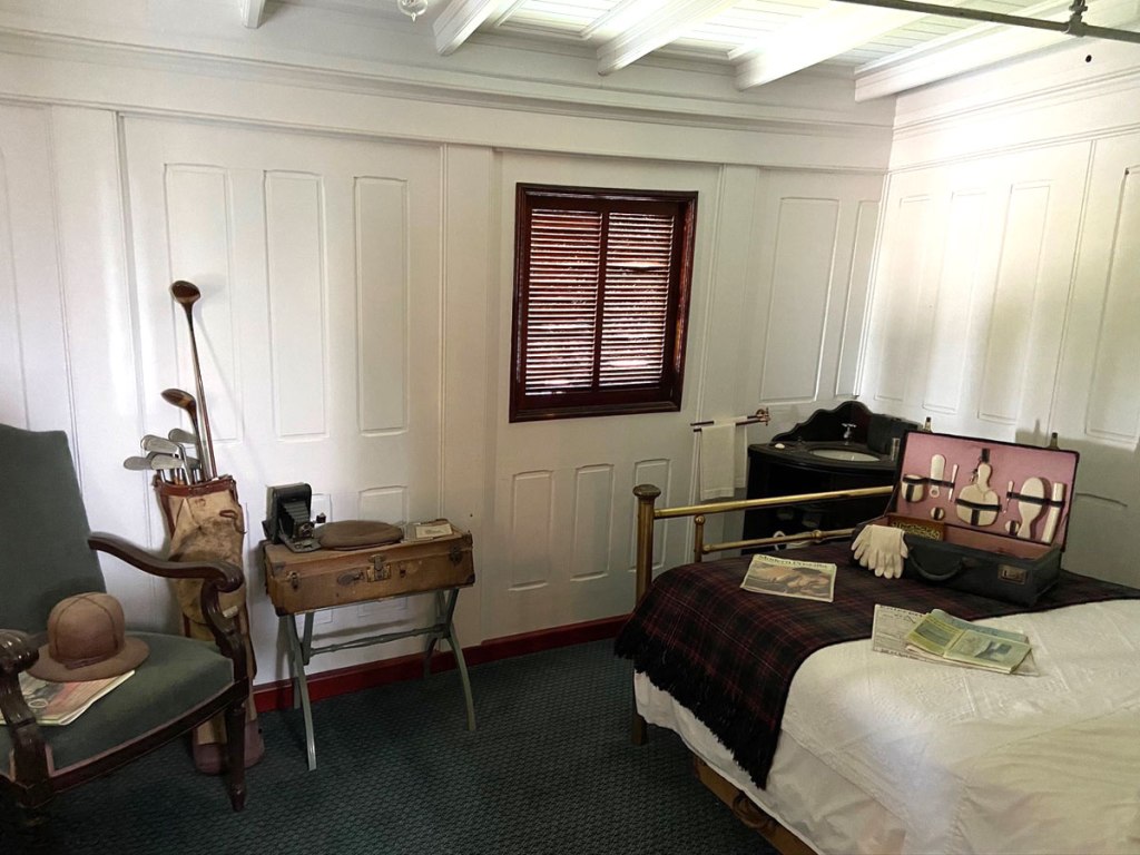
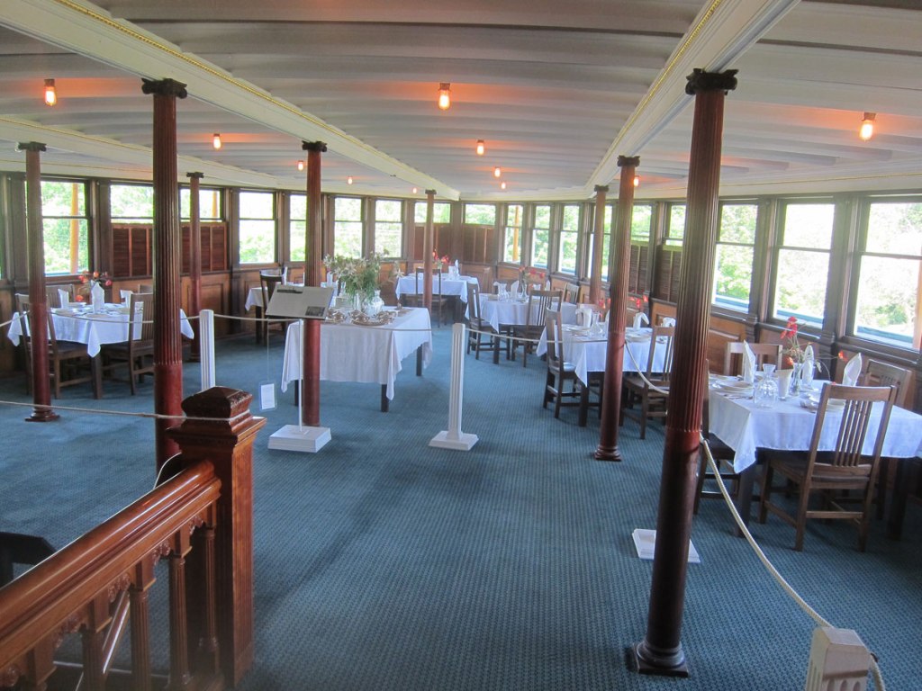
I again enjoyed touring around the vessel taking in this enchanting old mode of travel. The video of the overland move is also special. Here are some views of the vessel you may enjoy. First is the forward deck, then a side promenade, a luxury cabin, and the dining room aft.
This panel I found interesting. Just like Old Sturbridge Village being interpreted in the 1830s, The Ticonderoga has been interpreted to present life in 1923.
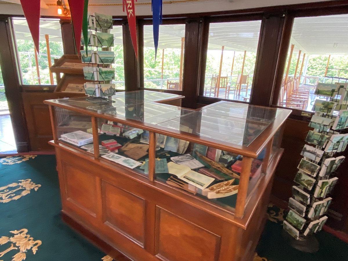
I find the souvenir stand at the entrance to the dining area fascinating with vintage items of the period.
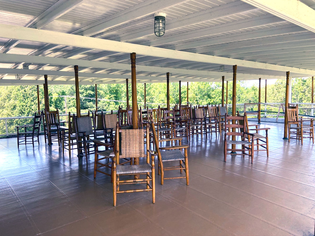
I would love to add this image to my “Rocking Chair Studies” page. A great place to relax and enjoy the water, but alas, no rockers to save the aggressive rocker from going over the side.
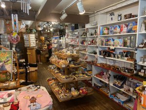
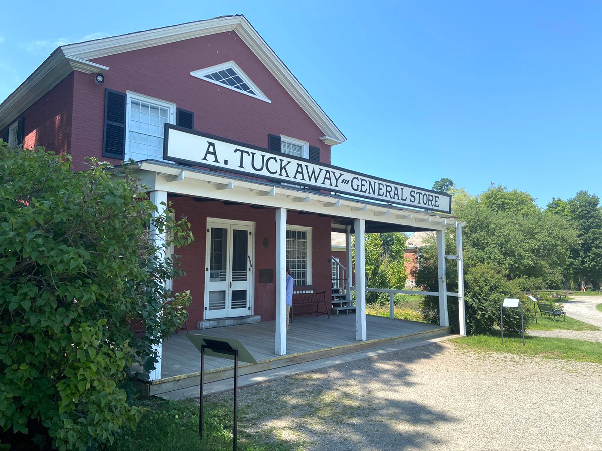
and, you should know that I have loved old 19th and early 20th century country stores for many, many decades. I have my country store collections and my bookshop is decorated as a country store would have been. Here is the store at Shelburne, followed by a slide show of interior views. Knowing many of the items, the interpreted time period is mixed – but how many people know what I know?
The museum has created an “escape game” on-line for the country store. I have not yet tried it, but here is the link – give it a try, and let me know.
Emailing with my daughter, with traffic they were running late getting north. We planned to meet at a restaurant on Route 7, and upon their arrival had a nice couple hour visit over dinner on an outside patio. Then they had to run to shop for some missing camp items, and I headed back to my inn in Waterbury.
Last year for my trip meeting them when they checked out the camp, Dr. Dewey told me I had to see Waitsfield and Warren, Vermont, as well as cross the Lincoln Gap (closed in winter). I enjoyed that trip through those two towns, but did not cross the Gap – so that was the plan heading home Saturday morning. So down Vermont 100 I went, and you can follow my route highlighted in yellow – and can click on it for a larger image.
I can now say I crossed Lincoln Gap and then traveled south through the Green Mountain National Forest on forest dirt roads over five miles, but about 25 minutes. I am glad I was going west over the gap. No scenery since in the forest, but you could not have looked anyway since room for less than two cars on a twisty steep road, and no shoulder to the down hill side. Down Hill? No, mountain side, and a car would roll many times probably before being stopped by trees. Lots of cars for hikers parked all over the summit, and a less dangerous drive, albeit steep, going down the west side.
Finally arriving at Ripton, I headed west to my favorite US Route 7 to head south and home. It was fun passing Waybury Inn in East Middlebury where I stayed in April 2018 – this inn provided the exterior shots for The Bob Newhart show.
I have been traveling US Route 7 for decades, and know all the changes. Busier, towns with vacant buildings, Rutland congested. All the fun stops I have made over the years, gone or changed. I really do not like change. Is that a sign of age? And, change. WordPress made many, many changes for subscribers to write posts easier and better –NOT SO WordPress. It is taking me more time, mistakes made, not intuitive, but I love my writing to you. It will just take longer to compose and create.
Not sure what traveling I will be doing as much as I would like to get back out — tad afraid as the Delta variant is kicking its feet around. If you have gotten this far down in reading and looking at my images – thank you so much. More to come soon, I hope, love, RAY
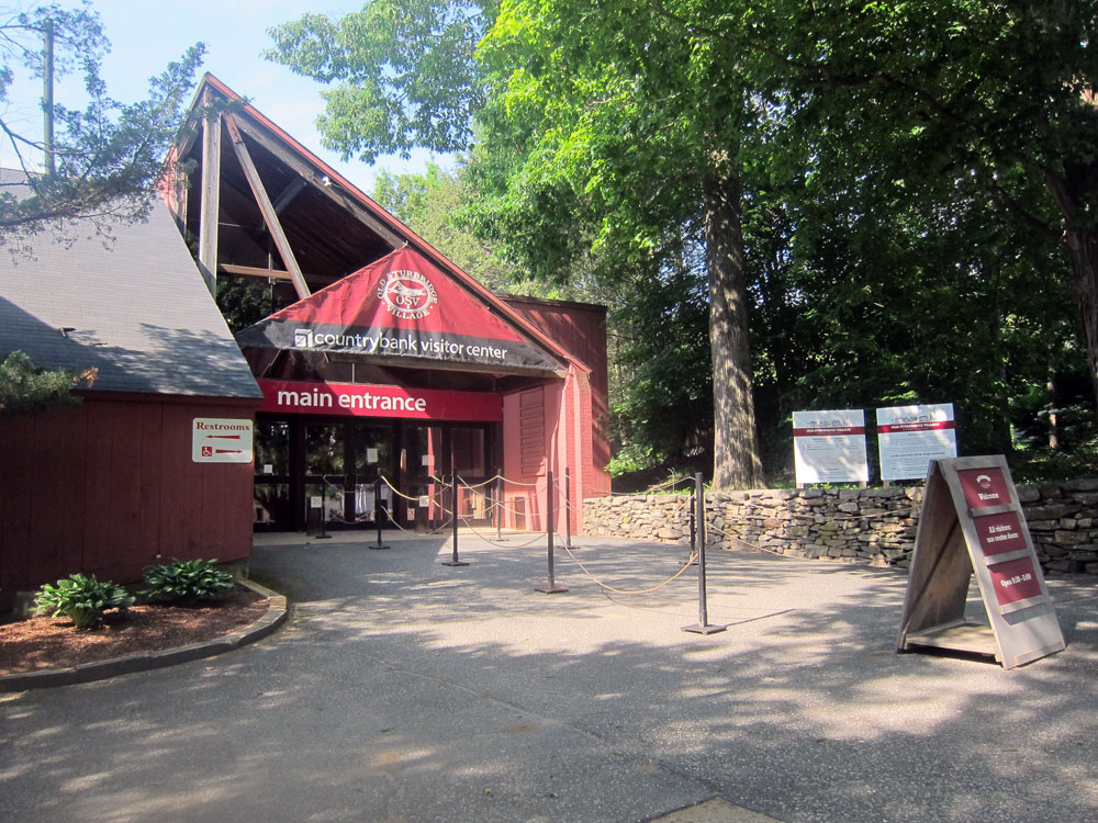
and, I had to be there, and first in line. June 8, 1946, my Dad was still in Germany. My mother was in the Bronx, and at just shy of three months old I was not able to convince her to take me to Sturbridge. But 81 visitors did attend that day, paying a dollar each for admission. Did I ever tell you I love spending time at OSV?
You may enjoy looking at (and I encourage you to look) at this email the Village sent with the early history leading to the opening of this wonderful place. Click on link below – CELEBRATING 75 YEARS OF MORE THAN A MUSEUM
Not one to take chances I decided to position myself on Monday the 7th. With OSVs lodging at the Old Sturbridge Inn & Reeder Family Lodges still closed, I decided to stay at the Publick House on the original Sturbridge Common. I stayed there over 12 years ago, dined there many times, but booked a room in the original building – 1771. My room is above the front door.
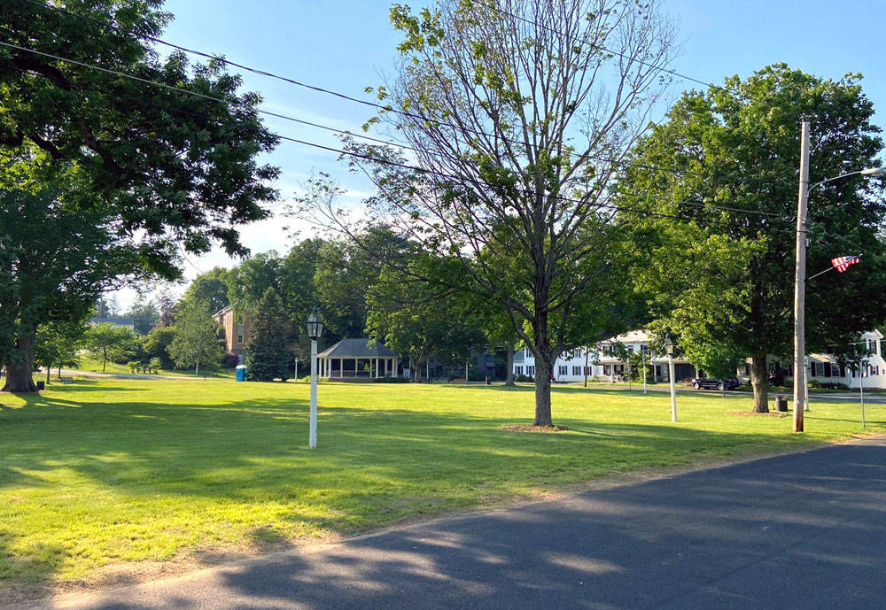
The Publick House faces the Sturbridge Common which was laid out probably by 1738.
I have a “history” with the Common. In 1963, and maybe 1964, I traveled to neighboring Charlton, MA, with high school friends to paint Leland’s Dad’s Black Angus herd’s barn. I traveled back once on my own (sleeping in the barn) and went to an antique show on this Common (notice a budding pattern?). At that time I was already fascinated with early Country Stores, and at the show’s auction did not get the nickel plated curved country store showcase I wanted (think I only had $25 extra – a great deal then), but got a large wooden one. With help, and the top down on the 1960 VW convertible I drove up from Wilton, I loaded the case for the trip home. While loading I was parked in the spot this silver car is in looking through the gazebo. See why I needed to stay here, over 55 years later?
another view of the Sturbridge, Massachusetts, Common looking from the gazebo to the Inn. You can “click” for an almost full screen view.
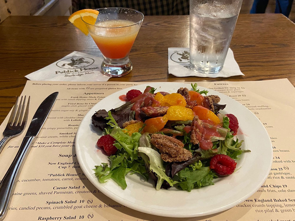
and, then I had dinner in the Inn’s Tavern – very nice and enjoyable.
But, remember the plan was to be first at OSV for the 75th anniversary of its opening. Up early, pastries and coffee at the Inn’s bakery shop, and a drive around the corner, so to speak. I arrived at 9:10, twenty minutes prior to opening – I WAS THE ONLY ONE THERE, AND FIRST TO ENTER FOR SURE.
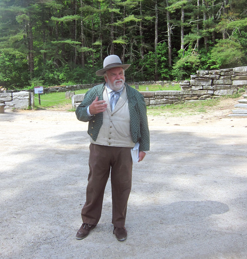
About ten minutes later another woman arrived. I jumped up from the mill stone heading near the door. We chatted. I explained that I was a gentleman, should let her ahead of me, BUT, I had to be first in the door for “bragging rights.” She acquised, but in the conversation we talked about the limited edition souvenirs, and our plan was to immediately head to Miner Grant’s Store to buy ours. After that, I headed to the Center Meetinghouse for the “Common Curiosities” tour. Tom was amazing with his historical information. A great memory and a wealth of information from his 38 years at OSV. I later learned he is a lead interpreter that everyone looks up to. Tom, I am ready to volunteer, if only to stuff envelopes. Here is Tom as he began for (sadly) only three of us.
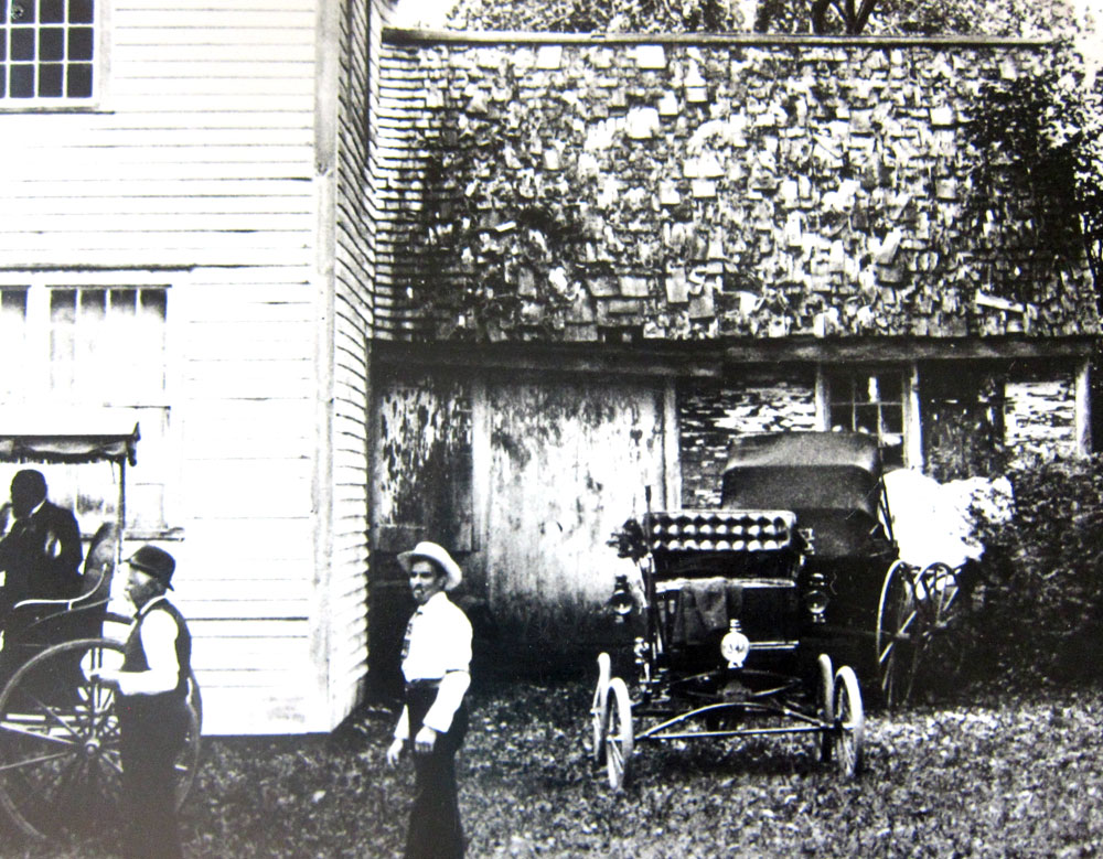
I had some questions, and was thrilled with his answers. I needed to know the original location of the Asa Knight store, and the OSV covered bridge, both from Dummerston, Vermont, a stone’s through from me. Thank you, Tom, I now know where to look, and will post an update here following my discoveries soon to come. To the left of the above image, is the old Country Store, relocated from Dummerston. Did I tell you I have loved old country/general stores since my early teens?
When Tom was done, we headed into the store because he said there were pictures there of the store’s original location. Here is a gallery of those images, and looking at Asa’s house, you can see the similarity of my home at “44” (down to the lantern style and location) and my need to find the location.
and turning around when in the store, there was Susan – docent extraordinaire, who I first met while “Boarding with the Bixbys” and I have enjoyed chatting with on all my return visits. One of the reasons, I am sure, that many folks return to OSV.
UPDATE — 12 JUNE — I FOUND THE LOCATIONS
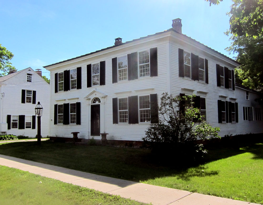
Today BLUE BELLE and I needed a break so we made a 57 mile circle to Dummerston, Brattleboro, Chesterfield, and home. AND, thank you Tom, with the information you provided I can now share the former locations of Asa Knight’s store and the Dummerston Covered Bridge, both now at OSV. Make sure you compare the store images below with those above. Just south of the triangular Common in Dummerston Center, the south end of the Common has a border of trees. Possibly a century ago a road ran in front of the store to the lower road. Have to find maps to see. But here you are:
above is Asa Knight’s home so you can compare with the images above. Again, just like my home at “44” down to the lamp and lamppost position. Below there is now a garden area behind the picket fence where the store was located.
I shot the above through the tree line, and then turned around to take the below shot north of the Common. That is the Grange hall to the right. I have gone to events there.
I continued west on East West Road and crossed the West Dummerston Covered Bridge and headed south on Route 30. The bridge now at OSV crossed Stickney Brook just below the old Iron Bridge. I parked, looked north for this image of the Iron Bridge, and then south to the “new” Route 30 bridge across the brook.
here is an early (late 1940s?) real photo postcard of the bridge in this location above. Postcard image is probably looking north based upon tree line – image above is looking south
below is an image of the bridge I took in 2017 at the village. There is a great story of how it was tied down and saved during a hurricane and flood, Ride with George for details.
on the east side of the “new” bridge you can look down to Stickney Brook as it enters the West River.
From the maps I saw Old Jelly Mill Falls a short distance to the east. And a short distance it is — and so well hidden those out-of-towners heading up Route 30 have no idea it is there. Carved down to the rocks it is amazing. Many people were enjoying the water and surroundings. All I need is a “date” and a picnic basket and head back. Now I need to learn about the old Jelly Mill. There were some old foundation stones along the banks. AND, after a couple hours search on 14 June I found history of the “Jelly Mill” and will begin a ROADS AND ROUTES page with its history – check back for the link when added here.
Now back to the original post.
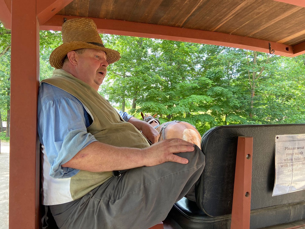
Now, another reason I return? To ride with George, of course, on a cart or stage with his horses around the village. George is an unsurpassed raconteur relating village history. And, early on in my visits we learned we knew the same people, and his nephew lives near me and works in town here.
on this tour into the farm area we first stopped and chatted with the potter who told us about this 12 cent jug – utilitarian, but not expensive. And then George explained the piggery under construction. With a piggery, the little ones had a better chance to survive the elements and eventually become a meal.
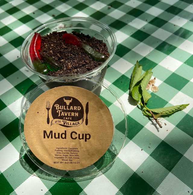
After riding with and enjoying George’s stories I got off at the Bullard Tavern for lunch. I had a shepherds pie (somewhat traditional in the 19th century) and a Mud Cup desert. Much to my surprise there were worms in my desert. YIKES – but on close examination, an extra treat – “gummy bear” worms. Do click image for a squirmy view.
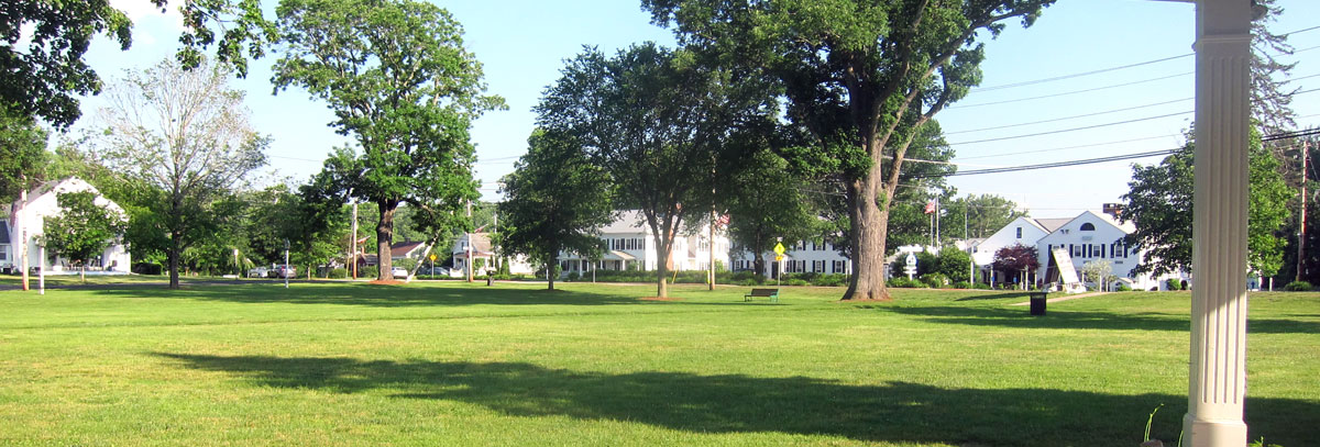
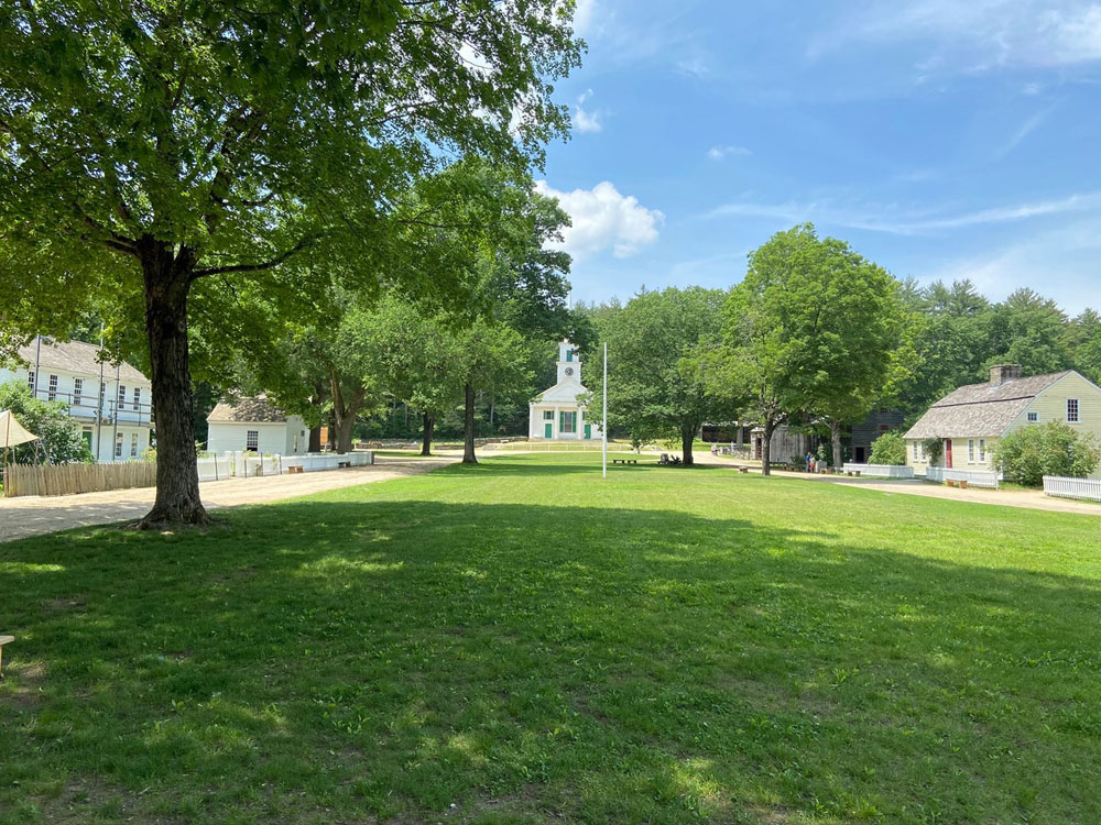
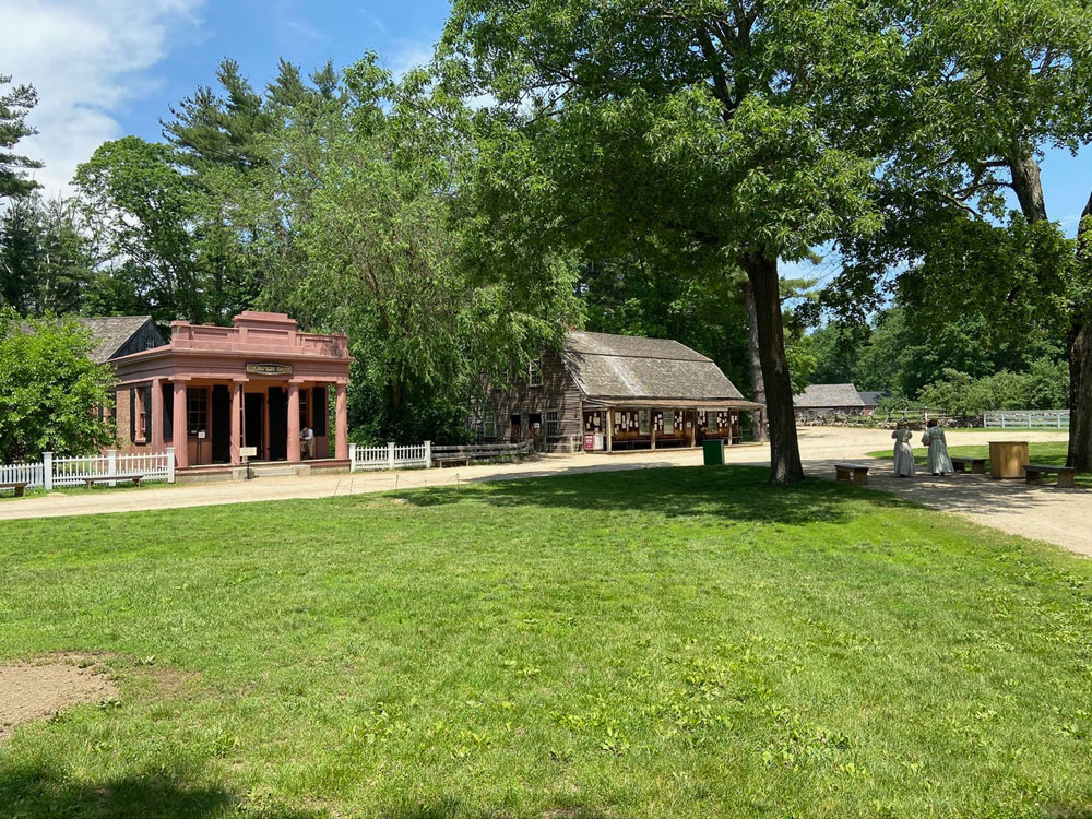
Finishing my enjoyable and peaceful lunch at a picnic table outside the Tavern in the shade, I strolled the bucolic Common before heading over to the print shop. Below are the Center Meetinghouse, looking across the Common to the Thompson Bank and Miner Grant Store, and to the Salem Towne House.
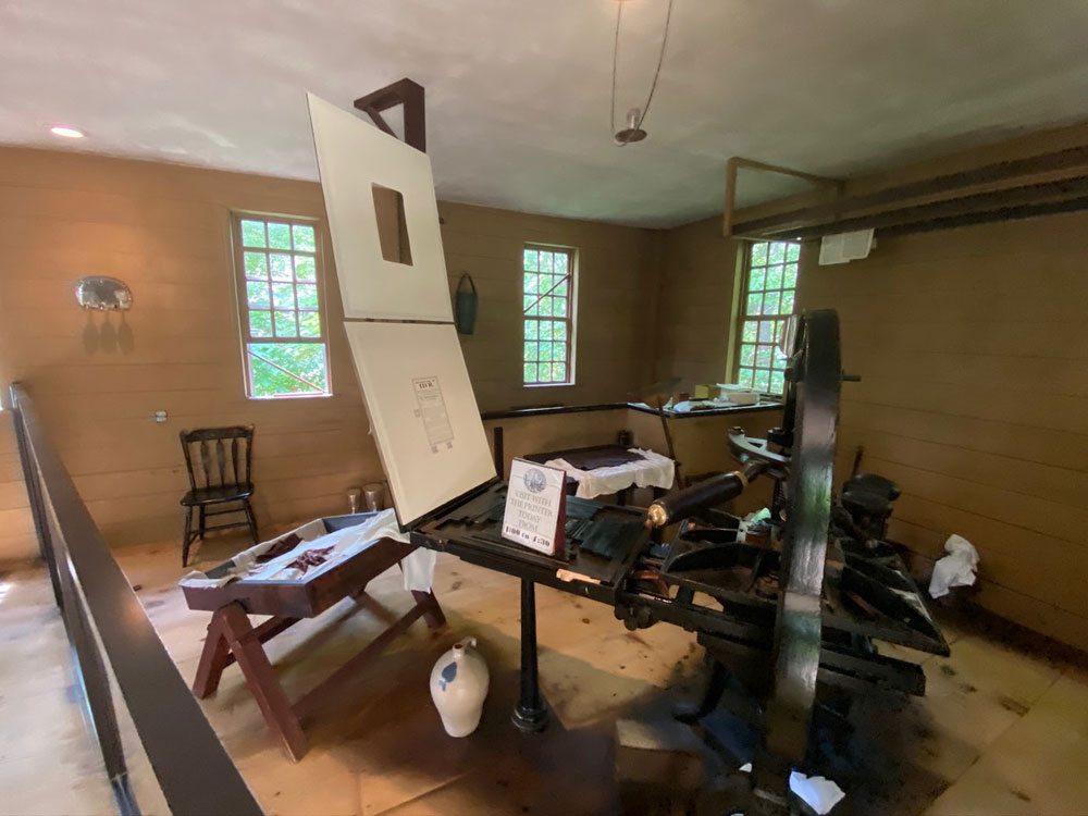
I got my first printing press in 1957, been fascinated with printing, and have a number of presses and equipment to this day. With hobbies of printing, photography and collecting US Commemorative stamps beginning in my pre-teens, it all led to Ray today – publishing and writing history articles, and life is good. The interpreter in Isiah Thomas’ printing office filled me in on much more than how a press operates since I told him my background. A great time. I learned that this press was among the items first purchased by Wells as his collecting mania began.
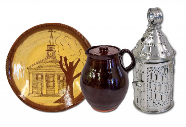
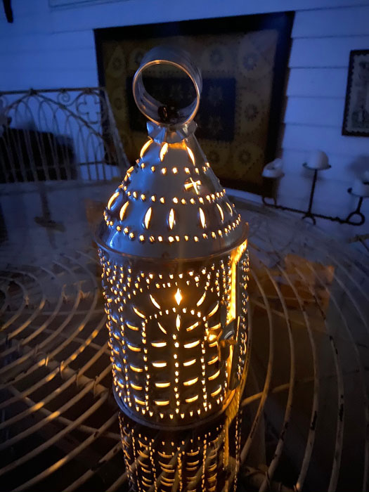
I had seen on the OSV website that special commemorative items had been made in a limited number for the 75th anniversary. Limited to 75 of each item. Once entering the grounds I headed right to the Miner Grant Store to purchase my treasures (as did the woman I did not let in front of me). I thought that the miniature punched tin lanterns would be small, but just a tad shorter than the real ones in the museum. And, my wood-fired pottery pitcher was a must have. The plates are not yet ready, they want me to come back for one. I left my purchases there to retrieve when leaving.
Now, limited number of items, you want a low number, if not Number One. The lanterns were not numbered, but the pitchers were. I searched for Number One, but was told that one of the clerks when unpacking them found Number One and scooped it up. But I found Number Three. I have enjoyed chatting with many people, as you have come to learn, and once outside a fellow followed with his purchase. Ends up he was the volunteer potter who made the pitchers while at home. We had fun chatting about lots of things (including spinal stenosis). He told me that as he laid the pitchers out for numbering he was pretty sure mine was the first made, but placed where it got numbered three. Well, makes a good story, I was first in the door, and have great souvenirs. I lit my lantern that evening when home using a tea candle.
Back at the Visitor Center was “Curator’s Pick: A Look into the Institution Archives.” This young lady was sharing some of the great ephemera documenting the early years at the village, including a paper board game.
Almost five hours there (includes my early arrival to be Number One for sure) it was time to head back north. Back roads of course, Route 32 into New Hampshire always enjoyable. I will be back several times this year, and someday hope I can contribute (more than dollars) time in some way. Old Sturbridge Village is a national treasure for all to enjoy. What I really enjoy seeing is youngsters being exposed to history, the early way of life, and as a result possibly develop an infinity for and get involved in history.
Remember, you cannot make this stuff up. I have adventures, and I am blessed (thank you, God). I am fine, well, and always “accept and adjust.” Remember in my recent Naulakha post I shared Ms “I’s” tale? When stopped she said, “do you know how fast I was going, officer, when you jumped out? You could have been killed.” — think I now have an equal (if not better) tale.
It has been hard getting momentum back to get out and play with LadyRABIII (1965 Airstream Caravel), but today was the day finally for a maiden voyage to head to Dr. Dewey’s to get the rear bumper welded back on for safety and aesthetics. I headed off to Weston a tad after 1PM. Heard a strange noise from “my lady” but could have been from rust on a brake pad from inactivity, and in a couple miles it went away. So, no problem.
I got to Weston, and Dr. Dewey went to work.
See that green speck in the background? BLACK BEAUTY’s sister albeit in BRG.
I started up to head home, “hey Dewey, there is that sound again.” It will go away, and it did. Wow, driving home was easier than going. Ray is getting good at towing “his lady.” Speed limit safely all the way, cornered well, my choice in rides to escort her (2001 Ford F150) was just perfect.
You know US Route 5 heading south into Bellows Falls. Coming down the hill into the village the speed limit changes to 30 MPH (hey I am driving American so thinking MPH vice KPH). You know the stretch – flashing speed sign (thanking you for being at the right speed) then the police station, fire station, J&M Towing, and Lisai’s where I love to grocery shop. Approaching the police station I see a cruiser pull to the curb – the blue lights come on, I slide past. The cruiser comes out, siren blaring. Must be on a call, I pull over to make room.
Cruiser pulls up behind me, angles to block the road. Young officer comes up to me. My hands on the wheel to show I do not have a weapon in my hands. A female officer, just a kid, and I say, “hi officer, I know I was going the speed limit.” “Yes you are,” she replies, “but did you know you are on fire?” Well, Ms “I” think that beats your tale!
I get out as the fire trucks roll up (remember the fire station is just yards away). The gracious and polite officer tells me a Cota and Cota driver behind me had called the station advising flames were coming out from underneath LadyRABIII. We crawl under. Right side wheel is leaning out and rubbing body. Fireman pops hub cab and starts spraying something to cool the wheel. It smells. I go inside to check for fire – none. Heat sensor shows major problem underneath.
What can I say? Brief conversation with police officer, fire department, and the towing company that shows up (they were the closest to me – hey, I am talking feet). Do I try driving four and a half miles home? Do I want to lose the wheel on the bridge under reconstruction and screw up the bridge for hours? Do I want to lose the wheel on Route 12, and maybe not relate this tale? Load her up fellows. And we did.
I did the right thing – for everyone. And, everyone was so helpful and gracious. Our Bellows Falls members are to be praised. The officer disappeared before I could hug her – well, maybe someday.
The plan, besides exploring in LadyRABIII, was to “party” in the back of “44” — and she is in position now for those parties.
And, her tow vehicle does not know what is next.
There are lessons here, and hopefully you know me by now. First, ACCEPT and ADJUST, there is always someone worse off than you are. And, for whatever reason I have been blessed, and Cathy and God are watching over me. There could have been a bad and final ending.
Count your blessings, love, RAY
The morning of the 26th, I sent the below email of thanks to the Bellows Falls Police Department, Fire Department, Town Manager, and Cota and Cota. What could have been a very bad situation was handled professionally and extremely well. At a minimum a note of thanks was in order – RAY
———————-
This is a note of thanks – yesterday my neighbors in Bellows Falls were special friends, professional and exceptional.
If I heard correctly from the Police Officer who pulled me over it was a Cota and Cota driver who had called the station to report flames were coming out from under my 1965 Airstream trailer as I was entering the village. If I have that correct, thank you to Cota and Cota.
Pretty sure it was Officer Jillian Cenate who stopped me. Well, going the speed limit, I thought she was going to a call, but when I pulled over she blocked Route 5 and came up to me. “I know I was going the speed limit,” I told her. “Yes, you were, but did you know you are on fire?” Professional and courteous, Bellows Falls has a fine representative with her servicing the force and the public.
Only began talking and crawling underneath with her and the Fire Trucks show up. Chief McGinnis and his sergeant were there. If others, they were professional, doing their job without my even aware of what was happening. I guess when in a situation like this it is hard to take in all that is happening. But, with trained professionals, things just happen
Yes, there was a problem, and looked like the wheel was about to come off. Discussion back and forth about what to do. Even with less than five miles to go – a real problem could evolve. I decided to do the right thing. Somehow J&M Towing walked up (I was feet from them, and yards from the Fire Department – blessed, yes, and thank God and my late-bride every day). I could not find an email contact for J&M, and did not get names, but believe the owner was there. They loaded up my Airstream, and the young courteous and professional driver placed “her” in my backyard for a summer’s rest.
I have nothing but praise for all involved in what could have been a bad situation. Thank you, yours, RAY
I almost immediately received these replies back:
Ray:
It is always refreshing to hear positive feedback on our public safety staff. They work very hard in a lot of tough circumstances and always strive to serve the public.
I really appreciate you taking the time to acknowledge them.
Thanks, Scott Pickup Municipal Manager
and,
Ray, Thank you for the kind words. The employee that call it in was Ed Carello on of our plumbers who is also a volunteer fire fighter. We are very proud of his actions and showing great character in a potentially dangerous situation. We are glad you and your airstream are in good shape. We wish you a happy summer and hope you are able get out and do some camping.
I have had a hard time getting back out – we all have. I have lost momentum with LadyRABIII, BLACK BEAUTY is buried behind LADYRABII who has a leaking carburetor and dead battery. Bottom line is I am really out of practice. Earlier this week I started planning a BLUE BELLE sojourn around Lake Raponda where Carrie and Rudyard Kipling would visit. On the way I could shop at the Wilmington, Vermont, flea market that opened today. But my mind waffled. Email replies to Ray said, “just do it.” But I modified to a shorter route to hit some new (and old) spots, and finally I left. Glad I did.
Did I say modified? Let me also modify my presentation. Get out your pad of paper and pencil. I will number the images of my route, and see if you know where I am taking you. It could help if you get out a map, I had my 1980 atlas open (real paper in book form) as I went. Write your answers down, and check with the answers at the end. Get them all, and “name your prize.” Actual award up to me. Let’s get going.
For some reason I always end up in Vermont. Better loops? More isolated scenery? Fun dirt back roads? All perfect reasons. I first passed through this village. Great meals at this inn. Sadly most all other retail and eating establishments I used to visit are now vacant
Number 1
Although abandoned, this great “Stonehenge” has not changed in my almost 20 years of passing. The nearby general store, however, is no more.
Number 2
This should be easy. An overnight here in 2002 changed my life. I turned left (south) here.
Number 3
Please do follow this road south. As with many older, original New England roads it follows a little stream. When the road ends, bear right and continue south passing lovely properties until you reach the next town with a perfect Common. This bandstand was constructed for the movie FUNNY FARM, and the “Towns” people asked that it remain.
Number 4
My new plan, hatched less than an hour before I left, was to get something to take out to eat in this historic village and find a spot to eat. I called and found that the village store, since 1822, re-opened just Tuesday by new owners.
Number 5
Around the corner I knew where I was going to eat. No picnic table, but how about a rock along side a small stream? I remember when this museum was opening for the first time, but I did not make it. Named 36 Miles of Trouble, this railroad ran along the West River from Brattleboro to South Londonderry.
Number 6
these images are not on the test, just click to expand, and look and learn.
Heading back south on the not so bad scenery wise main road, one of the few spots to cross the river for many a mile is right here – often seen in my posts.
Number 7
and, turn south just over the bridge, and on the almost immediate bend, turn right onto a unmarked dirt road that you can easily mistake for a driveway. I have wanted to explore this road for some while now, but in chatting with Ilana, I believe she biked this route last week. It follows the river, eventually climbs a mountain with amazing views. Coming back down the mountain, the road ends on a US numbered route near the Connecticut River. That end is close to Kipling’s Naulakha. Giving you too many hints.
Number 8
Yes, that is BLUE BELLE’s antenna that I did not see when taking this image. RAY HIGHLY RECOMMENDS — TRAVEL THIS ROAD. Along the way you can make out part of the old railroad bed and right-of-way. At this point (below) the old railroad bridge abutments exist, and with turn-offs for parking many folks were down in the river having fun.
With a spot in mind, I turned back north to this farmhouse. On my list, the Landmark Trust USA property is isolated and perfect for large gatherings. Sorry about not so great images – basically an overcast day, thus not that bad with top down (of course it is never up).
Number 9
Getting to this intersection, I turned right at this old 1874 Grange Hall to head down the hill to a US numbered route.
Number 10
Heading back up north I decided I wanted to get back home, and to “work.” I cut over to the super slab, thinking it was time to “blow out some carbon.” BLUE BELLE and I decided to stay a tad under 160 KPH and 4000 RPM until we exited. Then crossing the big river, and onto Main Street and home.
Number 11
Remember I said I was going to modify this post to a different format? Well, as writing, I decided on another modification. I am not going to give you the answers now. Instead I invite you to post your answers as a comment. So, get out your old detailed hard copy maps (or Google.maps if you must) and plot the route and identity the image locations. Maybe in a couple weeks I will post the answers, and annouce a winner, or winners. But if you just get out and explore, you will always be a winner.
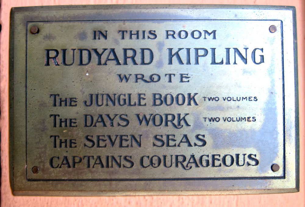
If you have attentively followed my meanderings, you may remember that I discovered NAULAKHA on Flag Day, 2015. And then toured it during an open house in June of 2019. Landmark Trust USA has a number of historic, impeccably preserved properties, and I have enjoyed three of them since November 2020. It was now time for a stay at Rudyard Kipling’s Naulakha in Dummerston, Vermont.
NAULAKHA – 13 MAY 2021
A PLACARD in the MUSUEM
I seem to gravitate to Porches and Rocking Chairs – time to get back to work on my ROCKING CHAIR STUDIES page.
Views from Kipling’s porch looking east and south
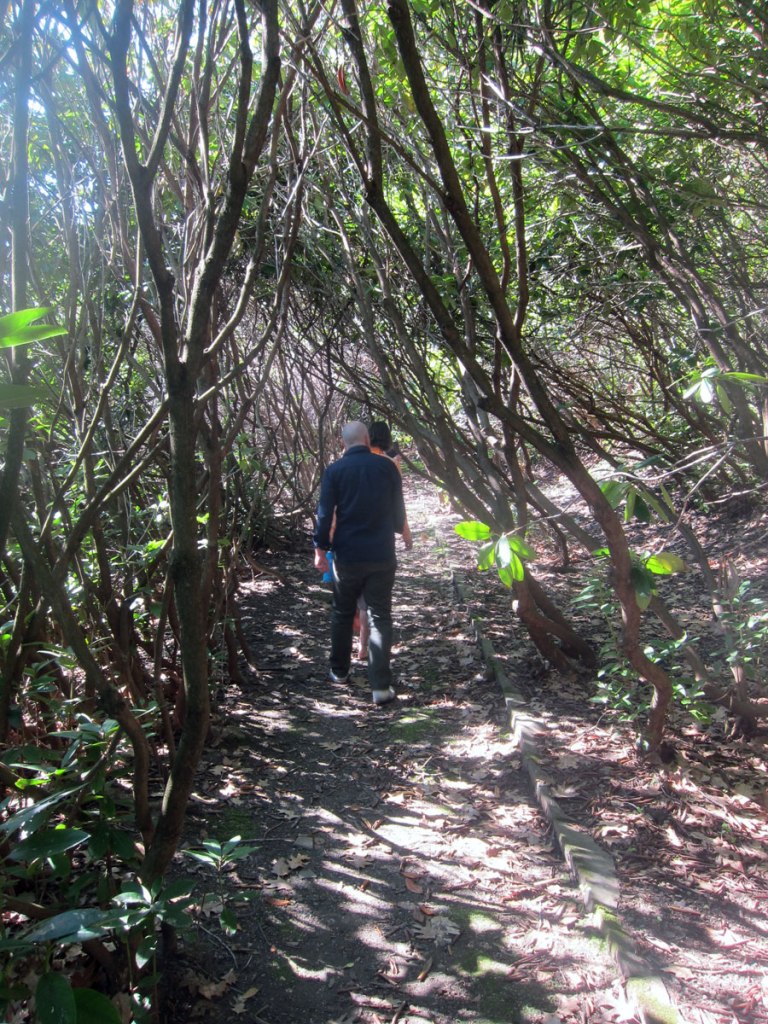
Remember you may click images in my galleries for a larger view. Below is the rhododendron tunnel on 13 May. I have now visited it in June in bloom, in February in snow, and now about to bloom.
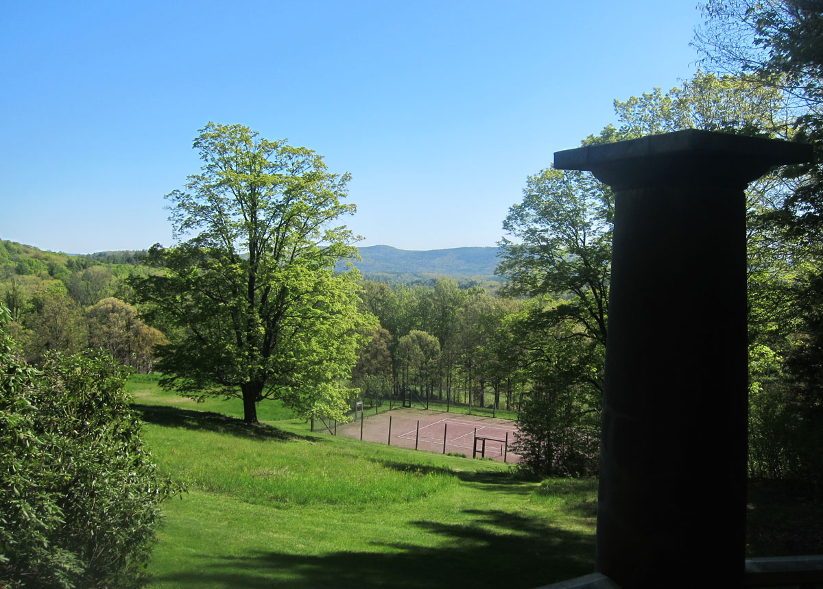
Heading south through the rhododendron tunnel you pass an old swimming pool (now filled in) ending at this peaceful pagoda overlooking the hills of New Hampshire in the distance. Kipling’s original clay tennis court is the first tennis court built in Vermont
and, another close-up view from this bucolic spot
The plan, as always, was to read, write, and watch some entertaining films. I brought three books to read, two pamphlets for reference to write my June “Did You Know That…” article, and I brought my projector, screen, and selection of films. Total accomplishment – about eight pages read, one and a half paragraphs written, and no videos. But – the company, the conversation, the laughs (“do you know how fast I was going, officer, when you jumped out? You could have been killed” – not me, culprit to remain unidentified, you had to have been there), and the meals.
But what I did get written was done at Kipling’s desk where he wrote, albeit in a different manner.
Below are a few images in Kipling’s library
I did not take a series of images around this amazing place on this visit because the professional images on Landmark Trust USA’s website are amazing, and the ones I took on the tour in June of 2019 are not bad either. Click on these links to take the tour(s).
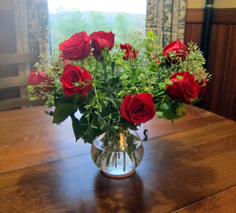
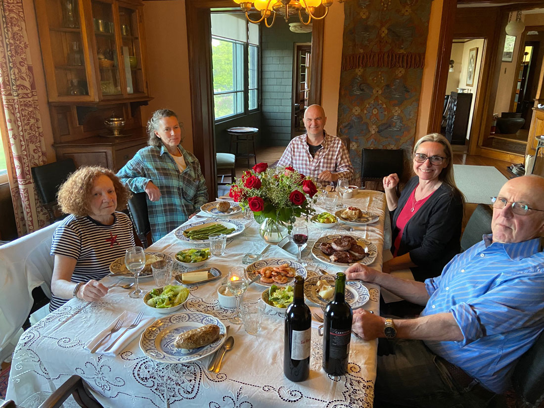
In my writings I enjoy alliteration, particularly in titles. The selection of the date of arrival for this stay was an alliteration of a sort, based on the date of May 13th. A bittersweet time to be with family and friends and rejoice a life — May 13th was the 13th anniversary of the passing of Cathy, my bride of 13 years. My son David, his wife and family, sent this beautiful arrangement which arrived at my home just before I left for Dummerston. It went with me to enjoy in the breakfast nook, and at dinner on Saturday evening.
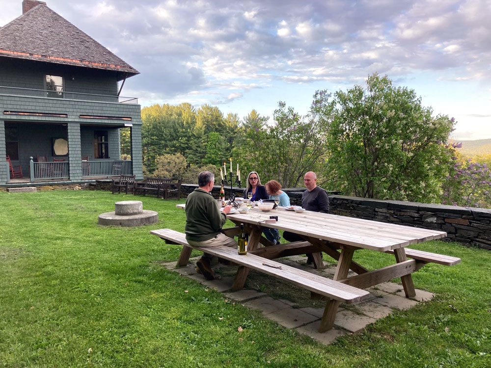
On our arrival evening, for ease we brought in Chinese from Panda North just down the hill on US 5 – never a bad idea. On Friday night we enjoyed the picnic table. How can you not enjoy this spot?
The sun sets behind the hills to the west, but looking east to New Hampshire can also provide interesting colors and feelings.
The “big adventure” for Saturday was to visit the “museum” in the horse barn at the bottom of the drive.
Built after Kipling had left, his horses that remained were stabled here. An addition (now removed) trapped water and did extensive damage to the structure. As is Landmark’s norm, the restoration is amazing, and you would never know it had been done (except the new support work in the basement). You may click on any image below for a larger view.
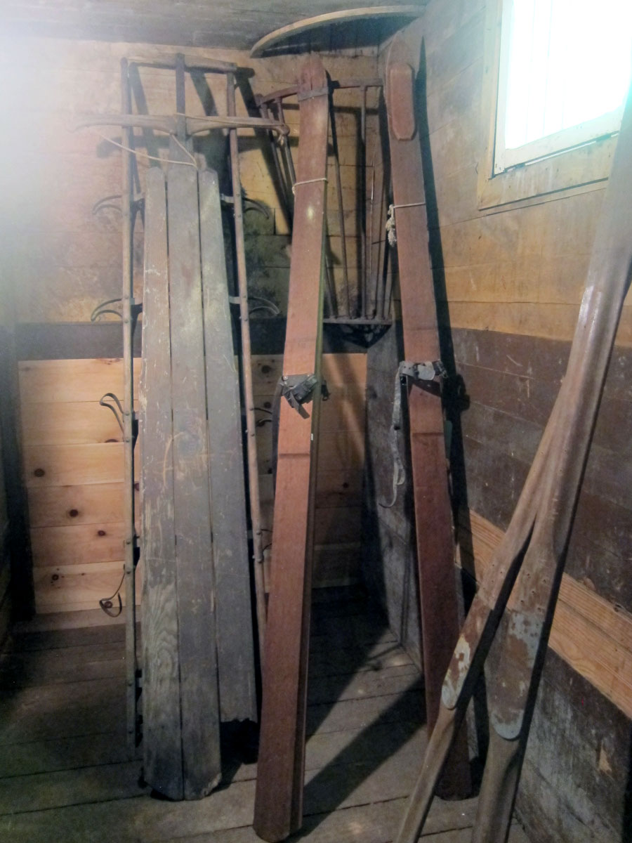
from left to right, top to bottom: one of the horse stalls (note the metal sheathing to protect from horses kicking, and their nibblings on the wood; Sled and skies used on the property; the main room; and the new supports underneath.
then back up the hill to “home” —
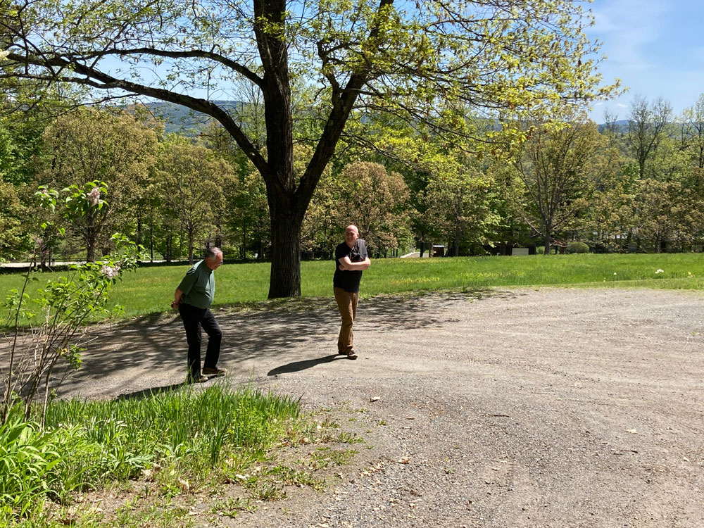
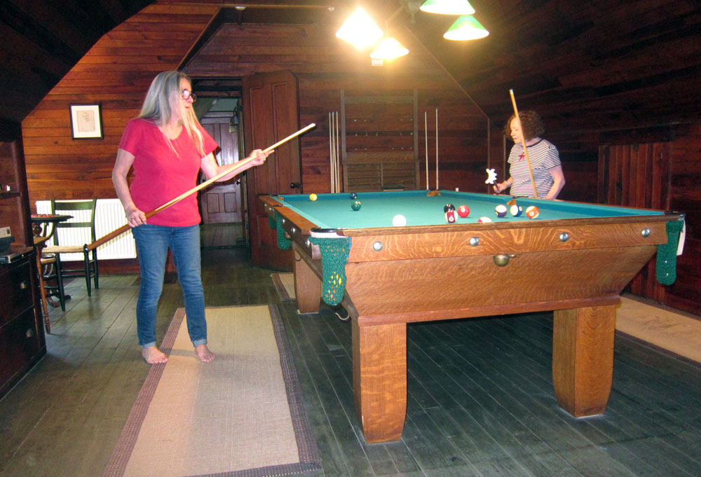
guessing game time — father? Number Two Son (in birth order)? — hard to tell who is who, isn’t it?
I do not even remember having lunch on Saturday (that busy and exhausted unwinding), but I do remember being coerced into a few games of pool after these two failed. They took the challenge at a quarter a game, and sunk the que ball loosing. And, three times. I may never forgive the 25 cents and 50 cents respectively owed to me. Nice to have people beholding.
On the third floor in one of the rooms is a little museum. I particularly like this showcase with Naulakha souvenirs. Michele, we have to talk. I have the perfect addition to gift the Trust to add here.
and, then it was “formal dinner night” albeit without tux and gowns. It cannot get much better.
and, I had to do this — not close, but close enough – one is Rudyard Kipling, and the other, “yours truly.” Was he that short? Even Ms. Google could not tell me.
And, all wonderful things come to an end, but must be repeated (Michele – I am looking at dates to book with you.)
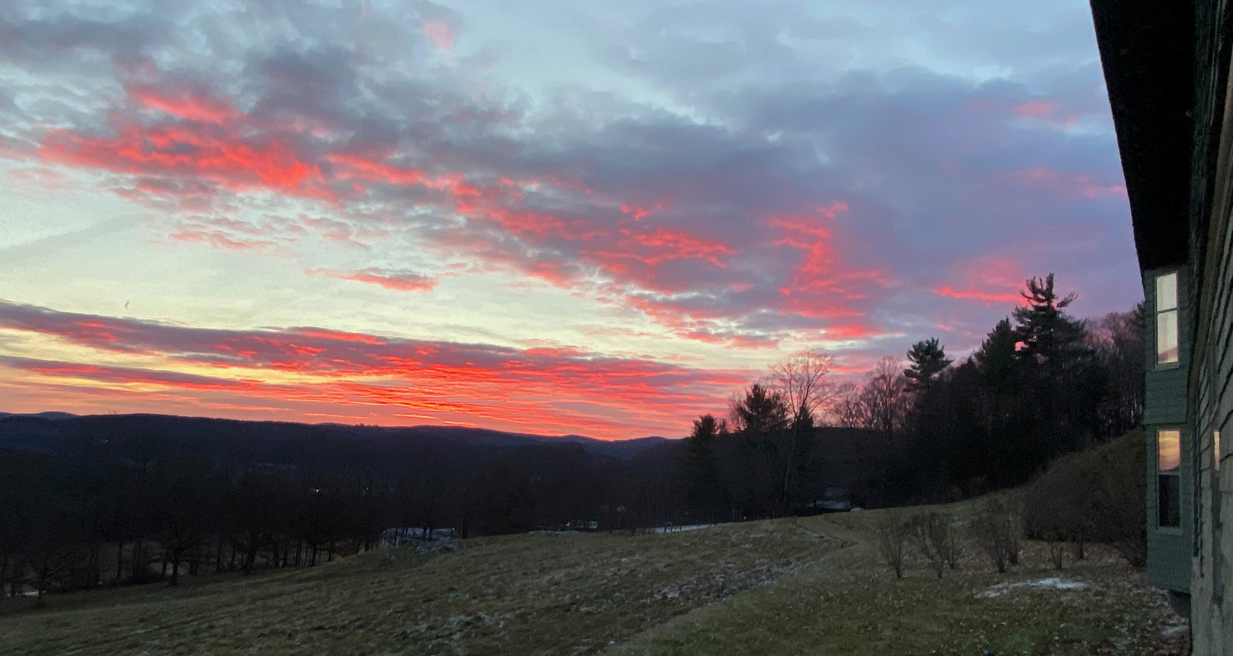
And, a return visit 2-5 December 2021, just because, and “Just So” — to be able to share this sunrise, Sunday, 5 December 2021