I am sure you remember a trip I planned in 2010, and finally headed off for on August 1, 2017, but sadly only made it half way when BLACK BEAUTY decided to shut down and ask for a piggy-back ride home from Pittsfield, Massachusetts. If you don’t, take a look at SEVEN YEARS “ON THE LIST” – NOW HALF DONE – 1-2 AUGUST 2017 — In fact, I encourage you to look at the images from that trip because this trip to Mount Greylock was obscured by constant rain and fog.
It was BLUE BELLE’s turn to make this trip to Mount Greylock, find where I camped August 5, 1963, and spend some time at the Hancock Shaker Village. I tried to book two nights at Bascom Lodge in July, but everyone was finally getting out, and I could not get a room until 18 and 19 August. That was fine, but I did not know that stormy weather would bring tears to BLUE BELLE’s eyes when I left in modern GiGi (Granite Girl). Oh well, an excuse to go again.
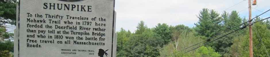
There are still routes through Massachusetts that I have not been on, thus have to see. I planned different routes going and coming. Sorry, I-91 to the Mohawk Trail to Shelburne Falls. Then Route 112 (scenic designation) through Buckland, then west on 116 (also designated scenic) through Spruce Corner (yes couple spruce trees and maybe four houses), Plainfield (not much there) and I stopped at Savoy, and the only spot to grab a bite to eat.
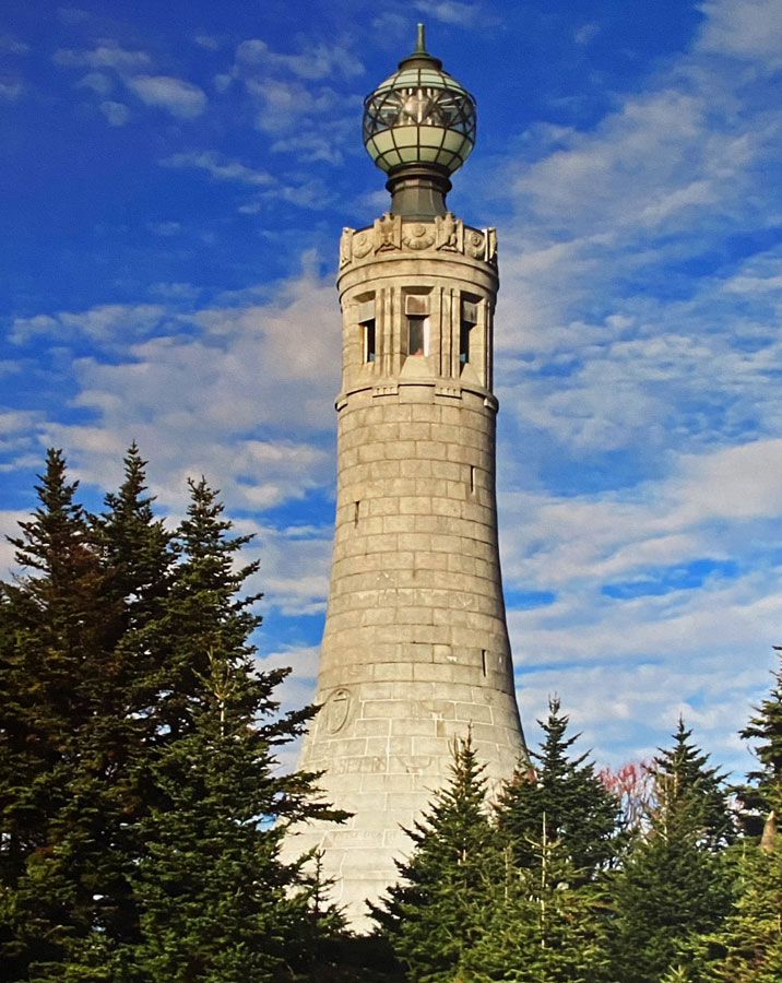
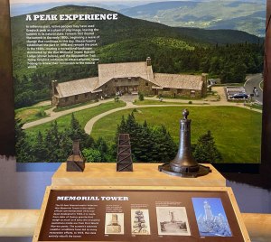
It was then up Route 8 into North Adams, and backroad up the mountain. Did I say fog on the 3,491 foot high mountain, wind and rain? If it were not for the light coming on in the Memorial Tower atop the mountain, I could not gotten an image at all.

and, this is what is beneath the light above – the light is in the globe at the top below (not my photo, but from a panel at the Visitor Center)
Do look at my post of my last visit for some wonderful images of the lodge and area, but how can you resist this CCC Arts and Crafts construction?

My plan to complete my last trip was a visit to the Pittsfield State Forest where I camped in 1963, and find my camping spot. My full day (also in the fog and rain) was to start that quest, and then head to the Hancock Shaker Village. I found the forest, drove around, and am pretty sure I found my camping spot from 59 years ago — but am constantly kicking myself that I did not shoot an image. Oh well, reason for another visit. Then among the raindrops, I arrived at the Hancock Shaker village.

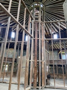
I was not concerned about the weather, nor my walking ability, because I showed the NARM sticker on my OSV membership card, and my visit was free. To do the village you really need more than a day, and I have also been fortunate to already have spent full days at the Canterbury Shaker Village and the Enfield Shaker Museum, both in New Hampshire. I headed over to the round barn (remember I was just at the round barn in Shelburne).

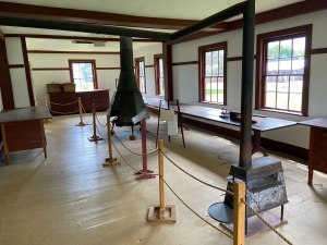
the first view below shows the central part of the barn, and then a view out a door.

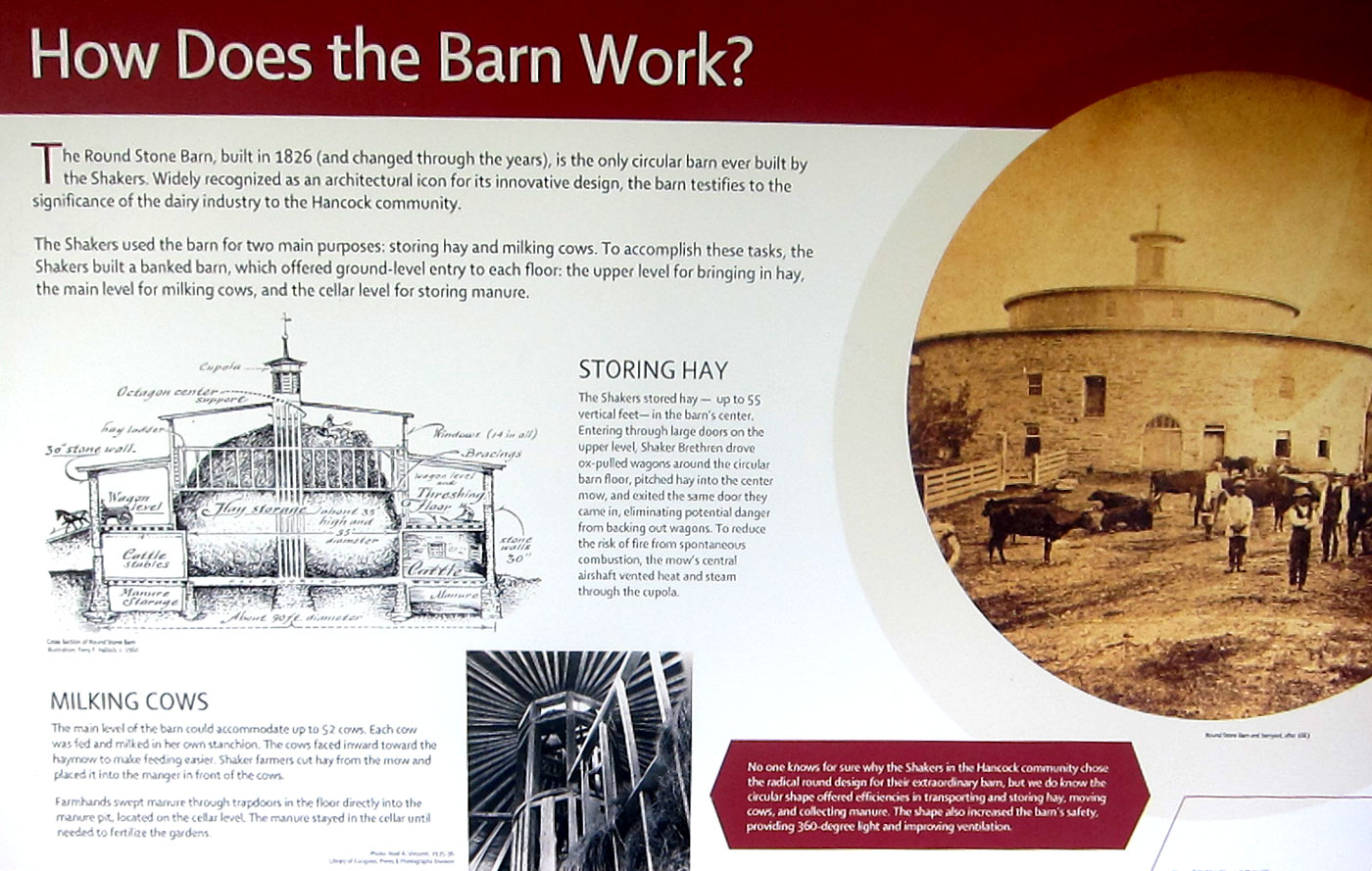
and, below is how the barn “works” -you can click for a larger readable view
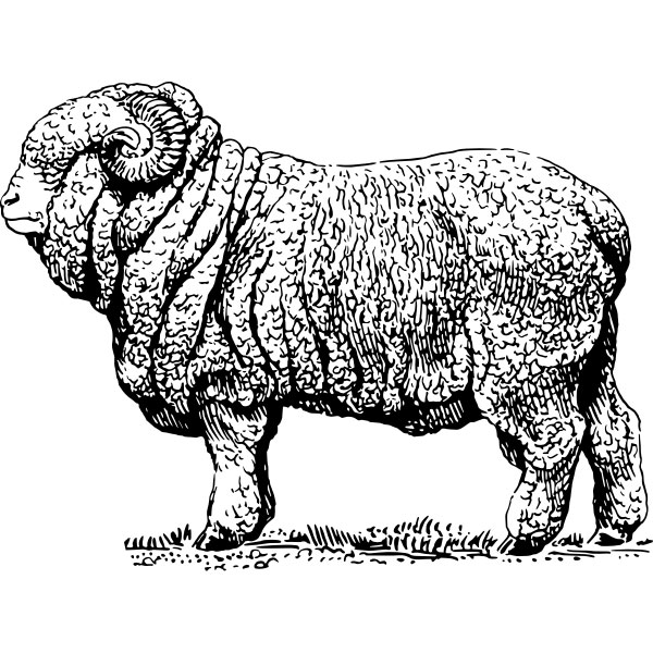
Coming off the barn was a wing for other animals. On the wall was information about Merino Sheep. Awhile ago I wrote about the Sheep Craze in the mid 1800s in New England. But reading the panel, and talking with a great docent (who I chatted with again later) I learned the sheep were bred with those extra folds around the neck so more wool would result. And now you know.
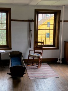
I next headed over to the large brick building, on the map simply as “Brick Dwelling.” A sleeping residence, the rooms had many educational displays.

The large hallway got me curious. As I came down the stairs, the young docent I met before was there. So, I asked why so wide.
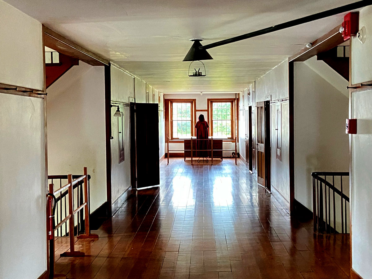
actually I was fascinated as to how the oil lamp was vented, thus the image. But the width – her answer the men walked on the east side of the hallway, and the women walked on the west side. The wide distance so they didn’t touch each other in anyway. The men slept on the east side of the building because they woke with the sun early and went out to work on the farms etc. The women then, when they got up on the west side, crossed the hall to the men’s rooms and cleaned them up for the day. This young lady was well versed, and in our chat I learned she just graduated in museum related work, had worked here as an intern before, and full time this summer before going to work in a NYC museum. Further asking her why the interpreters were not costumed she explained the Shakers asked they not wear traditional clothing, and also no particular time period is being represented, unlike OSV, which portrays New England in the 1830s, thus costuming is focused to that time period.
On the daily schedule at 2 PM was a water turbine demonstration in the Laundry and Machine Shop that I had to see. I have been fascinated with water power since the fifth grade when I built an overshot water wheel for a science fair project. I headed over, and positioned myself in a great spot.
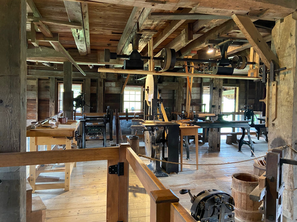
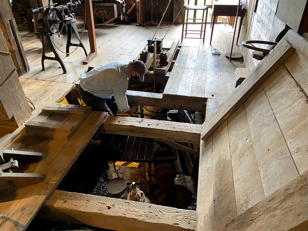
this is the machine shop above, and to my right was this opening in the floor where the 16 inch pipe from their reservoir came into the turbine.
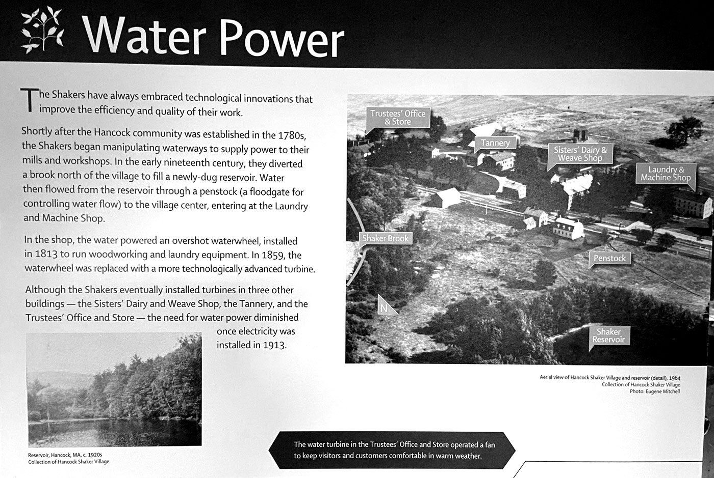
the panel below shows how the Shakers built a reservoir about 50 feet higher in elevation from the village. The water main came down to the village and to several buildings and hydrants for fire fighting and water supply. Click for larger view for easier reading.
When electricity came into use the machine shop was converted over. During a World War II scrap drive the unused water turbine was given to the war effort. In the restoration of the village the original plans for the turbine were found, and the same foundry in Springfield, Massachusetts, that made the original was still in existence, and made a “new” turbine as the original. Here are the molds made for the turbine castings.

and, opening the value, and putting the wheels in motion.
The machine shop above was built onto an old residence. The residence portion on the first floor had been turned into the community’s laundry with a washing area, and ironing area.

And, I did not need to do the whole village since I can easily go back (and remember it is no cost for me to get in), so I headed back up into the fog on the mountain to sit and read and visit with strangers. You will not believe the conversation a young nine-year old lady and her mother struck up with me.
I was on the wonderful Arts and Crafts couch with leather cushions made for comfort. “Is that Harry Potter you are reading,” asks the young girl. He mother says,”she is reading one of the books now on her Kindle, and has no idea how thick the books are.” Originally from the area, the mother told me they drove up from Maryland specifically to come to the top of Mount Greylock. You see, unbeknownst to me (and my Potter friends), the Ilvermorny School of Witchcraft and Wizardry, was founded in the 17th century on the summit of Mount Greylock.

What a great mother to drive that distance to share an experience with her daughter, even though being Muggles we could not find the entrance under the War Memorial at the top of the mountain. I had so much fun with them – and complimented the young mother on her daughter’s poise and willingness to have a great conversation and share. The full story and history has been published on J. K.Rowling’s Pottermore website. According to the account, part of the backstory to “Fantastic Beasts and Where to Find Them,” now a film about magic in 1920s America, the school has managed to operate concealed from nonmagical eyes “by a variety of powerful enchantments, which sometimes manifest in a wreath of misty cloud.” This is one of the better articles I found on-line once home, When asked about the school, Governor Charlie Baker’s office reacted to the question that the school has avoided state regulation. In a press release, “The governor believes that small businesses are the backbone of the economy whether they are owned by witches or mortals, and because the institution has operated for nearly 400 years without incident, the administration plans to revisit the matter sometime in the next century or two.” Just remember, you learn and learn with SHUNPIKING WITH RAY.
There is a visitor center to briefly enjoy with maps and nature information. Here are two panels I wanted to share – a view and history. (again, click for large size)

Did you read that it was John Bascom who was head of the reservation’s commission in the early 20th century? Thus the name, Bascom Lodge. You know me and timing. Just so happens a great-grandson of John’s had stayed there the night (from NYC), and we chatted in the morning. And yes, directly connected to the Bascom maple sugar operation in the hills just above me. We chatted area history. “Timing is Everything” be it the real world, or the world of wizardry.
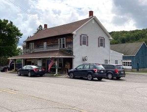
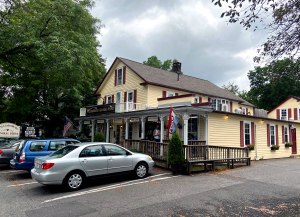
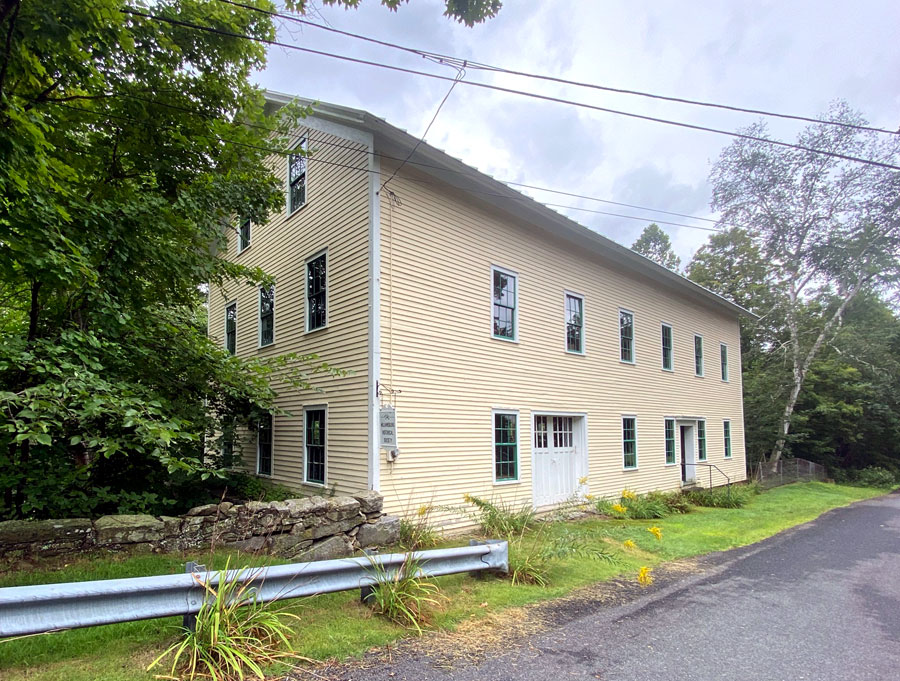
There was a reason also for the route home – roads I had not been on, and I wanted to re-visit Williamsburg, which is just west of Northampton. I had visited years ago, but this winter reread IN THE SHADOW OF THE DAM: THE AFTERMATH OF THE MILL RIVER FLOOD OF 1874. I recommend you sit down with this book, well done. So, down off the mountain on the southern entrance, left turn on dirt on West Mountain Road (tricky in places) to Route 8, and left again on Route 143 in Hinsdale. Through Peru (not Vermont or Maine), and not much there, nor West Worthington, but there is a general store in Worthington Corners. Stopped there once traveling on another road to RLI. Chesterfield, and then into Williamsburg (not Virginia – I do not get that lost). If in the Northampton area sometime, do swing up to Williamsburg and Haydenville. Here are the main buildings on the “new” main street.


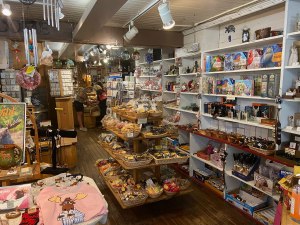
Above on the left is the Williamsburg General Store, which has been the site of a General Store since 1808. From an “uncommon map” I have of this area, “this store has become an attraction to patrons from far and wide.” Here two views.
I then explored the original Main Street area that was hit by the Mill River Flood when the dam broke. Below is the Grist Mill (now a museum) which was built in 1878 replacing the mill that was swept away in 1874 with its proprietor.
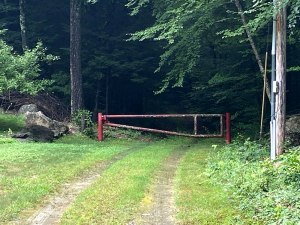
The small former downtown area is a “must explore.” Heading out North Street as you approach Judd Road is a trail (right image below) taking you to the remains of the dam. At then end of Judd Road, the road to the dam is blocked off, with a private property sign stopping me.

I then headed to Northampton and I-91 to slide home. No other stops, I was ready to get home. Rain kept me from doing all I wanted to do, fog kept me from seeing all I wanted to see from atop the mountain, and arthritis and bones slowing me a tad. But I love to get out, see, learn and then share. So, thank you for getting this far.
Ray Recommends
1 – Visit and experience Mount Greylock
2 – Tour the Hancock Shaker Village
3 – Read IN THE SHADOW OF THE DAM: THE AFTERMATH OF THE MILL RIVER FLOOD OF 1874 and visit Williamsburg, Massachusetts
4 – Join one of over 1,000 museums at the level that gives you free access to all the museums under the North American Reciprocal Museum (NARM) Association® network
5 – Stay safe and Stay well, get your shots and booster
And, a final note. I told you I have found my iPhone so much better for images, but fingers do get in the way. Search on Amazon, and I found this grip for fourteen dollars and change. Thrilled, and thrilled.


Great Ray, another informative and and intriguing adventure. Thank you for sharing.