Recently I have been staying closer to Walpole, but there is still much to see and experience exploring nearby ROADS and ROUTES. The impetus for my trips comes many ways, and there is constant learning that (hopefully) is keeping me young. I started this post on 21 June.
This route had its genesis following my being the first visitor “in the door” on the 75th anniversary of the opening of Old Sturbridge Village (OSV), June 8, 2021. Both the Asa Knight general store, and the Covered Bridge at OSV come from Dummerston, Vermont, just across the river. I enjoy talking with the interpreters at OSV, and my mission that day was to learn the exact original locations of the store and bridge. I was successful, planned a 60 mile round trip, and headed off.
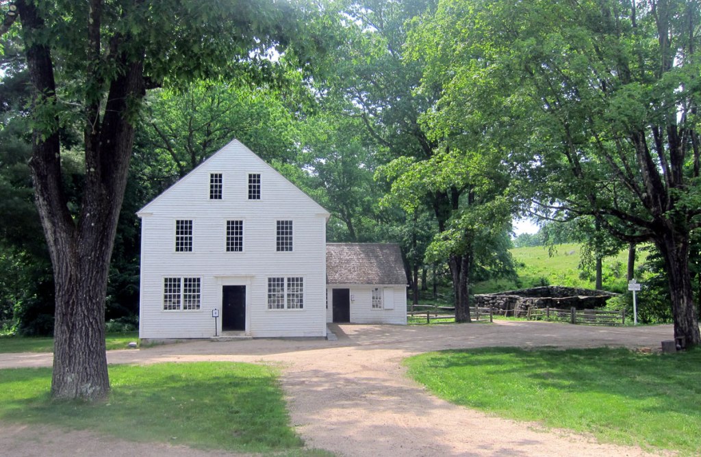
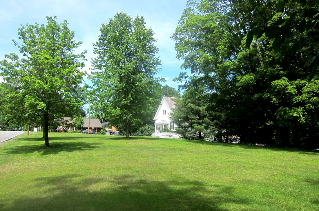
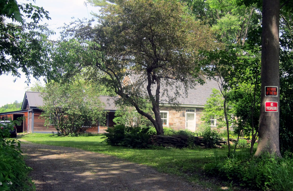
This is an easy trip with picnic and hiking opportunities, not to mention the history. Head south on US Route 5 from Westminster or Bellows Falls (forget the superslab). Turn right on School House Road in Dummerston, or better yet go a tad further and turn on East-West Road. Then you get to pass the VT-NH Veterinary Clinic which originated as a tavern in 1802. East-West Road brings you up to Dummerston Center Common – a nice triangular piece of land – with the Grange Hall, a Church and several houses. It was here I learned Asa Knight’s store stood at the south end of the Common. The home is still there, well hidden now behind trees, but it looks just like my home on the Common here. The store stood to the left, just behind the current picket fence.

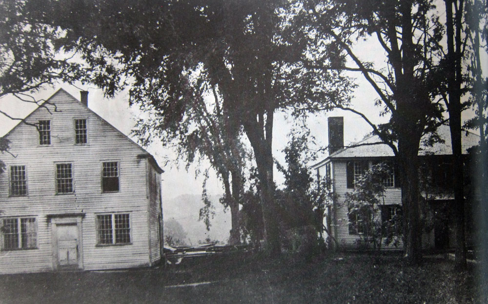
The house, built in 1810 by Asa Black (and so similar to my home built in 1806) was the home of Rutherford Hayes from 1812 to 1817, father of President Rutherford B. Hayes who was born in Ohio in 1822, but did visit back to his Vermont roots in the area.
shown below, turning around from this spot, and looking north across the Common to the Grange Hall
Now continue west on East-West Road, being careful descending, and cross the West River on the covered bridge, the longest covered bridge entirely within the state of Vermont. Head south on VT 30 (if you wish, detour up into West Dummerston saved by the re-routing of Route 30), and watch for the iron bridge. Yards south is the “new bridge,” crossing Stickney Brook, that replaced the covered bridge that was then sold to OSV for $1 and moved in 1951.


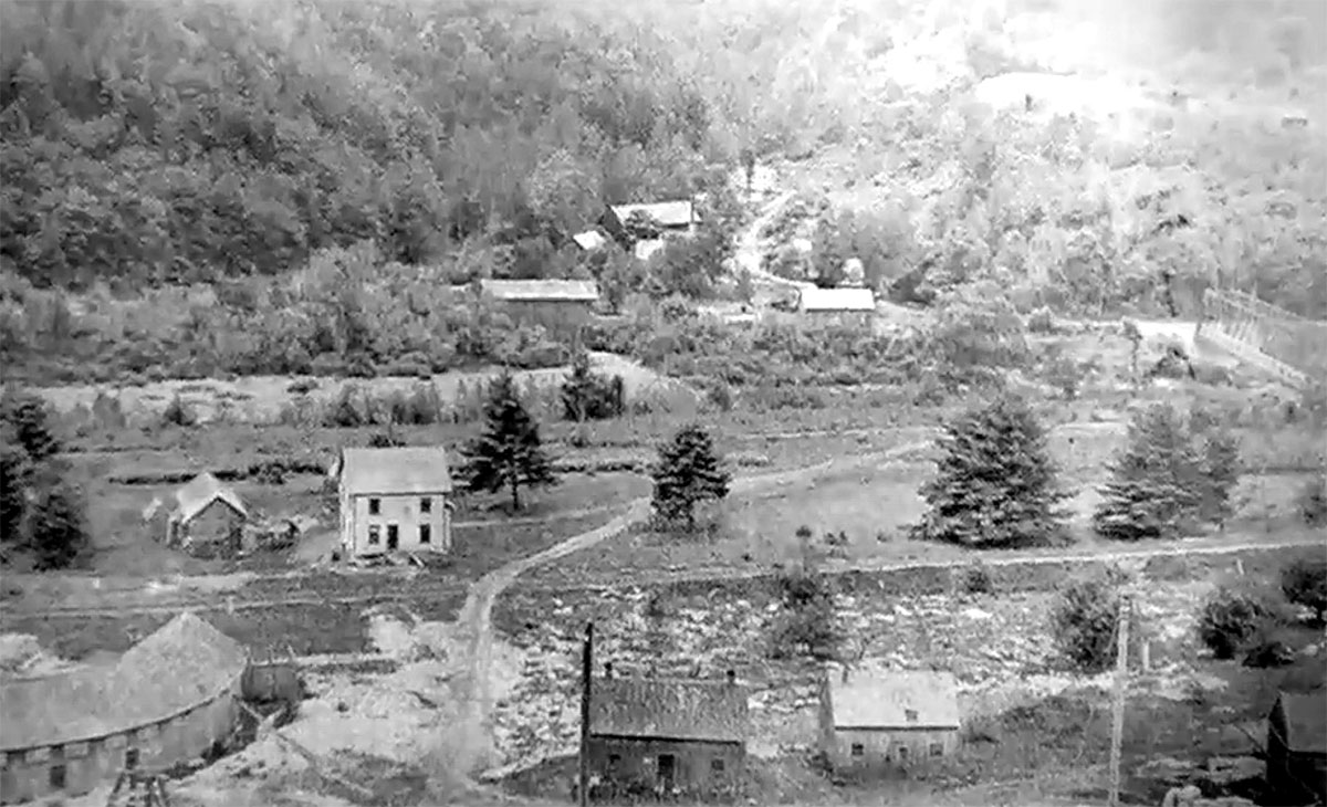
nothing exciting to look at today, but from the east on the quarry on Black Mountain, this is what you would have seen in the 1880s looking over the stone sheds at the bridge, and the mill on Stickney Brook. The covered bridge is roughly in the center a tad to the left, with the mills on the brook above it to the west.
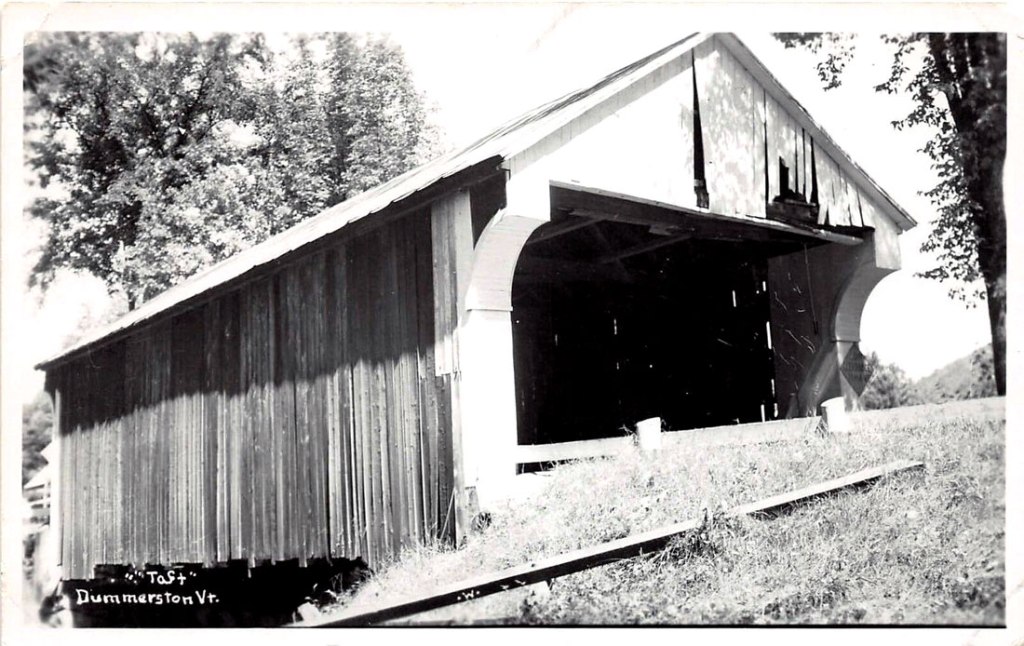
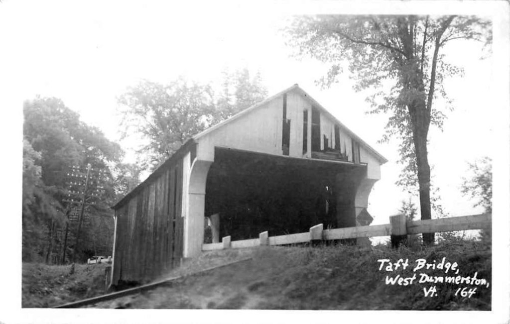
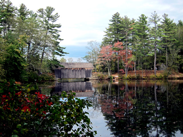
and, two real photo postcards – RPPC – of the 65 foot covered bridge now at Old Sturbridge Village.
And … Now getting back to this tale on 27 July 2021, the image below is the bridge as it is today at Old Sturbridge Village in Massachusetts.
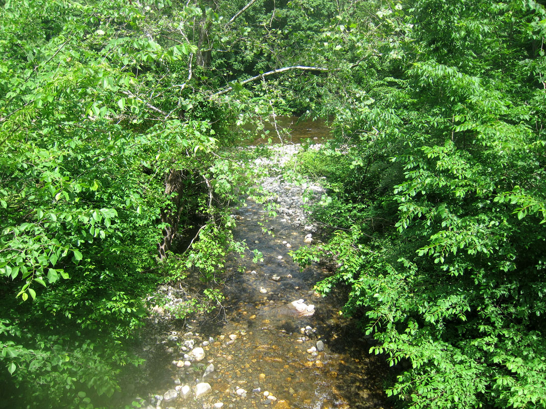
From where the bridge was, below is the little stream the covered bridge would have crossed as it flows east into the West River – barely seen through the trees.
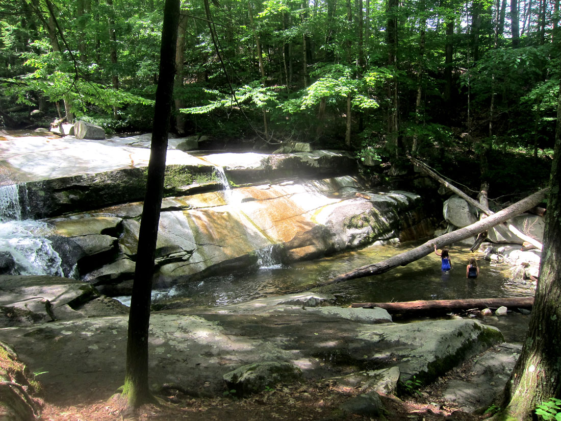
In looking at a real paper map preparing for this trip, just to the west of Route 30, on the stream above, was labeled Old Jelly Mill Falls on Stickney Brook. Now, that I had to see, and I had to learn what a Jelly Mill is. First here is part of this fantastic spot – beautiful falls cascading over slanted granite bedrock, with a number of nice shallow wading pools. The total drop about 30 feet, but no individual fall is greater than 8 feet. A favorite wading and hangout spot of local residents – think picnic spot, and bring your blanket and/or chairs.
In my research to understand, there may never have been mills built specifically as a jelly mill. In Brattleboro, L. J. Johnsori, in 1880, built a cider-mill and jelly manufactory. Jelly is not milled. Both jelly and jam are made with fruit mixed with pectin and sugar. The difference between them is the form of the fruit that goes into them. Jelly is made from fruit juice and jam uses both the fruit pulp and juice. Jelly is a clear fruit spread made with sweetened fruit juice. Jam has both fruit juice and fruit pieces in the spread. I believe that cider mills often also made apple jelly — thus the term corruption of “jelly mill.” But the falls are named after a “jelly mill” and if you may recall, in Manchester, Vermont, was a grand shop called “The Jelly Mill.” I had to dig deeper.
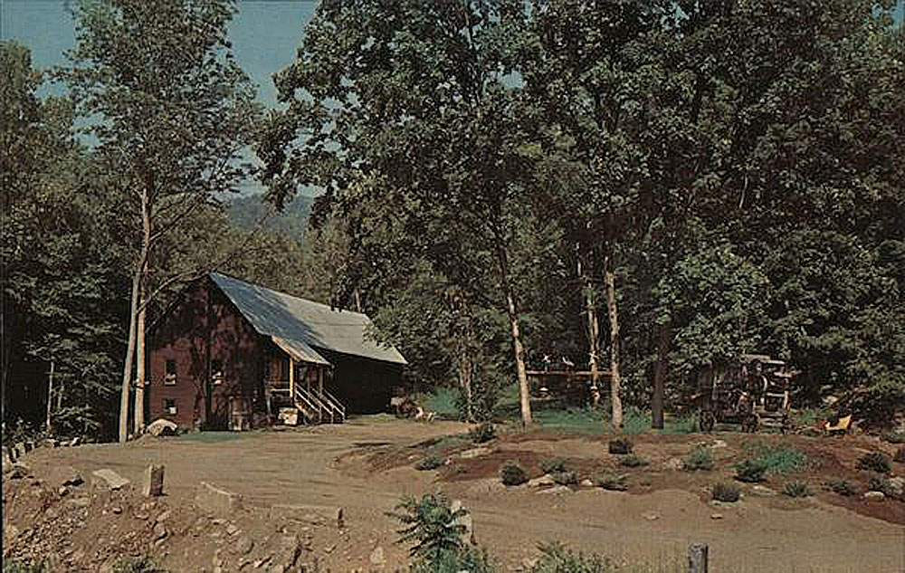
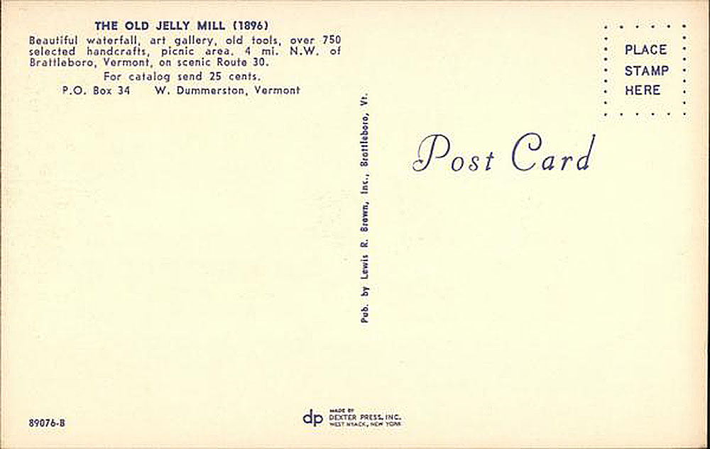
And, in an obituary I learned, “Clinton G. Lewis (1930 – 2009) and his family moved to Vermont in 1964, settling in Brattleboro. He soon established the The Old Jelly Mill, an abandoned jelly and cider mill in Dummerston established by John Taft, and transformed it into a truly unique retail store. The mill burned down in 1969 and they relocated to Manchester the following year and renovated the old Munson farm dairy barn into what was the Jelly Mill on Main Street. Clint operated the business until November 2005 when he had to retire for health reasons.” Below is a postcard from Lewis’ Old Jelly Mill on the falls here, and do click for large views.
May I encourage you to visit and picnic. Next on this sojourn I planned to head down Route 30 to US Route 5 in Brattleboro, and then head up to find one of the ferry crossings on the Connecticut River that I have been reading about — and must write about. I wanted to find the old stone building that served the Norcross Ferry behind the C&S complex. It was not until June 7, 1889, that a bridge crossed the Connecticut near here – (now NH Route 9 to Keene). Down a dirt and private road, I quickly snapped this image of Norcross Ferry building.
I crossed over into New Hampshire, and worked my way over to River Road (checking a few more ferry locations to still be studied), onto NH 63, and stopped at Stuart and John’s for an ice cream cone treat. BLUE BELLE jealously looked on as I sat in the shade at a picnic table.
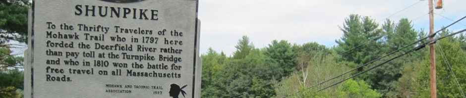
Reading DUMMERSTON” AN “EQUIVALENT LANDS” TOWN 1753-1986, I am finding many more places to explore just across the river in this area which also has the great Landmark Trust USA properties. Additionally, I have several ROADS AND ROUTES explorations planned in following the old West River Railroad from Brattleboro to South Londonderry, Vermont. So, sign up to receive notifications of my posts, gas up, pack a lunch, and get out and “shunpike.”
Enjoy, thank you, yours, RAY
PS – to set your stage for trips focused on the West River Railroad, here are two resource links:
Friends – West River Trail.org — https://westrivertrail.org/home-2/
YouTube introduction to railroad and trail — https://www.youtube.com/watch?v=ZjwUKeCbbNw


That was interesting. It is interesting how may ferries there were to help people cross in the old days where there was no covered bridge. Joey
as always, I am fascinated and amazed at the amount of interesting detail in your adventures in shunpiking
Good going Ray! Very interesting and fun to read.