I have had a hard time getting back out – we all have. I have lost momentum with LadyRABIII, BLACK BEAUTY is buried behind LADYRABII who has a leaking carburetor and dead battery. Bottom line is I am really out of practice. Earlier this week I started planning a BLUE BELLE sojourn around Lake Raponda where Carrie and Rudyard Kipling would visit. On the way I could shop at the Wilmington, Vermont, flea market that opened today. But my mind waffled. Email replies to Ray said, “just do it.” But I modified to a shorter route to hit some new (and old) spots, and finally I left. Glad I did.
Did I say modified? Let me also modify my presentation. Get out your pad of paper and pencil. I will number the images of my route, and see if you know where I am taking you. It could help if you get out a map, I had my 1980 atlas open (real paper in book form) as I went. Write your answers down, and check with the answers at the end. Get them all, and “name your prize.” Actual award up to me. Let’s get going.
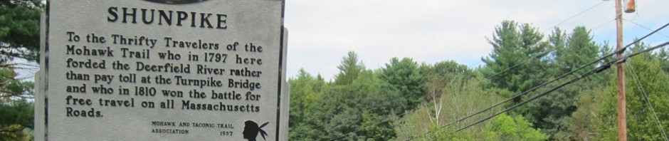
For some reason I always end up in Vermont. Better loops? More isolated scenery? Fun dirt back roads? All perfect reasons. I first passed through this village. Great meals at this inn. Sadly most all other retail and eating establishments I used to visit are now vacant
Number 1

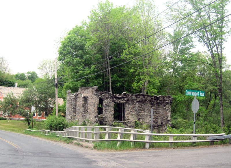
Although abandoned, this great “Stonehenge” has not changed in my almost 20 years of passing. The nearby general store, however, is no more.
Number 2
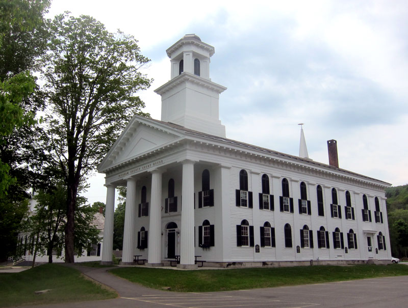
This should be easy. An overnight here in 2002 changed my life. I turned left (south) here.
Number 3

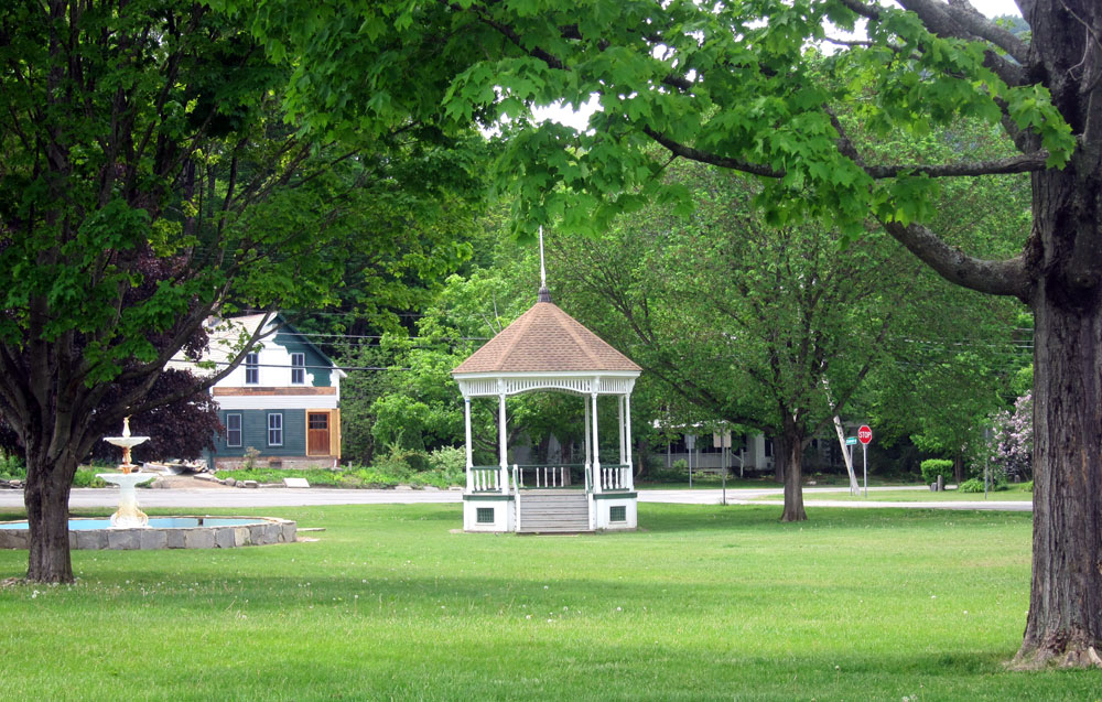
Please do follow this road south. As with many older, original New England roads it follows a little stream. When the road ends, bear right and continue south passing lovely properties until you reach the next town with a perfect Common. This bandstand was constructed for the movie FUNNY FARM, and the “Towns” people asked that it remain.
Number 4
My new plan, hatched less than an hour before I left, was to get something to take out to eat in this historic village and find a spot to eat. I called and found that the village store, since 1822, re-opened just Tuesday by new owners.
Number 5
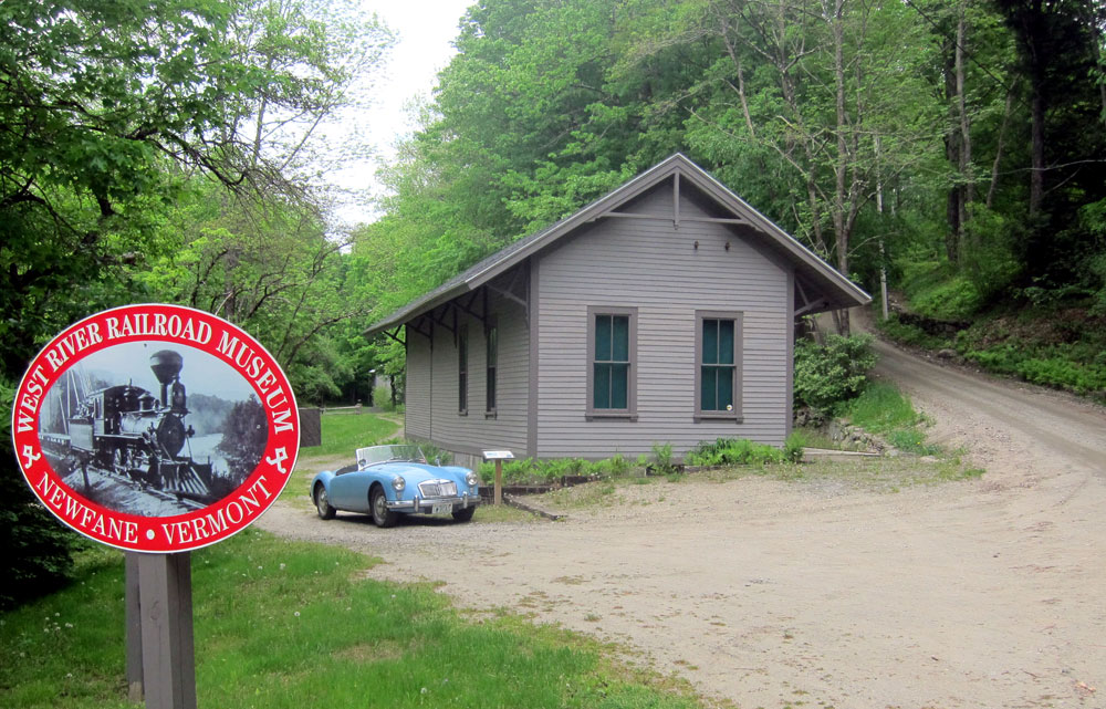
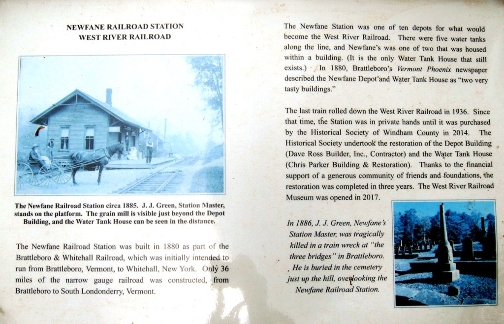
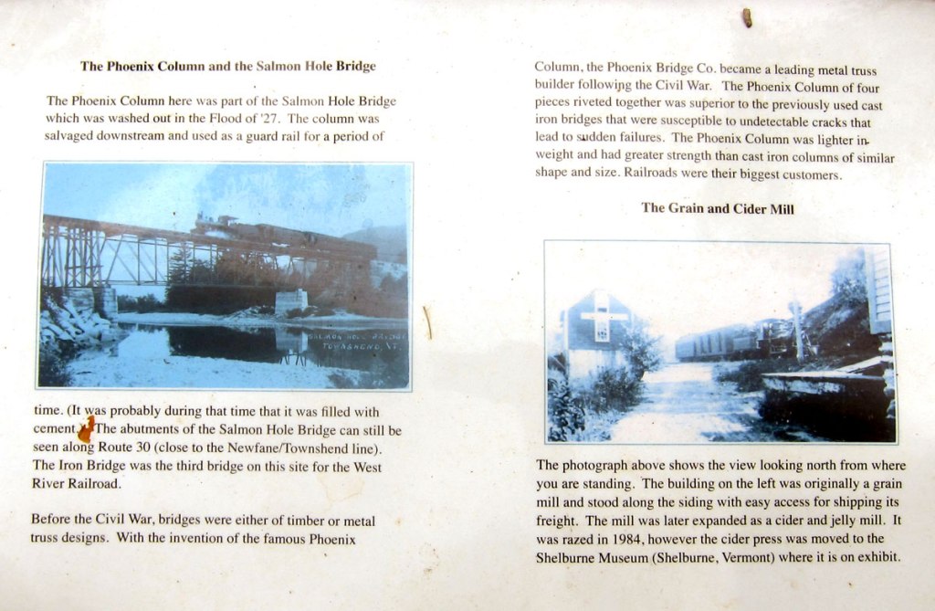
Around the corner I knew where I was going to eat. No picnic table, but how about a rock along side a small stream? I remember when this museum was opening for the first time, but I did not make it. Named 36 Miles of Trouble, this railroad ran along the West River from Brattleboro to South Londonderry.
Number 6
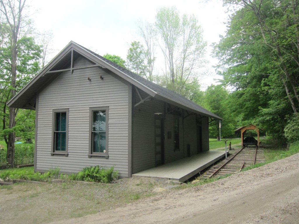
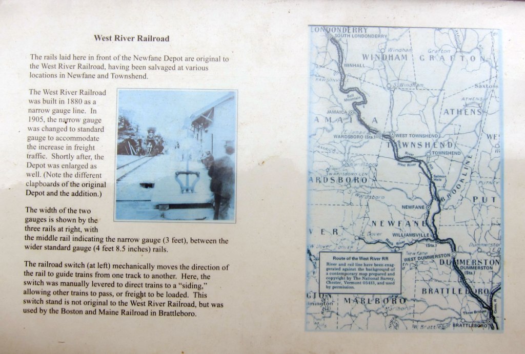
these images are not on the test, just click to expand, and look and learn.
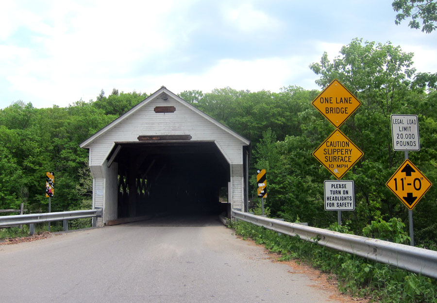
Heading back south on the not so bad scenery wise main road, one of the few spots to cross the river for many a mile is right here – often seen in my posts.
Number 7
and, turn south just over the bridge, and on the almost immediate bend, turn right onto a unmarked dirt road that you can easily mistake for a driveway. I have wanted to explore this road for some while now, but in chatting with Ilana, I believe she biked this route last week. It follows the river, eventually climbs a mountain with amazing views. Coming back down the mountain, the road ends on a US numbered route near the Connecticut River. That end is close to Kipling’s Naulakha. Giving you too many hints.
Number 8
Yes, that is BLUE BELLE’s antenna that I did not see when taking this image.
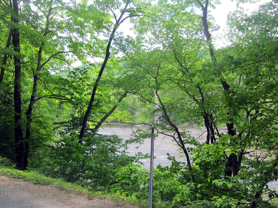
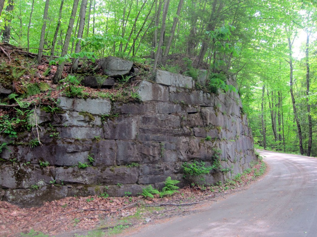
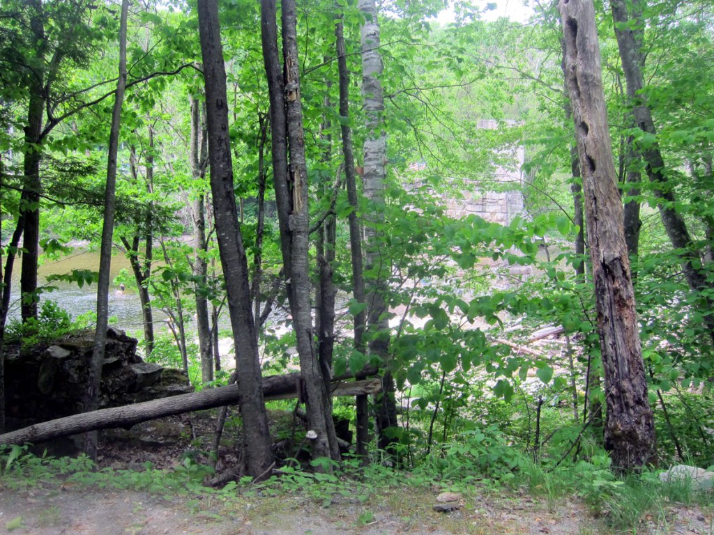
RAY HIGHLY RECOMMENDS — TRAVEL THIS ROAD. Along the way you can make out part of the old railroad bed and right-of-way. At this point (below) the old railroad bridge abutments exist, and with turn-offs for parking many folks were down in the river having fun.
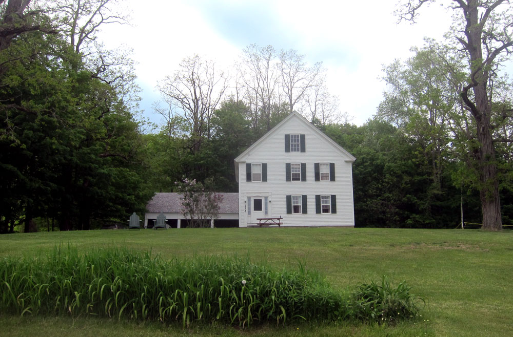
With a spot in mind, I turned back north to this farmhouse. On my list, the Landmark Trust USA property is isolated and perfect for large gatherings. Sorry about not so great images – basically an overcast day, thus not that bad with top down (of course it is never up).
Number 9
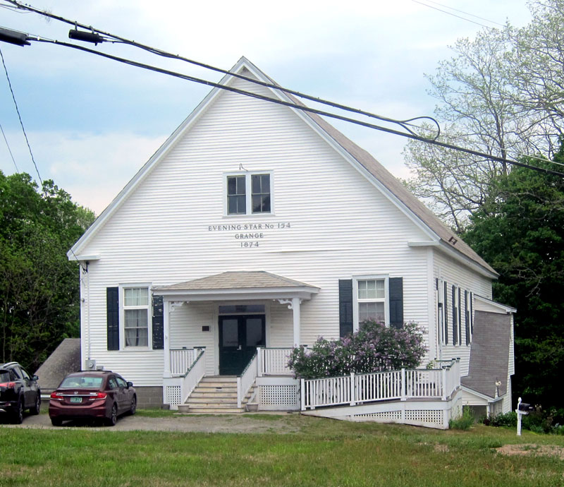
Getting to this intersection, I turned right at this old 1874 Grange Hall to head down the hill to a US numbered route.
Number 10
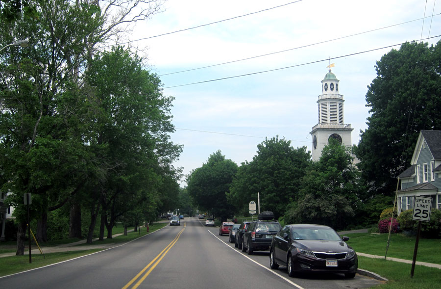
Heading back up north I decided I wanted to get back home, and to “work.” I cut over to the super slab, thinking it was time to “blow out some carbon.” BLUE BELLE and I decided to stay a tad under 160 KPH and 4000 RPM until we exited. Then crossing the big river, and onto Main Street and home.
Number 11
Remember I said I was going to modify this post to a different format? Well, as writing, I decided on another modification. I am not going to give you the answers now. Instead I invite you to post your answers as a comment. So, get out your old detailed hard copy maps (or Google.maps if you must) and plot the route and identity the image locations. Maybe in a couple weeks I will post the answers, and annouce a winner, or winners. But if you just get out and explore, you will always be a winner.
Hit those ROADS and ROUTES, love, RAY


Since you know I am directionally disfunctional, I have no idea how to plot this trip. I know that I have been by, seen a lot of these sites, and I am grateful for having the opportunity to revisit with your great shunpiking. travels.
Carolyn
If you remember, many years ago we were cross country skiing with you and I told you that my New Year’s Resolution was to try to get better with directions.
Well, that was a complete failure on my part; my name is still Mis(s) Direction.
That being said, still loved being a passenger on your trip-I’m much better as a passenger than a navigator!