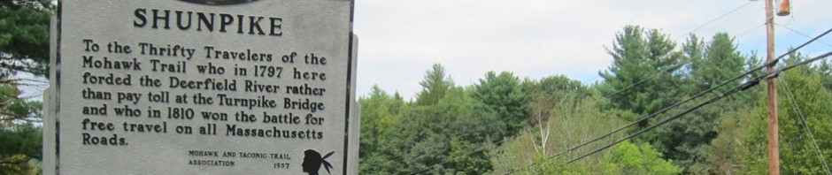
I still have places “on the list” to explore just across the river in Vermont, and here is an eighty mile round trip that took 120 miles in seven hours. Reading that Rudyard Kipling and his wife would spend time in a hotel at Lake Raponda, and not knowing anything about the lake, or where it was, I had to see it. And, you know I am trying to travel and explore the “36 Miles of Trouble” route of the West River Railroad. Not having been able to travel with all the rain, Saturday 31 July, looked like the day. I don’t trust my gas gauges, so stopped to top off BLUE BELLE. Five weeks since her last feeding, and only 1.7 gallons. No wonder she was so cranky not having had much to eat. Then off to the Flea Market on Route 9 in Wilmington, Vermont. Nothing begged to be purchased, so it was off on explorations. Think I will mark a map to show you where you need to go.
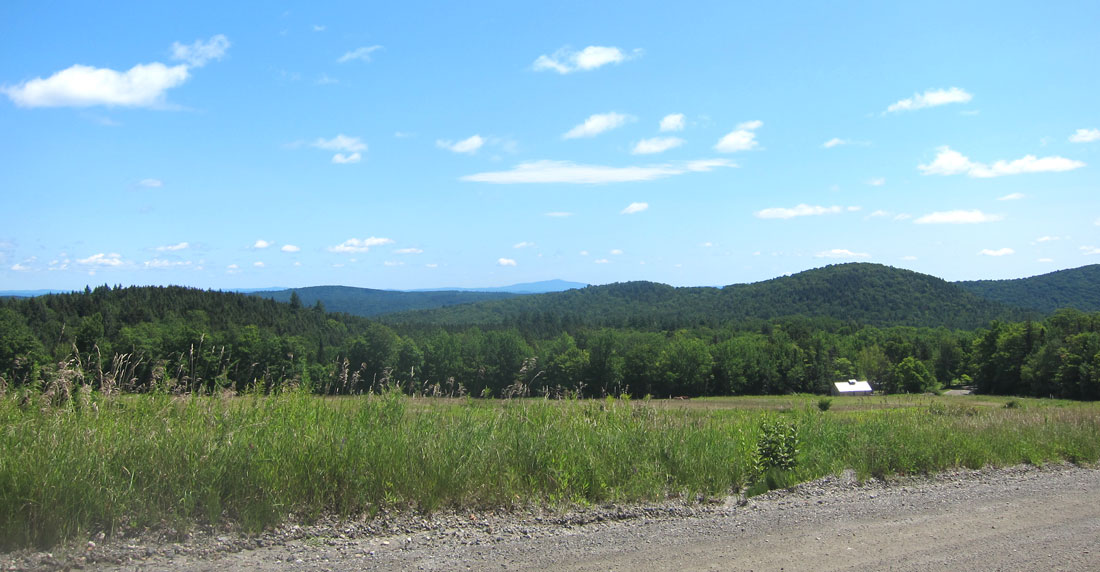
Lake Raponda is north of Route 9 just east of Wilmington. Coming from the east, turn north on Lake Raponda Road, but from the Flea Market I took Ballou Hill Road intersecting at the south end of the lake, which runs north-south. What a beautiful spot, and 120 acres of water surrounded mainly by trees and a mix of residences. Below is the only spot I could get a picture of the lake.

I wanted to find the locations of the hotels, and had no clue. But many people were out walking, and I stopped and chatted with several groups who shared what they knew. The first hotel was at the south end of the lake, near an “outcropping of rocks” I was told, but I did not find that spot (I have subsequently learned it was west of what is now Stearns Avenue – thus another needed trip). The Hotel Raponda opened to visitors in the summer of 1889. Starting as a large cottage with 50 rooms, it was enlarged in 1892. Here Rudyard Kipling and his wife, Carrie stayed coming up from Naulakha in Dummerston. Also visiting, President Theodore Roosevelt proclaimed the “scenic pulchritude of the place”. The hotel burned to the ground in December 1896.
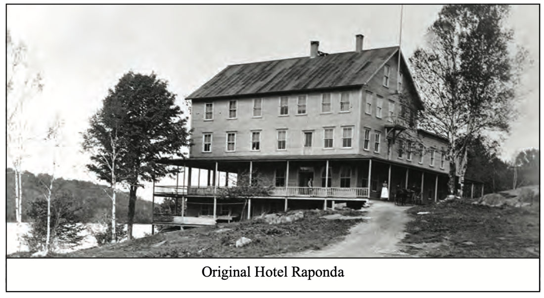
I should digress and tell you the origin of the lake’s name. In 1788 William and Benjamin Ray bought the property. A swampy area with many springs had been damned, and the Ray brothers increased the size of the dam creating what was then called Ray’s Pond. When a lake association was formed and the Hotel built, a more attractive name for Ray’s Pond was needed, it began to be known as Lake Ra(y)ponda.
The other hotel I was told was built on what is now Island Road. There is a small island where a dancing pavilion had been built, and the hotel was constructed on the shore in 1899-1900. Open in July and August it could accommodate 100 guests who were charged a weekly room and board of ten to fourteen dollars. The hotel closed and was torn down in the 1920’s and private cottages were constructed in the area. Here is the entrance to the land today.

and the hotel as it proudly stood

At the north end of the lake is a boat launch area, but I first circled around and to the end of the road on the west side of the lake. Then it was off to Route 30 for the West River Railroad explorations – on back roads of course. Below is a map of my route from the Flea Market to the Lake and then Route 30 – an X with a CIRCLE around it marks a First For Me. (you can click the map to enlarge).

The lake is on the left where I turned north. I turned right on Higley Hill Road, and some fine dirt road views.
Meandering south on Upper Dover Road, I took a sharp left back north on Lower Dover Road, a smaller dirt road, and then decided to take an even smaller dirt road – Stratton Hill Road – thinking I would short-cut east this way. It was narrow, even for dirt.

It had rained with major wash outs around Vermont and New Hampshire. As the road even narrowed more I encountered some recent rain ruts crossing the road, but nothing more than 7 or 8 inches across and deep. BLUE BELLE said “I can do it.” But then, she stopped not knowing what to do since THIS WAS A FIRST for both she and I.

See that open space on the left? As luck would have it, the tree came down just on the other side of the greatest width I had seen along the road, just enough to jockey back and forth many times to turn around. But as I started, a car pulled up behind me. “There is a tree down,” I called back. “We know, we live on the other side and had to go out the other way. Coming back now, I am going to hike up for my chain saw.” They backed up, I jockeyed, and waved bye as I headed down the hill. Sharing the photo with a couple friends, in unison they replied, “you are crazy.” But I have adventurous fun! Arriving eventually back on Route 30 and West Dummerston, it was time to search for old train stations.
Completed in 1880, the West River Railroad (which underwent many names and ownerships, and affectionately known as “36 Miles of Trouble”) ran from Brattleboro to South Londonderry – never making a connection in Whitehall, NY, as planned. Originally narrow gauge, it was upgraded to standard gauge in 1905. Never earning a profit, the Flood of 1927 signaled its end, followed by the Depression in 1929. It came back in 1931, only to be abandoned in 1936 except for six miles from the quarries to Brattleboro. Six of the ten stations still exist, and sections of the road bed are now trails. What a plan to explore this route which opened up this valley of Vermont to the world.
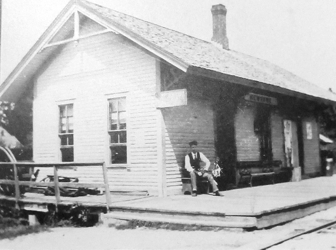
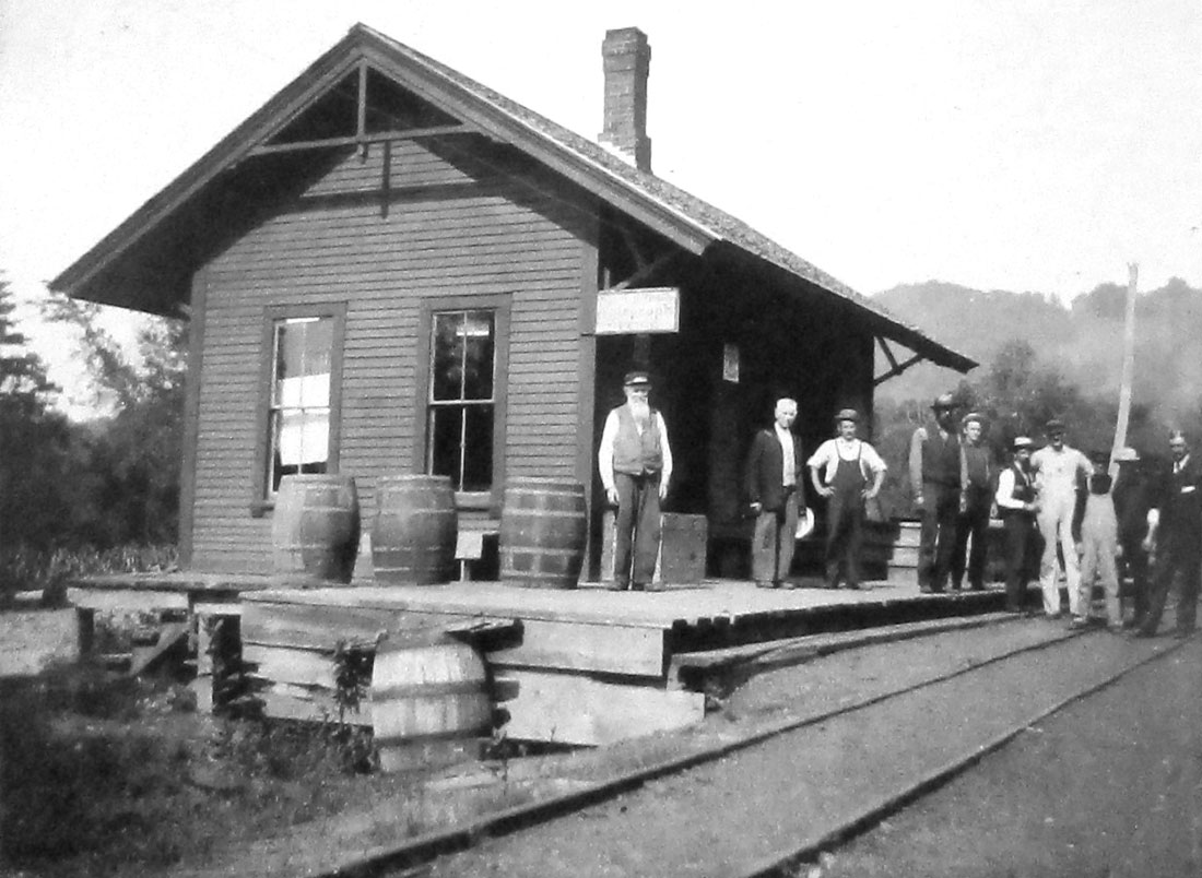
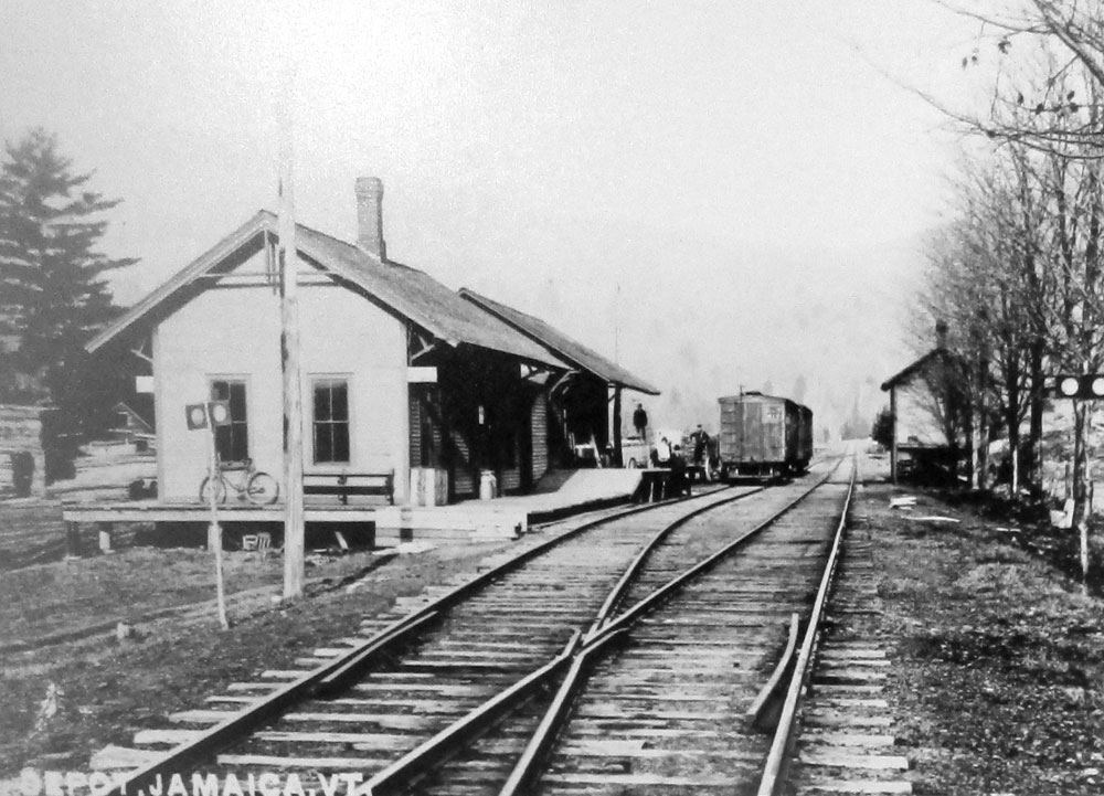
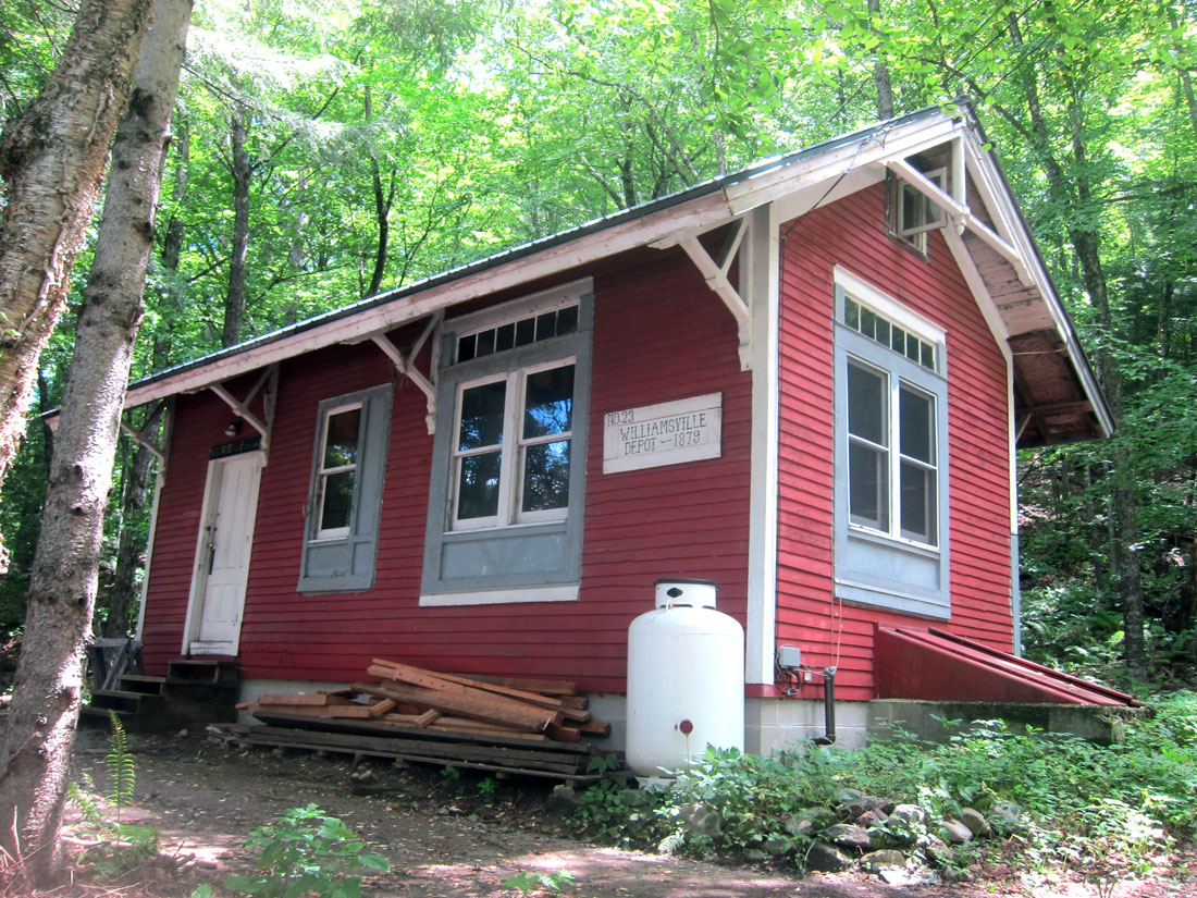
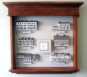
Here is a gallery of images of the ten stations, which you may click to enlarge. Left to right, top to bottom, and traveling south to north are: The original Brattleboro station; West Dummerston; Williamsville; Newfane; Townsend; West Townsend; Wardsboro; Jamaica; Winhall; and, South Londonderry.


My explorations will take me (and you) in several trips to the remaining six stations and sections of roadbed. Helping me locate the six (of ten) remaining stations is this You Tube Video – Click on the Link. And, for more history try this — A short video about the history of the West River Railroad produced for the Historical Society of Windham County. And, then, there is the second episode of the first video above on the West River Railroad – “Forgotten Rails” – Episode 01 – The West River Railroad of Southern VT. This has portions of the first, but if you need to learn, as I do, enjoy them all.
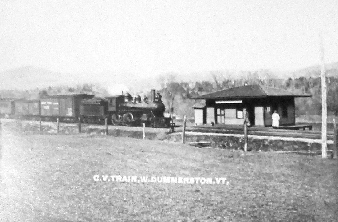
Now, for the first three of the remaining six stations. Take the bypass off Route 30 into West Dummerston, and at the northern end of the village is Riverside Drive. May have been a private drive sign, but I may have missed it to see the station as it is today.

Heading north, just after the busy West River swimming spot, there is a turn (Williamsville Road – also called Depot Rd.) just before the Rock River. Yards down is Station Road where we parked.

Across the street (paved) to the south is where the Williamsville station was moved to (from nearer Rock River) to this high spot as a residence/camp.
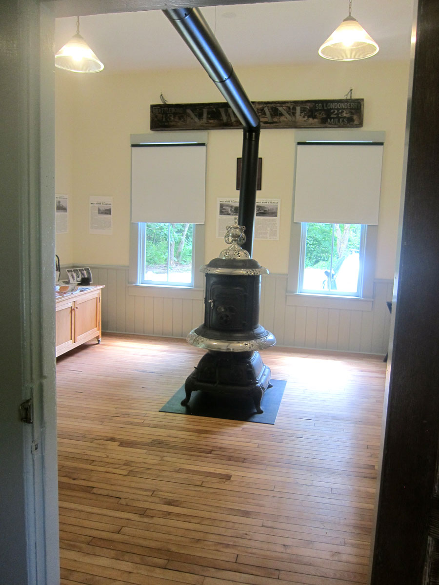
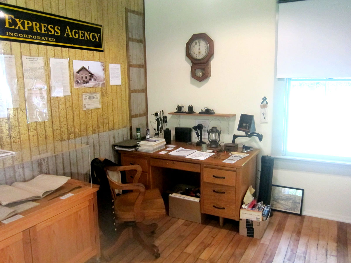
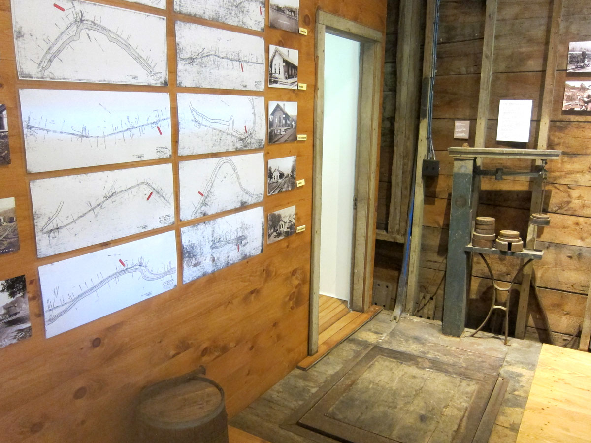
The next station still in existence (and also the next stop on the line) is in Newfane, and you may remember I stopped by in May of this year. But this time when I swung in, the station was open for visitors.
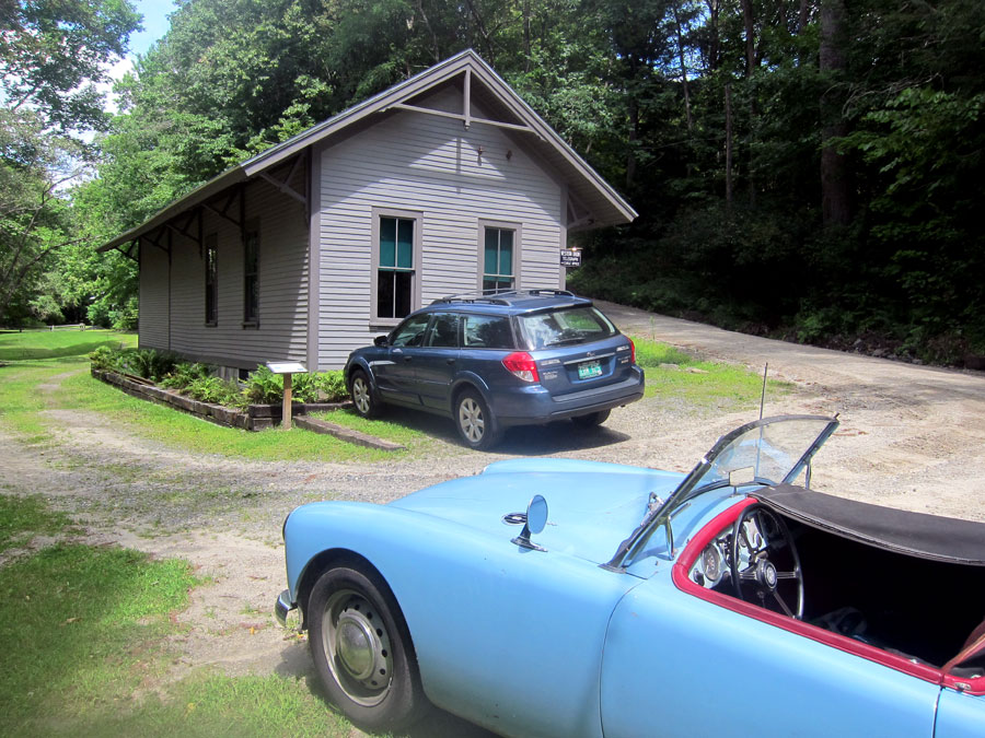
what a treat to get inside this well preserved station that is in its original location. Here is a gallery of interior views.

I then continued north on Route 30. In one of the videos a station is mentioned in Harmonyville opposite the General Store. But on the list of stations there was not a stop there – maybe just a flag stop. The road opposite the store was marked Depot St. but I could not find the building pictured in the video. I continued through Townsend (no station remaining) to get a bite to eat at the West Townsend General Store, only to find it no longer in operation – TEARS. Instead of looking for the West Townsend station I headed north up Windham Hill Road. Phase two of the West River Railroad discoveries will begin at this point. There was a permanent barn sale in Windham – a road you must travel up. I chatted for awhile with the gentlemen. He owned The Mill Restaurant in Londonderry for 50 years before closing it recently. He was fun to chat and learn from, and had wonderful antiques. I double checked with him the turn for Grafton, and he replied, “three miles up ahead, turn on 121 – BUT it is dirt,” he warned, “and with our rains it could be washed out.” I know Route 121, and there were no problems as I sped along the two plus lane wide super dirt highway – remember where we were earlier.
West Townsend store closed, Grafton always a treat to be in, and for the first time I grabbed a wrap at the Grafton General Store – no problem it was almost 4PM – and enjoyed relaxing at one of their tables under the trees.

What can I say? 120 miles — 7 hours — new “finds” nearby — places to explore and re-explore. I will soon get back to the rail route, and I do have some other adventures planned in August – finally — as always, yours, RAY


i enjoyed your trip! looking forward to the next one.
Sandy
Townshend station was on Depot Road in Harmonyville and was a major stop on the West River Railroad. It was disassembled several years ago to make room for a two car garage and is in storage waiting to be reassembled in the near future.