PRESS plus POTS – 31 AUGUST and 1 SEPTEMBER 2022

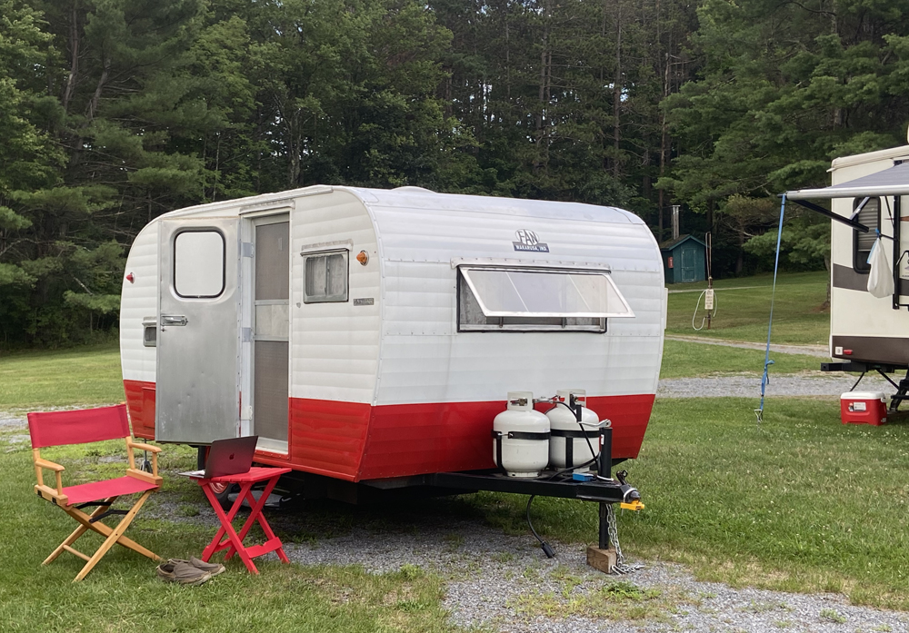
It has been hard to get out and about – COVID, out of practice, making arrangements not as easy as in the past BUT – I just had an overnight to get me back in the “shunpiking mode.” I had a great time combining two desires – 1) taking the tour of the American Antiquarian Society in Worcester, Mass, and getting back to OSV – Old Sturbridge Village. I believe I am “out of my funk.” My Cathy and I felt better just getting away for the day, and an overnight really rejuvenates you to “get back to work.” I combined two “day-trips” again into an overnight, close to home, but far away. Worcester, Massachusetts for a PRESS, and Old Sturbridge Village for POTS.

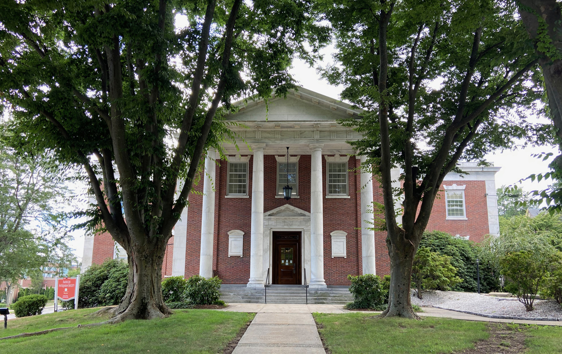
I recently learned that the American Antiquarian Society has tours at 3PM on Wednesdays. Odd time, but I had to see Isaiah Thomas’ printing press. I recently sold a reference book to one of the curators adding interest. Was I amazed to learn that over 40 people work here in a facility devoted to printed material from the US up to 1820 (they need to have it all) but have a cut-off of 1876. I told you I stopped by in February (do revisit this post) and peeked in the windows,

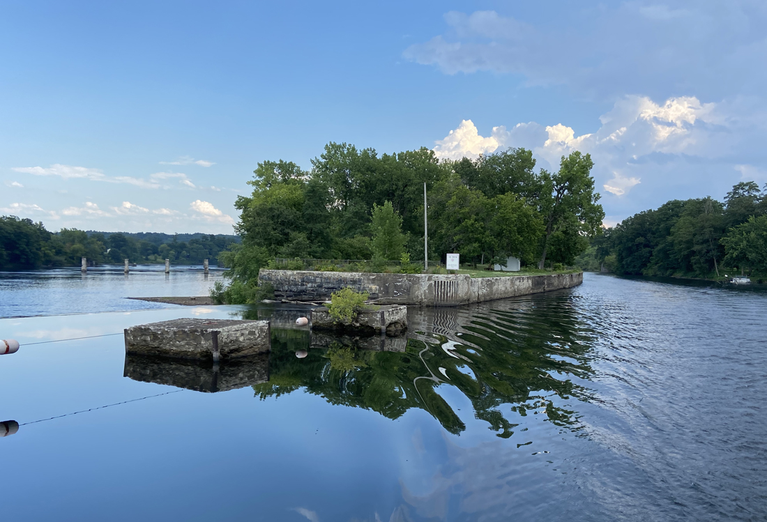
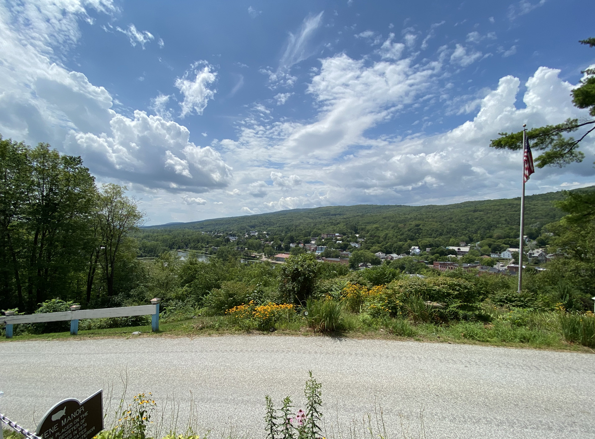
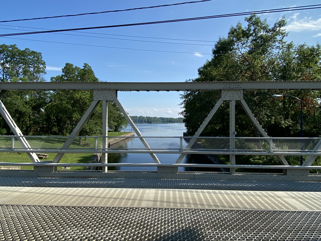
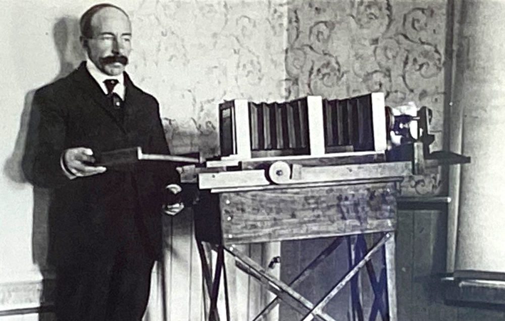
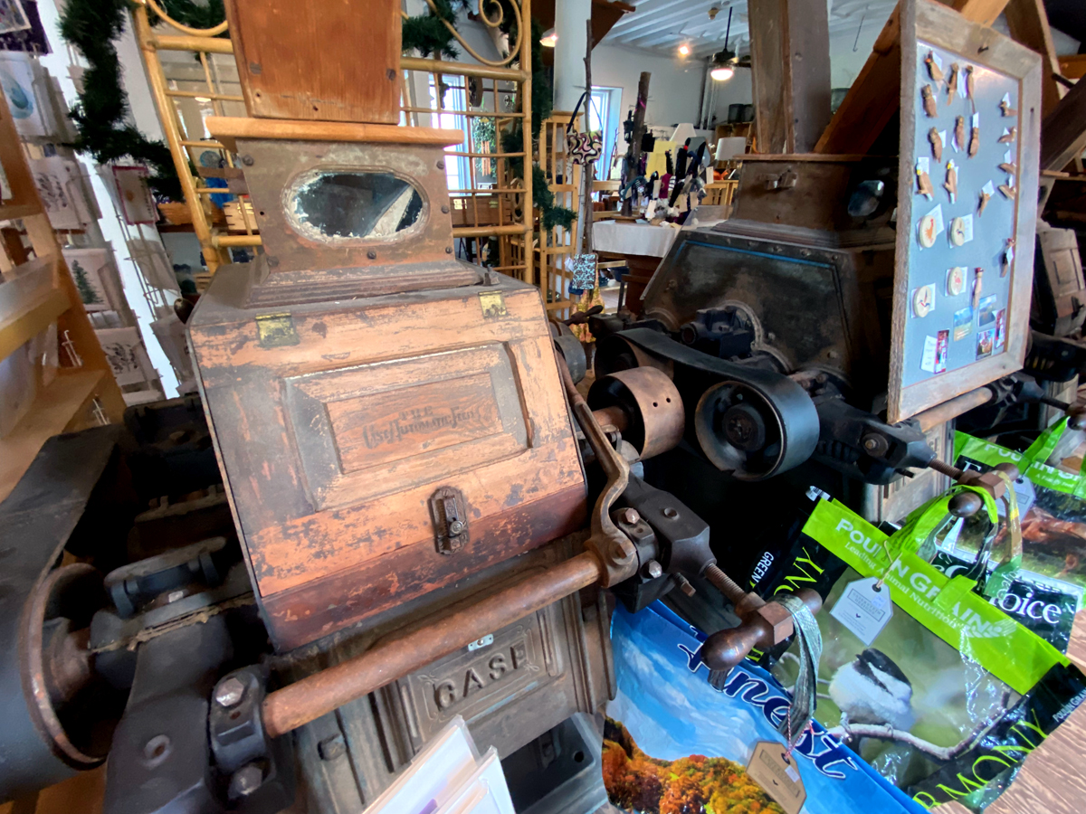
Getting there I backroaded, of course. NH Route 12, becoming MA Route 12 to Ashburnham and Fitchburg; right on 2A; left on 31 towards Princeton to Holden (there is a stretch on 31 with amazing architecture and views to the east); in Holden follow 122A to Worcester. I expect a report back on your explorations along this route. Below is the historic press, constructed in 1747 in London.  Thomas (1749-1831) learned as a child to print on this press while apprenticed to Boston printer Zachariah Fowle (1724-1776). When Thomas eventually took over Fowle’s printing business, he also became the owner of this press. I got my first printing press in 1957 when I was eleven – ironically I only own about eleven presses as this time, but nothing this large and historic. I encourage you to learn more of Isaiah Thomas’ work and life.

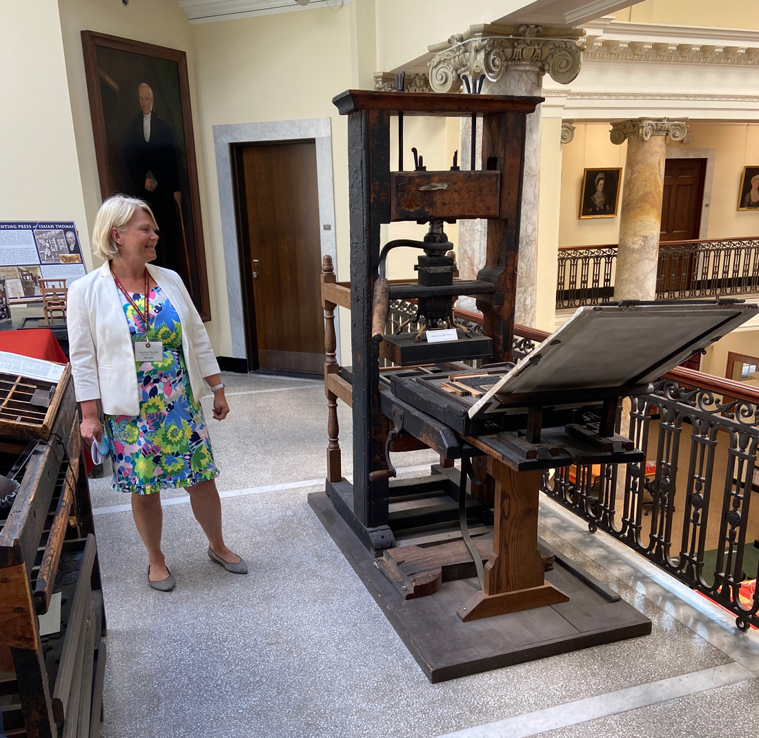
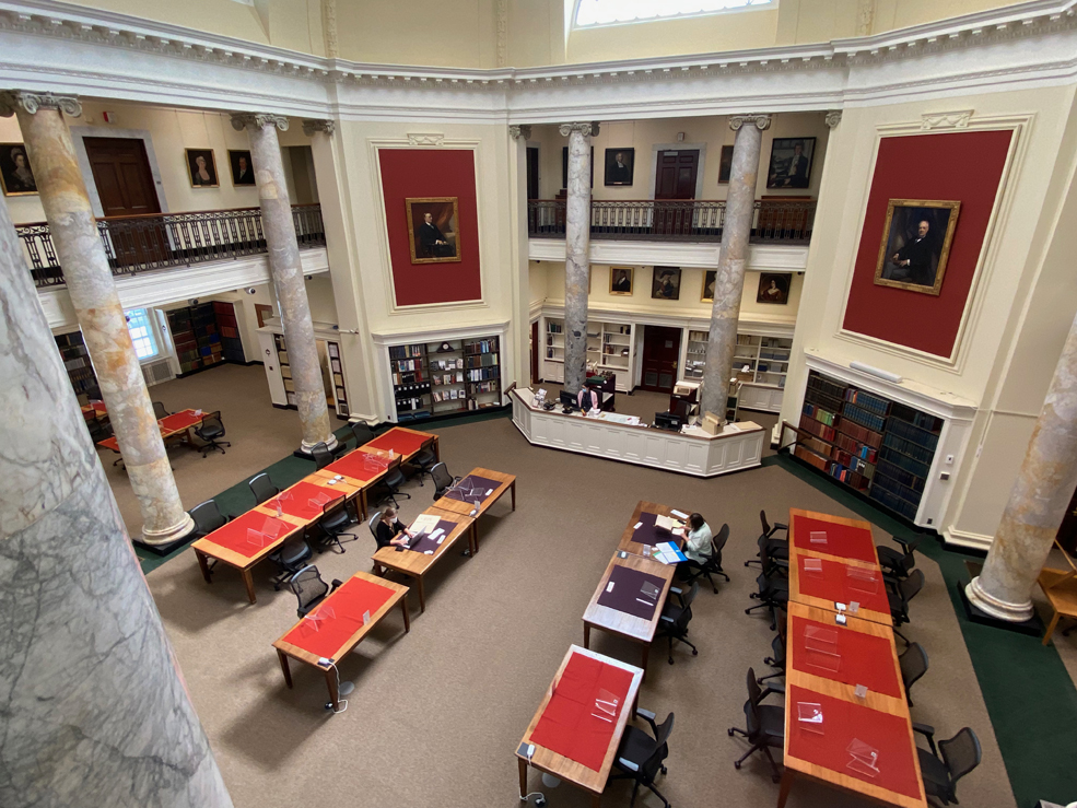
Above was today’s guide for the tour. The staff takes turns doing the “honors” so each tour could be different. I thought I was going to be the only one on the tour, thinking that would be great, then more folks showed up minutes before the start – 20 in all, the largest group since COVID began. I now will be an advocate for larger groups – there is an advantage. Different folks, different perspectives, and different questions, questions I would not have asked. As a result, insights I may not have otherwise gotten. So, large groups if they fit the area is better. Below is looking down to the reading room. We then passed through stacks, saw the preservation area, and you would not believe the size of the scanners being used to digitize newspapers.

I will visit again, I need to access digital copies of the FARMERS MUSEUM published at Thomas’ satellite press here in Walpole to pull snippets for my newspaper, THE WALPOLE CLARION (having roots back to the FARMERS MUSEUM), and I am adding the society to my list of worthy recipients of donations.

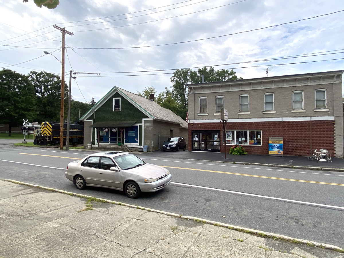
It was then down Main Street heading west. This visit to Worcester I saw more traffic than in my past visits. Main Street passes Clark University that I reported on in February where my great-grandfather, Franz Boas, taught. You pass through a number of ethnic neighborhoods, and ironically this evening I sold two books – one Armenians in Worcester, and the other Swedes in Worcester. I needed to go this route because I found in my files a brochure of the Historic Districts of Charlton, Massachusetts. I have almost 60 years of experience with Charlton, but have not explored it all. In 1963 high school friends and I painted the barn of the Black Angus farm owned by one high school chum’s Dad, and I bought my last Model A Ford there in 2019 – remember there are constant threads in my life.

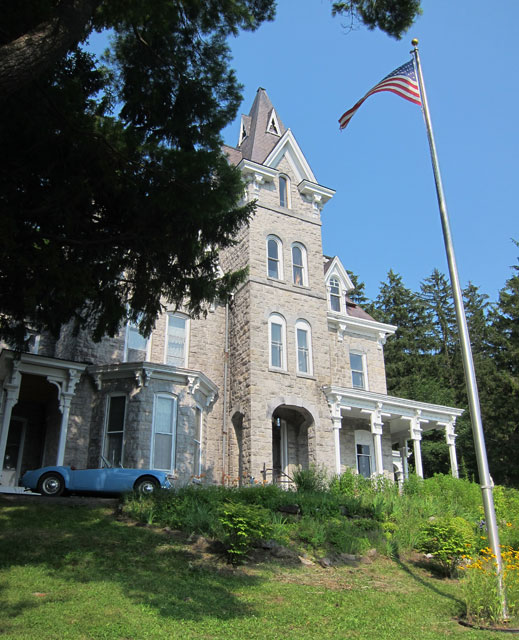
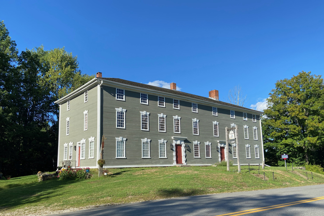
In a remote area, but close to the Massachusetts Turnpike, I first passed the 1799 Rider Tavern, one of the top ten architecturally significant buildings in Massachusetts.

around the corner is the boyhood home of William T. G. Morton. Morton was the first to discover the properties of ether as an anesthetic and demonstrate its use in operating procedures. Honored as the man “who banished pain from the operating table”.

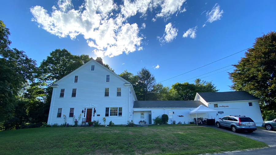
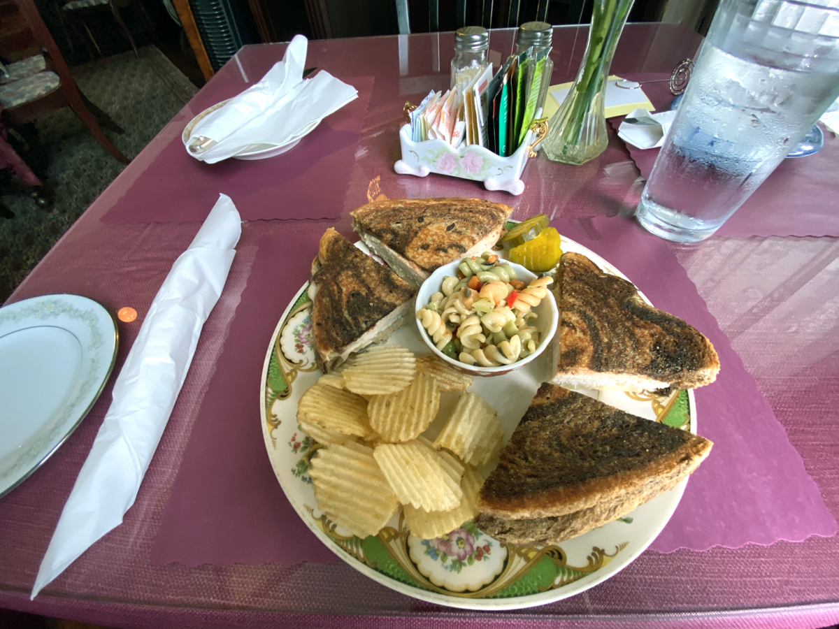
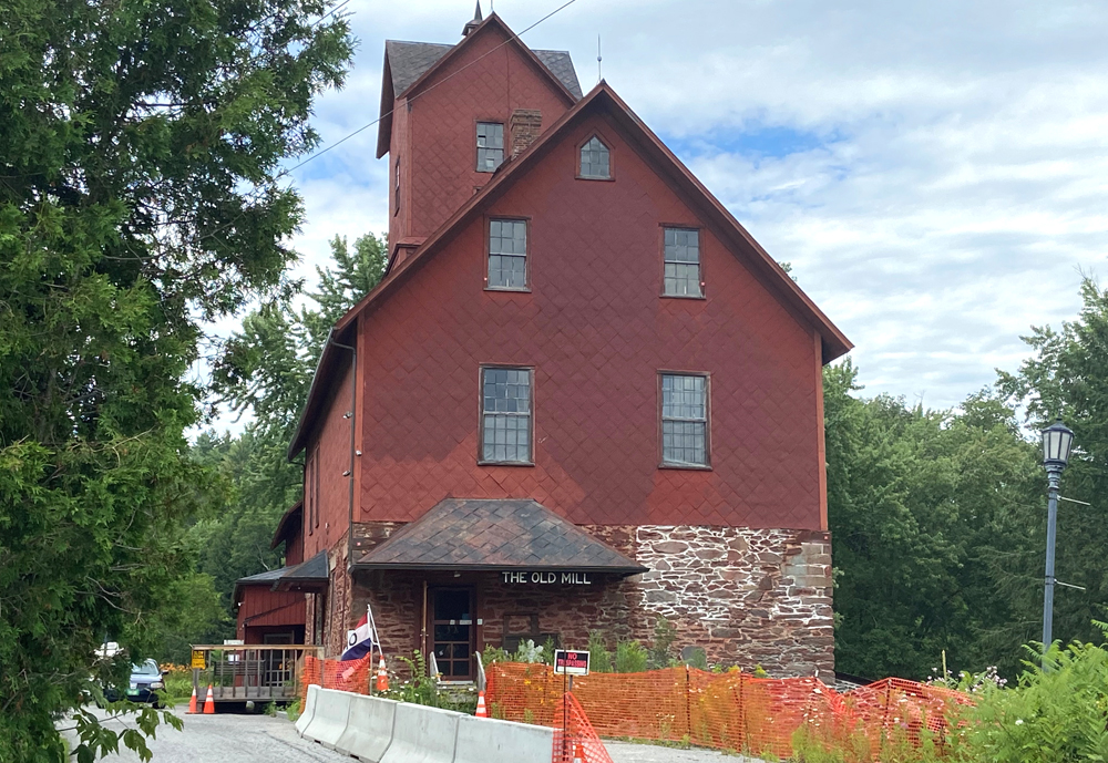
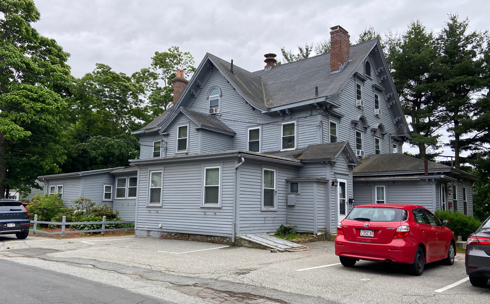
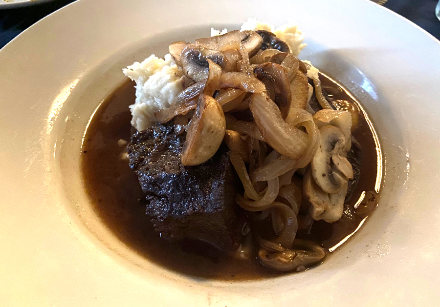
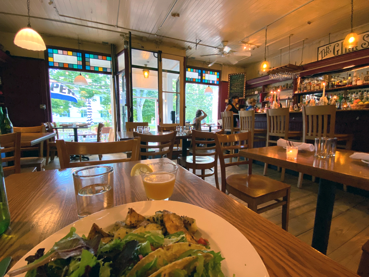
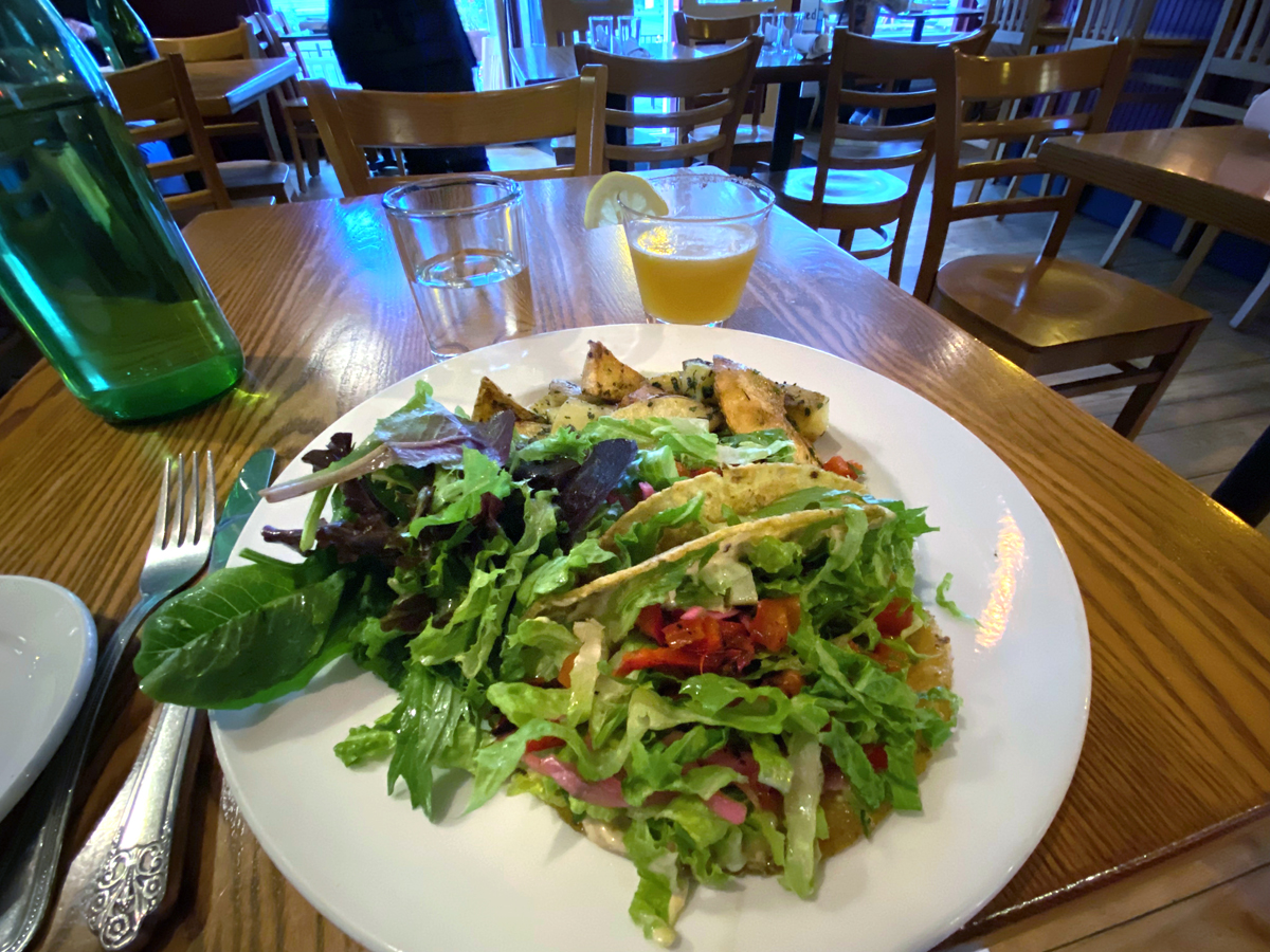
I then “back roaded” to Southbridge for the SOUTHBRIDGE HOTEL ​& CONFERENCE CENTER. Although not a B&B or Inn, it was fine, but the hook for me is it is in the original American Optical Company building, the company owned by the Webbs who established Old Sturbridge Village. Industrial and close to Sturbridge it was nice to experience the town. I had dinner at Fins and Tale, in an old building, and had a fantastic special – braised beef, mouth watering. Below is the fantastic old building before being converted (facade still the same) and my dinner.

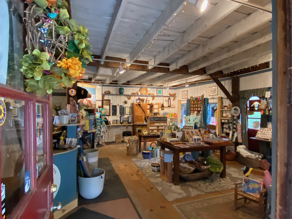
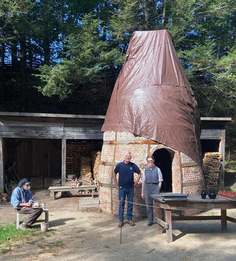
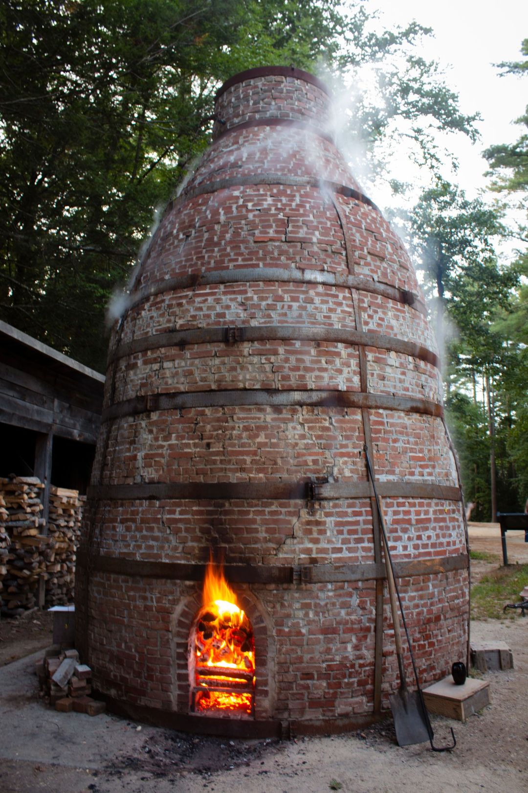
The second reason for this overnight was a day at OSV. I was the first one “in the door” on June 8, 2021, when OSV opened for its 75th anniversary. I had a great time, and bought some souvenirs made for the occasion at the Miner Grant Store. While deciding on which pottery item to buy, a fellow came up to me and said, “I made those.” Tony is a volunteer potter at OSV, and we have emailed since then. He told me the kiln will be in the process of being loaded for firing on September 10, and I planned to meet him there to see the loading and chat. It was great. Below is the original pottery shop. When we visited before I left, we chatted in the underground pottery area that is so well hidden you would never know it exists.

One of the things Tony shared is their clay comes (since 1940) from the Sheffield Pottery, and he showed me an aerial photo of the spot, and a ground view. On my favorite US Route 7 in Sheffield, MASS, I have been passing by for six decades, only stopping once. On my list to stop next time passing by.

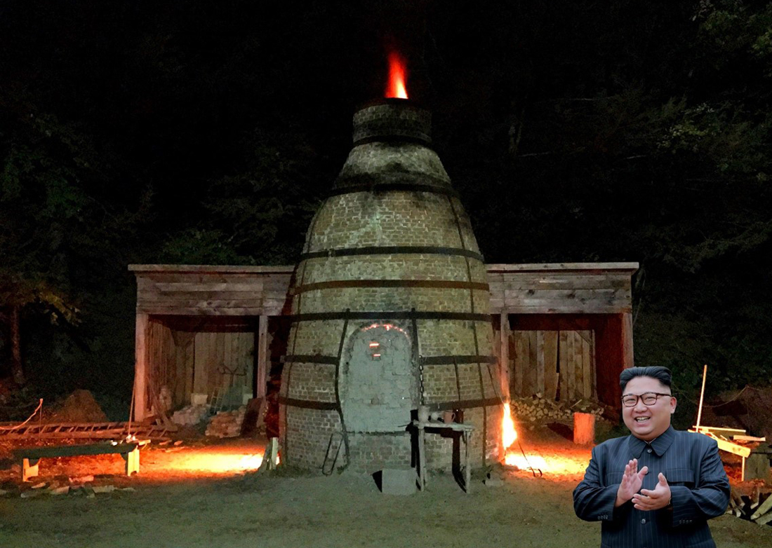
In our emails Tony explained the covering I would see, saying, “Due to all the rain downpours we have been getting we opted to cover the kiln. A dry kiln can reduce our firing time by 20 hours. 32 hours vs 52 hours. Very significant as we would have to staff the firing for the additional hours with another overnight and use at least another 1-1/2 cords of wood. To reach temperature the additional fuel is required to drive out all of the moisture trapped in the brick and hearth of the kiln. The kiln is 16” thick. Unfortunately the modern day tarp is a detriment to the old time appearance to the kiln.”

To the right are Jeff, Tony, and “apprentice” Caitlyn with the protected kiln.

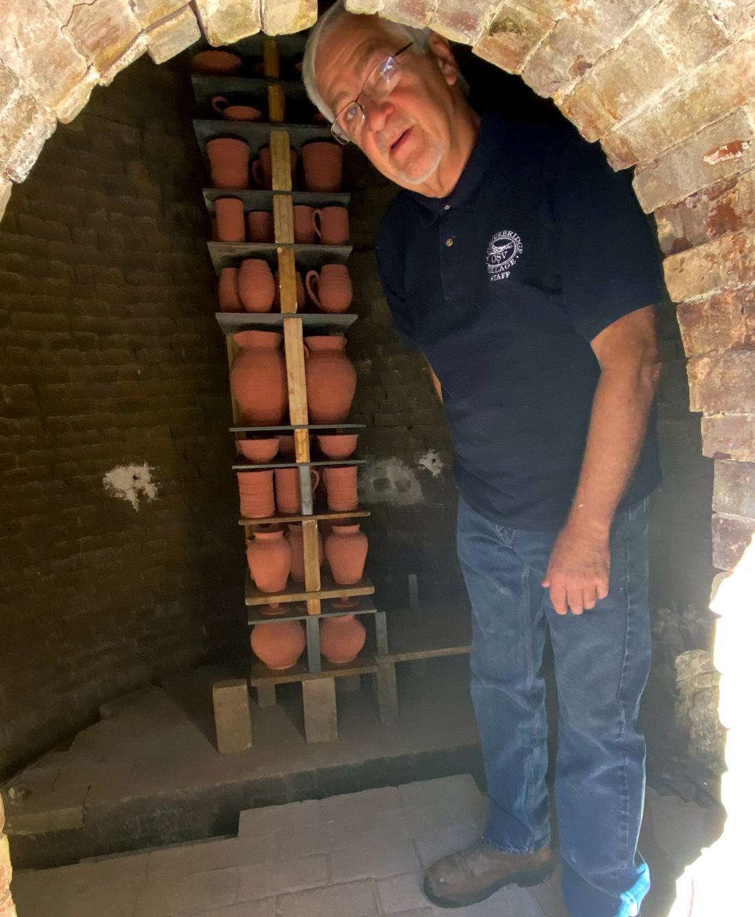
Here is Tony heading in to stack the kiln with product for firing. It will be packed entirely, they had just begun.

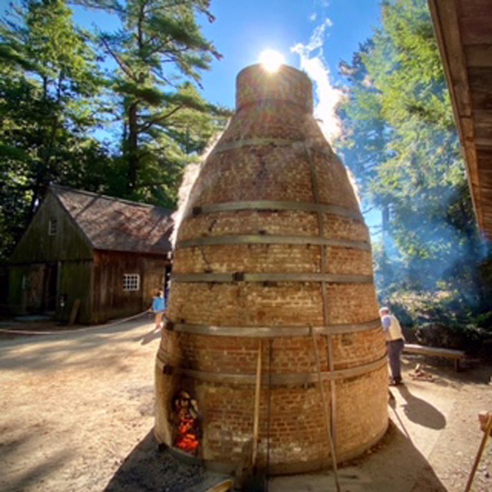
below are some “firing” images that Tony sent to me — you now can see what happens, and what I saw during my overnight in 2018 when the Kiln was firing.

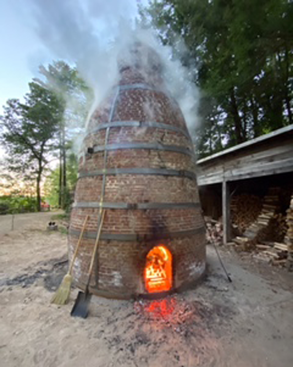
UPDATE – this image from the Village’s Facebook page, the Kiln being fired with over 1,000 pieces of pottery inside on September 11, 2022.

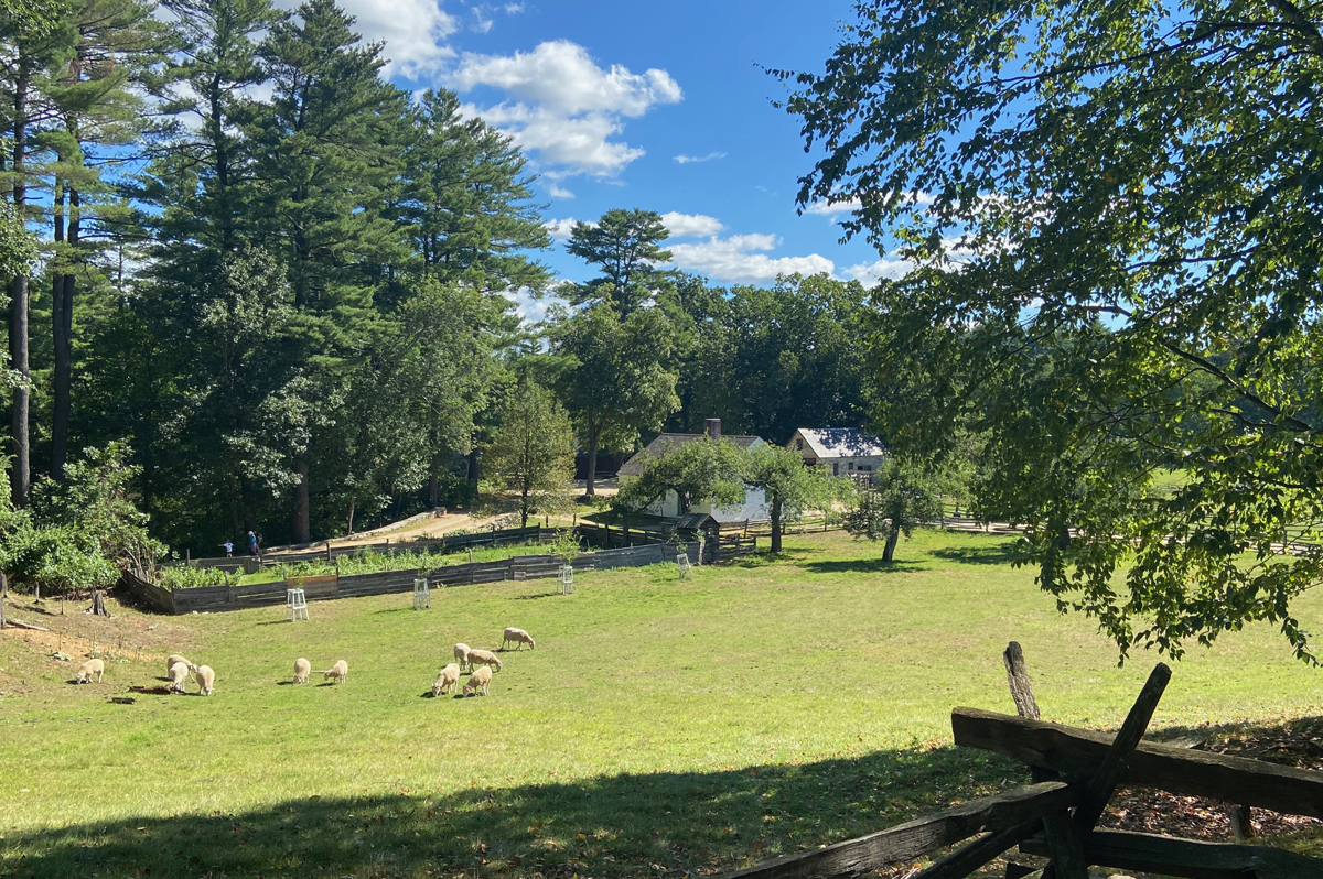
Leaving the pottery heading towards the Freeman Farm this is my favorite view looking down to the Bixby House where I spent one of the most enjoyable overnights in my life..

I have been fortunate to develop “friendships” with a couple of the docents/staff at OSV – Susan, George and now Tony. Susan was my docent for my overnight in 2018 – Boarding with the Bixbys – an experience I would sign up for again in a “heart beat.” I entered the Bixby House, and Susan was there. She offered me a chair, and we began visiting, but stopped when visitors entered so she could share the experiences folks like the Bixbys would have.

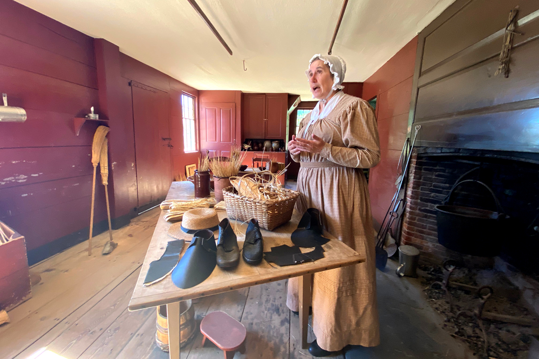
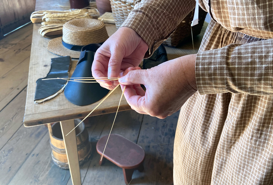
Susan explained how the women would weave the dried rye into braids that would then be traded at the local general store for other goods. Those braids would later be made into hats as seen on the table. The women would also get leather goods to create shoe uppers. Making shoes in the early 19th century was piece work done at many locations for further assembly. I have talked about this in the past in other posts.

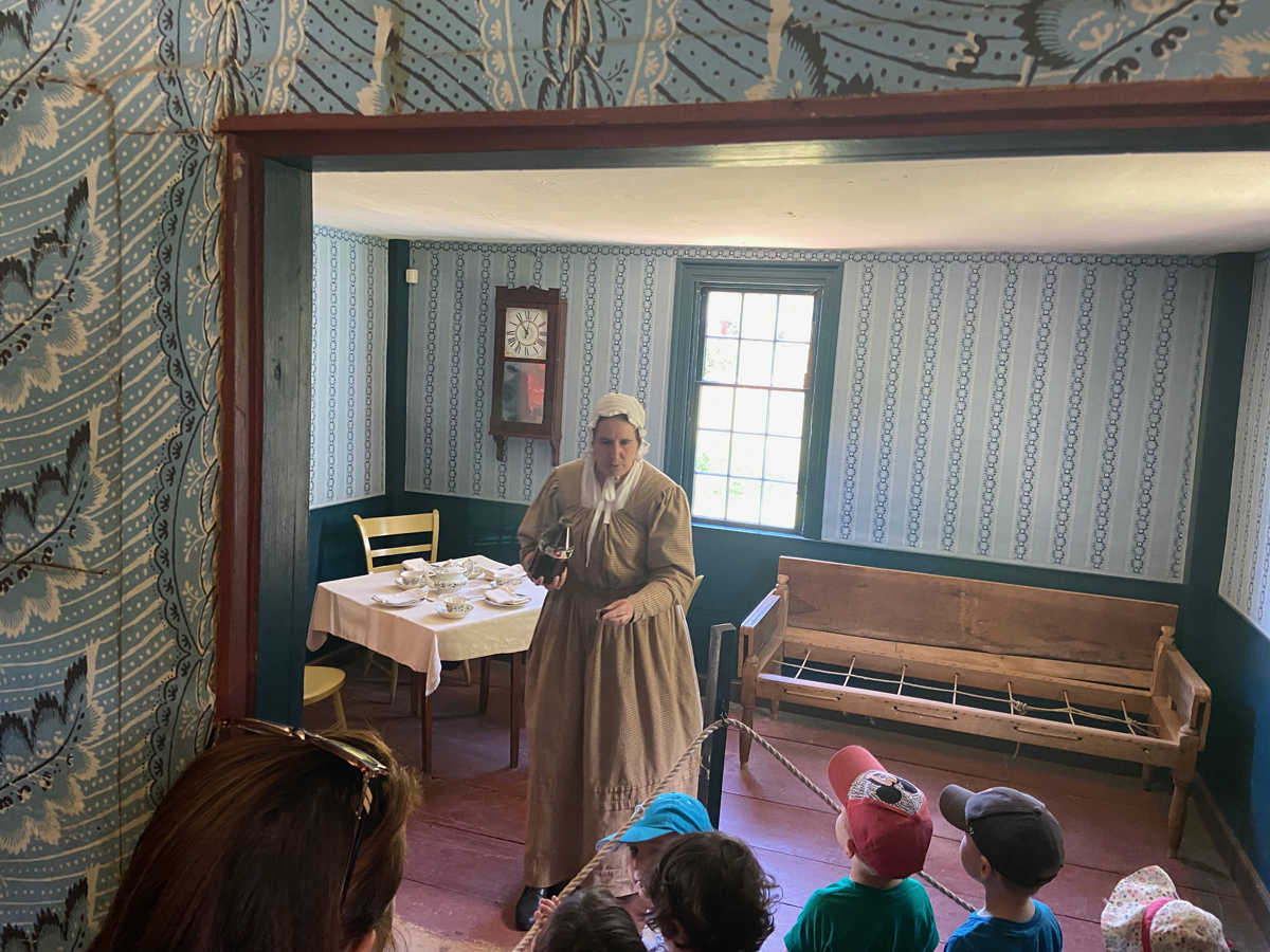
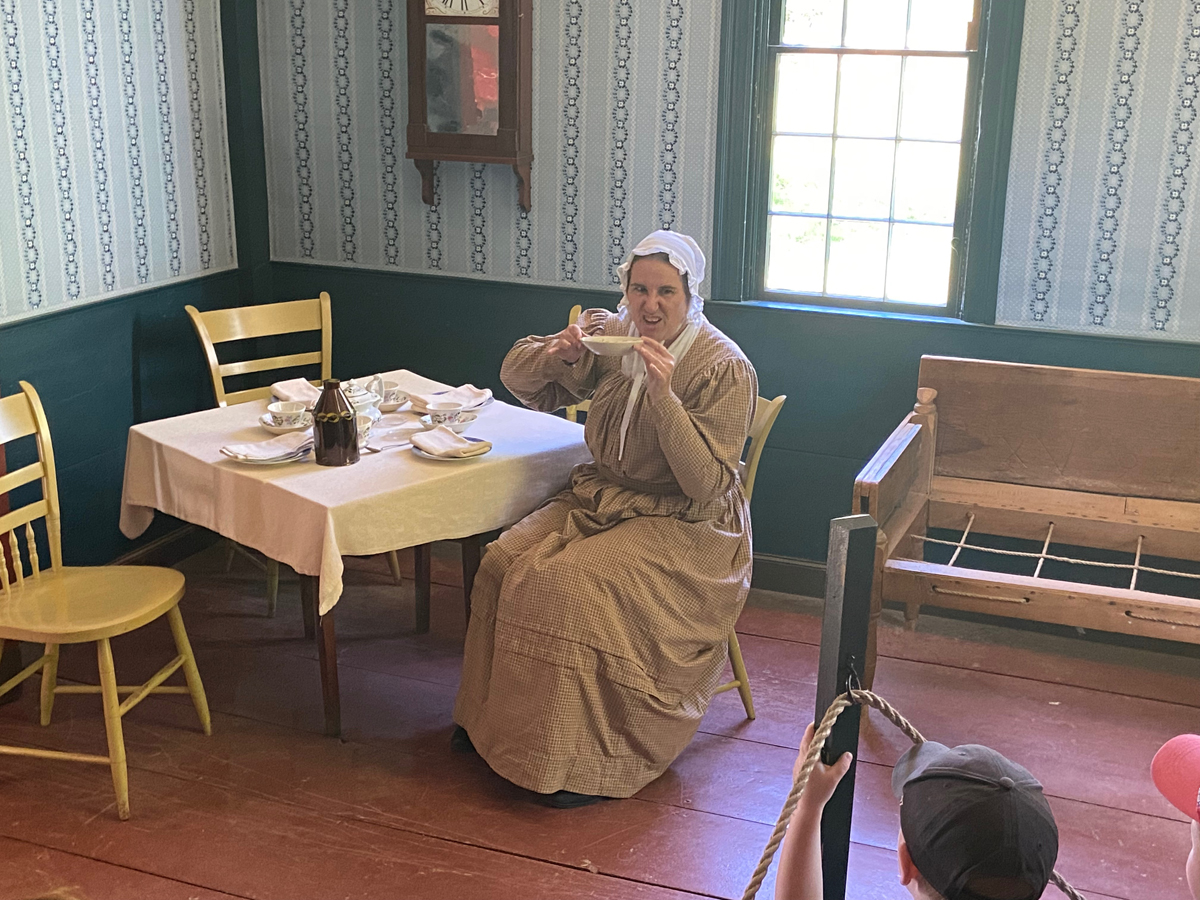
When another group arrived she invited them (and me) into the “guest parlor” where she discussed the serving of tea. Tea leaves would be added to hot water in a cup. The resulting tea liquid would then be poured into the saucer carefully to not include remnants of the leaves. Tea was then drunk from the saucer – and now you know the 19th century tradition.

I heard the carriage outside – it was George. I said bye to Susan (I did go back later to say good bye), and then rode with George on his route and talk through the village and its history. Years ago we learned we knew the same people in Walpole, and his nephew lives close by. Most all of my images of George on my visits are the same.

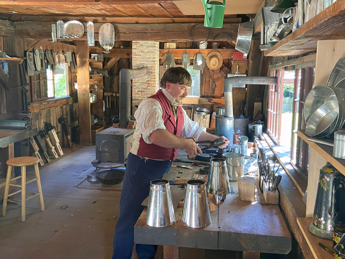
After lunch at the Tavern I stopped in the Tin Shop where I apprenticed during my overnight and made two tin sconces, now proudly on my walls. And, I visited the “new” cabinet shop.

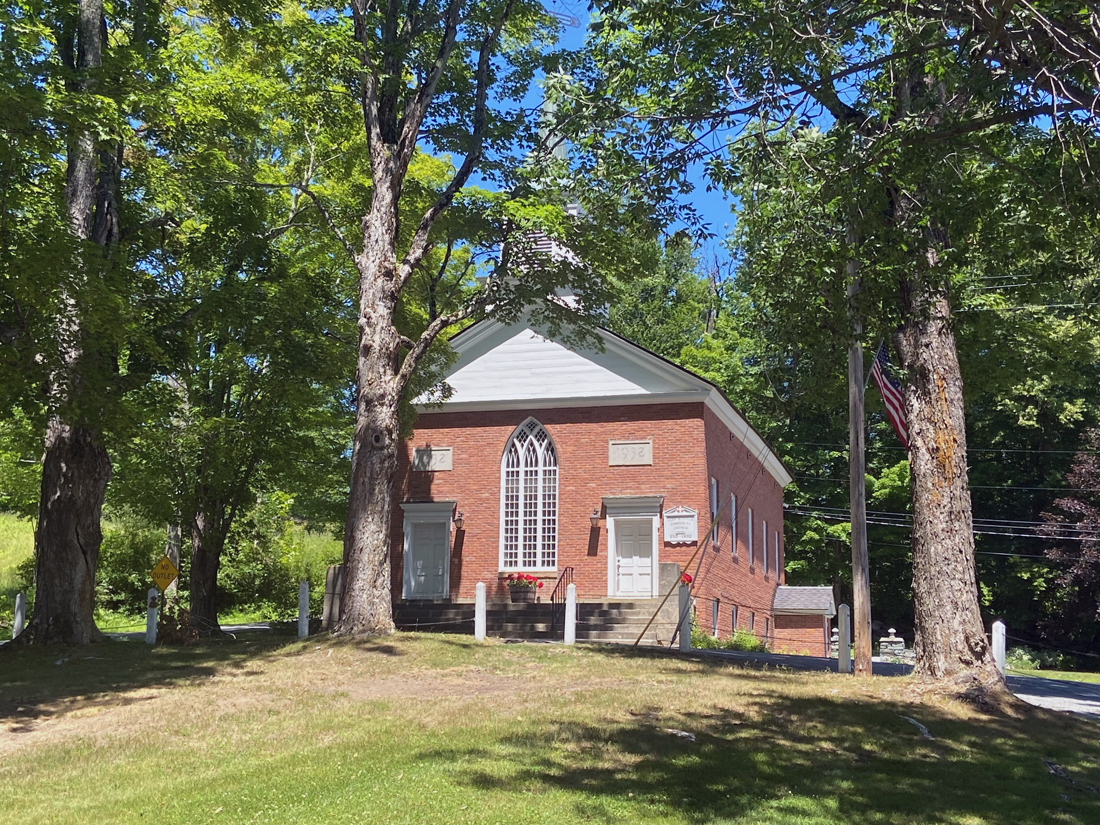
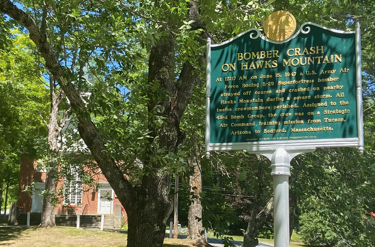
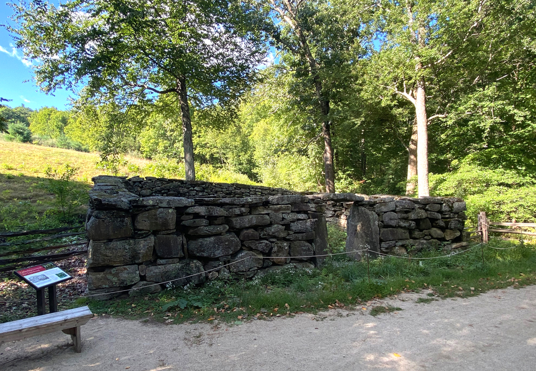
I have not before shared with you the Town Pound. One of my next “Did You Know That…” history articles in my newspaper will be on Town Pounds.

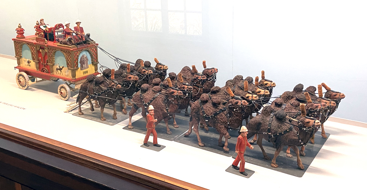
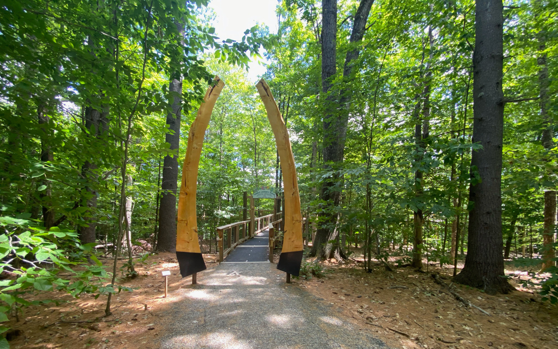
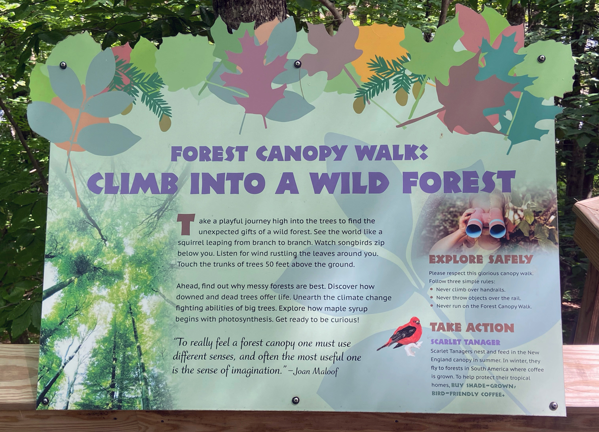
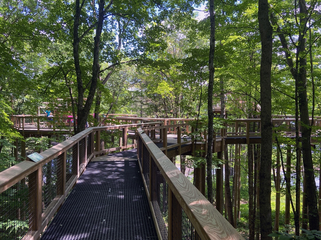
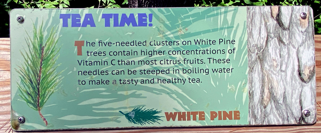
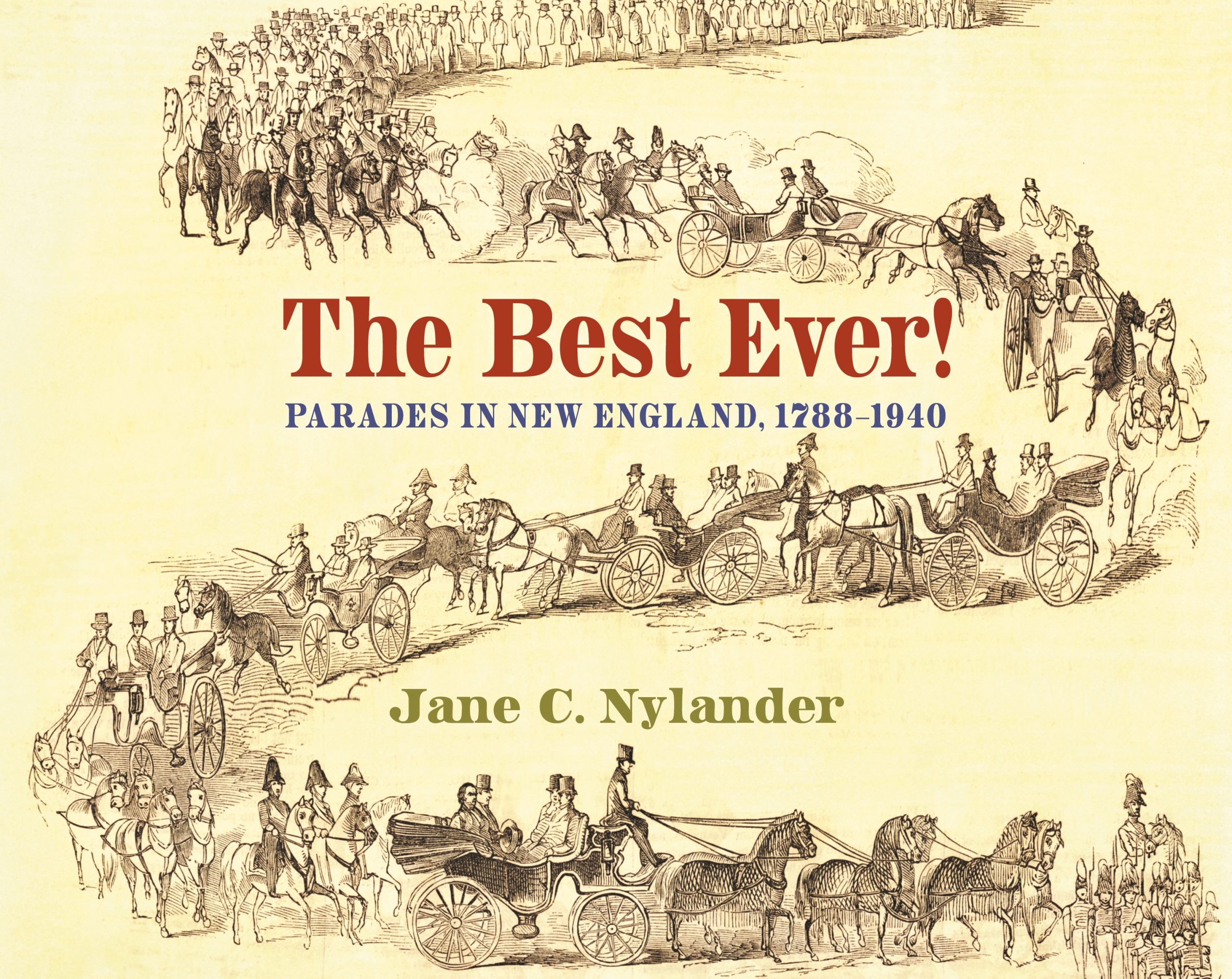
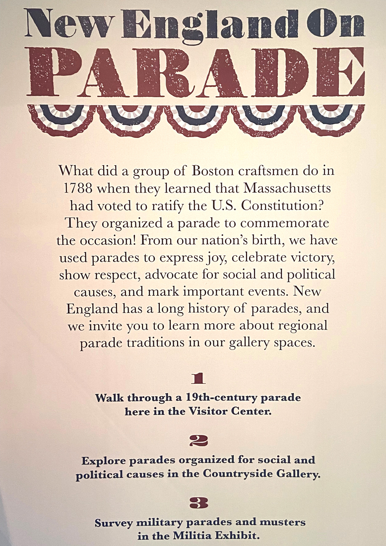
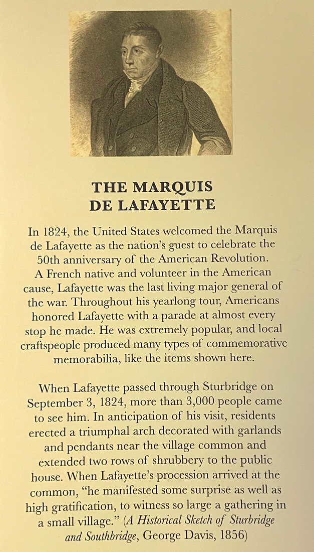
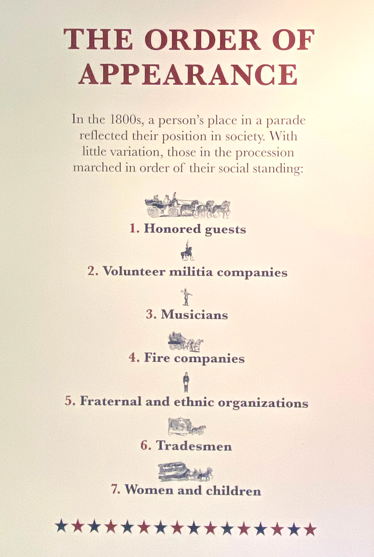
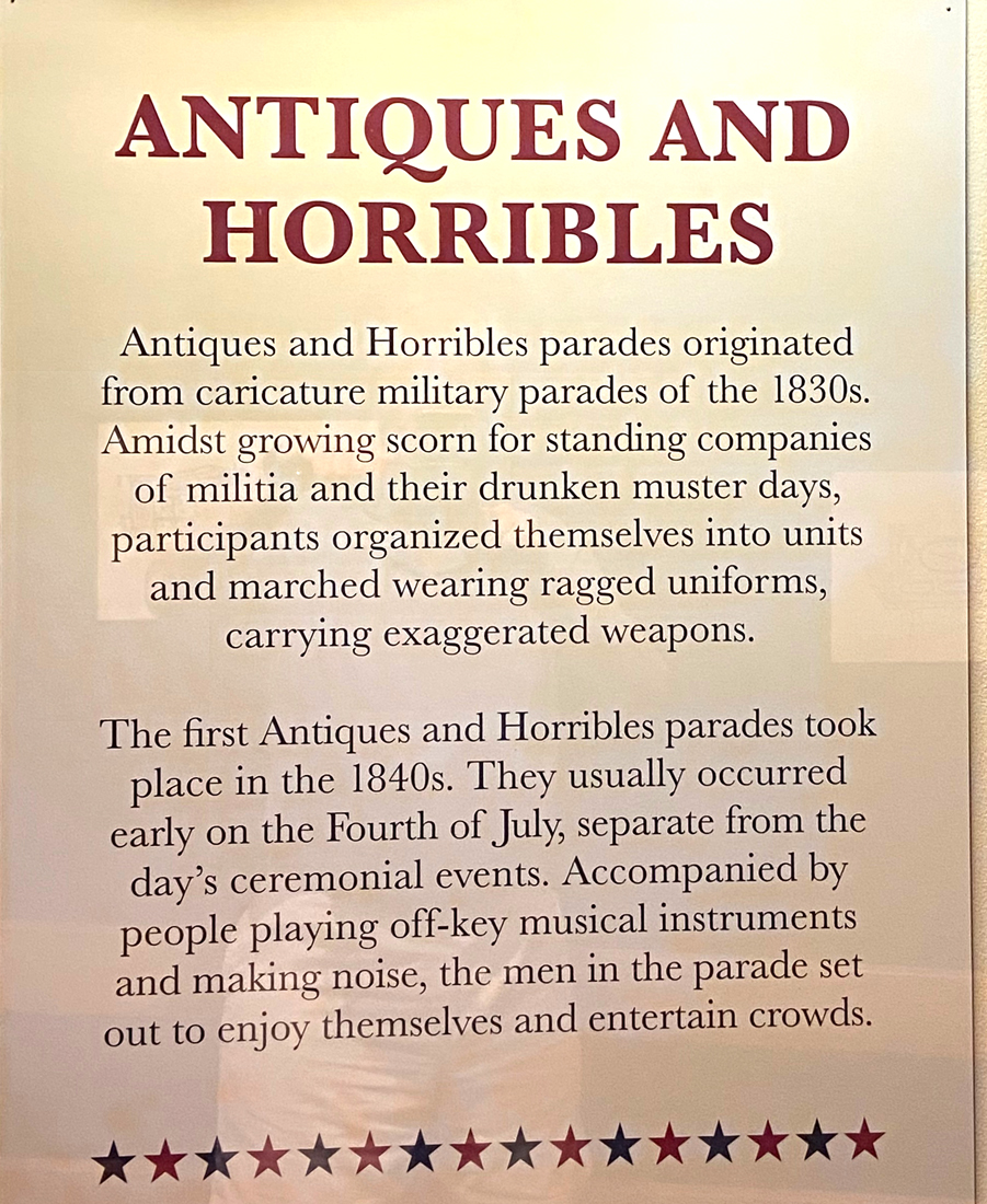
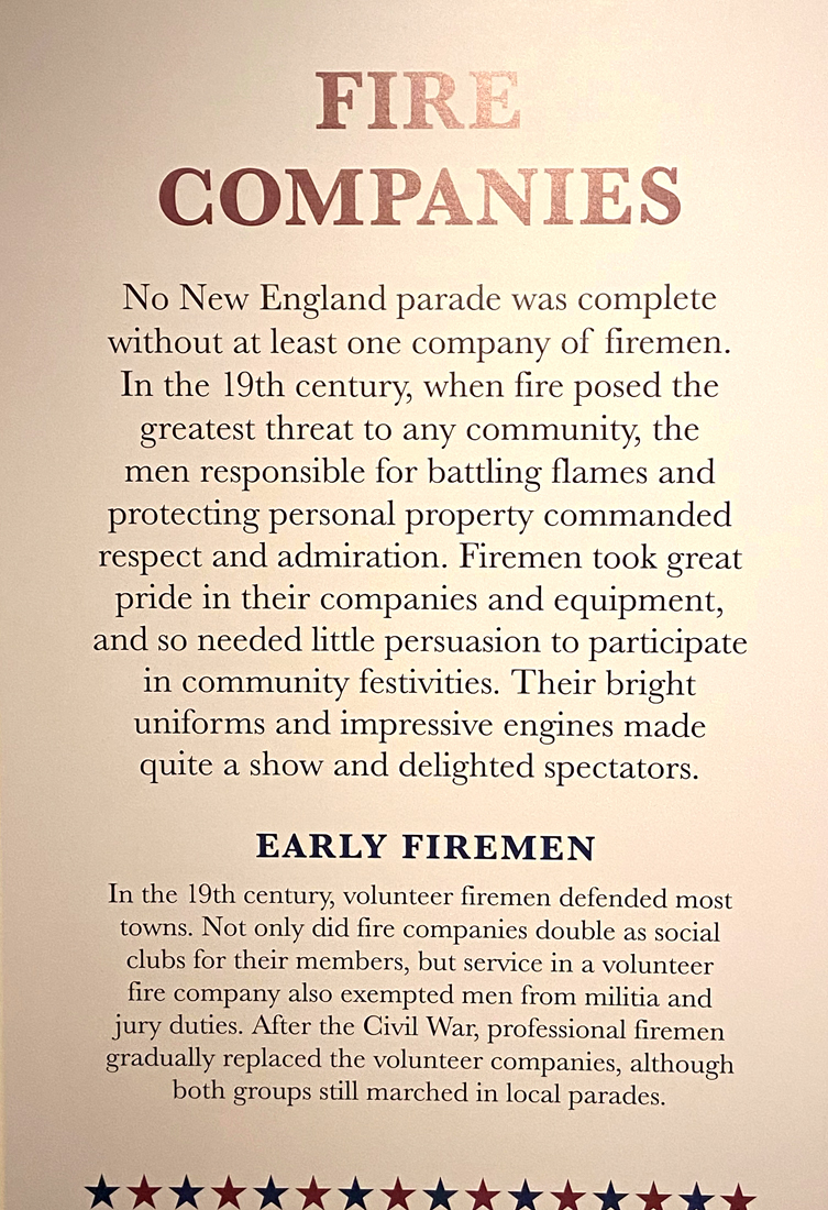
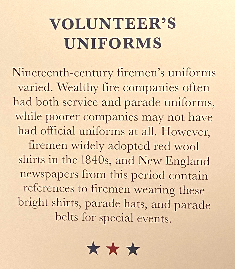
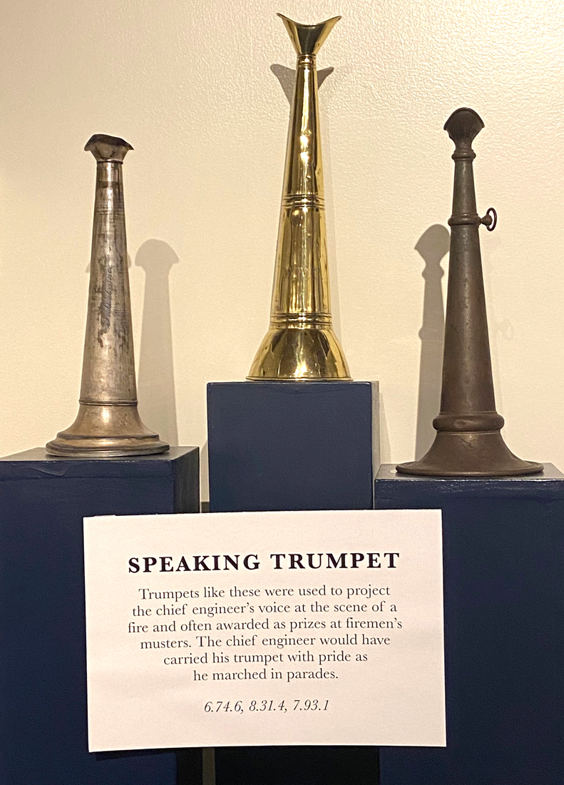
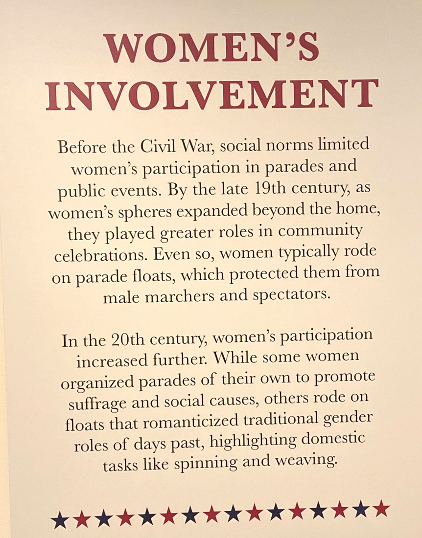
I wanted also to see the new exhibit on parades based upon the book shown below. The exhibit is in three places through out the village, but from the main visitor center part I have included some interesting panels that you can click on for easier reading – ENJOY.

In May of this year I discovered the Gill Tavern in Massachusetts. It was closed, but I promised myself I would return. Routing myself home once leaving a great day at OSV, and buying books at a few stops, I arrived in little Gill for dinner.

45 minutes from home on super slab I-91, I cannot wait to get back with friends.

Well, I am ready to get out again. I have to review all my notes for trips – and hopefully there will be “no stopping me.” If you have not been:

RAY RECOMMENDS:
1-Visit Worcester, Mass, and the American Antiquarian Museum
2-DEFINITELY – visit OLD STURBRIDGE VILLAGE
2-Plan your trip to have a meal at the Gill Tavern in Gill, MA

ENJOY – luv, RAY

Posted in Old Sturbridge Village - OSV | Tagged , , , , , | 5 Comments

VERGENNES, VERMONT OVERNIGHT – 17-18 AUGUST 2022

I do not seem to be getting out and about as much as I used to, but I am busy. Lack of “shunpiking explorations” is probably a combination of factors: I still wish to avoid crowds; places I wish to stay are all booked as people are again traveling; I do not want to go far; you can no longer talk to innkeepers but have to use APPS that are all different, do not answer your questions, and often do not work; and, my mobility is not what it was. But life is good. With some books I purchased the end of July was a history of the Robinson Family and the Rokeby Museum in Ferrisburg, Vermont. Also in adjoining Vergennes is the Lake Champlain Maritime Museum that I last visited about 12 years ago, and also a B&B Cathy and I were always meaning to experience. A plan developed, and date picked for the stay.

On my favorite US Route 7, I have passed the Rokeby Museum countless times, but never gave it a thought. But here is true history of what life was like in Vermont through the 19th and early 20th centuries.

The four generations of the family were Quakers, farmers, abolitionists, authors, and artists. They raised Merino sheep from the outset when that was the thing to do, and opened a tourist camp in the 20th century as America took to the roads.

The farmhouse has had many additions and changes since the 1700s and is surrounded by all the typical Farm buildings of the 18th century (well not the modern garage to the left that replaced a barn).

The family was quite active in the early Abolitionist Movement in Vermont, and the related exhibits in the newer visitor center are informative and eye opening.

Roadside Americana fascinates me, and I have about 30 feet of books in my personal library about highways, their development, and what lined the sides of the roads. Tourist camps in farmers’ fields evolved into tourist cabins, then motels, and concluded with chains as the Interstate system bypassed the old roads (any idea why I “shunpike”?). In 2016, I selected for The Walpole Players (I was president at the time) and directed a rare play by Dorothy Canfield Fisher entitled TOURISTS ACCOMMODATED about how Vermonters opened their homes and also build cabins as lodging for folks who had just bought automobiles and were getting out into the countryside. The Robinsons hung out a sign and welcomed tourists in their home and in this cabin. Click on the gallery below to learn more.

After touring the grounds and various buildings ( click on this link for a map of the grounds and details about the buildings ) I headed back down to Vergennes, which with a population of 2,553 in 2020, is the smallest of Vermont’s ten cities in terms of population, I always enjoy walking around the “little city.” And, then off to the Strong House Inn blocks outside town. Cathy and I always passed by, but never did get to stay. My first floor room off to the side, and off the library. I had the wing to myself, and yes, I read and wrote comfortably on the couch in the library.

Part of the decision to make this escape was to again visit the Lake Champlain Maritime Museum. I was last there maybe 12 years ago. Of course on the lake itself, its entrance adjoins the Basin Harbor Resort which maybe someday I should experience. This is a remote area. This museum is special and its research, particularly underwater, on Lake Champlain is noteworthy. Here is a view of the “campus” followed by a map of the museum.

New since my last visit is this building with an interesting collection of boats.

having recently re-read one of my Hardy Boys books from my earlier youth, in which the brothers and their pals were out on their iceboats, I found the iceboat on the lower level with their history most fascinating.

I always wish museums would do booklets for purchase that would include the details (and more) from their exhibits. I am not sure whether I will ever fully understand all the American Revolution events on Lake Champlain, but in this gallery is a sampling of knowledge (click to see full size). So much more I need to learn.

I am including this map to put the area into perspective for you.

You know my interest in canals, and my last trip to the Champlain Canal. Down the path and on the lake is the premier exhibit – “The schooner Lois McClure is the Museum’s full-scale replica of an 1862-class sailing canal boat, based on two shipwrecks located in Lake Champlain. This replica project was initiated in 2001 with the goal to understand our region’s unique 1862-class sailing canal schooner; how it was built and operated; and the economic, cultural, and personal impact the canals had on our region and people.” You may wish to look at this page on the museum’s website to see the Lois McClure under sail.

I needed a break, and even a day away is great, an overnight doubly great. Each museum I spent about two hours at, thus could have done one in the morning and the other in the afternoon. So, if going keep that in mind. BUT IT IS THE JOURNEY, and you know I have to see roads and areas I have not been on. I spent much time driving “to and fro”, but that is also relaxing and thinking time for me. So, instead of marking up a map to share, I encourage you to get out your map, and follow my routes “to and fro.”

TO Vergennes – I took I-91 to exit 9 where I followed VT 12 to Bethel. Just north of Bethel I discovered (on my maps before leaving home) a new to me route over the mountains – I took Camp Brook Road to Rochester (turns into Bethel Mountain Road on the west end). Fun and views across the mountain – marked not for large trucks, with sign saying GPS brought you here in error. From Rochester up VT 100 a short way, west on VT 125 on another wonderful, Ray Recommended Route, over more mountains, past Middlebury’s Snow Bowl and resort area, down the hill past Bob Newhart’s Inn (well the facade for the show – stayed there in 2018 check out that post). Once on my favorite US7 it was north to Vergennes.

FRO Vergennes — an isolated route, but you have to see a totally different flat landscape in Vermont, but looking west to New York’s Adirondacks across the lake. Take VT22A south out of Vergennes, and enjoy. Instead of going all the way south to Orwell or Fair Haven and cutting east, I had never been through Shoreham Center to Whiting on Route 30, and then Route 73 to Brandon. I always enjoy browsing through Brandon. From there south on US7 to Rutland, and VT103 to Chester and home.

Hopefully you will get out a Vermont map and trace these routes and develop your own new adventures. At my B&B I got a brochure I had never seen before, probably since published in 1998 by the UVM Historic Preservation graduate class of 1999 — OTTER CREEK HERITAGE CORRIDOR — pretty much the territory I covered. I see more explorations coming, but cannot find much on-line. Guess I will have to correct that.

Stay safe and well — back to you soon, luv, RAY

Posted in Day (or maybe two) Trips | Tagged , , , , , | 1 Comment

TWO VOYAGES – MAIDEN and CANAL – 3-6 AUGUST 2022

After my Oswego Canal trip in early May I started doing more research on the Champlain Canal to see if there was a boat I could rent to explore the canal since all the Erie Canal boats had already been booked up for the season. Shortly after, still early May, I found one of the last two seats on the Mohawk Maiden Cruise’s CALDWELL BELLE “Free History Cruise with Hudson Crossing Park.” It was for Thursday, 4 August, plenty of planning time. And, then on May 28, I found and bought the “new” LADYRAB III – my 1959 FAN Sportsman’s Friend – a classic “Canned Ham.” See where I am going with my planning? A first “maiden” outing with LADYRAB III to coincide with my Mohawk Maiden cruise. The plan – to explore the locks and old route of the Champlain Canal before and after my boat trip, and see more of New York’s Washington County. I found a spot at a campground in Cambridge, NY, somewhat central to my explorations. And, we settled in…

Ironically, the street adjoining the grounds, to the rear of my spot, is…

As much as I have read and studied, I cannot still totally keep straight all the important things that happened along this corridor from Albany north to Lake Champlain to Canada. The French and Indian War, and the American Revolution with its turning point here. I started in Schulyerville at Fort Hardy Park where the British surrendered October 17, 1777, at the spot below.

If you study a close up map you will see that in most of this area the Hudson River is on the east of some islands of land, and the old canal route (and other water ways) to the west. Enjoying maps I found Towpath Road and headed down — but it narrowed, became private property, no place to turn around, and fortunately I did not go for a swim extricating myself. This was not the narrowest spot of the path – if I had taken an image at a narrow spot, I would have gotten wet.

With my boat trip at 3PM, I planned to head to Lock C3 in Mechanicville and work my way back up. Below is Lock C3 looking south. I bought a sandwich before arriving here and ate under the only tree at a picnic bench. Many of the lock properties have recreational areas for the public. When I passed through here in early May the canal was not yet opened, and the gate was locked.

The locks are operated even for kayaks cruising the canal. There was a boat in the lock as well north of these kayaks.

Lock C4 is in Stillwater, NY. US Route 4 follows much of this route from Whitehall south to Albany.

north of the lock was this assortment below of Canal Corporation work vessels.

History abounds along this someone rural route with small towns that are probably unchanged since the 1920s. Saratoga National Park, Freeman’s Farm, many markers and sites of historic import. Below is the “Saratoga Surrender Site” looking east down to the Hudson. This is where Burgoyne turned over his sword on October 17 – kind of confusing with the “surrender tree” site above — back to my history books to understand – so much happened it is really confusing.

A tad north is the Philip Schuyler Country Estate – and someday I will be traveling through when it is open. Destroyed by the British October 10, 1777, it was rebuilt, and now restored to its early 1800s appearance. The original canal ran along to the rear, and someday I have to find the aqueduct over the adjoining stream.

“Downtown Schylerville” and up the hill to the west is the Saratoga Monument, a 155 foot stone obelisk. Ccompleted in 1883 it stands where Burgoyne’s camp was entrenched during the campaign’s final days. 

It was then time (well I am always early) to head to Lock C5 for my canal cruise. Arriving there I walked around, and to the west of the new “barge canal” is the old route and the entrance to this old lock – now blocked off.

and, I walked over to Lock C5 for the images below.

and, then headed down to the landing and pier for the Caldwell Belle as she was arriving.

There were only six of us for the tour (limited still due to COVID) and the park tour guide. The guide was late, the family of five did not arrive until shortly after we were supposed to leave (as did the history guide) so I got to visit with Captain Marla and her “skeleton crew.”

The family of five arrived, as did our history guide, and off we went to head south through Lock C5.

we went south a tad, then headed back north into Lock C5.

below part of the divide of the Hudson River and our passage – this is looking south.

I chatted with Captain Marla, and hope to charter her craft for a tour with friends from Schylerville to Whitehall before the end of the season, but for now, paddle away….

One thing I have learned about Washington County, New York, is the relative lack of lodging options as well as limited eating options. Wednesday night was alright at a family Italian restaurant in Greenwich, but Thursday night heading back to camp, the tavern and restaurant I stopped at in Greenwich was a disaster. I ordered onion soup and the special. Eventually my wine came with the comment, “no soup.” Another thirty minutes waiting for the special, that should be ready to serve, I went to the bar and said, “I am no longer waiting, what do I owe you for my half-glass of wine?” The server seemed to be alone outside the kitchen, tied up on the phone with orders, then listened to me, played with the cash register, and turned back to me saying, “you are all set.” Thank you said Ray, and he exited.

The day before I wanted to drive through the Village of Shushan, New York, on the way to the campground, but WAZE would not let me. Thursday morning I tried again to see Shushan. But, two miles east from the campground I turned the corner, down the hill to see the roof of the covered bridge, and only the abutments to the new bridge being rebuilt. The campground had flyers for the Shushan Covered Bridge and School House Museum (you know I collect all this stuff), and also Yushak’s Market – established 1941, now second generation. A village in Salem, it is not named South Salem as the residents wanted because the “Post Office Department in Washington D.C. objected because Salem already appeared so frequently on the list of the United States post offices. The officials, therefore, christened the place “Shushan,” a good Bible name, and it was suggestive of royal magnificence.”

NOW HERE IT GETS CONFUSING – I grew up three hours to the SOUTH of Salem, NY in Connecticut, and just WEST of me was NORTH SALEM, NY — but to ease your pain, SOUTH SALEM does exist and is only 15 minutes SOUTH of NORTH SALEM, which then makes it three hours and fifteen minutes SOUTH of SALEM. I know, you are worn out now.

So with no dinner I headed back to the campground, but remembered another route into Shushan. I made the turn. I love Shushan, and it is worth a visit four miles from the Vermont border.

Old Shushan, NY, railroad depot and former post office

I arrived after 6PM, saw lights on at Yuskak’s and went in. “Sorry we are closed,” I was told. But they let me look around, I pulled a prepared dinner, and they heated it up for me. I enjoyed it “at camp.” So the images below are of Shushan (the next day), and my prepared squash lasagna dinner. The images below basically are the town. Remember you can click my galleries for larger views.

And, besides the Georgi Park Park and Museum, you need to go to Shushan to see the Shushan Covered Bridge Museum and School House Museum. I was there too early in the day to peek inside.

It was then, on Friday, north on remote Washington County roads with rolling views, fields, corn, and horses (remember Saratoga is just to the west). I arrived in Whitehall, and stopped at the Skenesborough Museum and Heritage Area Visitor Center, not having been there in about 12 years. Nice history starting with this diorama display.

Here was the birthplace of the U.S. Navy where the first ships were built for the American revolution. But for some background on Skenesborough, Major Phillips Skene, an officer in the British army during the French and Indian Wars, established the first settlement here in 1759. Skene became familiar with the area while serving as a Major of Brigade at the British fort in Crown Point. He settled more than 73 families and scans borough by 1773. Now Whitehall, the Champlain Canal connects here with the southern reach of Lake Champlain, connecting the route to the St. Lawrence River.

Over hearing a conversation, I learned I could have lunch at the Skene Manor. BLUE BELLE and I visited the outside only in 2015.

Skene Manor, Whitehall, NH

an aerial view (not my drone) and then some interior views, my lunch, and the view out the front door to Whitehall in a gallery.

At Whitehall is LOCK C12, which I have reported on before – CLICK THIS LINK FOR LOCK C12 also some Lock C9.
and, I have also shared my visit at LOCK C11 – and CLICK HERE FOR LOCK C11 – same report as above
LOCK 10 was never built as planned in the early 1800s, so, next here is LOCK C9

looking at my maps, from here south on the west side of the barge canal was Towpath Road – obviously along the original canal bed – so off I went heading to Lock C8. The road did indeed follow the old canal all the way.

entering the road heading south to Lock C8 it is a long straight stretch of open land and waterway. Here is looking north once I was almost at Lock C8.

and below, looking south to Lock C8.

there is so much history along the Hudson River in this area. I have been trying to visit the Rogers Island Museum at Fort Edward for years, but it has always been closed. I finally got in, and there is so much history here.

I still have explorations to accomplish in Fort Edward, including the Old Fort Museum which I never seem to be able to fit in when in the area. But I did find an old Lock at 9 Argyle Street – an Old Junction Log – if I had found this link before writing I would have explored more – guess another reason to return. Below is the lock as I saw it, and across the street the Hudson River.

In Fort Edward is also Lock C7 where I had a wonderful visit with the Lockmaster in June 2016 – scroll to end of that post. But, I had to stop again, of course. Below looking south to the Hudson.

Even traveling down Route 4 there is not much built up, but I did stop at this Guard Gate to share with you. Wanting to learn why it was there, I found another website that I wish I had remembered to study in detail. Take a look at this Champlain Canal document on the Erie Canal Website (official title – NEW YORK STATE CANALWAY WATER TRAIL GUIDEBOOK – you can download PDFs, I want to find a hardcopy)– but here is the detail on the Guard Gate – “Guard Gate, Crocker Reef — This 55-foot-wide guard gate is suspended from lattice steel towers and is normally open throughout the navigation season. It was built in 1914 to protect the 2.25-mile land-cut section from here to Lock C6, allowing it to be drained in winter and for maintenance. It is the only guard gate on the Champlain Canal.”

Many of the lock accesses to recreation areas are closed between 4:30 and 5 when the locks shut down, so I wanted to get to Lock C6 before the witching hour. But, not the case here since a road crosses a bridge just below Lock C6. So here is Lock C6, and then the small bridge built in 1907.

If you got this far — THANK YOU – remember I write for myself to remember, but enjoy sharing. Hopefully you can find an interest to stimulate and focus your travels around. It has taken me over a week to pull this post together. With the heat and humidity the beginning of this adventure I was thinking “never again” but in my writing and review, and finding the detailed guide with maps, I will head back again at some point. ENJOY and EXPLORE, luv, RAY

Posted in Erie Canal | Tagged , , , , , , , , , , , , , | 2 Comments

NO TWO ALIKE and LARGEST IN THE US – 22-24 JULY 2022

You know I like to find and share unusual superlatives, and combining those discoveries to share in conjunction with a “road-trip” makes it even the more fun for me. This “road-trip,” as in the last couple of years, was to see my daughter and her family as she was traveling up from New Jersey to take her daughter to camp north of Burlington, Vermont.

Friday after getting my work done in the morning, I headed north, buying books on the way. I “did good” and “I am good at what I do.” With luck I easily pay for my “toys and trips” with my purchases once sold, but “you make your money when you buy.” I met my family at their AirBnB, and went down to the private beach on Lake Champlain that came with their lodging. About 7PM I headed to Jericho, Vermont to check into my B&B – the Sinclair Inn Bed and Breakfast.

In my twenty-five plus years of stays at inns and B&Bs I now place this B&B in my top three, and cannot wait to again find a reason to stay again with Tom and Dan, if nothing else for their breakfasts. Everything absolutely outstanding – the appointments, decorations, cleanliness – all without equal. It was getting dark when I got into my room.

Saturday, my daughter Julie was checking Devi into camp, so our plan was to meet early afternoon at the Shelburne Museum, which you should know I visit as often as possible. Before meeting, there was a small exhibit I wanted to see, but it was opening at 11AM, so I first headed to Essex Junction to an antique center. I had not before been in Essex Junction – a great little town, and Amtrak runs through its center. The book buying was great, and turning one corner there was a red Cosco cart – display only, not for sale. Oh well, saved me money, and I did just finish restoring my Massachusetts Cosco cart purchase from two weeks ago. About five more booths, and there was an original cart, with its original Cosco label underneath – FOR SALE — Shortly SOLD – and loaded into GIGI.

It was then a short hop back east to Jericho to The Old Red Mill.

Housed here are the town offices, a craft shop, and a small historical society museum exhibit – important history that you need to know. You have heard that no two snowflakes are alike, but do you know why? Jericho’s Wilson A. Bentley at age 19 in 1885 was the first to capture a single snowflake on glass plate film. Developing his own equipment, he went on to photograph over 5,000 snowflakes, never finding two alike. His published studies are still “the Bible” on snowflakes. Below is the exhibit room as you enter.

BAILEY and his EQUIPMENT
Bailey’s Projector for his Lantern Slides of his images.

Here are some of his amazing images on display

You probably know I enjoy visiting and studying mills. The majority of this mill is a really nice craft gift shop that also has snowflake collectibles. But fascinating and still in place is this original equipment.

We then met at Shelburne Museum around 2PM. I arrived first using my NARM membership pass (do get a membership at a member organization for an unequaled benefit), went to the cafeteria, and the kids met me shortly getting a two day pass so they could stop on the way home on Sunday. Then we headed to the TI.

This is an amazing nautical relic that was brought inland two and a half miles from Lake Champlain in 1954. When you visit on-board do view the video of that feat. I have watched it maybe five times now. I could relish life on board in the early 20th century.

I did not recall walking through the galley before on the lower deck astern of the boiler area.

In the wheelhouse topside, Patty explained these large back-up wheels for steering. If the powered smaller wheel had a system failure, these two large manual wheels would be engaged, and two men on each wheel would turn the cables running to the rudder for steering – not an easy feat. Note the brass piping on the rear bulkhead – radiators with steam heat for the bitter Vermont winters on the lake.

It was a hot day. On the way out we walked through the air-conditioned circus building (this was my Cathy’s favorite exhibit here) which in 518 feet has a carved circus parade extending almost that entire length. On the opposite wall are vintage posters and original carousel animals. Of course outside there is a real operating carousel.

Heading back to their AirBnB which was a few rooms in a private home – the key feature was being almost on the Burlington bike path along the lake, and a private beach which I enjoyed with them both evenings. After this it was dinner out, and goodbyes until next time.

I really regret not having had my camera at breakfast Saturday morning, but here is Sunday morning. Dan’s meals, the presentation, and Tom’s adeptness at serving make me want to return — if only for breakfast. I sat in the corner of the dining room taking it all in. Breakfast starts with a fruit presentation followed by a main course – this morning a unique hash, and a poached egg on top. Dan’s family was in the restaurant business Tom told me.

I could have easily headed south to I-89 or Route 2 to head towards Montpelier and Barre, but that is no fun when there are back roads I have not been on, and towns I have not seen. I traveled east on Vermont 15 which heads north for awhile up and around Smuggler’s Notch in the Stowe area. My plan was to then go south on Route 12 to Montpelier. Not much on Routes 15 and 12, but I have now been on these sections of road to report on. I saw a sign in Johnson for Ithiel Falls Camp Meeting, and went down a back road to see this camp founded in 1899. I have an affinity for church camp meeting grounds that provided much of the genesis for American vacations. In Morrsiville (per GPS in my phone camera) here is a wonderful round barn, built in 1916, complete with an interesting entrance and leaning round cupola, that I had to share.

Hopefully you remember the title of this post. I have educated you how “no two alike” came about, and here now is the largest in the US – the largest Zipper that is, and made of granite in Barre – the Granite Capital. Unless on the Main Street there you don’t have to go out of the way, because here it is —

Built in 2014, the 74 foot long zipper still needs a 450 foot pair of trousers to be effectively used. And, now you know.

Next I “shopped” at another antique center, picking up another mid-century appropriate decoration for LADYRAB III’s outside focal point. Full report coming once my vintage custom made awning is installed.

Continuing on more “new to me” roads, I headed west on US 302 (do get your Vermont map out) and then south on VT 110 through Washington, turning east in Chelsea on VT 113 through Mill Village, West Fairlee, Post Mills, Thetford Center to Thetford Hill. I once stumbled into Thetford Hill, probably from the east – but was thrilled to see it again. Make sure you make a short side trip from Exit 14 on I-91 to visit the Common. From the extremely picturesque village green I headed south on the back road taking in amazing views to the east. Going down and around you soon arrive at the Union Village Bridge, built in 1867.

Knowing roughly where I was in Norwich environs I back roaded to my favorite US 5, and along the Connecticut River (lovely in this stretch) and onto I-91 to sail home. A great two nights, three days away, time with family, and some good purchases to top things off.

Back to you again soon, I hope, with more adventures – stay well, luv, RAY

Posted in Day (or maybe two) Trips | Tagged , , , , , , , | 3 Comments

“FILLING IN THE MAP” – 4 JULY 2022 WEEKEND

My plan for this 4th was to have no plans – just stay comfy home, and not get out in the crowds (now there is an oxymoron for my perfect part of the world). But in my constant research and reading a couple things piqued my interest to, if nothing more, get me out and to then “fill in the map.” Yes, still roads I have not been on, and once I zero in on an adventure, I look for those roads and areas I have not yet explored. For Saturday a sale I knew would not be fruitful would get me near a road I wanted to see. Sunday a potential purchase got me out exploring, and on the 4th I just had to see the parade in a Vermont town – population just about 500 (that is not a crowd).

Saturday I headed to Newfane (going through Athens and Townsend – check your VT map – or look below at the map marked up with these outings). Ten minutes (maybe eight) at the sale, and off I went on the dirt road towards Wardsboro. Been on it once, but not remembering all the turns, my plan was to eventually head south on East Dover Road – not been on that. Great dirt roads, BLACK BEAUTY was pleased. Coming down a hill, and around a bend, I recognized where I was – downtown East Dover – the general store and post office.

This is where I parked, and below me was the road from Dover to Williamsville. Williamsville you must also visit, sorry no images this trip. I asked the young lady in the general store (which was gift items and coffee) how often she is open. “Everyday but Sunday,” see replied, “everyone who goes to the post office comes in and gets coffee.” Here is her shop and walkway to post office.

I would have loved to have fifty years ago poked inside this barn almost next to where I parked. But still a hangover from that era, note the ubiquitous peace sign – there for decades.

Passing through Williamsville the only logical scenic route was down Route 30, cross the Dummerston Covered Bridge, up into Dummerston, down the hill towards Kipling Road to pass my favorite escapes. Then, having to search for books (don’t have enough) I crossed the Connecticut River, cruised to Keene, shopped, ate at a food truck I frequent when cruising through (sweet sausage, onions and peppers), and then slid home.

Sunday, the third, again no plans. But Saturday night I saw something on Craig’s List that I did not need, but I usually have two of everything to be safe. I emailed, it was available, I realized it was on a Ludlow farm where I enjoyed a hit-n-miss show in 2018 (and now will go back this September). In looking at my maps I found a fun way home to include the Cavendish Gorge and Baltimore (Vermont that is). What did I go to see? An original 1966 Norris “canned ham.”

I arrived and was told it had been sold later after I was emailed, but the NYC buyers seemed to have no idea how to move it, to where, and how to get cash. Strange – but, so be it. I asked if I could look inside, and it was nice to see original. Smaller than my “new” LADYRAB III, kitchen in the front, small bed in rear, Stove on one wall, and toilet on the other – but no table or seating. Asking the fellow, who has had many trailers over the years, he replied, “seating? Probably a picnic bench outside.” Even with cash hidden in BLUE BELLE (Gary, I put the “green” back in its location) this became one of those inspections that is an after purchase look that confirms you recently made a good purchase.

It was then to the east on Barker Road from Barker Farm, down the hill, and enjoy the scenic views on the way to Route 131 where I turned left towards Cavendish. On July 6th, waking and wanting to learn more about Cavendish, I found THIS CAVENDISH WEBSITE – do click on the link to learn more, and then plan a visit.

Remember I recently told you that once you trained your nose, they are everywhere? On the right below is a “canned ham” in Cavendish, and another (a Shasta) I later spotted (sniffed) in Perkinsville.

from my old “paper maps” I had a vague idea where Cavendish Gorge was – you probably have not heard of it, so I needed to find it and share. To be safe, I stopped on 131 to ask a fellow painting a white fence for help (he was not Tom Sawyer). He said yes, turn just up in Cavendish at the old three story brick factory, cross the little bridge, go under the smaller railroad underpass and turn left and look for the trail. After my second turn I asked a couple walking on the road who said, “yes, turn in 300 yards, find the snowmobile trail and you will be fine. I did not like the first turn I saw, passed it, but found a likely spot, and started hiking. Watching out for bears in the Hawks Mountain Forest Preserve, I finally decided that I best turn around, just as I did a few weeks ago not finding an abandoned railroad tunnel. You can see that WAZE knew where I was, off in the woods. Walking then down the other sharp drive I found the blocked off trail with a sign which said – “go to Power Plant Road to the Cavendish Gorge Recreation Area.” I did so. Lovely area, not as wooded so easier to spot bear. Click the image below for easier reading.

a young couple pulled in to picnic up the portage trail. Having been there before they said with the woods you really cannot see the gorge. I hiked up a tad, and went back to BLUE BELLE who was patiently waiting for a picnic – next time. With more after trip, and after initial writing research I found lots of information and views of Cavendish Gorge on the New England Waterfalls website. Click the link, and here is one view I borrowed from there.

I continued east on Route 131 along the Black River, which I highly recommend, and then headed south on Route 106 to Perkinsville. A great little village, meeting house at the top of the green, and a state marker relating the 1947 bomber crash into Hawks Mountain.

how do you top this? Make a quick run to Baltimore – Baltimore, Vermont, that is – population about 229. Loop road (long) in and out, I recommend you watch carefully for Baltimore Road off 106, and get ready to enjoy the dirt roads. I was not worried because BLUE BELLE assured me she can still out run bear. Eventually I came to “downtown” Baltimore – with its former one room school house, built in 1894 and continued to be used as a school until it was closed in 1988. Now the building serves as the Baltimore Town Office and is the only public building in the Town.

Continuing on, the road opens up to amazing views looking down towards North Springfield, Eventually the road ends at Route 10 where I turned right back to Route 103, Chester and home — now more roads on the map “filled in.”

HAPPY 4TH OF JULY — Remember long ago on Wednesday I passed into Brownsville on the way home from the VINS NATURE CENTER? Seems ages ago, but remembering the signs for their 4th festivities I checked on-line. Food, exhibits, and the parade starts at 1:30 – my plan was set. I arrived well before noon – early enough to park at the school (this is a small town of 500) right on the parade route. I set up my vintage web chair (think LADYRAB III) and headed down to see the vendors in the Town Hall, and then pick up my cheeseburger and fries to enjoy under a tree in the shade. Did I ever have fun during the well over hour wait vicariously partaking in the fun all the families and friends around me were having. And, then the half hour parade began.

David and Alex – here is a unique GO[AT] CART.

there was a small SHRINERS group adding their antics and color.

With the 2022 theme of the parade being “Our Hills are Alive!,” in a news article it was stated there are many opportunities to use this theme on a float – camping, hiking, biking, hunting, and strolling. But in a town of 500, it was probably wonderful to get two entries:

then came some “antique cars.” BLUE BELLE was resting behind me, but in the parade, I have owned or driven most of what was there. First was a 1927 Model T Ford pickup – I learned to drive on my Dad’s 1919 Model T Touring car. Then came a 1930 Model A Ford Tudor Sedan (sold mine a few years ago). And finally was a 1930 Model A Ford roadster. Moved mine with me to NH 20 years ago, selling her only to pay for BLACK BEAUTY’S rehabilitation.

and completing the thirty minute parade was probably every fire truck in the State of Vermont. — well, at least everyone within ten miles.

I had fun – lots of fun – and unlike sadly what happened at a parade today in Highland Park, Illinois, there was no sniper fire killing people – just one more reason why we live here. But what do you do on the way home? Why revisit the four covered bridges within minutes to again share. Below please enjoy (and click to enlarge) —
BOWERS COVERED BRIDGE – Bible House Road off Route 44 to the north
BEST’S COVERED BRDIGE – Churchill Road off Route 44 to the south
DOWNER – UPPER FALLS COVERED BRIDGE – off Route 131 just west of Route 106
SALMOND COVERED BRIDGE – evasive off 131 heading east – look for Henry Gould Road

Then south on my favorite stretch of Route 5, cross the river to Charlestown and home – home to share my weekend with you. I hope you had a safe and fun 4th as well – LUV — RAY

And what makes my travels even more fun?

I AM ON A NEW QUEST

Yes – to work in my vintage LADYRAB III decor I need a vintage three tier shelf Cosco Kitchen Cart similar to this image. I need red, but will accept any color cart regardless if not pitted and I can repaint shelves red, and legs white (I do not desire chrome uprights). Ready to travel 50 miles (maybe on unfamiliar roads) to obtain the right example) – thank you, RAY

and, here is the map for these adventures –

Posted in Day (or maybe two) Trips, ROADS and ROUTES | Tagged , , , , , , , , | 2 Comments

VINS NATURE CENTER – QUECHEE, VT – 29 JUNE 2022

Now 50 years old, founded in 1972, and I have been passing the entrance (near a bend in the road so not really looking) now for 20 years. But the other day a friend told me the fun they had there with grandchildren. Then looking at the map realizing there were some more Vermont roads I had not been on – I need to visit, and “fill in the map.”

You should know me and backroads, and I may never traverse I-91 and I-89 to Quechee and Woodstock again. Below is my route with BLUE BELLE yesterday. And I have circled three stretches of roads I highly recommend, even if you are not in a little convertible. Heading north, NH 12A is a great stretch from Claremont to the Windsor-Cornish covered bridge. In Windsor I headed north on US 5 to Hartland where it joins with VT 12, but I crossed onto Quechee Road – new to me, and a definite repeat. Heading home, I came south on VT 12, which I had not been on before, to Hartland Four Corners where I turned right to go over the hill (not been this way before) to Brownsville. Getting ahead — my favorite spots on US 5 are from Acsutney down to Charlestown, then you have to jog under I-91 to head south again on my second favorite stretch. Great views, great farm land – pack a picnic and go. Here is the map (large to encourage you) of my route, and then I will tell you about my time at VINS NATURE CENTER.

If you sadly do not “back-road” but are heading west on US 4, start watching on the right for the center after Quechee Gorge. This image below I took as I was exiting (looking east), so it is the other side of what you are looking for.

Setting the stage for this great place to visit, here is their Mission Statement:

Motivating individuals and communities
to care for the environment through education,
research, and avian wildlife rehabilitation.

there are outdoor lectures throughout the day, and I arrived with plenty of time before Predators of the Sky at 11AM, and later I sat in on Raptors Up Close at 1 PM. The lecturers are incredibly informative, impart much information, so much I can easily sit in again. Here are some of the birds they talked about. The center serves as a rehabilitation hospital, but the birds used as “ambassadors” have been injured to the point that they cannot return to the wild. The same with the display birds in enclosures. Remember that with my “galleries” you can click for larger views.

A fascinating exhibit in an enclosed pavilion next to the open air theater traces the evolutionary path of birds. Well worth the trip alone. Below are some of the information panels (click to enlarge) that provide some good background of bird’s development over millions and millions of years.

Wrapping around the theater area are well done enclosures where you will meet and learn about many of the now permanent residents of the center. Here is one such resident.

If for no other reason, you need to visit to enter and explore the Forest Canopy Walk.

you may click the image below also for a larger reading version

This unique walk is so much fun and so informative with the panels along the path explaining how forests work for the environment that I decided to give you full size, and not gallery views. You need to – repeat, you need to take the walk and learn. Below is an interesting tidbit along the way.

If it were not for the kids (and maybe my bone joints and mobility) I would have climbed right in this web, high above the forest.

and, then there is the tower. as I recall my counting, 80 wooden steps before the platform (81 feet high according to the sign) where the spiral staircase began with 30 more steps Yes, look UP.

and look DOWN

and maybe NOT LOOK DOWN

yes, me at the top

thought I would share this map you are given. The “shows” are at the Hawk Fly, dinosaur-bird exhibit it in the Neale Pavilion, and many hiking paths on the 46 acres.

During my visit it was pleasing to see many young families, and groups of campers enjoying the shows, exhibits, and grounds. BUT — ATTENTION WALPOLE LIBRARY PATRONS — admission to VINS is $18 for adults with a dollar off for seniors or veterans (don’t think I would get credit for both) – BUT, CHECK OUT THE LIBRARY’S MEMBERSHIP and that entitles you to admission of $5 each for up to four people. Once I post this, I hope the line forms.

remember the Vermont road map, way above, with my route of favorite roads and new roads filling in the map? Leaving I headed west on Route 4, then south on Route 12. At Hartland Four Corners I turned right on Brownsville Road to go up over the hill and down the hill into the little village of Brownsville with Mt. Ascutney looming in the background.

It was a great almost seven hours out, particularly when I was able to sail back down my favorite sections of US 5 as noted above. May I encourage you to also explore VINS NATURE CENTER, and Lauren, when you take Abby I would love to join you to experience everything through the eyes of a child (younger than me).

Happy 4th of July everyone – luv, RAY

Posted in ROADS and ROUTES | Tagged , , | 1 Comment

MIDDLESEX CANAL and GREAT WEEKEND – 18-20 JUNE 2022

A month or so ago my son Gary and I were “Zooming” and I suggested meeting at the Middlesex Canal Museum in North Bellerica, and exploring the canal which traverses both Woburn and Winchester, Massachusetts, were he and my son, David, live. A plan was hatched, a day picked, and then we realized it was also Father’s Day weekend – what a special treat it became.

As the 18th approached, Gary’s schedule got busy with friends, and it made sense for me to visit the museum on my own, gather material for future exploration, and arrive at his home mid-afternoon Saturday. Ends up that was the right plan – right plan so we could effectively plan canal explorations after my purchasing all the material available from the museum. I headed to Fitzwilliam, and turned east on Route 119, which is still 119 in Massachusetts. I cannot wait for a more detailed study on Route 119. Recently I have started trying to learn about Colonial Meeting Houses, and they are to be found along this route, particularly in Ashby and Townsend. A day’s outing is now “in the works.” I arrived at the museum a few minutes after it opened at noon. As you may have noted, many of my outings are “theme related” – canals, and soon meeting houses.

currently in this amazing restored mill, by the end of the year the museum will be across the street in an historic building on the canal they are restoring. To set the stage, here are some facts from the museum. You can click this image for easier reading.

A great little museum, I was overwhelmed with all the presentations. As you enter, you see this model boat.

Middlesex Canal Museum

the shovel that turned the dirt at the beginning of the canal – oh, keep in mind that all 27.5 miles were dug by hand.

This working model shows youngsters how locks work.

in a number of instances, it was easier in building the canal to build aqueducts over existing waterways instead of trying to incorporate them. Here is a model of the Shawsheen Aqueduct.

Still overwhelmed with this canal marvel, I purchased the books below for study prior to a mile by mile exploration.

I arrived at Gary’s just as I said I would at 3PM. We had a project, and started it. In 1957 I was a contestant on GIANT STEP, a quiz show with Bert Parks. We had found very little on line about the show – only one video. Eventually I will relate the entire tale to you, but I have a recording of the six times I was on TV, and lots of ephemera. Gary and I planned to digitize my recording, and develop an illustrated video to share with the world. So, our first project was to play my record, not touched in over 60 years – now that sounds scary. Here I am with Bert Parks on set in February 1957.

Sons Gary and David live three miles apart although in two different towns north of Boston. I am blessed that I have wonderful children (their sister is in NJ), they all get along, are supportive of each other, and are contributing members of society. Saturday was David and Mari’s seventeenth anniversary, and we picked them up and headed to Cambridge for dinner at Shabu Shabu. They had dinner at the same restaurant in Tokyo – this is unique, like fondue, but you cook what you wish in various broths.

my family ready to eat away.

The Middlesex Canal is an amazing early engineering marvel in the infant United States, and as I dig, more and more information comes to surface. Gary’s town, Woburn, was incorporated in 1642, but amazingly the historical society not established until 2006. They have an amazing number of history videos, and I will be watching The Middlesex Canal: Woburn’s First Interstate shortly after I complete this post.

After brunch with David and Mari on Sunday, Gary and I set out to explore the canal as it passed through Woburn. I am so glad I purchased at the museum the book MIDDLESEX CANAL GUIDE AND MAPS by Burt VerPlanck. We started at the monument at historic Horn Pond – one of the first resort spots in the US.

along the pond there were three sets of double locks, basically along what is now this path. We wondered how many people enjoy this area are aware of its history over two centuries ago.

at the locks for amusement and respite there were taverns, inns, and bowling alleys. The “most pretentious of the Horn Pond taverns” is on Lakeview Terrace. The guide said number 7 is a brown dwelling house, but now it is gray, and still impressive in a “modern neighborhood.”

the step by step guide book is fantastic – “go directly across onto North Warren St., then immediately turn right between the first two buildings onto Wade Place, which is a narrow alleyway built on the old canal bed.”

“… go right onto Middlesex Street. On the left, almost hidden by shrubs, is the canal. The first house on the right, number 5 Middlesex St., was the house of the keeper of the stop gate located nearby.”

if you did not have the guide book you would never know that this hidden depression was a canal two hundred years ago.

“… Continue north on Route 38, passing under Route 95/128 at the traffic circle and immediately turn sharp right at the traffic light, into Alfred Street. A water filled and dredged section of the canal stretches to the North.”

“… Here stands the Baldwin mansion, moved in 1971 from its original location in the nearby shopping center. Now a restaurant, Baldwins was formally the home of Loammi Baldwin, superintendent and chief engineer on the construction of the Middlesex Canal.”

off School Street “… This section of the canal has been dredged and the railroad embankment removed so that the canal and towpath are restored to the original configurations.”

Did I say that I have “too much fun?” There is so much to see, so much to learn, so many places to explore. And, with a focus to the learning and exploration, I find that one thing leads to another and more adventures. And what could be a better way than to share it with family.

This week is Old Home Days in Walpole, with the introduction of my new book – DID YOU KNOW THAT: EXPLORATIONS INTO WALPOLE, NEW HAMPSHIRE HISTORY. Then comes the week before the 4th – not a good time to get out and travel. BUT — then watch out, LADYRAB III and I will get out as will BB1 and BB2 and I.

Thanks for following, luv, RAY

Posted in Day (or maybe two) Trips | Tagged , , , , , | 4 Comments

HOOT TOOT & WHISTLE and a QUEST — 11 JUNE 2022

Or, as some called it, HOLD TIGHT & WORRY – officially the Hoosac Tunnel & Wilmington Railroad. Remember my last stay with Amos Brown in November? During that trip I got to the Hoosac Tunnel for the first time, and toured a different road down the Deerfield River. That was a great experience, and reviewing it now – I need to get back, but I did state then that this rail route needed more exploration, and that began today.

BLUE BELLE got inspected yesterday (I forgot this was her year, discovering that when ready to back out a week ago), and she wanted to get out. Eighteen miles an hour she averaged today for about 128 miles in over seven hours. Last night we had no real plans, but yesterday I also decided I needed a vintage RED Coleman Cooler for LADYRAB III. So, always seeming to end up in Vermont I thought the Wilmington Flea Market a potential, then looking at the maps for a circle and to “fill in the map” I realized I had not taken Route 8 south from Searsburg, and then playing with the maps I saw in fine print the “Glory Hole.” Remote – that had to be seen and shared. So, off BB2 and I went.

Route 9 was torn up from West Brat to almost Wilmington when I passed in May – it is still construction dirt. Even though we like dirt roads – construction dirt for mile after mile is bad – avoid it until repaired. The Wilmington Flea Market was nice, but only about half the vendors from what I have seen in the past – and there it was – BUT…

I waved my magic wand – I repeated all the magic words and spells I know – but alas, the almost perfect find did not turn red, but remained green. The vendor suggested a can of spray paint, “but I am an originalist,” I replied. The QUEST continues, so, HELP. Let me know when and where you see one for me (vintage please like above – they still make “new” ugh, ones) – all must be color coordinated RED in my “new” LADYRAB III.

So, now onto Hoot, Toot and Whistle discoveries. Below is the route I took today. I needed to find the Wilmington Station, and traverse the route from Readsboro to Whitingham – AND – discover the “Glory Hole.”

I brought along my $200 Volume One of THE COMING OF THE TRAIN,  by Brian Donelson, to help in my search with its maps and photographs of this little rail line. Remember – “books are tools,” but also in the past decades have paid for my toys and trips.

At the light in the center of Wilmington (now a vacation ski town) I turned south and then right on Shaffer Street which the 1906 map in the book shows where the train depot and other buildings were located. I feel BLUE BELLE is parked in the spot where the station probably was. The buildings in the background are newer and a propane facility now.

I chatted with a fellow cutting grass, and he said he thought the building below (which I had to share) was part of the railroad, but the 1906 map shows it as a farmhouse at a distance from the rail lines. BUT, he told me of a tunnel I did not know about – “head out of town and turn at the green bridge he said. End of the road and a hike. There was a railroad bridge crossing the river at one time” he added – gone and “covered” with the creation of the reservoir which I learned happened in 1923.

Next I explored the old mill area to the west and behind this “farmhouse” Hard to imagine the industry here in what is now just a resort town, but supported by the HOOT & TOOT and the lumber supply in the area. You can click to enlarge the below to learn.

Back heading west on Route 9, just past the Harriman Reservoir I saw the “green bridge” – actually an abandoned green bridge, with a new bridge to the east with green railings. Here is the bridge once across the river looking back at Route 9.

I then headed down the dirt road (did you know that BB1 and BB2 and I like dirt? yes you should). This was Woods Road leading to Mt Mills West Picnic Area – on the hydro project land. This was the site of the now gone, and water covered Mountain Mills, Vermont. BB2 and I parked where the road was blocked off.

And, believe it or not with my decrepit bones, I hiked for over ten minutes up what appeared to be the old rail line. Tempted with each bend that I would find the tunnel the fellow told me about, it was not to be. Going back downhill should have been faster, but not – so a nice 20-25 minute walk, no bears, but on return I did find what appeared to be part of the old railroad bridge across the original river.

Once your nose is trained, you can find treasures. Here in the woods on Woods Road in Wilmington I found this old gem, just waiting, and waiting…

Writing to remember, and to again enjoy, I started this post on Saturday night, but with intentions of finishing Sunday – so off it was to “Camp 44” for the night.

I sent this image to a few folks saying “good night” but in the house this morning, and adding it here, I noticed the light blue spot above the trailer. Too low for a real UFO, but has to be my “Guardian Angel,” and we know who. PS – nothing in that direction but thick pines. Upon study, it could have been caused by my lantern — BUT HOW? Must be a reflection off my “angel,” but it is reversed and upside down. Always with me.

Harriman Reservoir covered the rail route to Wilmington – and that led to research, and the small map reference to the “Glory Hole.” Looking at the map I saw Searsburg, Heartwellville, and Readsboro Falls – towns I did not recall transiting. So, a route was planned, and I can report that those towns exist only on maps and extremely easy to miss signs. No general stores for a bite to eat. The store fronts in Readsboro are now vacant, but I did get a wrap in the “new” general store, and enjoyed it overlooking a river – yes, at a picnic table

Heading east on Route 100, next comes Whitingham where the train also stopped at Davis Bridge. But from my maps I knew that just before the finger of the reservoir at Route 100 there would be a turn to my destination, and there it was, a small dirt (yeah) road with a very small sign – DAM RD. I drove to the end where there is a picnic spot beneath the dam, The trail map sign below gives an idea of the “lay of the land.” You may click to enlarge – the RED label (not a Coleman Cooler) indicates the location of the Dam and Glory Hole.

The road is at the lower finger of the water as the road takes a slight right up a hill. I thought it best to just provide you with this information from a website on the reservoir — “…the 217-foot-tall Harriman dam. Extending 1,250 feet across the Deerfield River Valley, the earthen dam impounds 38 billion gallons of water to create the 2,184-acre Lake Whitingham, named for the town and settlements it inundated. The dam is protected from high water by this unusual spillway (one of the first of its kind), which functions like an escape drain in a bathtub that allows water to exit before it overflows. The Glory Hole—a term that may have come from the miners who excavated the rock for the downstream outlet—is a 180-foot-deep concrete funnel whose 160-foot-diameter rim is set at the desired level for the lake. In the event of a flood, the overflow drains into the spillway at a rate of 30 million gallons per second and is safely discharged below the dam rather than over it; this became known as a “morning glory” design because it resembles a blossom when water spills over its face. This is critical here because earthen dams quickly erode and crumble if crested.” My images tell the rest of the story, and I hope you plan a visit.

The Harriman Dam – 11 June 2022

and, below the “Glory Hole” – hopefully from a safe distance – but I doubt the chain link fence would stop a determined, or impaired driver.

Lake Harriman “GLORY HOLE” – 11 June 2022

I need to call the local historical society to find where the Whitingham “Hoot & Toot” station was, but I am betting it may be underwater. But while searching (on a back dirt road) I sniffed out another old treasure.

Continuing east to Jacksonville I need to ask where that station was as well. Continuing on the few back roads in Halifax (not Canada, but Vermont) I usually take a wrong turn, but eventually recognize a corner and correct myself to end up at one of my favorite places – Green River – where I sat with a bottle of water, learning you are invited to enjoy on the private property, but not picnic.

GREEN RIVER COVERED BRIDGE – 11 JUNE 2022

Continuing east on Stage Road towards US Route 5 at Guilford, at last I was here at the right time to enjoy some ice cream at the BLUEBERRY HAUS while BLUE BELLE looked on with a tear in her Grille. I will head back, even if a “dead head” trip.

North on US Route 5, and home. Home with memories, new explorations, and enjoyment writing to remember, and to share. Stay well and safe, as always, luv, RAY

Posted in ROADS and ROUTES | Tagged , , , , , , , , , | 6 Comments

NEW GIRLFRIEND – NEW TOY – NEW PLACE TO SLEEP – 3 JUNE 2022

AND — WE MET ON-LINE – It was Friday night, 27 May, just a week ago, and I started doing some searching that I had not done in a long, long time. AND, THERE SHE WAS – Dressed in white with red trim, the classic curves I have desired for four years, and “the important stuff” in all the right places. INTRIGUED? I BET YOU ARE.

The CURVES…remember my CANNED HAM ADVENTURE 3 JUNE 2018? Hey that was exactly four years ago. I have always been in love with the curves and shape – yes the canned ham appearance of a vintage camping trailer. And “the important stuff” the layout – table with facing benches at one end, and bed at the opposite end (usually front and back) with kitchen and cabinets in between. And, that wood panelling!

My search was re-sparked in late 2019, and then COVID hit (not to mention the second back surgery). Travels and adventures ceased, as did an active search for a “canned ham.” But then in late 2020 a friend said his neighbor wished to sell his original 1965 Airstream Caravel. I love original, I looked, I bought, I had a great deal of fun over the winter of 2020-21 thinking about and researching some minor restorations – vintage decorations – and adventures. Then you may recall that on 25 May 2021, while driving home from some welding rebuild to bring the rear bumper back to original – I lost a wheel bearing. A piggy-back ride home, and what to do. Do I keep her or let someone else adopt her? The layout of my Airstream was not exactly what I wanted – and her classic look yells out “Airstream” but not “canned ham.”

With times of emails, and taking images, I can rebuild timelines fairly well. It was about 7:46 PM Friday, 27 May, that I saw “my new girlfriend” on-line, and she lived just up the road in Enfield Center. The owner and I corresponded, and at about 11 AM, Sunday 29 May, our eyes met – “it was love.” Meet my “new” 1959 FAN made in Wakarusa, Indiana.

see that “canned ham” shape? Oh, the curves, and here is the important stuff, all in the right places as I originally wanted.

It did not take long to inspect, and learn of its close to original refurbishment. Some cash changed hands (smart people on the hunt for whatever comes along know to always have some green at home in case). And a promise was made to repack the wheel bearings before she came south with me. Yes, did not want another mishap, and obvious Dan knew what he was doing. We coordinated the timing for pickup, and at about 1:20 today, 3 June, I arrived in Enfield Center, ready with the rest of the green (there is a limit to what you keep in that secret hiding place Gary knows about, just in case), and after a great visit and learning of the fine points, my new girlfriend – the new LADYRAB III, and I were ready to go.

back to “44” and “Camp 44.”

But Ray, what about the “former LADYRAB III?’ Well, the quandary is over, and I am working on finding only the right adoption and new home. On June 1st, I published a page on my website – 1965 AIRSTREAM FOR SALE – ORIGINAL. I then created a local Craig’s List post, and then posted on the Facebook AIRSTREAM ADDICTS page, and four other Facebook groups that are devoted to vintage campers. With these posts I included a link to the above page so people could read further and see many illustrations. As I am writing this, in about two full days I have had 10,968 page views of my for sale story and the images, and queries from all over the country. By the time you read this the number of reads will be over 11,000. A couple will be looking tomorrow, and another couple coming down from Burlington on Sunday, and they acknowledged the current hiccups. Classic Airstreams are popular, and now I have my eye turning “CLASSIC CANNED HAM” – my new GIRLFRIEND, MY NEW TOY, and MY NEW PLACE TO SLEEP.

Stay safe and well, as always, luv, RAY

UPDATE – 6:45 AM 4 June posted from “Camp 44”

Enjoying Friday night tradition watching ABC 2020 – and awaking now after one of the best sleeps in a long time. TOO MUCH FUN – I could almost live here

Posted in LADY RAB III | Tagged , | 11 Comments

ONE YEAR AGO — “BUT OFFICER…”

My son Gary recently found circulating on the internet this video of my mishap a year ago today. As it is said, “all is well that ends well,” and I am keyboarding and LADYRAB III is reposing at “camp 44.” We thought we would share what he found – make sure your sound is on.

and, hoping you wish to re-read that tale, here is the link to —

BUT OFFICER, I WAS GOING THE SPEED LIMIT – 25 MAY 2021

I am playing with plans for some little shunpikes, hopefully soon. Stay well, and have a nice Memorial Day weekend. As Always, RAY

Posted in Uncategorized | 1 Comment