10-12 MARCH 2021
Yes, I have been staying at the Red Lion Inn now for twenty-five years straight. I did walk through the first floor some time in the 1980s, and drove by many times in the early 1960s in my 1929 Model A Ford Roadster. You, by now, should realize there have been wonderful patterns in my life. I am blessed, and do not take it for granted. I began writing this memory on 11 March – a year ago today COVID was declared a pandemic, and I got a call from the Inn, “sorry, Ray.” I rescheduled my visit to September 2020.
Cathy and I first stayed for Valentine’s Day in 1996. Many visits followed including three nights for the millennium celebration 1999-2000, and also the following New Year celebration. We  canceled the next New Year’s since we were still settling in with our move to Walpole. In April 2008, on the way to Connecticut to adopt Nellie Ann, we had lunch in the Tavern here. That was Cathy’s last visit. I felt I could not come back. It took a year. When I finally came back I realized how important the Red Lion Inn is to me. I am sitting “in my spot,” sorry Sheldon, can see the staircase, and can still hear her footsteps coming down.
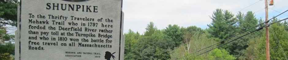
The past several months I have read a number of books on 18th century development along the Mohawk Trail and Deerfield River. I also found a series of self published books, “A Revolutionary War Road Trip… .” Of course I bought the ones for the area. With these readings, I developed new routes to explore to the Inn and home. The plan that developed was to get to the Mohawk Trail a different remote way, and on the way home to explore part of the Henry Knox Trail – and as I found out about nine miles of roads “new to me” in the Sheffield area.

Guilford Vermont Country Store – US Route 5 looking south
If you wish, get your maps out. Down I-91 to Exit 1, US 5 into Guilford where I turned right at the General Store onto Guilford Center Road. I have eaten here in the past (T – they have inside seating). In a short distance I headed south on Weatherford Hollow Road toward Leyden, Massachusetts – never been there. And, this is hill country, isolated and with no reason to be there. Well, I saw an agricultural fair grounds – could be fun – hopefully this coming September. Then a right on Zimmerman Mill Road to Leyden, and truly a small hill town. Town Hall, Church, couple houses, and great views.

From here to Colrain. And, why? My French and Indian War reading included much on Charlemont and Colrain, Gary and I drove through Colrain in November, and after reading I needed to see more, and in the process I found a significant event that happened in a now abandoned hill town in Colrain.
I drove into the small crossroads town, and hope to someday see the historical society. I then found my right turn to cross the Arthur A. Smith Covered Bridge.

Crossing the bridge I looped back to Foundry Brook and Village – this was a busy place using the North River.
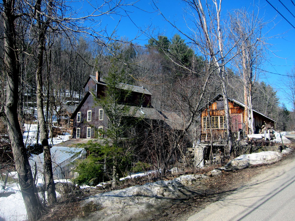
and looping back, to the bridge again

and down Route 112 to Charlemont Road to find Stacy Road — stay with me.

Stacy Road would take you to the now abandoned village hill town of Catamount Hill within Colrain, but no longer. Talking with a hiker I could have gone further to a parking area, but I could tell he felt that would be ill advised. Probably why all the hikers’ trucks were behind this spot parked. Also no longer connecting are South Catamount Hill Road, and North Catamount Hill Road, which I later found off Heath Road. In my readings in January I found that it was here, in 1812, that the first US flag was raised above an American Public School, and possibly the first over a building. Perfect for my June (tying in with Flag Day) Did You Know That… history article in my CLARION. More on that as time approaches, but I had to get close to the area. Possibly with mud gone, and in BB1 or BB2, I will go further, and then hike with walking stick.
On my list was next to see Adamsville village in Colrain, so back north I went heading there and then to see Heath and Rowe. I eventually turned around and headed back to the sign I saw saying Heath Road. “Must go to Heath,” Ray says to Ray. Passed a goat farm, rounded several bends, and started climbing. Did I say “hill town country?” Became dirt, Ray loves dirt, but wait. When mud takes over when you are still sharply climbing on a narrowing path, and the tires decide on their own where to steer – time to turn around. Twice in one day, what is happening to me?
 Back down 112 then to Route 2, and west on the Mohawk Trail to Charlemont. Charlemont is an outdoorsman’s haven, but seen better days. Most buildings closed, but somehow Avery’s General Store has survived since 1861 and is considered the oldest continuously operating general store in New England. They did not have a deli for me to get a sandwich, but I did get an Asian Noodle salad from the cooler, and headed to a roadside spot that may be familiar, but here it is looking from the opposite direction to the east. I slid open the van’s side door, and enjoyed my salad and black cherry soda.

With much in the area to still explore – the Hoosac Tunnel and more remote villages – I checked out the two camping places on the Mohawk Trail. Sorry, not my forte with packed year round tin cans. Lady RAB III already has told me, “Ray, remote quiet spots, wooded and old-fashioned.” My future explorations in this area will be BB2 day-trips.
So passing 1,000 feet over the Hoosac Tunnel in Florida, I opted not to go down Central Shaft Road but continue to North Adams and find the location of Fort  Massachusetts. The western most fort during the mid 1700s, on August 19, 1746, eight hundred French and Indian soldiers surrounded Fort Massachusetts and took prisoners to Canada. Rebuilt, but falling into disrepair and ultimately lost, a replica was built in the 1930s as a tourist attraction, and the DAR placed a plaque. The replica was demolished in 1970, and all that remains is the chimney. So, look for an abandoned Price Chopper parking lot, and in the rear is the preserved spot. Next trip I hope to see the plaque.


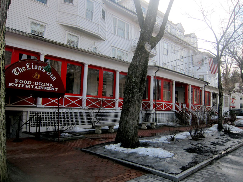
Then into Williamstown, south on my favorite US Route 7, through Pittsfield, into the Red Lion Inn’s parking lot, check in, unpack, and head to the porch to find this new enclosure of vinyl in custom aluminum frames – ingenious. Small heaters were also included, thus they could spread out tables for meals here and also on the side porch, which was not enclosed, but in use since it was in the 60s.
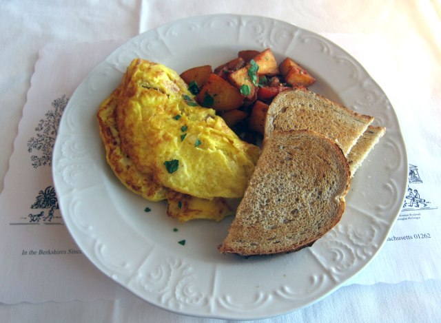
Dressed for dinner, enjoyed the lobby, slept, and breakfast (below) the next morning before heading off for my usual routine, plus a new exploration.

Staying for two nights, I have a whole day without unpacking and then packing. I have a routine, my day out may vary, but does hinge around some of the antique shops in the area. Always looking for presents for Ray, and books to sell to pay for those presents.
-

- Great Barrington Antiques Center
-

- Berkshire Great Finds
-

- Millerton Antiques Center – Millerton, NY
I bought some books, but sadly no new presents for Ray (maybe LADY RAB III and her towing companion fill the bill for awhile). But most important, at Great Finds, just seconds before I pulled away, Joe pulled up alongside me. I have known Joe for almost 25 years, Cathy and I first visiting, and buying books from him, at his “inn” in Connecticut. Timing is everything. We visited awhile, and will get together again soon.
After Millerton began the new adventure. North on NY Route 22 (another favorite road of mine) looking for Route 71 at Nobletown, to see the Knox Trail Monument. I could go on and on, and maybe will in a separate history article. But briefly, and most important, Henry Knox was a Boston Bookseller (just one more connection and thread in my life). In winning confidence from George Washington, Knox moved captured cannons from Crown Point and Fort Ticonderoga to Boston. His “noble train” took from November 17, 1775 to January 25, 1776. Placement of the cannons around Boston finally drove the British from holding the city. I learned of the Henry Knox Trail and his feats in my readings. In 1927, 56 granite and bronze monuments were installed along Knox’s route in New York and Massachusetts to create the 300-mile-long Henry Knox Cannon Trail, one of the earliest heritage trails in the country. A new quest was begun, and I found the turn.

here is a close-up of the bronze plaque that appears on the New York State markers. Notice the tokens on top left by visitors.

east, two and a half miles, is the Massachusetts border. Massachusetts’ monuments take a different form, and the ones I visited later on are similar. But, on the back side, facing New York State, is the same bronze plaque as above.

and a close up of the bronze inset

further down Route 71 (five miles from the state line) is North Egremont. I had never been down this route before. Ironically one of the books I purchased earlier is a history of this small village and the work a local historian did correcting the route through this area using Knox’s diary. Here at the country store (where I purchased a muffin to eat on the bench) is the next marker.
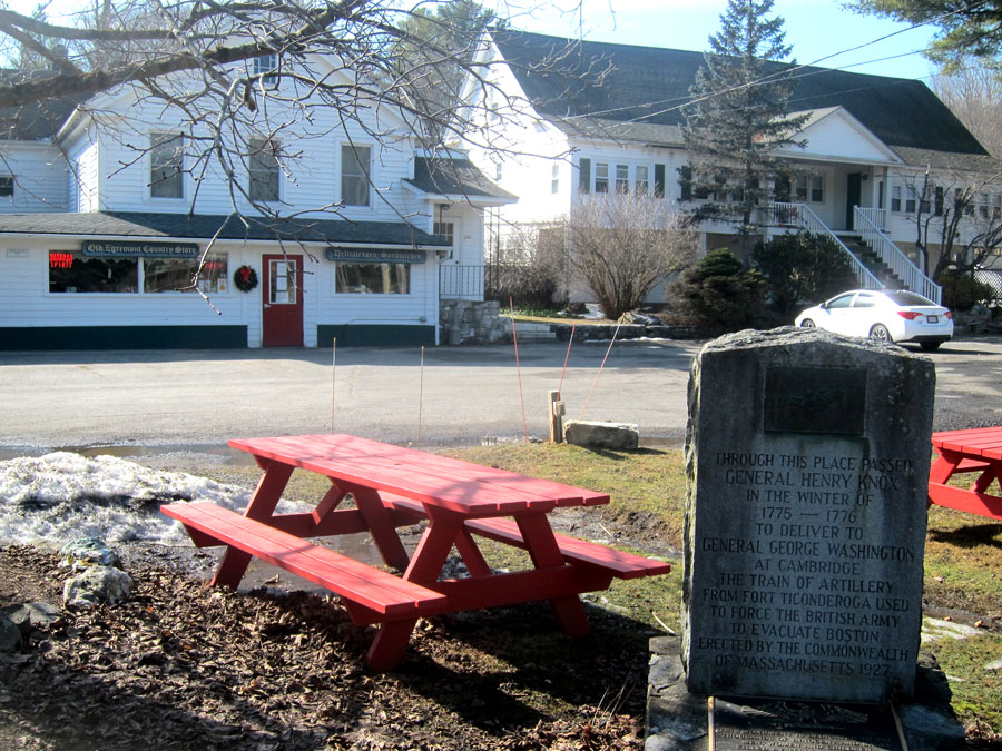
and, a close up including a memorial to those lost on 911.

Next I passed through the village of South Egremont which I have visited before with Cathy. I go back even further in time here. September 15-16, 1963, almost 58 years ago, I drove up from Wilton in my 1929 Model A Ford Roadster to the now defunct Jug End Barn resort for a Model A Ford show. I took many pictures, but in checking my collection just now (yes I save almost everything), I only have one image of my Belzebuth there, below in the background (right) loaded with camping gear on the running board. Still struggling whether to sell or not sell my “new” ’29 Roadster.

another very important part of American history I am grasping to understand had its conclusion just down the road in Sheffield. Shay’s Rebellion (1786-1787) which exposed the weakness of the government under the Articles of Confederation and led many, including George Washington, to call for strengthening the federal government leading to the Constitutional Convention in Philadelphia. So much more to learn, study, and keep me young. On Sheffield/Egremont Road (which was new to me, and I will traverse again) is this monument of the battle in the field behind the stone.

in this gallery below, if you click to enlarge you can read the history plaque that is here.


it was then back to the RLI parking lot, a walk around town, and return to the Inn to show you the new enclosure from the outside. It is tastefully done in my opinion.
It was then time to prepare for my further explorations along the Henry Knox Trail on the way home. Lots of good information on-line, many notes taken, and I probably will write more about Knox – hey he was a brother bookseller. I discovered that the writer of the series of books I purchased missed a location, off the main road. Yes, on my list to find.
Leaving on Friday the 12th (the three quarter century day) I headed back down US 7 to Great Barrington to head east on Route 23. At that intersection is another Massachusetts Henry Knox Trail marker. I bet very few people pay attention to historical markers.

The next marker is in Monterey where I have visited before, even have lunch inside the country store here during a great trip through in November 2014. I recommend you click, read, and follow that trip. Below is looking west from the marker to the village.

and, by now you know what the Massachusetts marker looks like.

it was then east to Blandford and a small park in front of the town garage.

surprise … no, actually I have been moving one marker from spot to spot.

the next marker, that the writer of my guide missed, was in Russell, so off I went to US 20 and Russell. But no marker. Checking my notes I found it was at the intersection of General Knox Road and South Quarter Road. So, I dictated into WAZE, and off I went – backtracking, making a turn off Route 23 to find this small rural intersection.

and the marker


I decided to skip finding the marker in busy Westfield, so headed north on Route 10 since I had not been on it in awhile. Do not need to do it again – too cosmopolitan and commercial for me. Back onto I-91, I always pull off and into Old Deerfield, and was hoping to buy a toy for Ray at the Museum shop. It has been closed the days over the past year when I have driven through. But, Friday, it had to be open – NOT – not until late April.
But also on the plan was to take the image below to help you win more drinks. One imagines that the buildings in Old Deerfield are all in situ, but there is an exception – Hall’s Tavern, now the visitors center.

Driving down the Mohawk Trail from Shelburne Falls, just before East Charlemont you will see a field and farm – Halls Tavern Farm. Yes, in my readings I found that the Tavern (c1760) was originally here, and moved in 1949, 20 miles to the Deerfield site where a tavern stood until burning in 1799. You may share you winnings with me any time – chardonnay is fine.
RAY RECOMMENDS
1 – Do not stop reading and learning. One thing leads to another, and new explorations and experiences are right in your back yard, or easy day trips.
2 – Add an over night or two, and stop and look at the markers, for again the learning continues. Simply maintain an active mind and intellectual curiosity.
3 – Just don’t stop.


What a perfect antidote to a rainy afternoon in Houston! I love reading your travel notes and experiencing the markers , buildings, and bridges vicariously. How endearing that you are able to bring precious memories with you to each stay at the RLI! I happen to know “Sheldon” and he would not mind your choice of seat at all! In fact, I’m sure he would be charmed by your reference. I agree totally with your 3 “rules” and can hardly wait until travel is once again a safe pursuit.
Regards, Mardhs
Great trip, lots of info and lots of scenic beauty, wonderful sharing
Carolyn
Really enjoyed seeing your Shunpiking blog banner picture in it’s location! What a fun scavenger hunt it was for you to find those Knox road markers. I had heard of Shay’s rebellion but did not remember the details, so kudos to you for schooling me on that! I remember reading that another way the government raised money after the Revolutionary War was to tax distilling. I’m sure we mentioned to you before that is why so many people from PA, with it’s great limestone water, left the “U.S.” and headed down to Kentucky, also with great limestone water, to continue to distill their bourbon tax-free!
Beautiful weather and beautiful pics! Can’t wait to camp with you soon!