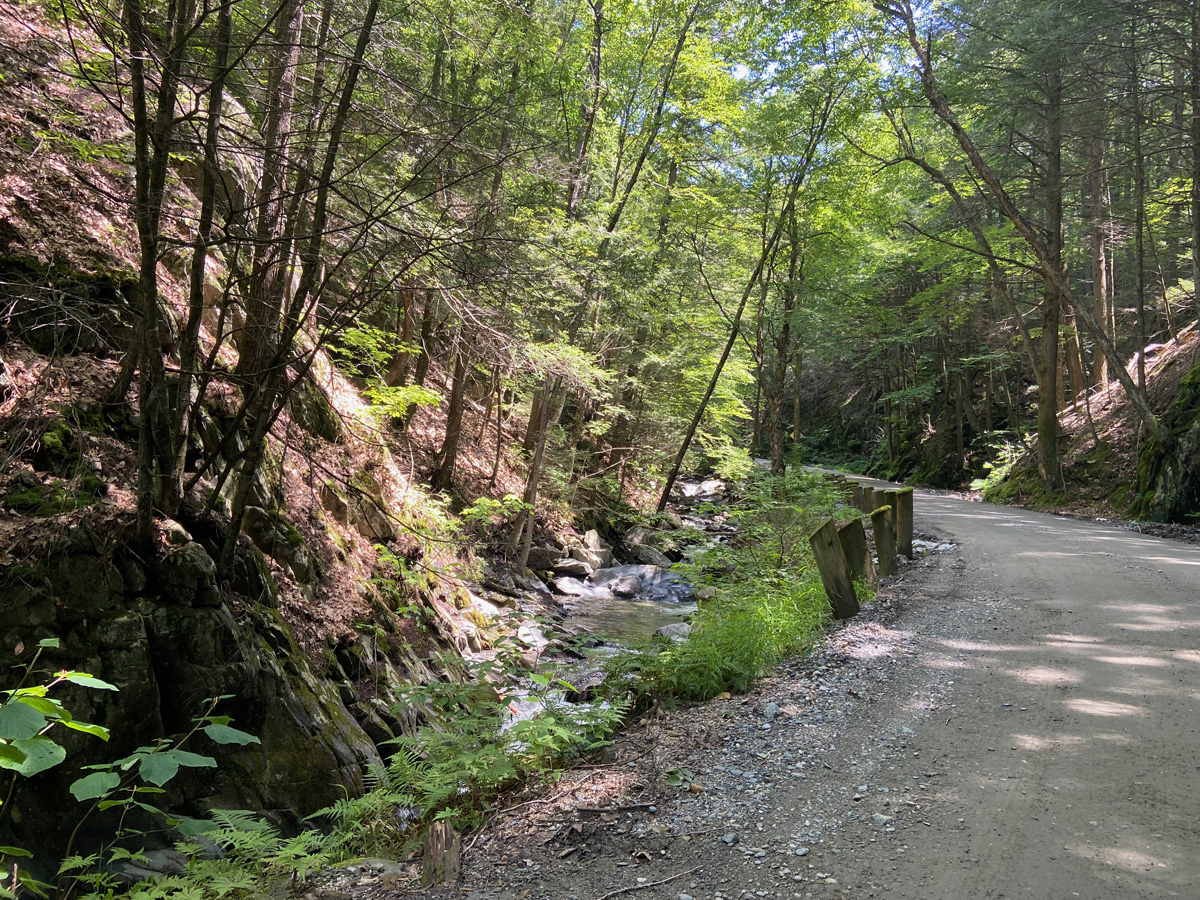
A few weeks ago I told you it was “Fair Season” and I was visiting a wide range of fairs – more so than in previous years. Why? I do not know, I go in cycles “chasing interests and learning” and that is my fun. My history article, DID YOU KNOW THAT…? for my October issue of THE WALPOLE CLARION is all about Town Fairs held in Walpole over the years. I decided not to go to the Greenfield or Tunbridge fairs this year, but today attended neighboring Landgon’s small festival/fair. At the total opposite end of the “size” spectrum I will experience for the first time THE BIG E – THE EASTERN STATES EXPOSITION this coming week – and will report on that.
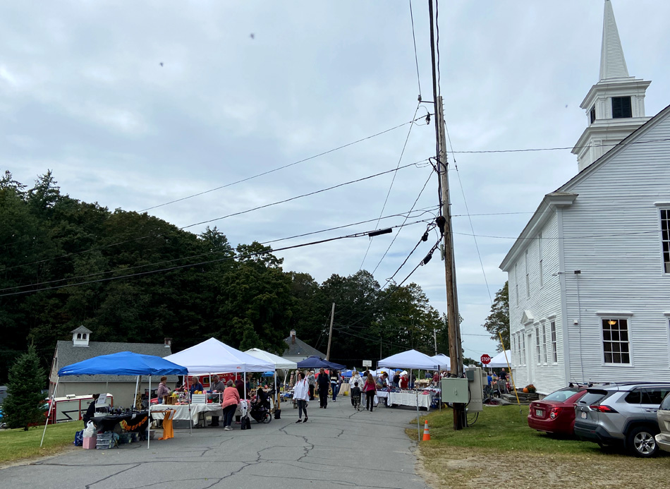
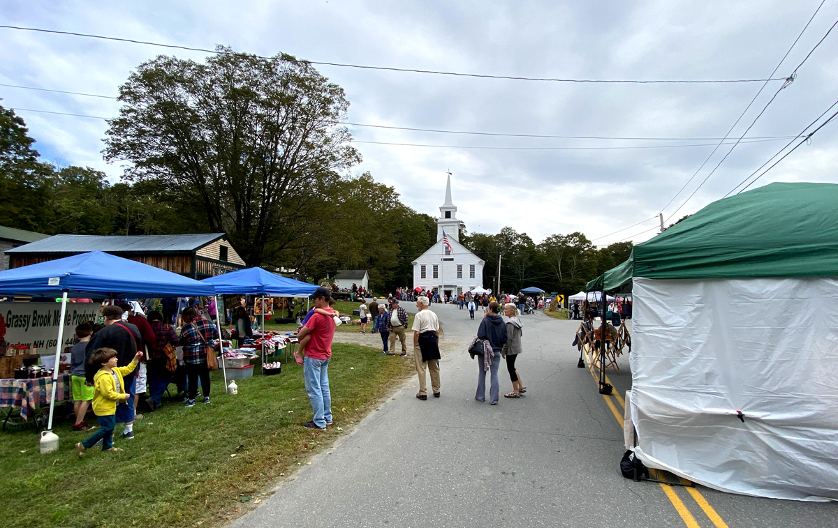
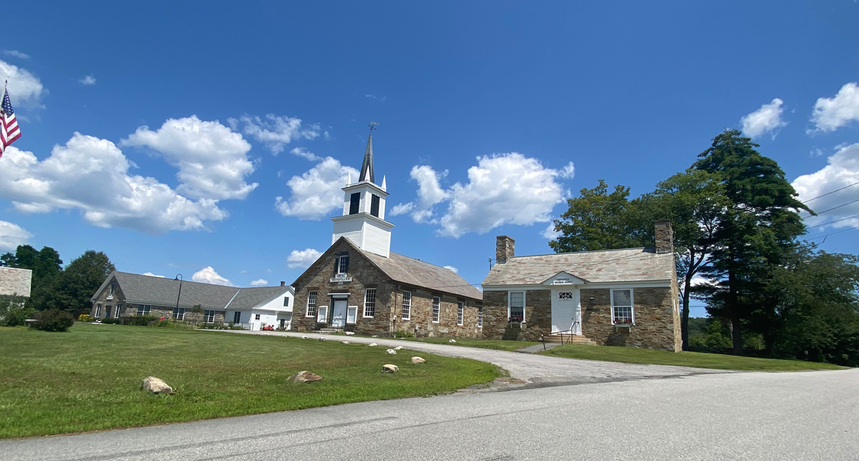
You have to purposely plan to visit the Village of Langdon, NH, just a few miles from me. You will not pass the Village with its Town Hall, cemetery, little school, and a couple houses by accident. And you should plan a side trip, I will be making more. Small fair, well planned out with the cross roads in the village all blocked off, signs well placed on the “main routes” (ha-ha re: main) to parking, up over a dirt road, lots of kids controlling “traffic” (could be another local laugh), and into a hilly field for parking above the Village. A short walk down hill to the center of the festivities.
getting closer —
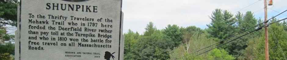
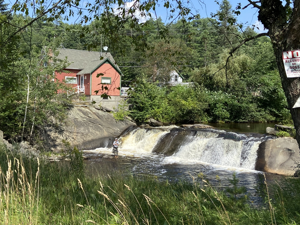
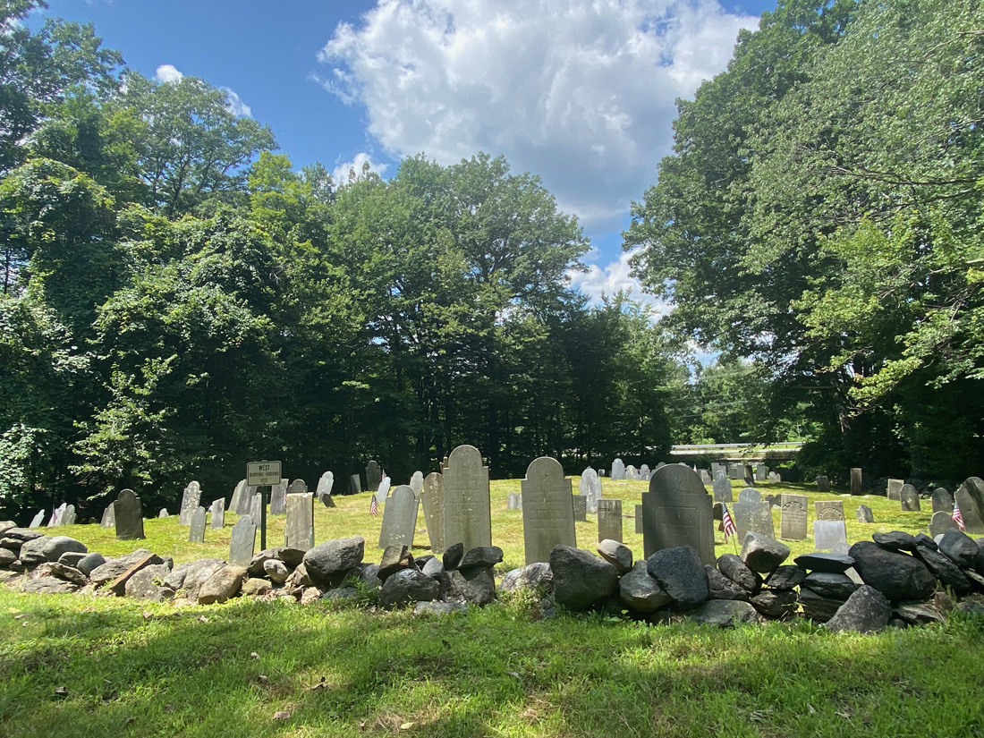
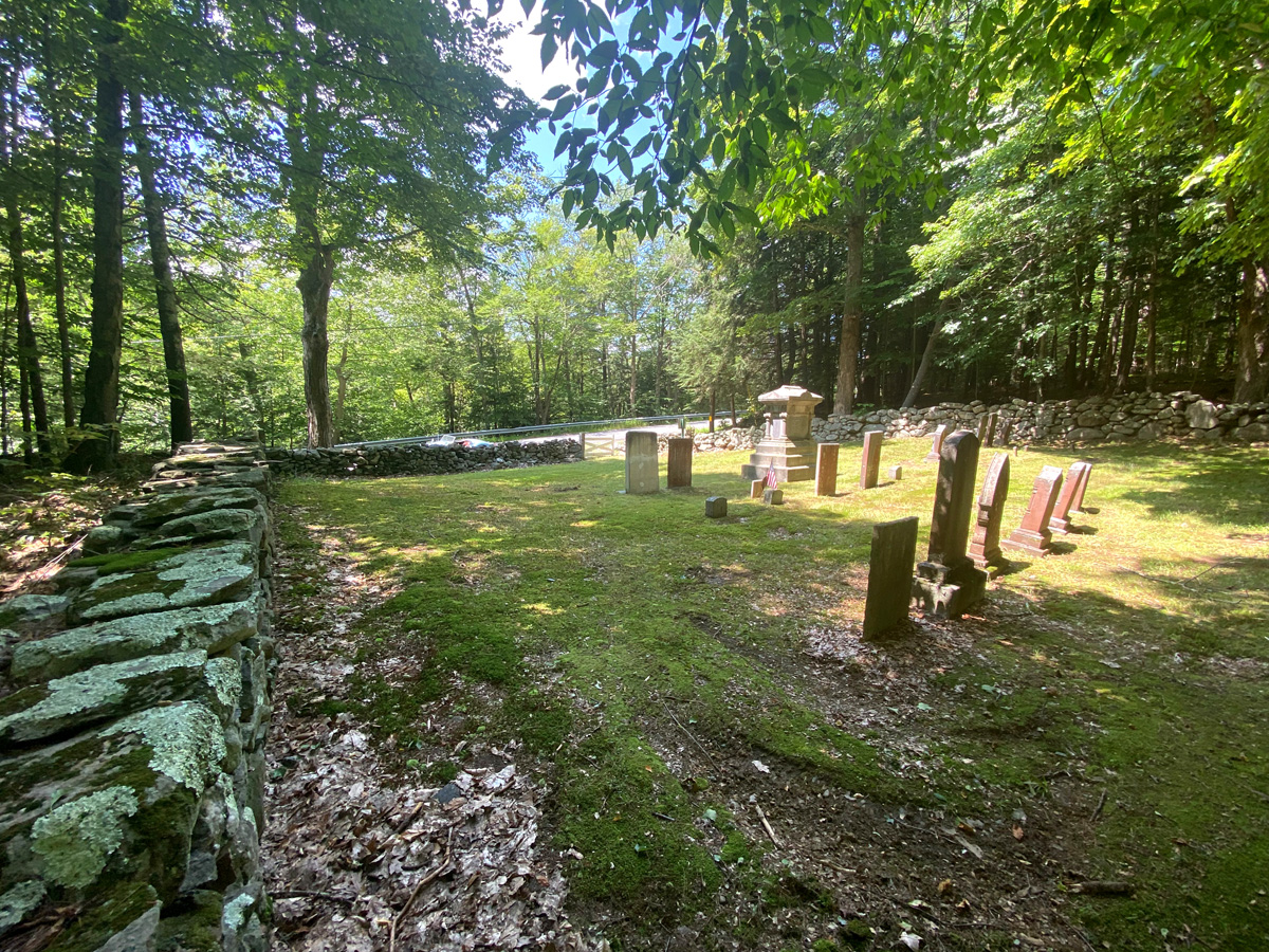
and, looking back at the Langdon Meeting House. Completed in 1803 as a combination town hall and church. When the NH 1819 Toleration Act established the separation of church and state, the building became multi-use. It is claimed by the town to hold the record for consecutive town meetings held in the same space – now 220 years. I will not argue that.
There were several performances scheduled, and I was in time for this group of “Company of Witches” – is it Halloween yet? Am I ever getting ready.
just beyond was the Pinnacleview 4-H Club from Walpole, and their exhibits.
Below, turning around at the end of the vendors’ booths looking to the Town Hall. I could not believe how many folks – both vendors and visitors – there that I knew, and we chatted. Did I say you have to visit this spot?
I planned my visit to have lunch, and add support to the organizers that way. But while waiting for my cheeseburger and cider, what’s a country fair without SMOKEY?
a blacksmith had set up to show his craft and sell some wares. Ready to purchase some candle stands for $29 (I know, I know, my collection of candle holders probably exceeds forty different), sadly I saw them marked “sold.”
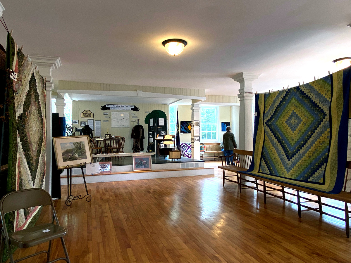
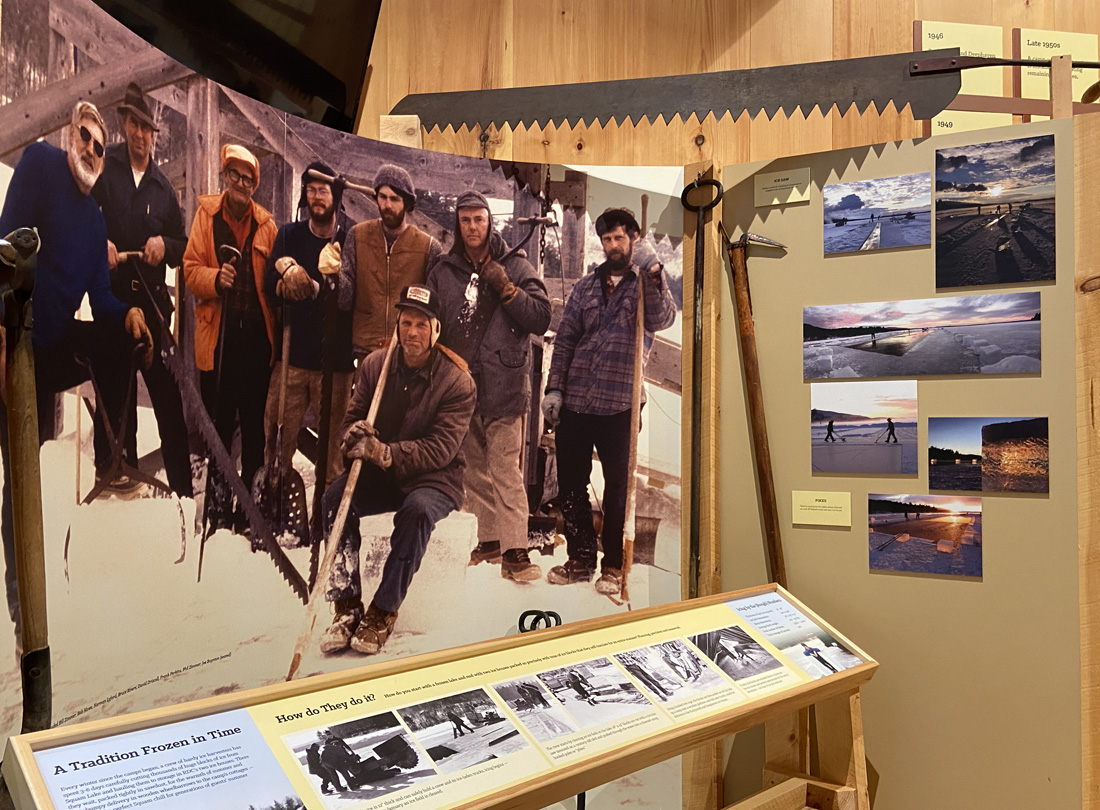
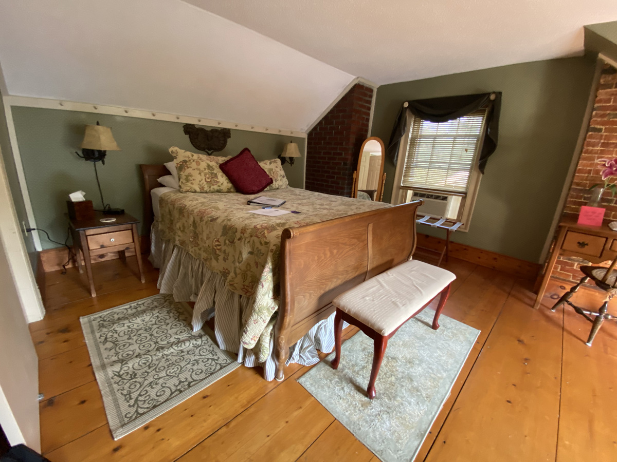
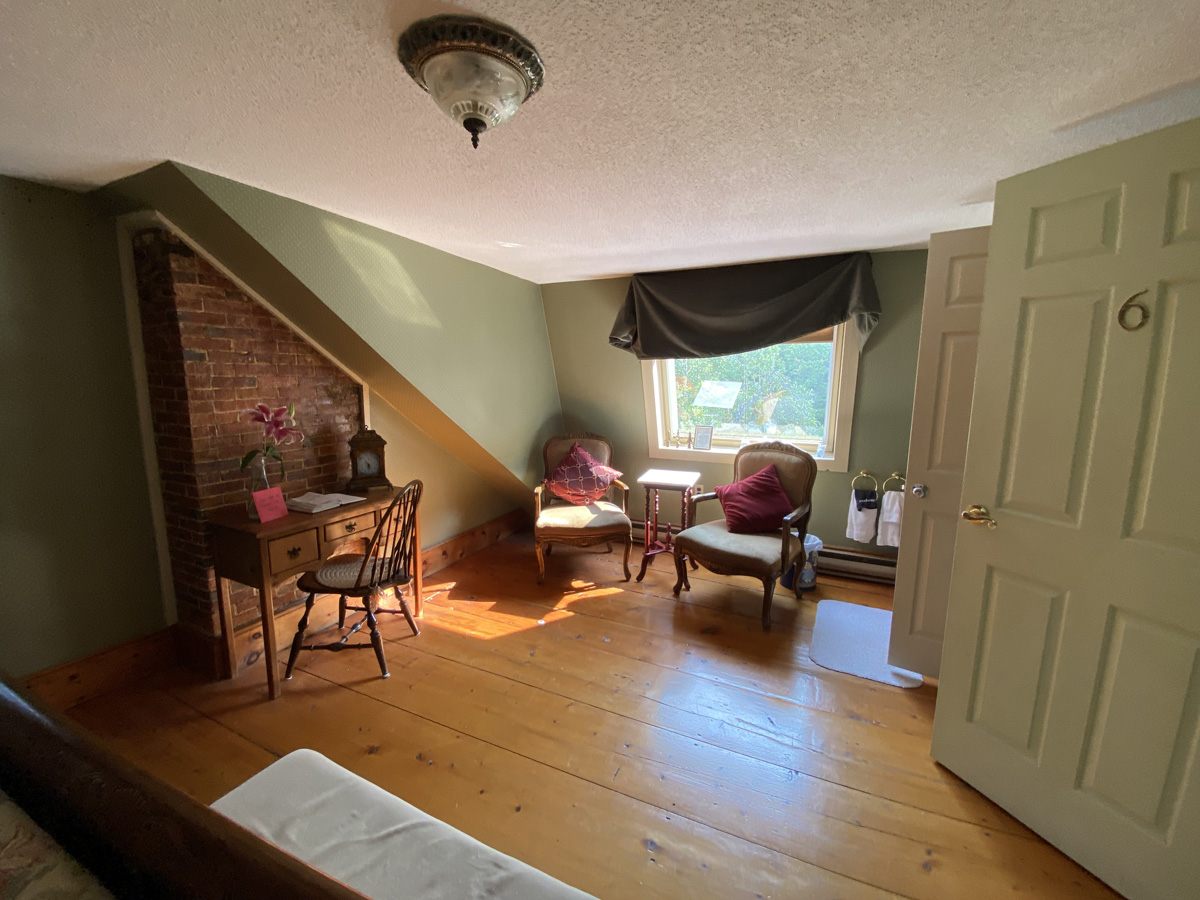
small fairs as today’s was in Langdon you often can get inside a building that otherwise may not be open when you “discover” the town. Such was the case with the Town Hall, completed in 1803 as I mentioned. Sadly I realized when I got home I did not find how to see the second floor (reason to return) but here is the lower level with history exhibits, and the ubiquitous fair quilt display. In a side room is a Town history exhibit – reminder you may click my “galleries” for larger views.
But while reading the panels on the raised platform, I learned much that ties in with my current projects. I came home, and of course had the right books in my own library and shop, to dig into, and although not part of the fair, I NEED TO SHARE with you now what I learned and you may find of interest, hopefully.
One thing leads to another in my study and research. My son, Gary, and I discuss the fact that our “rabbit holes” have multiple levels and passages for that further study. So – some background to the below – I am giving a presentation this week on local taverns and turnpikes. In my Connecticut bookshop in the 1990s whenever I had a book on the itinerant painter, Rufus Porter, it flew off the shelf every time I had a copy. Then my Cathy and I would stay in an inn with Rufus Porter murals when scouting for books in NH prior to moving here. And, settling in our 1806 colonial, we had Dutchie paint our dining room in the style of Rufus Porter. Our dining room was featured one evening on WMUR-TV, and documented in NH Magazine – CLICK HERE FOR A PDF of this November 2005 article.
Reading the history panels I learned the Bidwell Tavern was built about 1818 near where the entrance for Fall Mountain Regional High School is now. It was an extremely celebrated hotel in Langdon. It had a bar room, a large ballroom, and an elegant room with frescoed walls done by Rufus Porter. The inn was located on the Cheshire Turnpike which entered Langdon from Drewsville. An extremely popular spot sadly the tavern burned to the ground in 1930.
The Bidwell Tavern as it appeared for over 120 years.
Between two books I have, one on Langdon, and the other written in 1927 by Marion Rawson from East Alstead, there are conflicting comments on the murals in the Bidwell Tavern. But the authoritative book by Jean Lipman (yes always in my library) discusses Porter’s work here in detail. Sadly lost in the fire, here is the image of this bed chamber found in Rawson’s book.
The mural shows a lake in the background. From the 1987 history of Langdon, “there is no lake to be seen in Langdon today and the previous history failed to mention anything more than a few ponds.… A flood however appears to have washed out the lower end of his lake and subsequent drainage and land-use nearly obliterated what was once a considerable body of water.” Supposedly an old shoreline can be seen — I guess another trip is needed. Again, above is the lost Rufus Porter mural in the one room. Supposedly he did work around Bidwell Tavern.
See how “one thing leads to another,” and “I have no idea where my days go?” At least my brain is active, and I will be here to educate and entertain you for some time to come — I hope.
Get out there – shunpike and explore – stay well, love, RAY
I left you on Part One with my capturing images of some of the wonderful cottages. Then it was porch time – surprised. Another great dinner, more reading, and once bedded down it was time for Moose Calls (I compared to a YouTube video). My first night was Loons, and advance reporting, my last night, Thursday, was barking dogs across the lake, great rain fall, then the most perfect silence. Plan for Thursday, my second full day, was to head off after lunch for a BIG adventure.
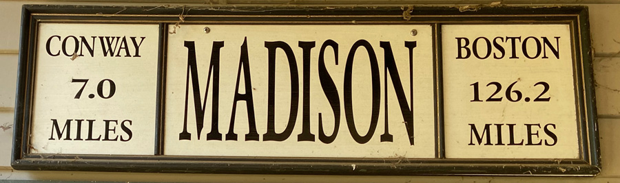
Remember the planned route map from Part One? I headed off through Center Sandwich and Sandwich to West Ossipee and then north on Route 41 towards Madison. At Silver Lake, I had to stop — how many post offices do you still see operating in a train station?
Yes I stopped, wandered around, and now research to learn more. As I was wandering a fellow pulled into the back, and I of course struck up a conversation. Having seen the post mistress through the window, and his carrying a purse, I was correct in guessing he was bringing his wife’s purse to her.
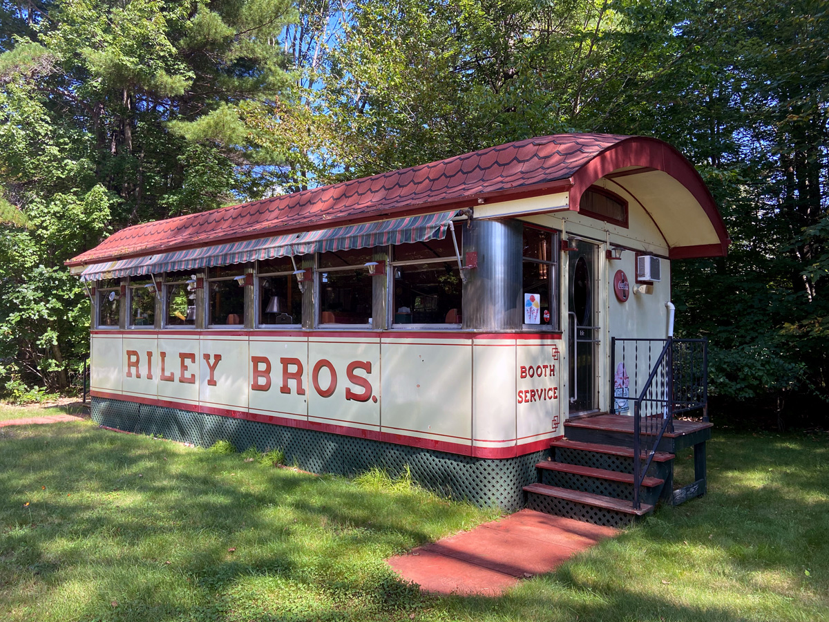
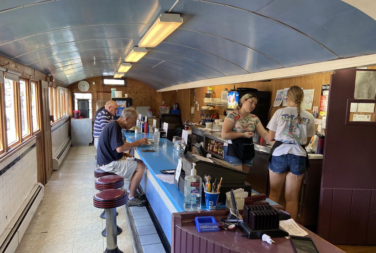
At the north end of Silver Lake, in Madison, this station was a stop for the Boston and Maine Railroad from 1872 until passenger service ended on the line in 1961. The fellow told me that “snow trains” brought skiers to Conway from Boston through the early 70s, but he may have been mistaken. I asked if this had been a museum, and he said yes. Founded and owned by Neil Underwood, Silver Lake Railroad opened July 7, 2007, operating from Madison Station. renamed Silver Lake Depot. Underwood restored the station which has its original features intact. Chatting with the post mistress she pointed out where the original post office was in the corner of the waiting room. Operating offering rides by donation, the Silver Lake Railroad last operated in 2017 (sorry I missed it). Underwood is selling off some of his property, rolling stock, has a barn of old cars the fellow told me, and has a diner. You may know I have been fascinated by diners since 1957 when I told Bert Parks I wanted to own one when I grew up. Still waiting to “grow up.”
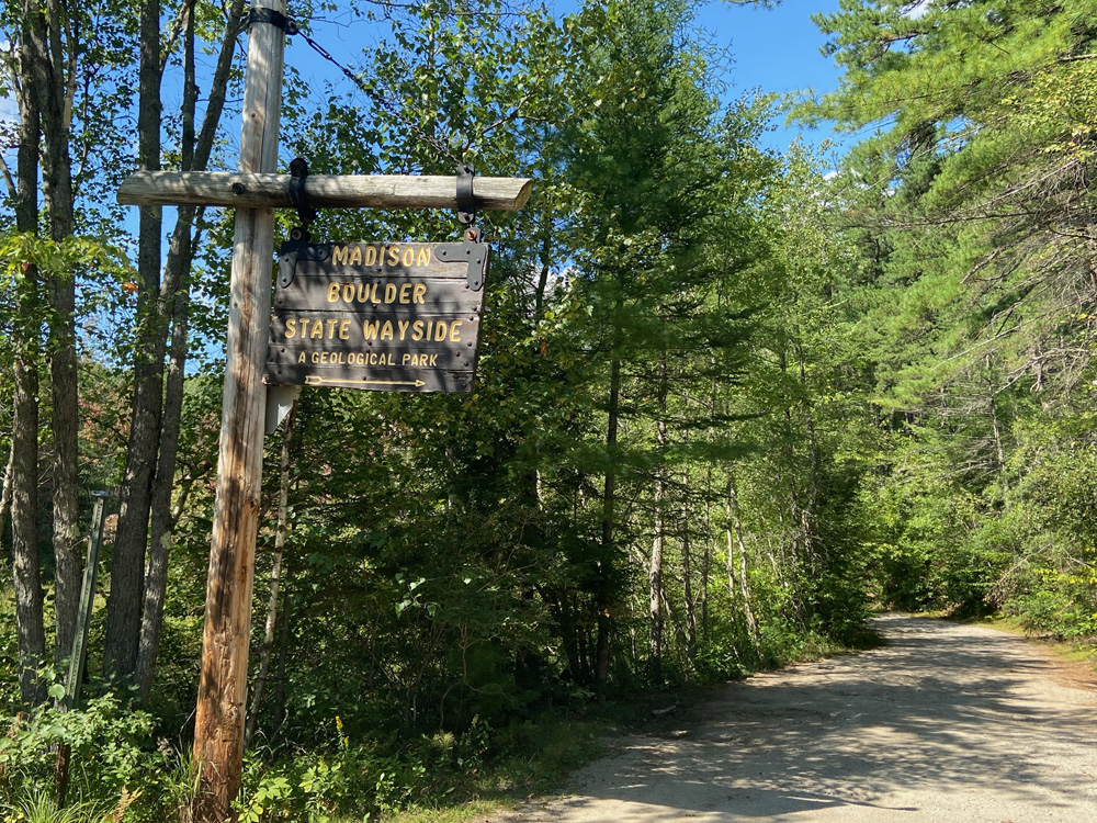
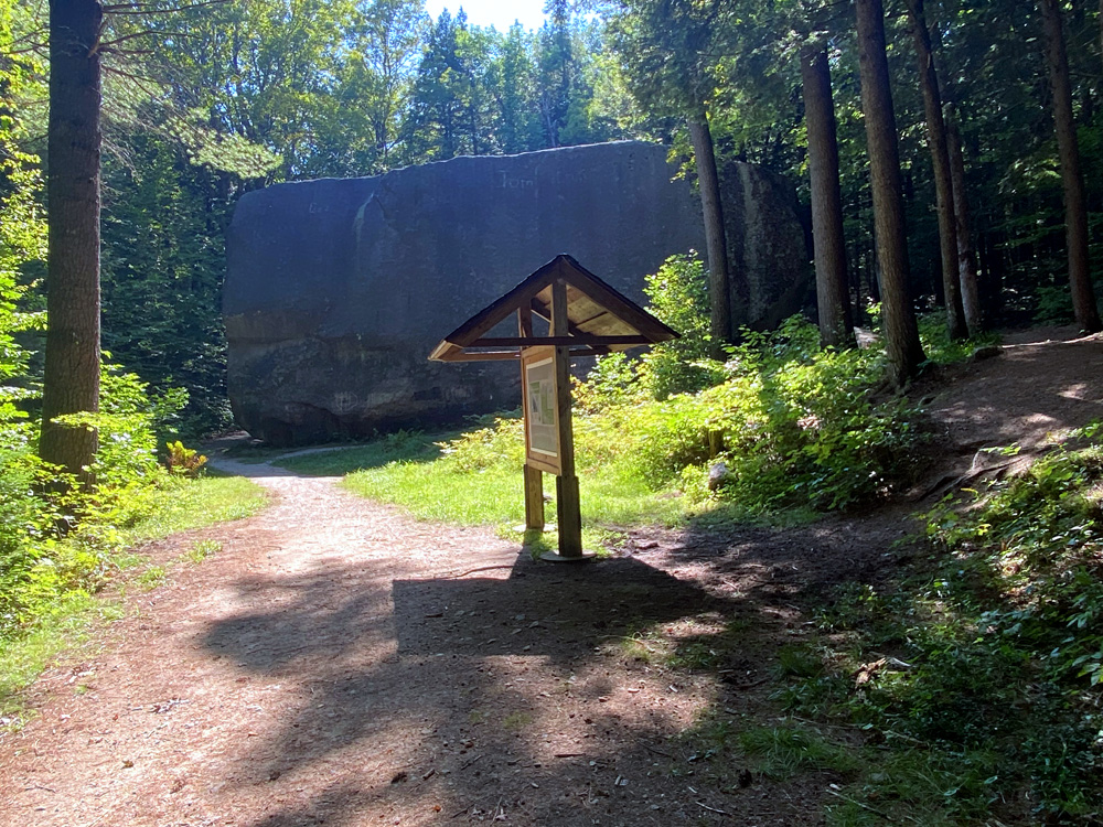
But it was time to get on with my BIG ADVENTURE. Remember I shared with you the BIGGEST ZIPPER in the US, at the end of this post in July 2022? And, in Part One we discovered the Longest Covered Railroad Bridge in the US. See an education trend here for your knowledge edification? If you feel there is something ERRATIC in my behavior, there is – for GLACIAL ERRATICS – stones and boulders that were moved during the ice age, and deposited in new locations when the ice moving them melted. Now, “Did You Know That?” in moments I would be arriving in Madison to see the MADISON BOULDER – Measuring 83 feet long, 37 feet wide and 23 feet high, a rectangular granite boulder that is the largest known glacial erratic in North America. This link will bring you the state’s tri-fold with stats and history.
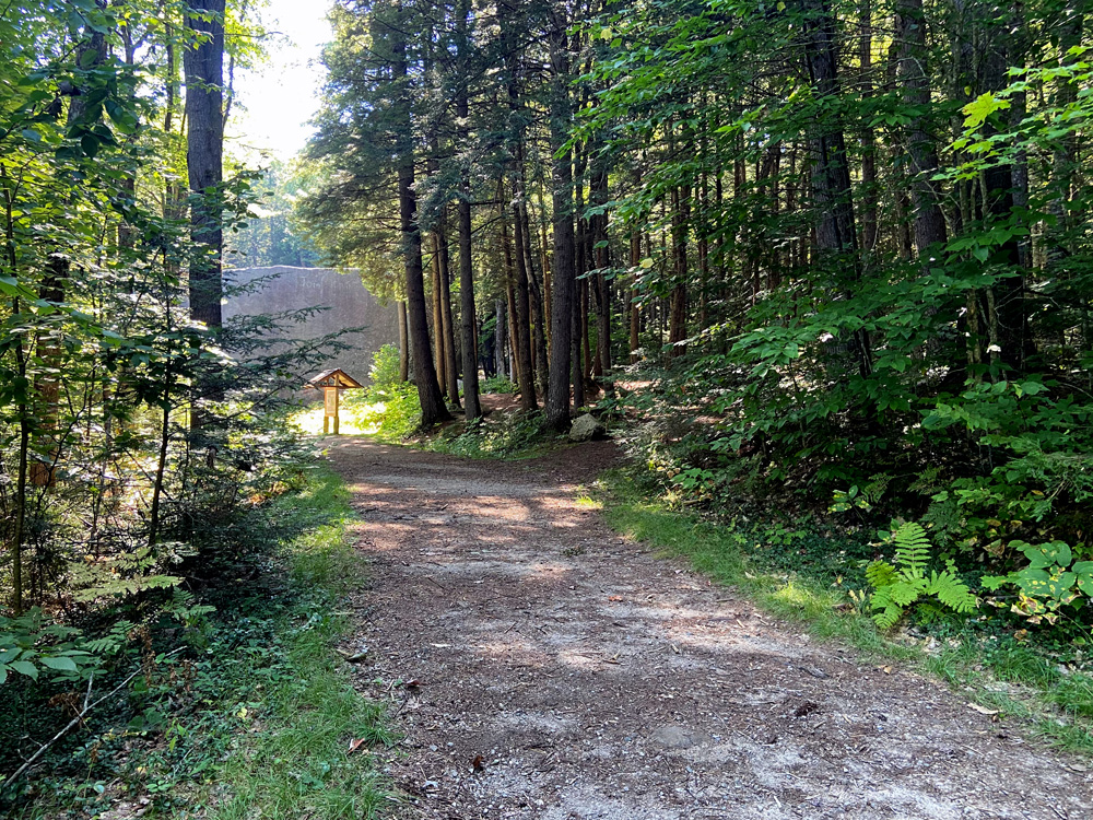
I turned down the back road, and then onto state property at the above sign. State dirt road not well maintained, I arrived at the parking lot and was saddened not to see two or three charter tour buses there for this BIG attraction. I parked and headed down the trail – with cane my bones advised.
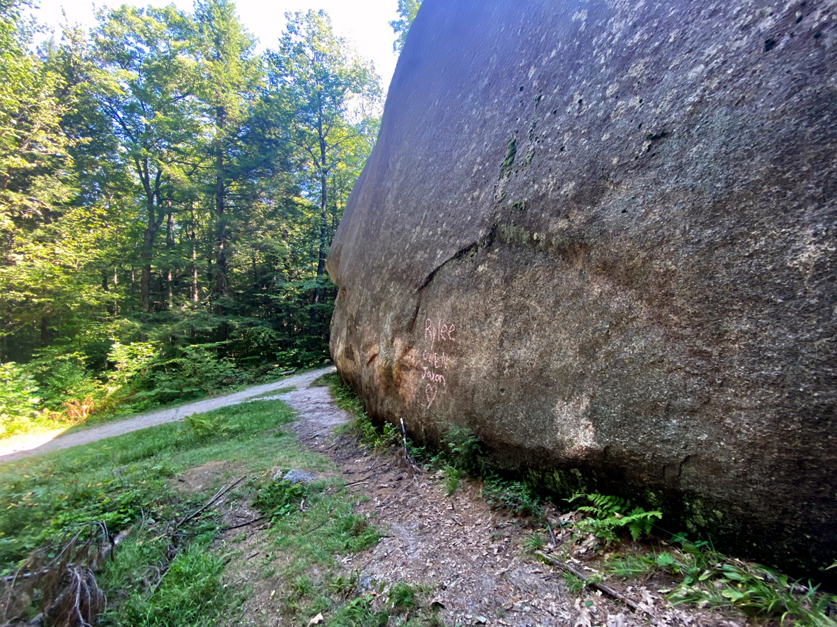
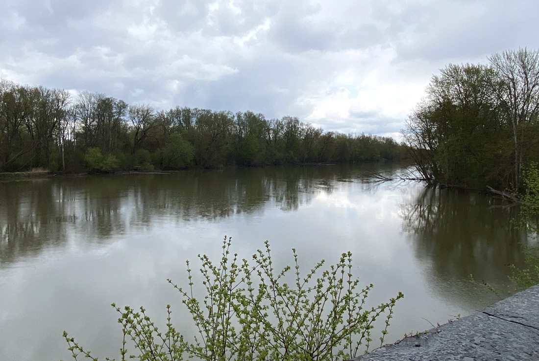
WOW – but where are “250 of my new Japanese friends with their 350 cameras that were all scrambling for a place on the boat for 200” with me on the St. Lawrence on 12 October 2011? How could I show you the size as compared to me without them? My first Glacial Erratic, and my fascination, began with the rock below on Nod Hill Road apposite my grandmother’s property in Wilton, Connecticut. When I visited two years ago at least I have my car there for comparison. As a youngster I need not tell you how many times I parked my bike here trying to figure out how to climb this “little erratic.”
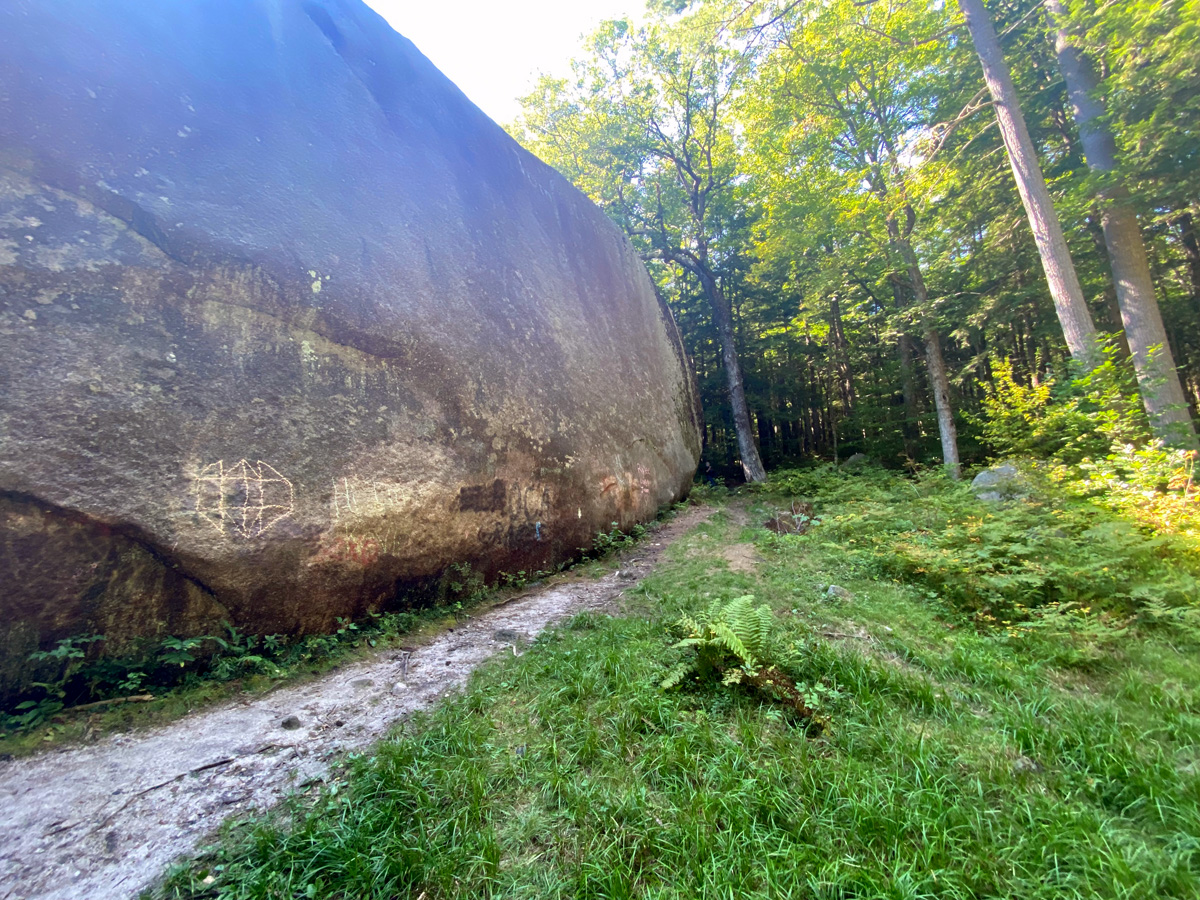
well, if I circle clockwise taking images of all sides, maybe, just maybe you will believe the size.
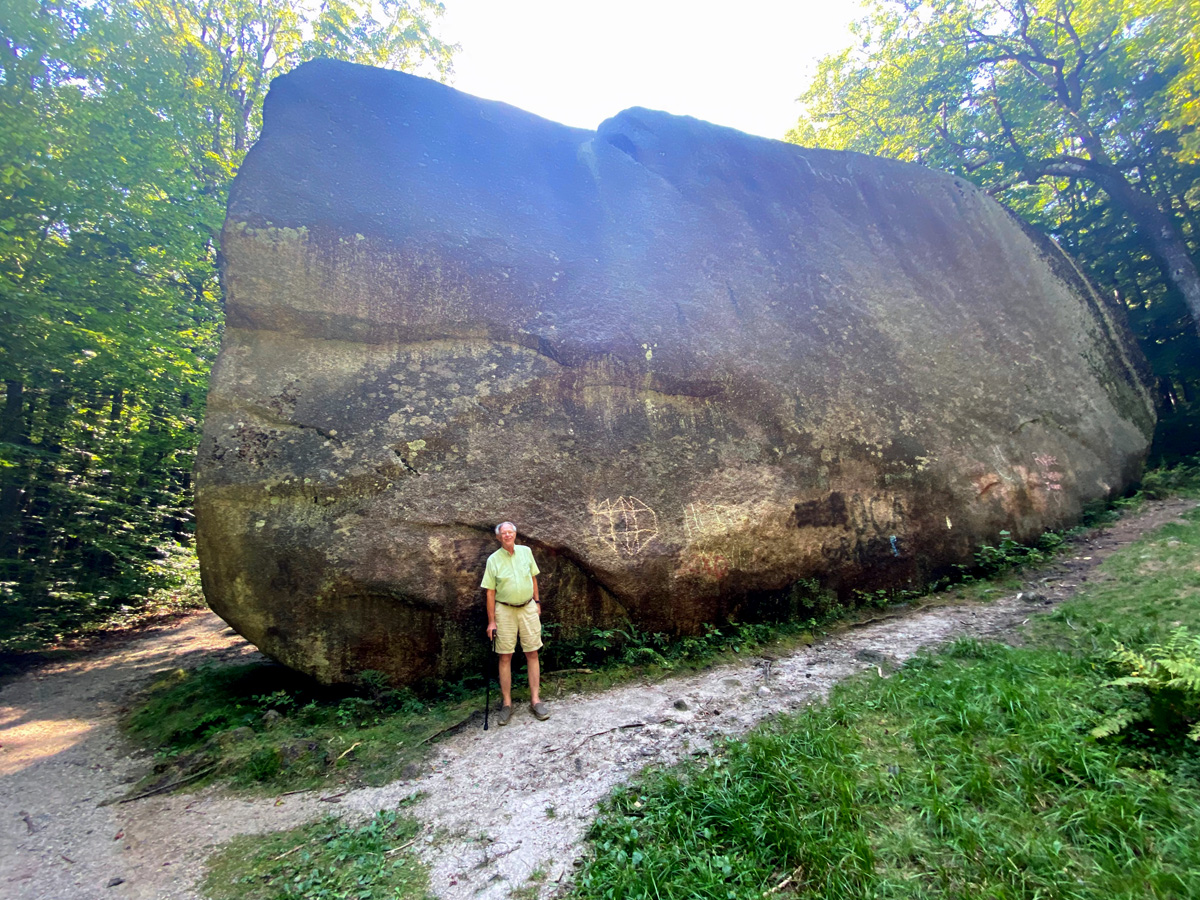
As luck would have it a man showed up holding about three cameras. Hoping he was not a serial killer out in nowhere with me, I struck up a conversation. “I am from Chicago, and whenever I come to New Hampshire I have to visit the Boulder.” He then began to tell me of an Erratic in Australia that is amazing. Figuring he would not run off with my iPhone looking at his equipment, he took a picture for me – so now you can get a feel for size. Even with removal of stuff from my spine, I am still six feet tall.
It was then different back roads to return to camp, and some reading. I packed up all the books I had brought for research for writing – and now will remember I not bring so much again since I pulled out my left arm moving them back to the car. Thursday night’s sounds were angry barking dogs across the lake, then some rain, and then extreme silence.
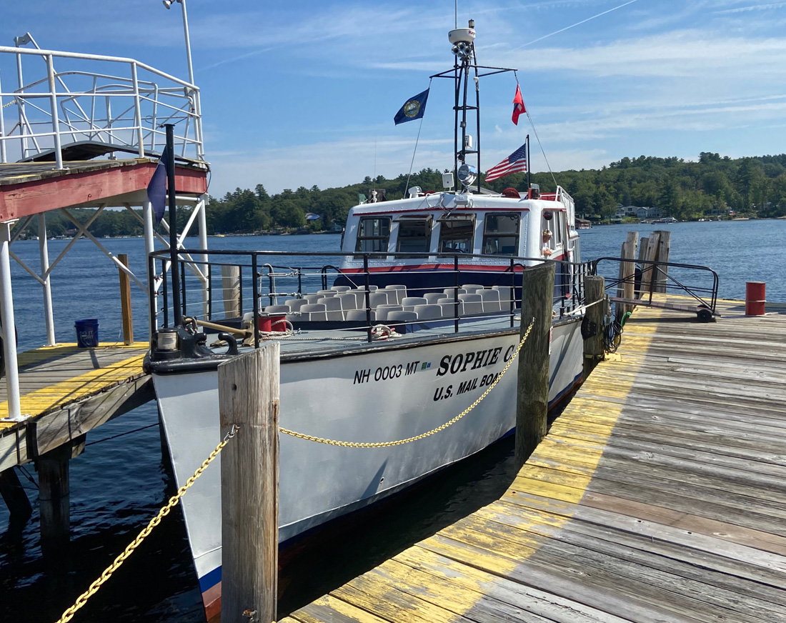
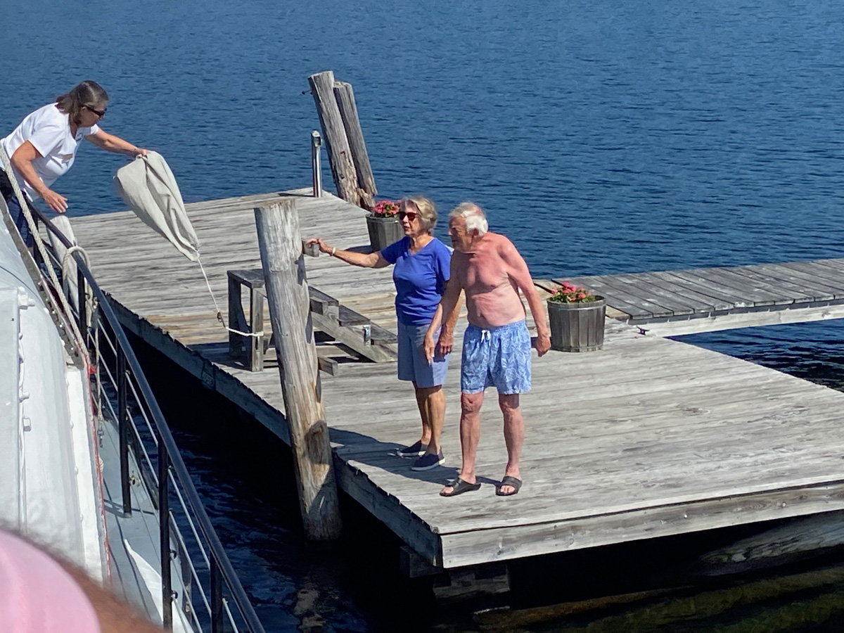
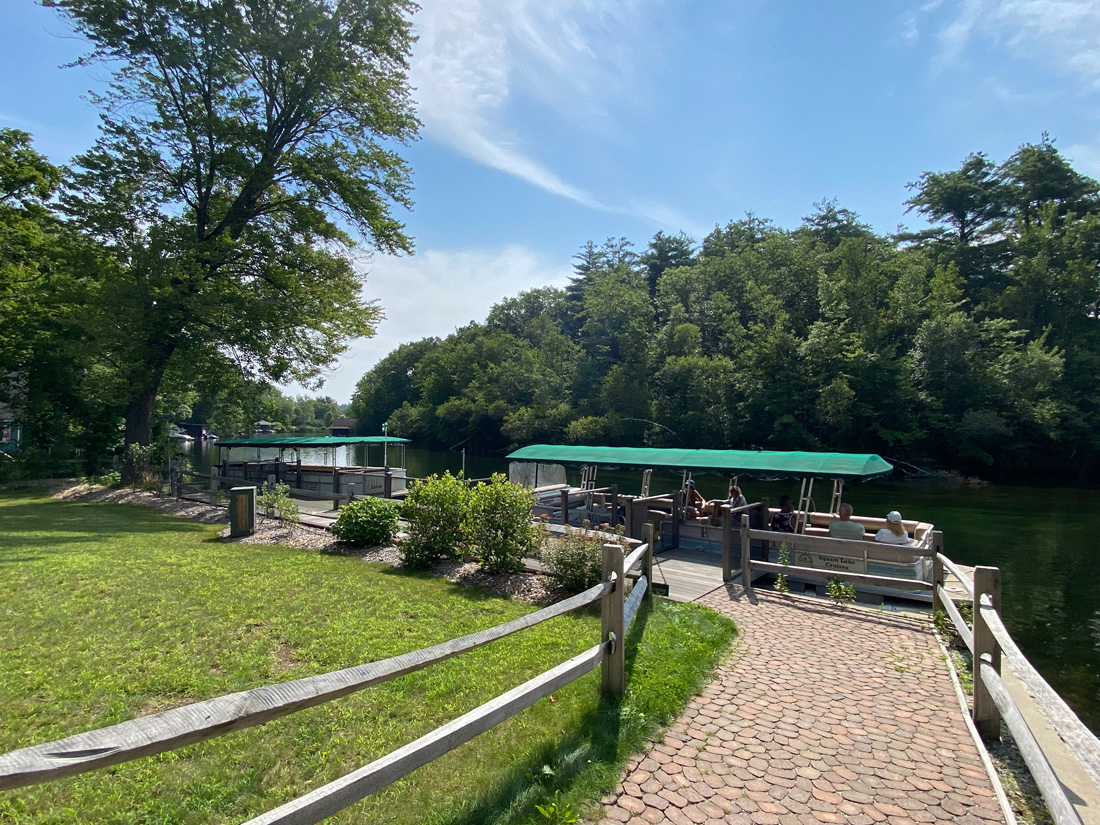
Sorry to disappoint you, but my adventure for Friday on the way home was NOT THE ONLY ONE IN THE US. I have been trying to find out how many. The Postal Service has 233,585 delivery routes across the United States, and I cannot find out how many exactly are by boat. Some are USPS, and other deliveries by boat are by contract, but there has been mail boat delivery on Lake Winnipesaukee for over 130 years, and I had to go. I had purchased my ticket for the 11 AM cruise, the first of two each day, each with different stops. GREAT I KEPT SEARCHING — THIS IS THE OLDEST FLOATING POST OFFICE IN THE UNITED STATES. I boarded the SOPHIE C for a two hour cruise – again sadly not three hours, and no MaryAnn (nor Ginger).
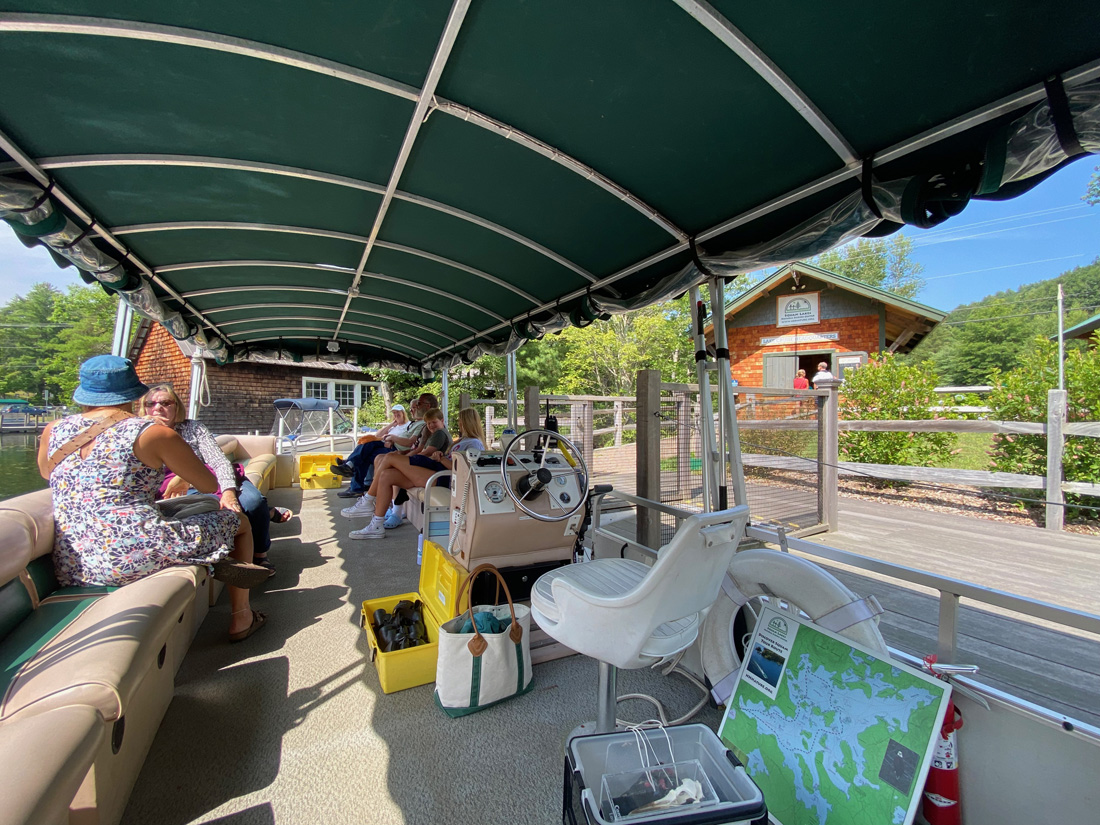
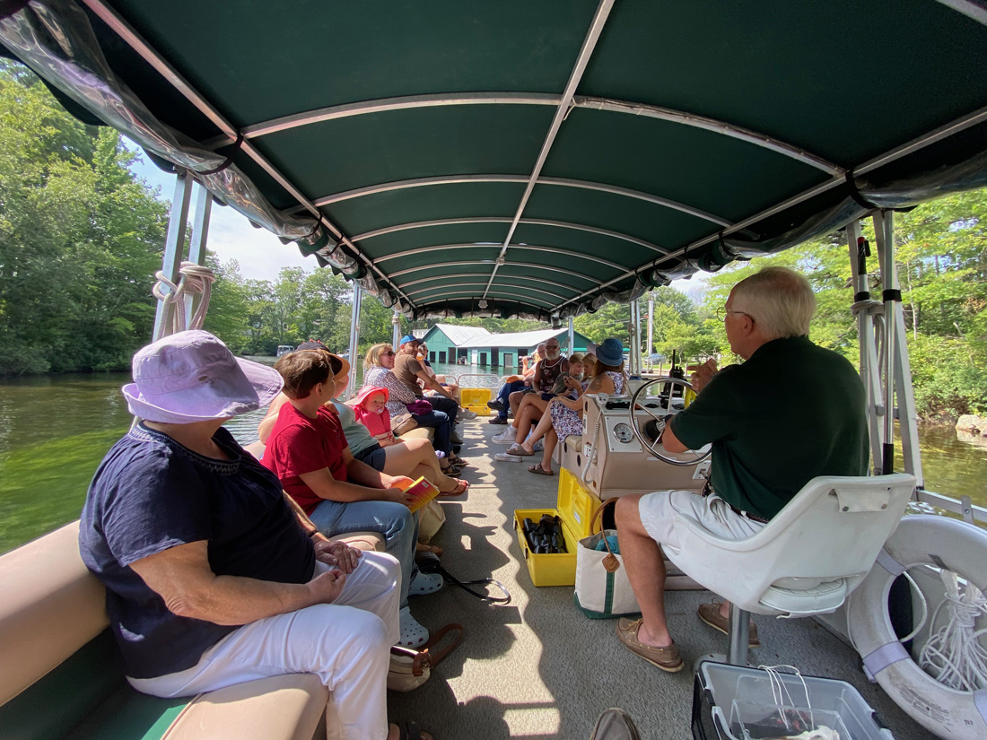
and off we went pulling away from the dock and M/V MOUNT WASHINGTON.
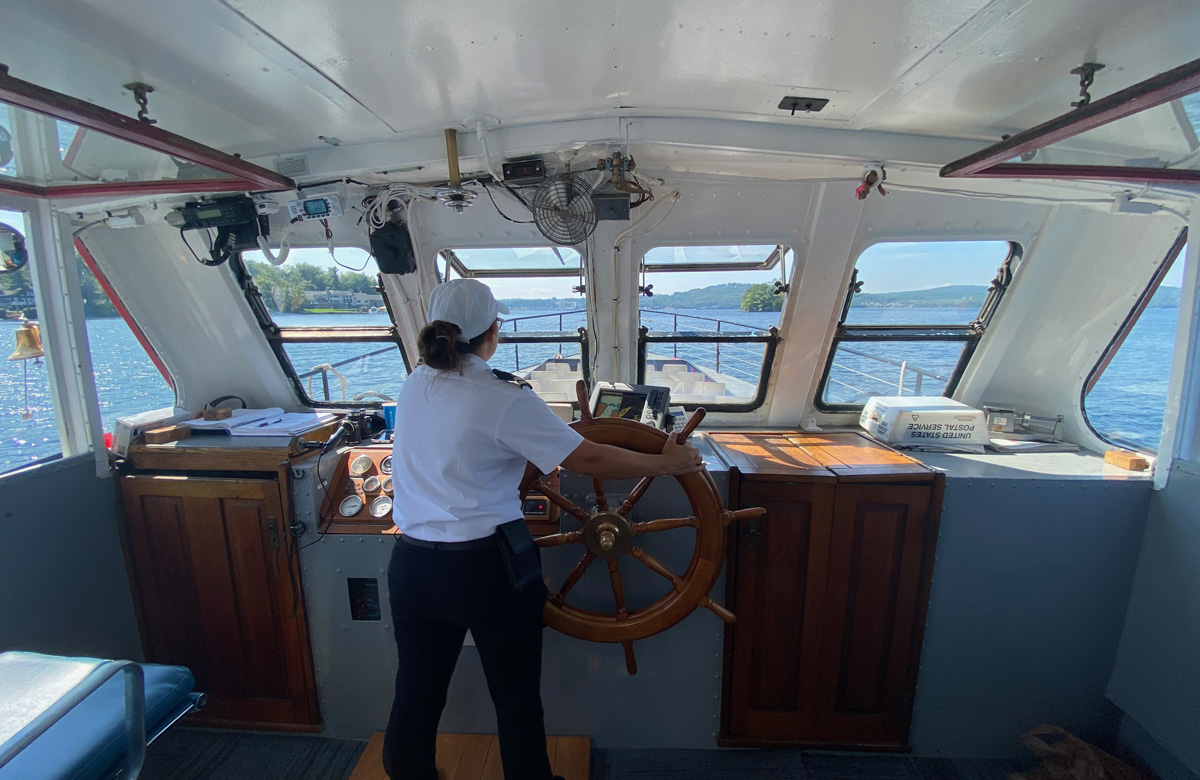
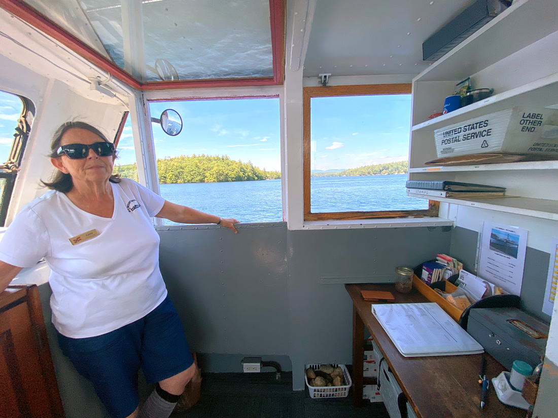
the captain above, and below Anne, the contract carrier “manning” her post office.
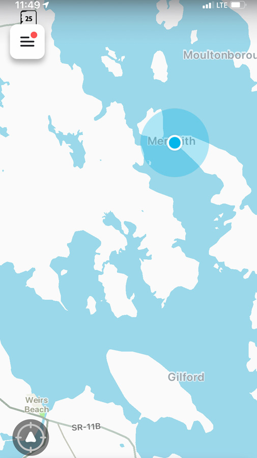
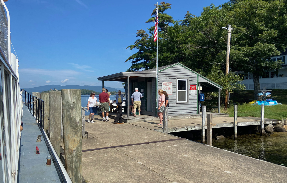
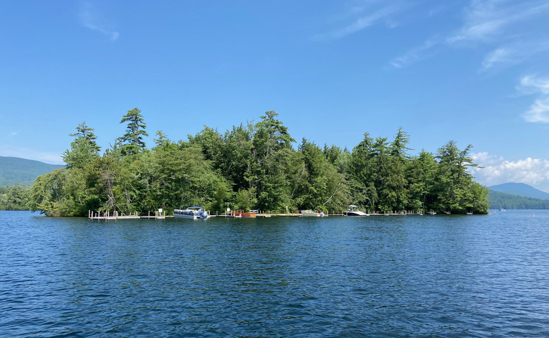
there were four delivery spots – Loon Island, Bear Island, Three Mile Island, and East Bear Island. The first stop was a drive-by to the primitive collapsing dock, and the last stop on Bear (the biggest island in the lake) the boat headed in and made a mail bag swap on a hook like done with old Railway Post Offices.
The map to the left will give you a feel from the start at Weirs Beach – bottom left. The round dot is when I secured this location shot off Bear Island
BELOW – Approaching LOON ISLAND, and the trade off
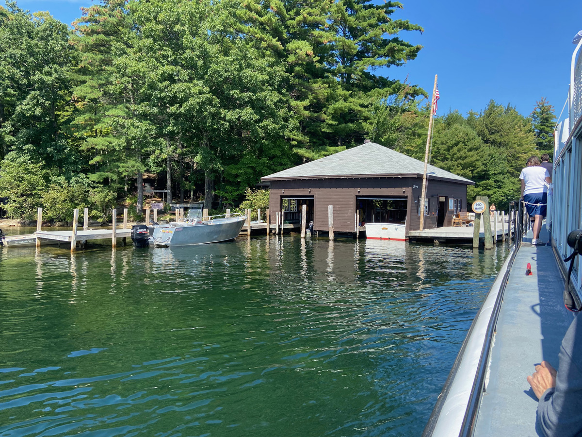
Then to Bear Island with the “post office” on the dock. A community event, Anne passed mail out and visited with residents.
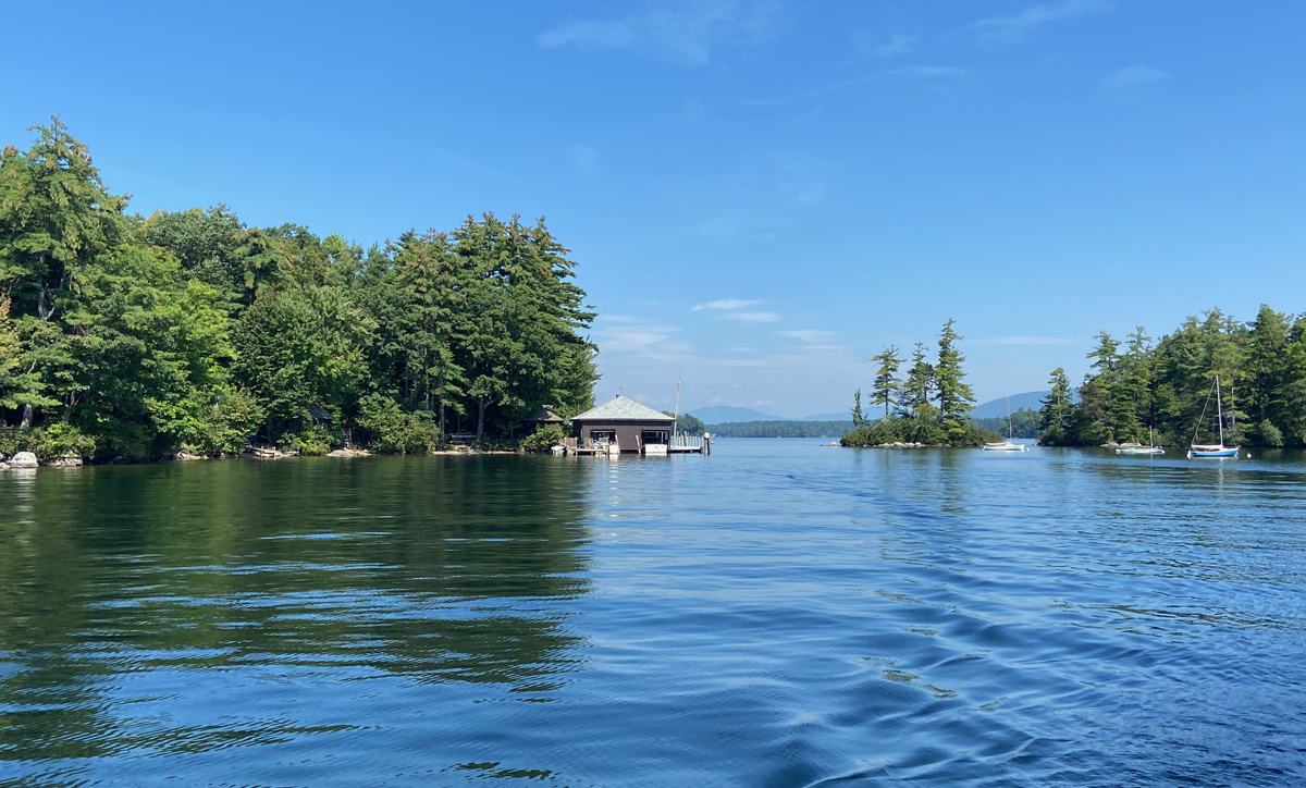
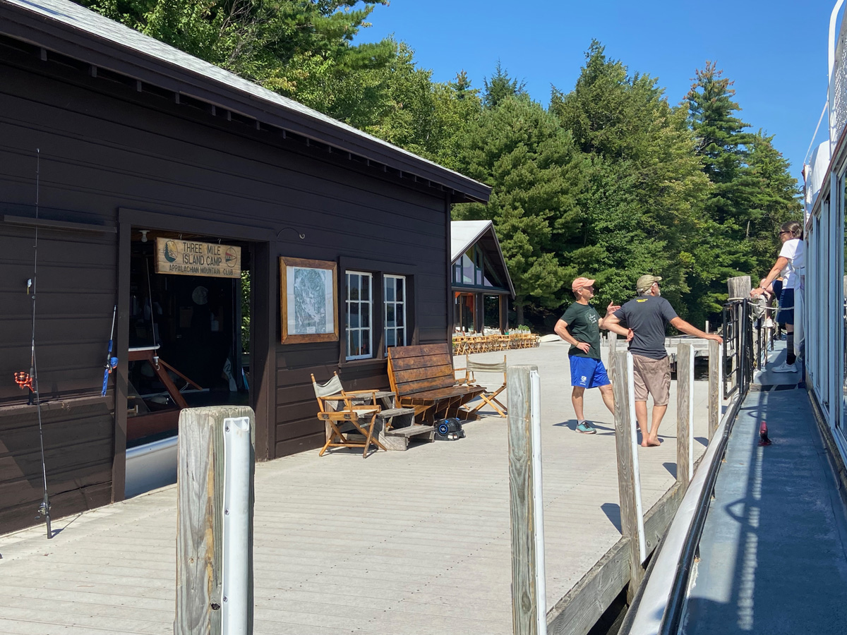
next onto Three Mile Island Camp which is an outdoor experience owned and run by the Appalachian Mountain Club. There was no mail coming or going, but time to visit, this the next to last delivery day for the season.
on returning, the MOUNT WASHINGTON was heading out for its afternoon cruise.
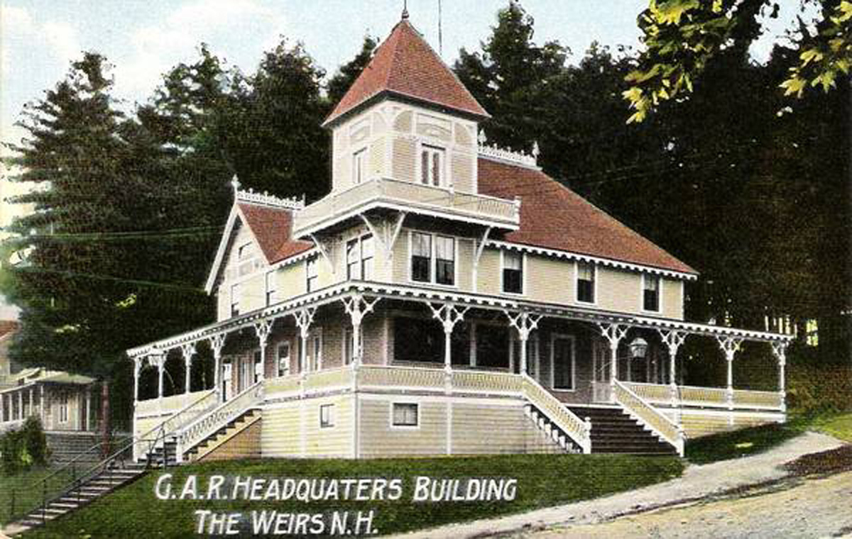
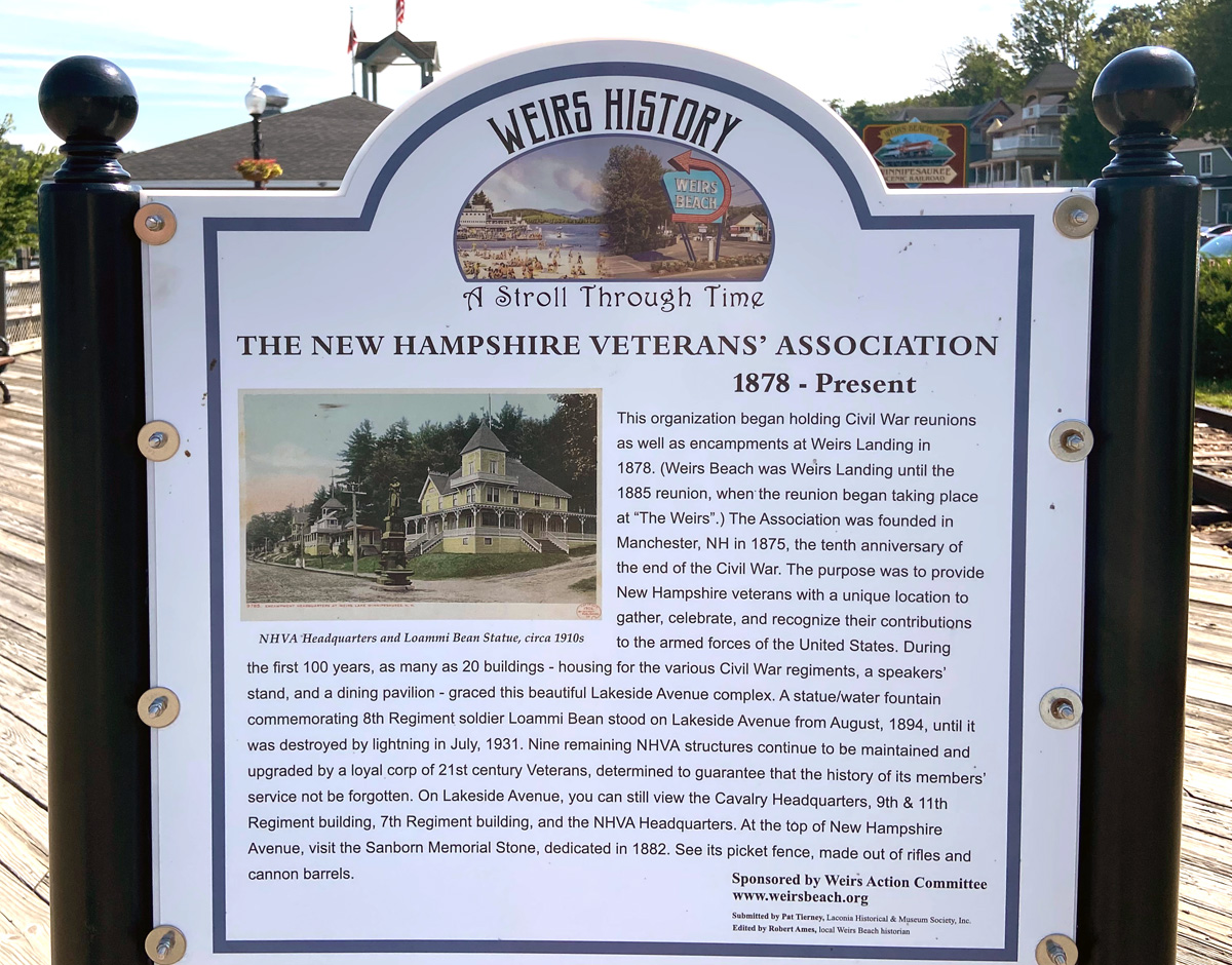
I have visited Weirs Beach since the early 1970s when camping with the kids just up the road in Holderness. There is much history here, and I thought I would share some of the history panels that are on the pier. First the NH Veterans Association encampment building, and the history of the Laconia Motorcycle Week (Weirs Beach is part of Laconia) – remember to click to enlarge.
Home late Friday afternoon – “work catch-up” and life is good. Had things on the list for the weekend, but stayed in, read, wrote, and planned for the future. And, yes I do have things in the future to share.
Stay safe and well, and thank you for getting this far with me, love, RAY
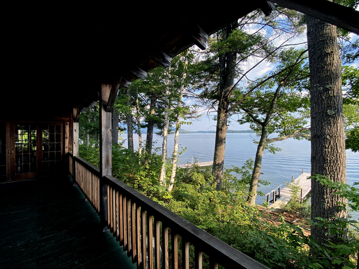
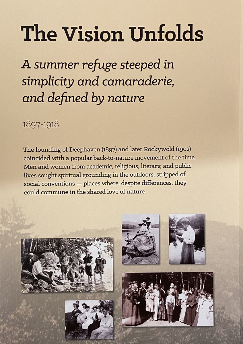
Remember I finally had an overnight 8-9 August with a Squam Lake Cruise the second day? I told you the boat guide “… pointed out a bucolic camp – ROCKYWOLD DEEPHAVEN CAMPS, established in 1897. Now ON MY LIST, and hopefully I will be able to experience in September.” Well, I found in one of my books I had highlighted the camp and its history, but it only took me days once I returned home from that overnight to make a booking, and I am now writing from the porch of Long House lodge, just 30 feet from Squam Lake, and listening to the loons. Check in was at 4PM on Tuesday for me, and I have now been “experiencing” for 26 hours.
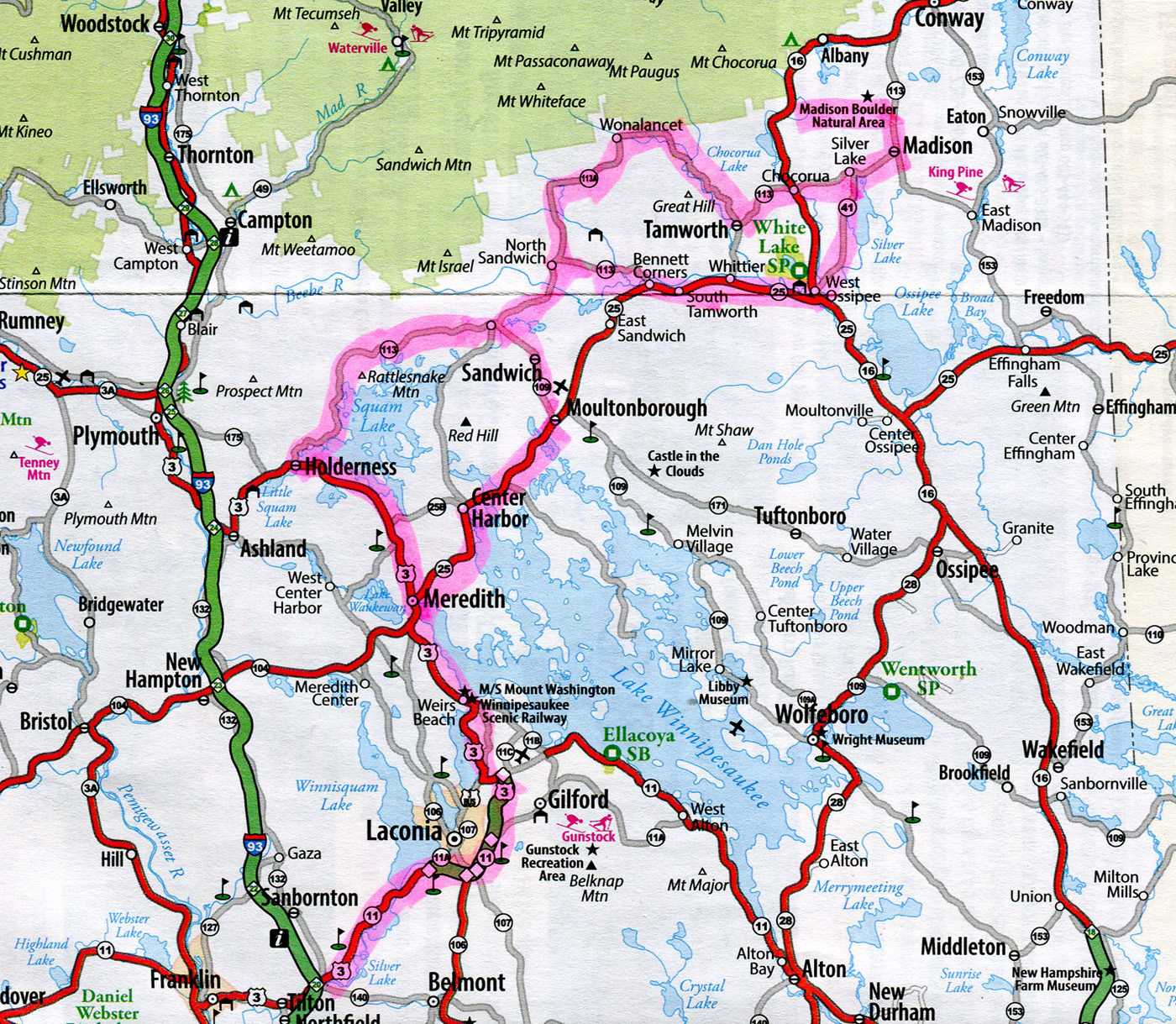
I planned my trip up and back as you can see lighted on the map below (well from Tilton).
The “camp” is where you see Rattlesnake Mountain marked north of Squam Lake – a two hour drive from home for me – but in typical Ray Shunpiking fashion it took me five hours to arrive at 4:02 to the grounds. Why? Well first heading up towards Newport I wanted to see a book shop Cathy and I had visited 20 years ago – believed it had closed, but I had time to check. Turning off the main road was a sign for two covered bridges – yeah.
Yes, I found the bookshop – unchanged since our visit twenty years ago, and possibly abandoned. Note dirt on the car.
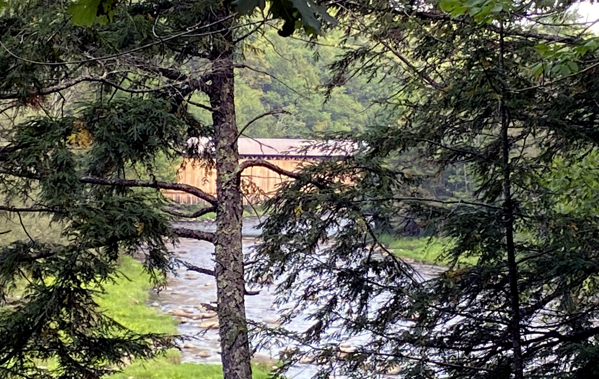
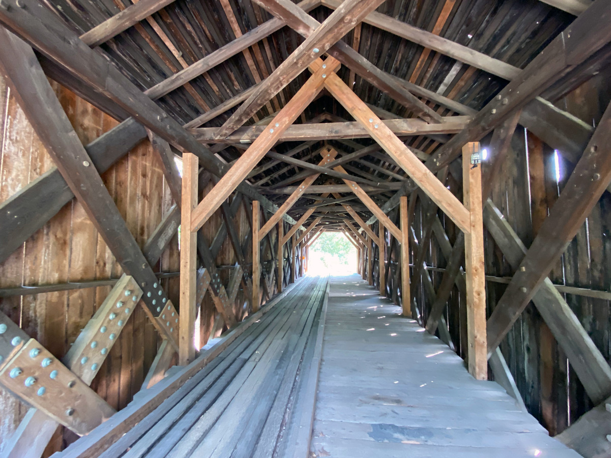
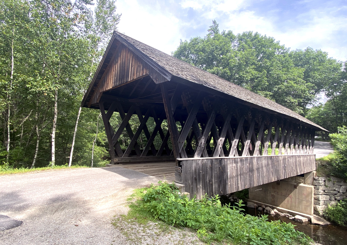
but the first bridge came before the bookshop – WOW – vaguely remember it, and now will. Pier, or Chandler’s Station Bridge in Newport, NH, at 217 feet it is the longest remaining covered railroad bridge in the nation according to the sign at the entrance. It is right off the road
just to give you and idea of size for a train, I heard ATVs coming and waited to get the image below for size comparison – the second image (remember you can click my galleries for large views) shows the rail trail exiting out and along the Sugar River the bridge crosses.
I continued on looking for the second bridge, but finally gave up. Driving back, through the trees and near the Pier Bridge I spotted the Wright bridge which I learned you can only access from the rail trail.
I always am fascinated when I see what is obviously an old rail bed alongside a back road. Then it occurred to me, and I now own two books on Vermont and New Hampshire rail trails so I can learn what old railroads ran where – beware, another “hook” for Shunpiking adventures.
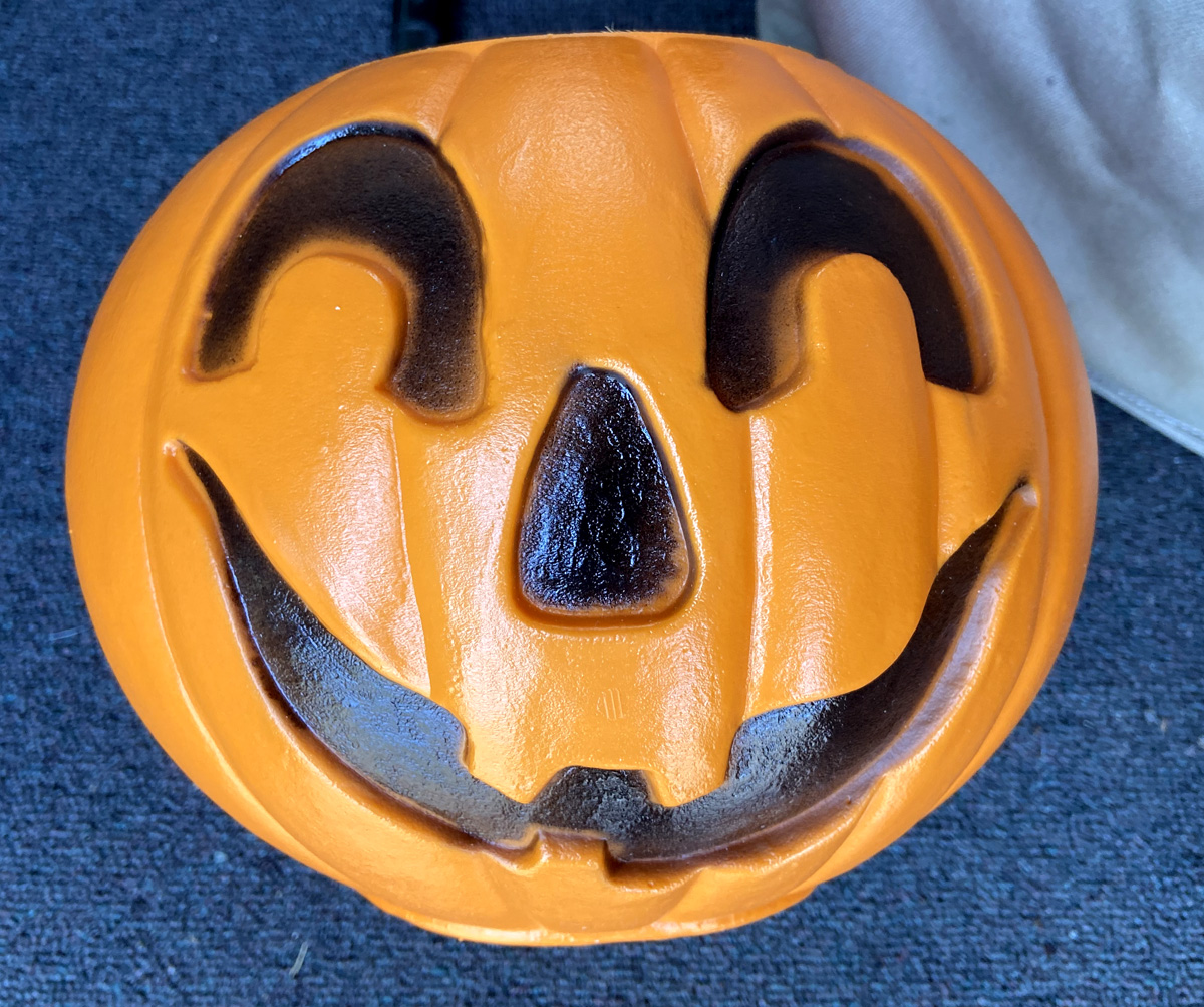
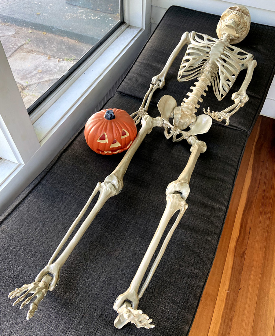
Part of my five hours for a two hour trip was searching for treasures, and yes, first stop I purchased 31 books for resale. You may know I am on a “blow mold” pumpkin quest even though a friend has advised I had better curb my ORANGE ORB OBSESSION – but I am selective. On Saturday I “made a good acquisition,” and now stopping at a shop in Weirs Beach I have this memory – Union Products (Leominster, MA) CARRY JACK CANDY PAIL – 7 ¼”H x 9″W, and available 2000-2006. Not old, but fits in with my collection. To discourage “pumpkin thieves” I left the fellow below as a warning to others who wish to “mess with my pumpkins” as this is the result.
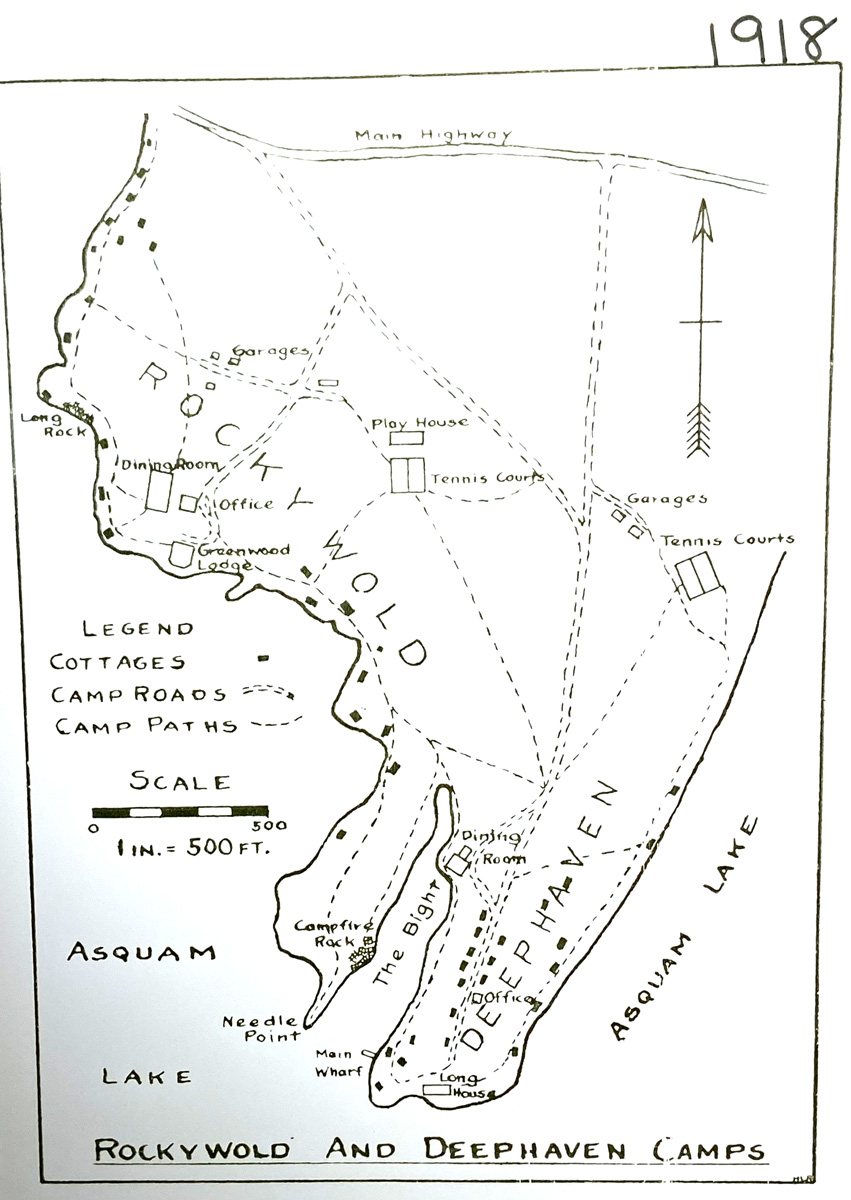
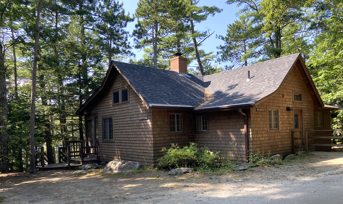
In Meredith I turned on Route 25 to Moultonborough, then up through Sandwich (a must visit village) and back roads to RDC – Rockywold Deephaven Camps, and checked into 1897 (albeit with minimum electric and plumbing added). Checking in, I heading down to Long House and my “room with a view.”
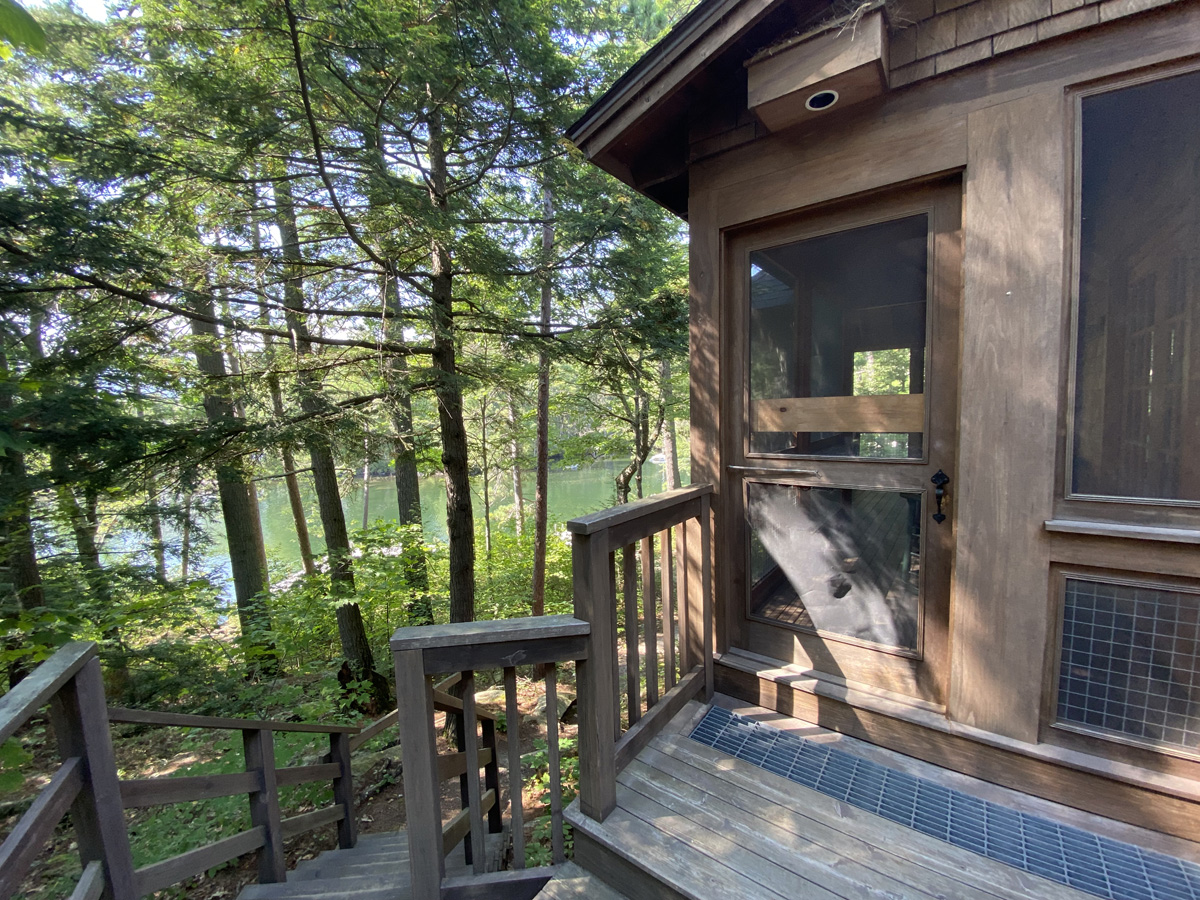
I crossed along the porch, through the great room to my room right off the porch.
and, the views of Squam Lake just outside my room.
Quick history lesson from Wikipedia — Squam Lake was originally called Keeseenunknipee, which meant “the goose lake in the highlands”. The white settlers that followed shortened the name to “Casumpa”, “Kusumpy” and/or “Kesumpe” around 1779. In the early 19th century, the lake was given another Abenaki name, Asquam, which means “water”. Finally, in the early 20th century, Asquam was shortened to its present version, Squam. And now you know.
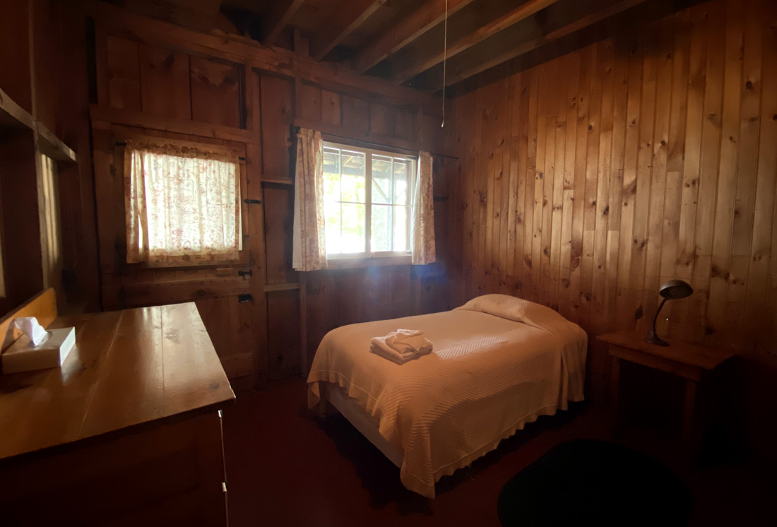
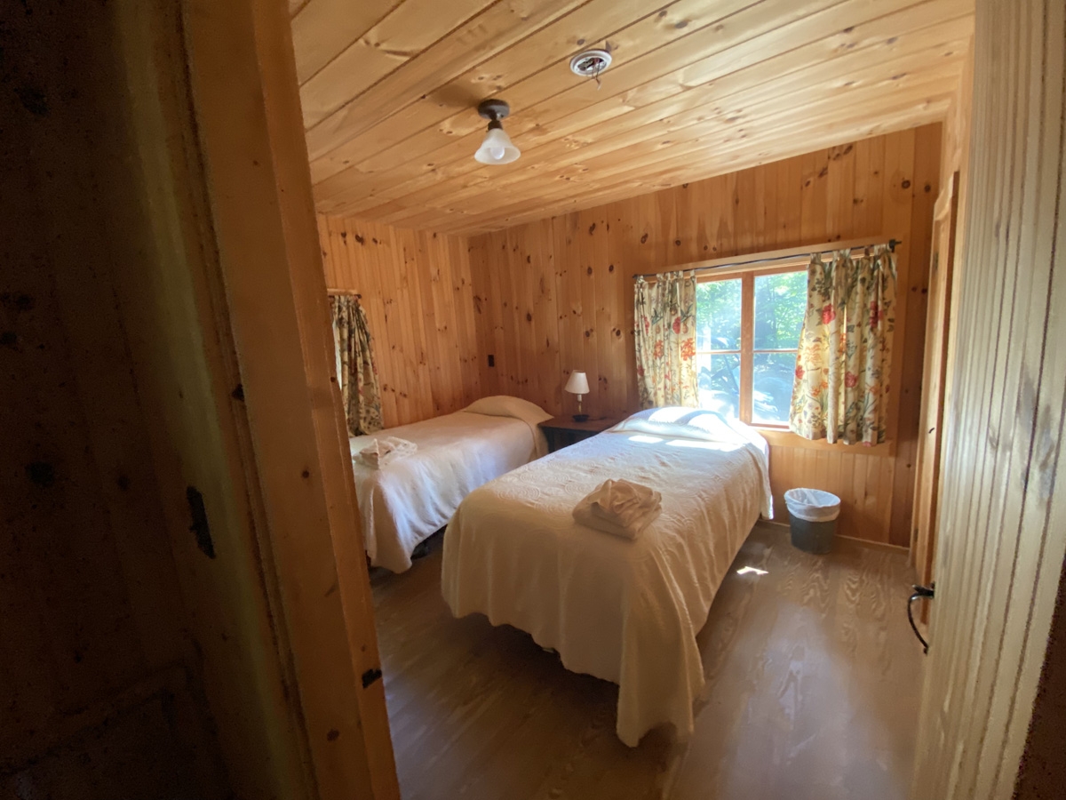
Below my room – for sleeping.
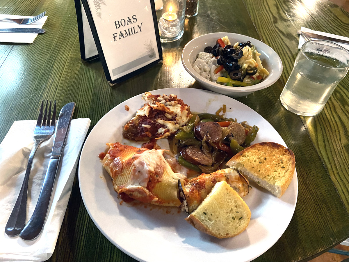
and heading to the dining hall for dinner – wonderful spread, many choices – I started with all the entrees.
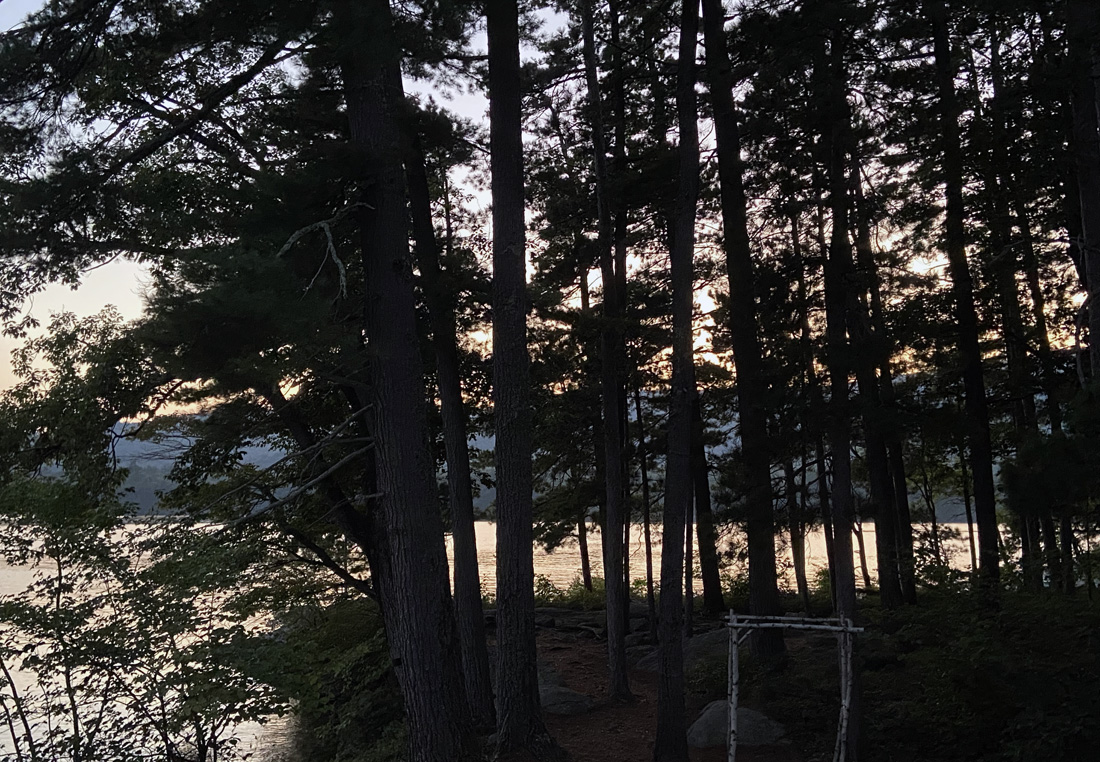
It was then back on the porch, Zooming with Gary, and watching the sun go down. This second evening I sat in the dark watching the bats come out.
In the morning I headed off to the “Rock Dining Hall” for breakfast. RDC is on two peninsulas so to speak, each with cabins, lodges, and a dining hall. I choose Long House lodge for the waterfront room, but later learned the dining hall here closed after Labor Day. So off I went on what I thought was a path. Not really, so I soon returned got my car keys and eventually found the dining hall again. For someone who has a good sense of direction I have been a tad challenged – guess all the trees and perfect dirt roads “look alike.”
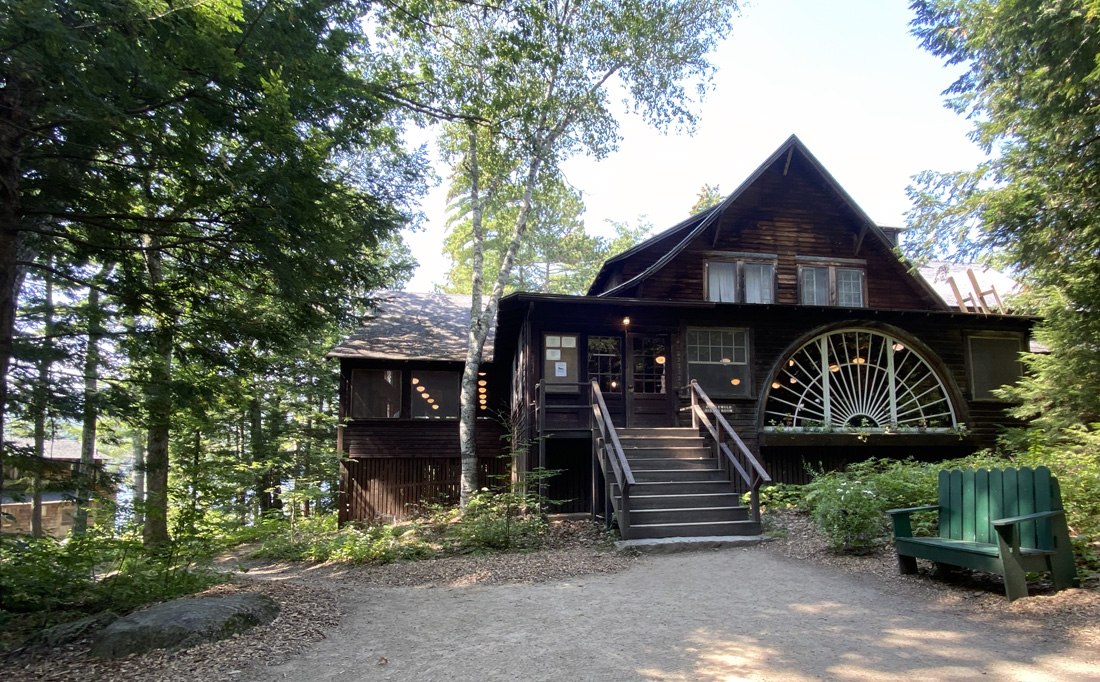
Exploring on the way back I found the playhouse and “camp store” and “camp story,” a museum of the camps’ history. Serendipitously the camp director, Natalie, was there and visited with me. I knew some of the history because in reading about Squam Lake I learned of a 1997 book – Roots And Recollections Century Rockywold-Deephaven – and ordered a copy to study. Ends up there are copies in the store here – I did not check if originals or reprints. Natalie headed off to a meeting, and I entered the museum -“camp story.”
In my opinion RDC is a ‘”national treasure” and a microcosm reflective of social and cultural changes over the past century as impacted by the development of the summer vacation and recreation, the automobile, war, and the civil rights movement. Adapting with the changes one can still have a feel of the early twentieth century, and as Natalie and I agreed, “not everyone gets it.”
Here is some of the history from the museum, but better yet, get the book when you visit the museum while staying.
and, then I “staked out” my spot on the porch (which I have had all to myself) with the “work” I brought, and books to read. When will I ever learn it will not all happen?
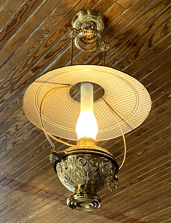
For dinner the first night, and then breakfast, I drove to the dining hall, but for lunch had asked enough folks to be able to find the path and hike along. With cane, fun through the woods but care given to roots and rocks. Fine for day, but not worth a chance at night even with a lantern (and yes Beth, I forgot to reread your email and neglected to bring a lantern or “bug juice” but bugs not been a problem for me). I arrived for lunch, with an appetite.
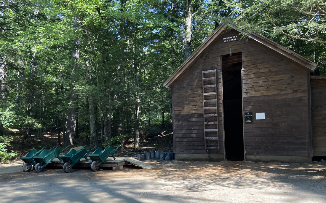
For a future stay with Gary, Ilana and others, I asked if there were some empty cottages I could take a look at, so the plan walking back was to look at a few. Found some perfect spots for Gary and I to “do our thing” while Ilana pedals around Squam Lake, and maybe Winnipesaukee the next day. Here is one of two ice houses. Blocks of ice are cut, stored, and delivered daily to cottages keeping an old tradition.
This is BY THE WAY cottage, and “by the way” I am ready.
But, maybe SUMMIT – housekeeping was there at the moment, but look at the porch !
and in the same area is SUNNY RIDGE – smaller, but secluded (as they all are) and the porch. Note the old ice box is just outside the door.
Rest of the day was reading, some writing, thinking about laying out my upcoming presentation, nap, dinner, reading, falling asleep, waking to moose calls – no loons this night. What could be better? Well, the BIG adventure I have planned for Thursday after lunch. Something ERRATIC, and again if you know me you have it figured out. And, click this link for Part Two of Ray ON GOLDEN POND.
I believe I am back “out and about” – YEAH. Covid slowed us all down, back hiccups and balance have slowed me down – but I am out and again exploring as I mentioned in my last post that included Squam Lake, and a discovery there leading to another post coming soon. I have enjoyed country fairs over the years, but this year I seem to have discovered more of them, and made a point to visit them. This story will cover three fairs I attended from 18-27 August: Hardwick, Massachusetts; Cornish, New Hampshire; and Bondville, Vermont.
Some fairs I have enjoyed in the past, or just learned about, and now “on the list” – they include
Fortunately based on my interests I get some interesting links on Facebook. Not a fan of Facebook, at least seldom post there anymore, but it is a great discovery source. I believe that is how I learned of the HARDWICK (Massachusetts) COMMUNITY FAIR – self-proclaimed “The Oldest Fair in the United States.” From their history, “Brigadier General Timothy Ruggles an early settler to Hardwicke and a prominent loyalist to the King. … as speaker of the House in 1762, with Hardwicke being very prosperous, Timothy Ruggles used his position to promote a formal act of the court, establishing the first Fair to be held in his home town of Hardwick, to be known as the Hardwicke Fair. This was the equivalent of having the King grant his favor in England.” But as you read their history it has not been continuous for 261 years. Hardwick is one of those towns that you have to go there – off the “beaten path,” that is the only way. Just east of the Quabbin Reservoir on Route 32A, you will see what I mean. You have to plan to go there.
But, on my way on the major roads, I made some “major finds” for Ray. Orange Orbs caught my eye, I backed up for a yard sale, and I now own a blow mold trick or treat pail (c1960s A. J. Renzi #1100), and a newer (but amazing) lighted pumpkin (out a whole dollar). And, then a “new” tin chandelier. You may know I love Colonial tinware, this is new, on Amazon for $250, but why not for $45 at an antique shop I like to frequent. Just have to now build an addition to use it.
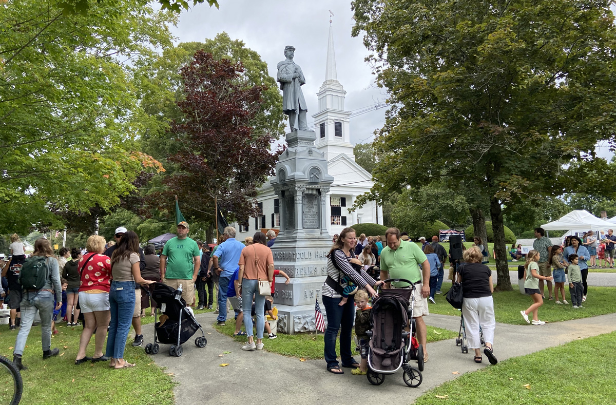
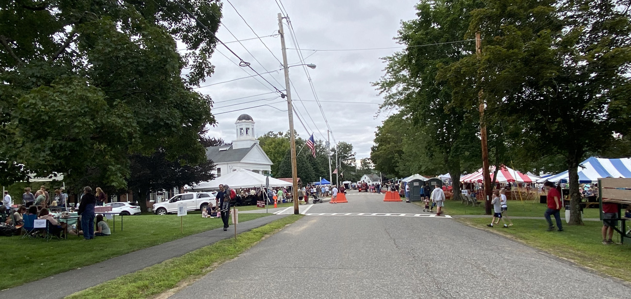
Each of the fairs I visited and am relating here, had their “own feel.” In Hardwick I felt I was at a welcoming town picnic where the community was out visiting their neighbors at the fair on the Common. The post office faces the Common
opposite on the Common is the ubiquitous church and Civil War memorial statue.
around the Common – just neighborhood booths sharing the spaces (please do remember you can “click” on an image in my galleries for larger views”)
at fairs I search out the community group food booths to support those organizations, and not the “commercial” food trucks or vendors. Here I think there was only the fair committee itself offering food. Driving down I decided I wanted to have the perfect sausage sandwich with grilled peppers and onions – I was not disappointed, and this time with “Mom’s Red Sauce”. I thanked Mom.
not billed as an agricultural fair, but while I was eating I watched the long, long tractor parade — no, not something I need to own, but can enjoy others enjoying “their toys.”
The historical society was next to where I enjoyed my lunch, so I headed in there next, learning this history of the fair and enjoying the exhibits.
Here is my first “first” seen here at a fair — exhibit and awards for the “1st Cutting Mixed Hay.”
in the background above you can see the scarecrow contest in the cemetery and below.
You should know that over the last 62 years I have owned nine Model A Fords, and lament selling each one. Now every time I see one, I still desire another. This 1931 Model A Ford pickup was parked along the cemetery – “I want another.” Have one in your barn you don’t need? I need it.
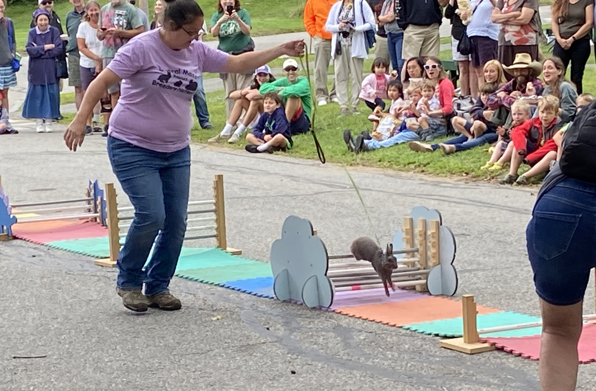
now for my “second first” seen at a fair — a wide variety of rabbits shared by folks who love and need rabbits as I love and need another Model A. And, after talking about them, each was put into its paces jumping along a cushioned course.
How do you beat all this fun? The next day Sunday, BLUE BELLE and I took off for the Cornish, New Hampshire Fair, started in 1949 and now 73 years old. Remember I said each fair had its own feel, and differences? Cornish was fun, and I had not remembered what my Cathy and I experienced maybe 19 years ago. Exhibit barns, multiple simultaneous agricultural contests, and a midway with more aggressive and daring rides. And, the food and souvenir vendors.
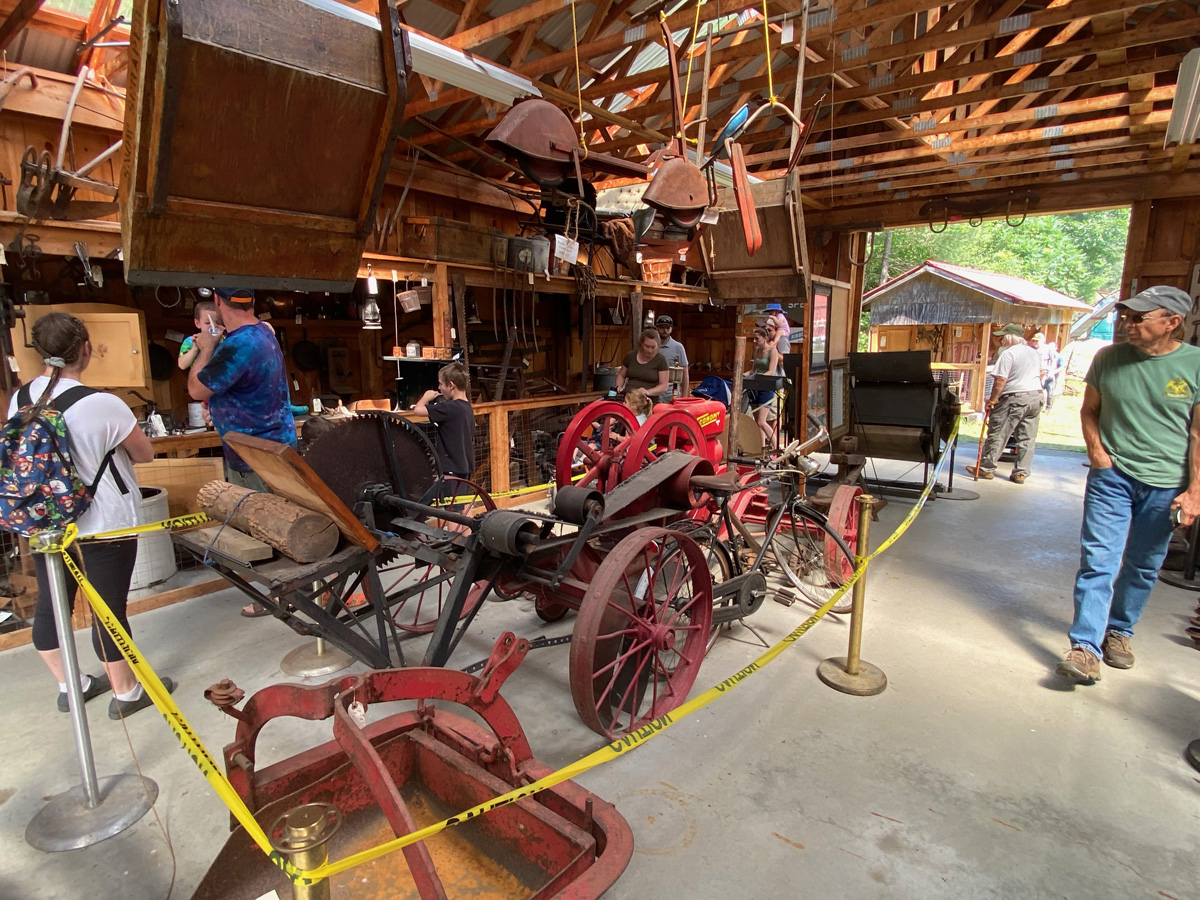
Here is the Farm Museum sponsored by the NH Antique Tractor Club which is involved with much of the fair.
you know I like “hit and miss” engines. The above is a 1928 Economy purchased new by Paul Tewksbury, and on loan from his great-grandson, Paul Tewksbury. And, then I was “flagged down” and offered some ice cream fresh from an ice cream freezer churn powered by a “hit n miss.” YUM
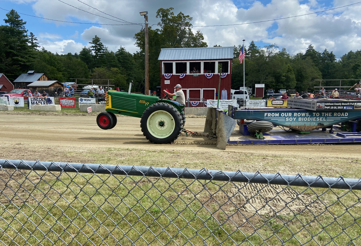
It appears that a necessary event at an agricultural country fair is the tractor pull. Chatting with folks I learned much – kinda fun to watch even if you do not know the contestants and classes – by weight I believe.
this was a pretty intense conversation – I only caught about half of the conversation.
I also learned there is more than one way to get to a country fair.
also new to me was the chain saw competition. Many different ways they were competing and many different rules. Fun to watch, trust me, I will not be competing.
In many spots around the grounds were hand-written notes on 8 1/2 by 11 sheets of paper – Lasagna Dinner at the school – sponsored by the Masonic Lodge – $13 with salad, drink, bread, and ice cream desert. Remember above I said I would prefer to support a non-profit group instead of a commercial vendor? Well, that was my choice, and asking one of the cart drivers on the ground where the school was she said, “hop in I will take you.” Yes, uneven ground and I did carry a cane – not abusing it, but was easier.
It was just right, and nice in the school, sitting down with only a few other folks.
A crowd sat on a hillside listening to a group – they really did sound like Fleetwood Mac.
and, on leaving I strolled out through the midway, and checked out the cows.
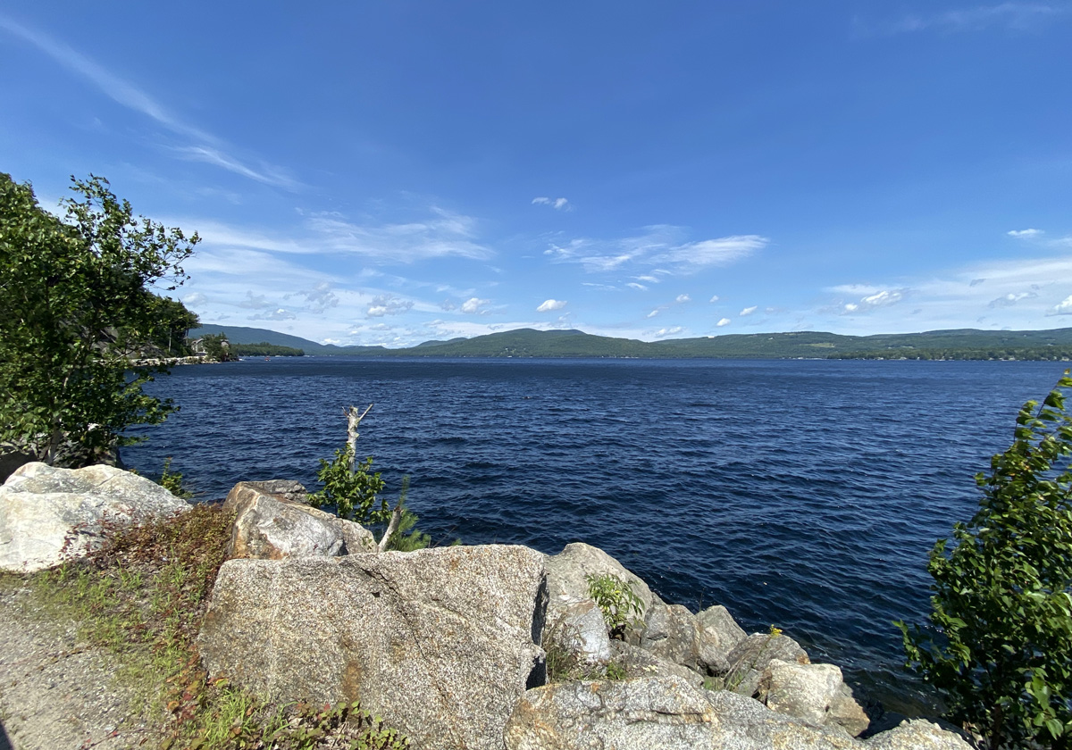
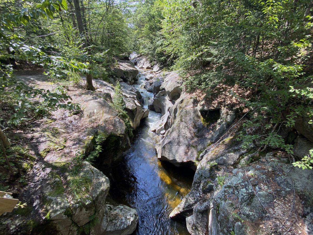
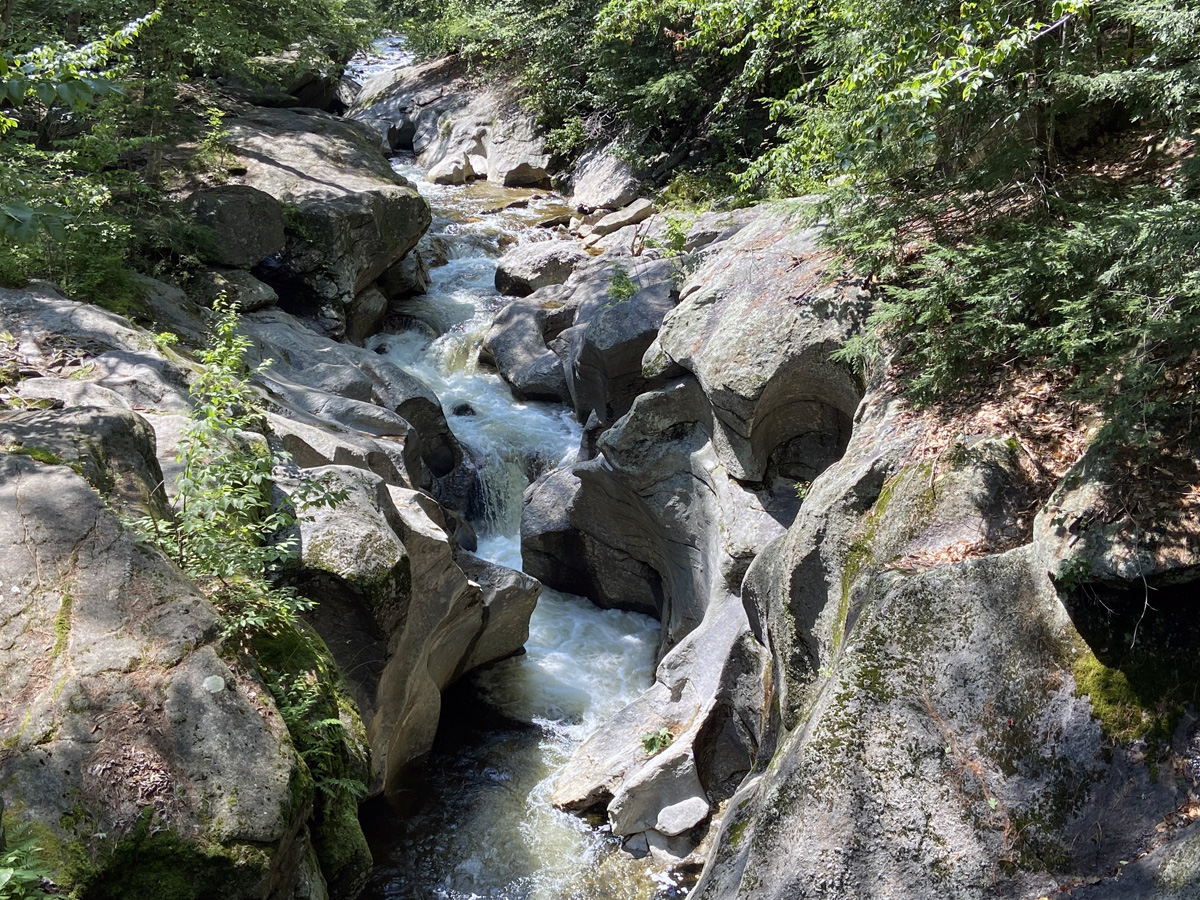
On the way home I wanted to re-explore Crescent Lake, and the Cold River that I wrote about this month in my history article, DID YOU KNOW THAT…? in my newspaper – THE WALPOLE CLARION, September issue, page 8. Checking the maps, I found where the old 2nd New Hampshire Turnpike headed south from Claremont, and off I went on a road, “new to me,” but over 200 years old. I arrived at the lake
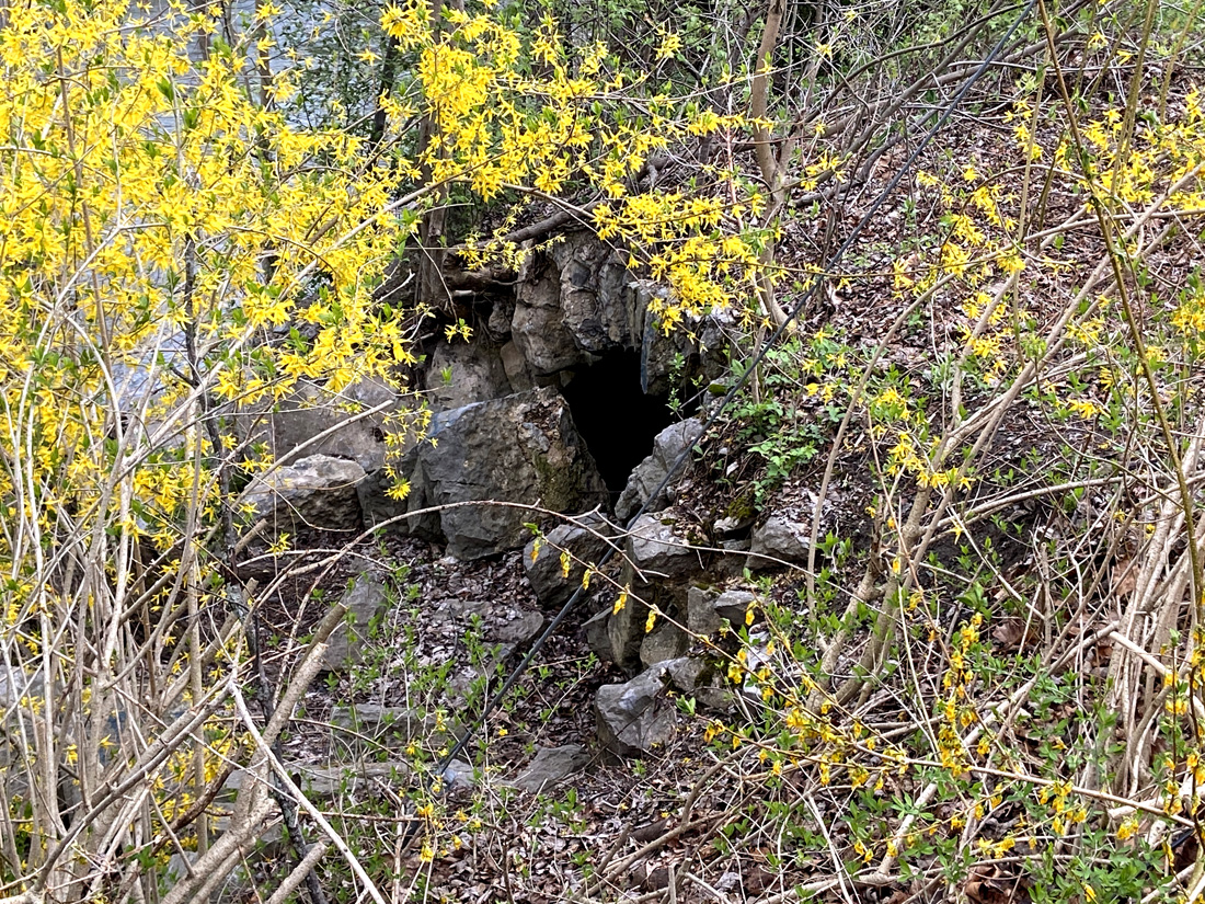
then trying to find a certain secluded spot with a waterfall I headed to South Acworth. Here is the bridge across the Cold River, but I did not find the spot I wanted. Notice the shale rock.
exploring back roads (of which there are few) in the area, I found this washout from the July flooding.
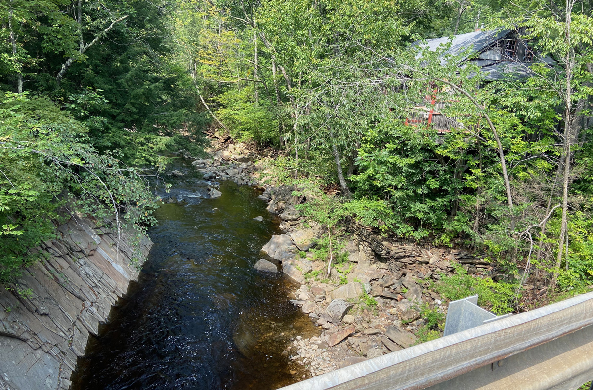
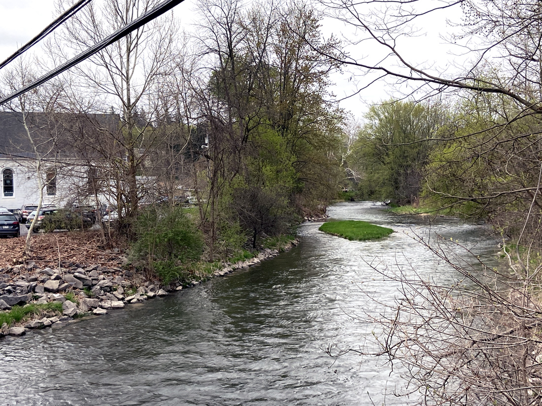
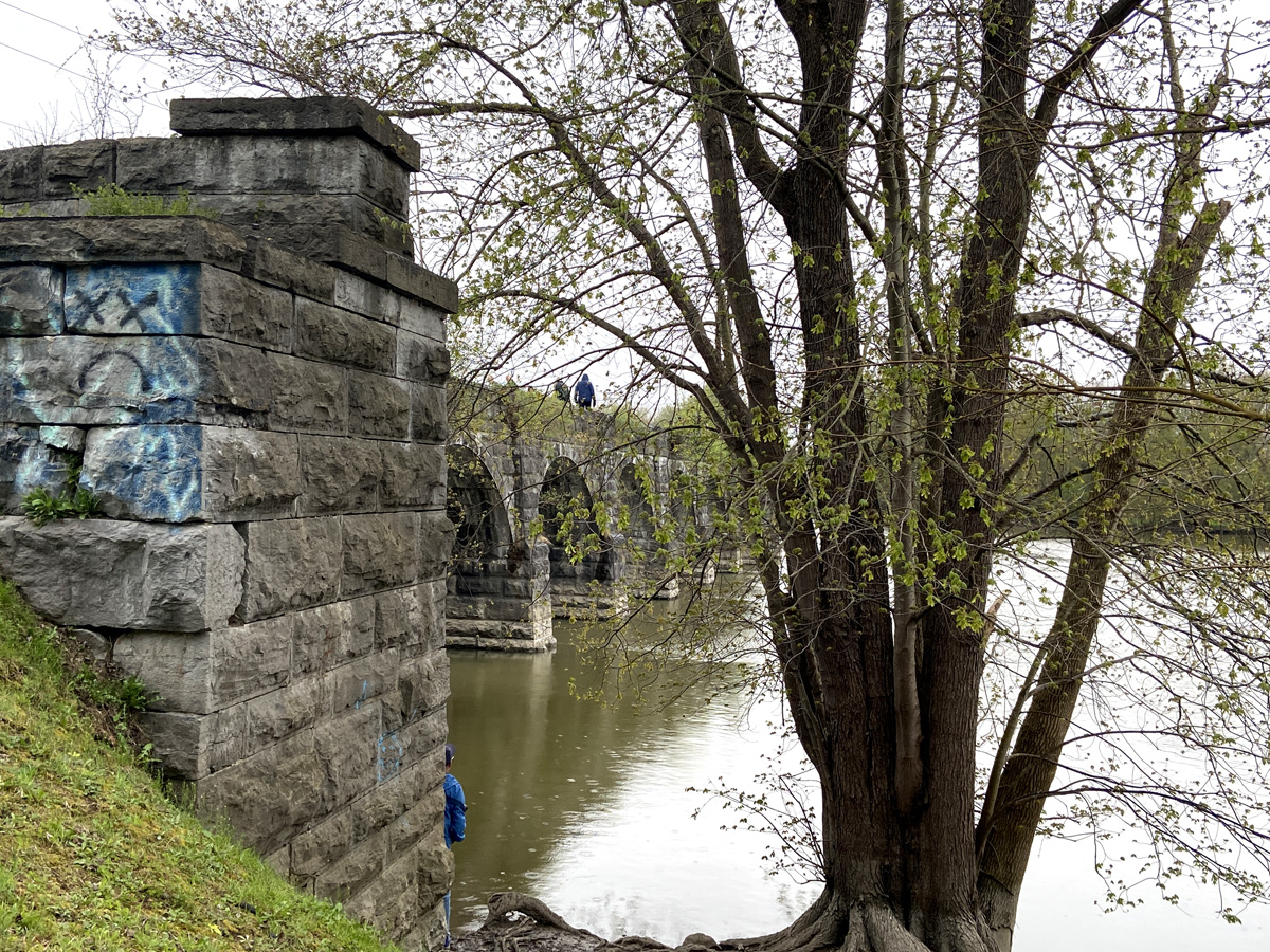
Following the river to Walpole, built in 1869, the McDermott Bridge spans the Cold River in Langdon, and is visible from Route 123A, just north of Vilas Pool Park. Below the bridge, and a view of the Cold River.
And, then BLUE BELLE and I returned home, awaiting the coming weekend, and the Bondville (Vermont) Fair, attending, Sunday, 27 August.
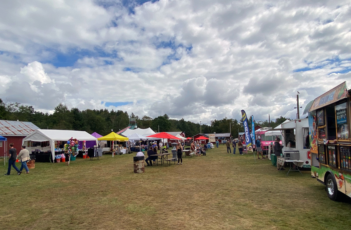
The 225th Bondville fair, this is a very small family friendly fair with a small midway appealing to younger riders, a couple animals, and the ubiquitous tractor pull. BUT a special reason for why I needed to go, and finally got there after missing for a number of years. My longest time friend, Mimsy, who I knew from pre-kindergarten, she and I visited Bondville several times during her visits. Her grandparents owned a summer home on the hill across the road from the grounds, and she would visit them. This trip was for her. So glad I went, I love traveling the area, and this was a comforting stop on my outing. BLUE BELLE was not so sure when challenged to the tractor pull.
the small and calm midway and food and vendor tents
only two exhibit buildings
some nice music from some geriatrics
and, four small “token” animals for a small fair – well, I did not take a picture of the newborn piglets.
and, again, I sat for another interesting tractor pull. BLUE BELLE registered, but did not weigh enough.
And, I guess that is it with this post. RAY RECOMMENDS – find and attend one country fair, if not more. This is true Americana at its best.
Cannot wait until my next adventure – stay tuned the end of next week, luv, RAY
I have long gotten out of the process of taking off on a whim and exploring – COVID affected us all in different ways, I got “out of practice,” enough said. But my armchair traveling happens every day and I save ideas from emails I receive and things I stumble into on-line or in my readings. A railroad museum in Maine, Adirondacks, Hudson River, have all been under consideration. I make notes, struggle, and weigh ideas. Couple days ago a plan developed – Polar Caves, and Squam Lake Cruise with an overnight. Most places full, I found a vacancy at The Federal House Inn in Plymouth, NH.
Many options for the 1 and 1/2 hour drive – it took me seven hours, and as usual I did not accomplish an original goal – but you know that means unplanned discoveries along the way. Check your maps, plan was from New London, NH, to Routes 11 to 4 to 106 and Bristol for an antiquing stop. I stopped at Sunapee Harbor – again need to get back.
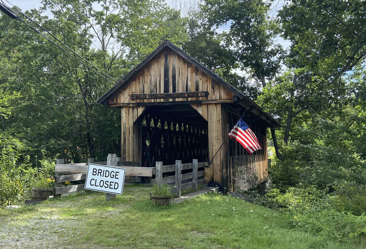
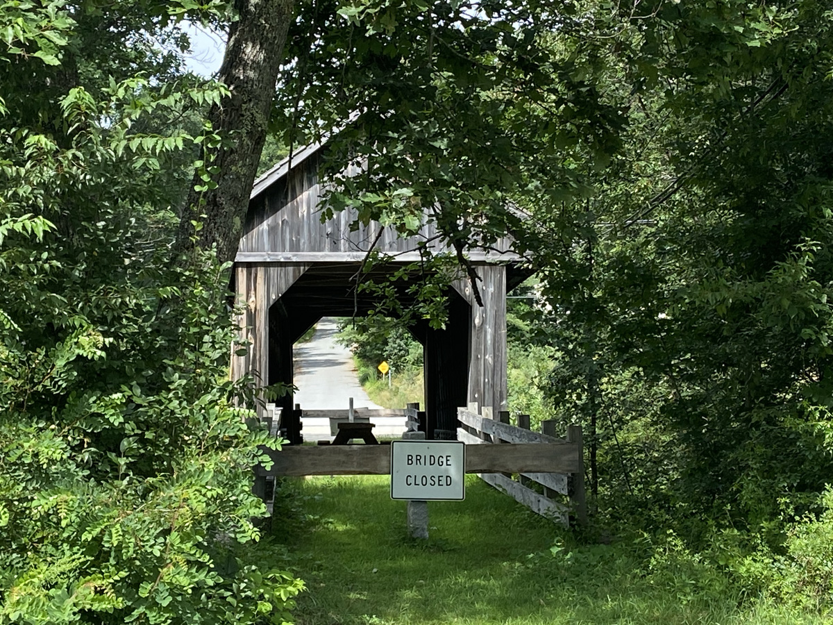
On the map I saw two covered bridges I had not before visited – so the planned first stop at the intersection of 4A and 11. Spotting the bridge and pulling in I realized usually I am heading the opposite direction, and Bridge 16 is a tad hidden coming from the north.
Cilleyville / Bog Bridge, built in 1887, this bridge spans Pleasant Brook. It was bypassed in 1959 and restricted to foot traffic (but now totally blocked off). The bridge was the model for murals of typical New Hampshire scenes which were once located in the State House in Concord. Style is town lattice truss, 53 feet long.
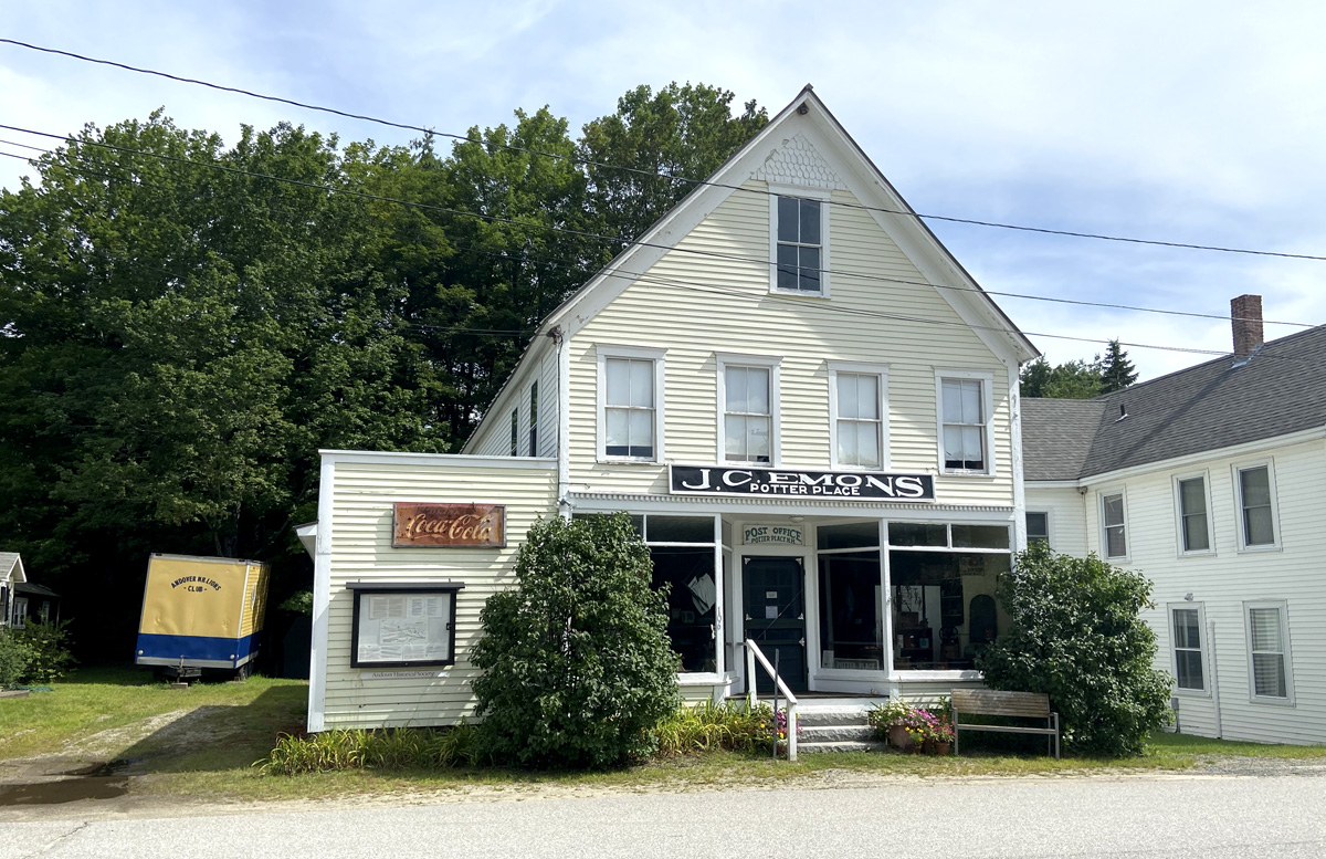
Driving east on Route 4 toward Andover and Bridge 15, through the trees I spotted a Victorian train station – again never would have seen coming from the east. Of course, I swung into the side road into Potter Place.
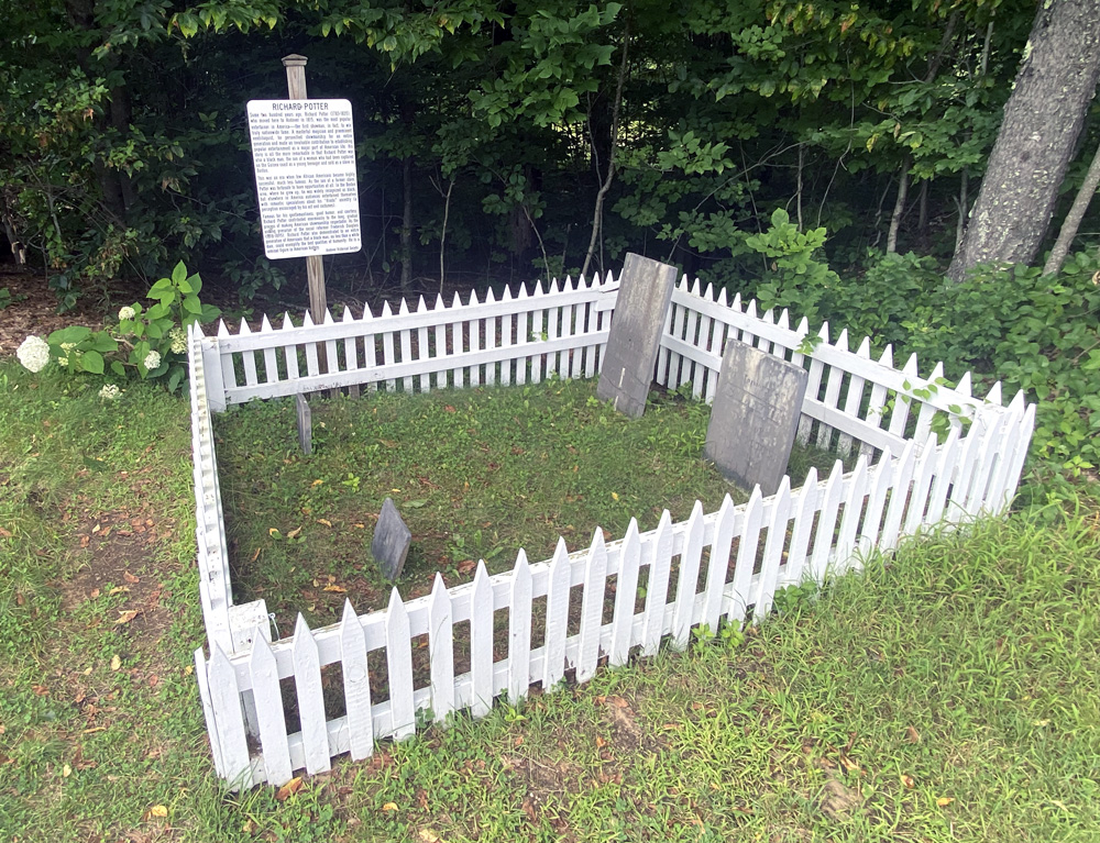
but just across the tracks I spotted this and crossed to look.
The grave site of Richard Potter (1783–1835), and from my visits to Old Sturbridge Village I knew who he was. An early magician and ventriloquist, Richard Potter moved to Andover in 1815. Extremely popular and successful, even more interesting life when you know he was Black. Do enlarge the gallery below and read about him.
worth pulling in to see the small village, train and freight station and couple streets. Having a good sense of direction, I figured I could drive down the “Main Street” and eventually find the other closed end of Bridge 16.
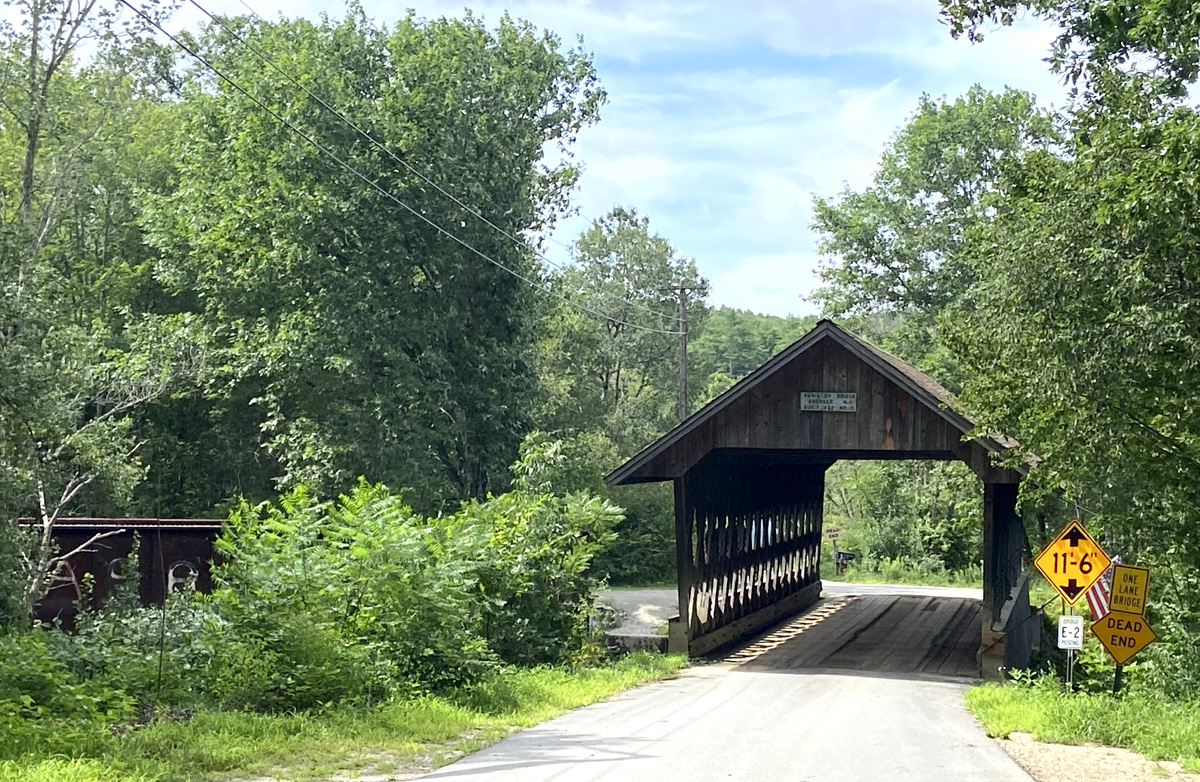
Back down Depot Road to Route 4, for the first time I saw the state sign for Bridge 15 – of course on Dead End Bridge Street (also called Lorden Road). Coming to the bridge.
Not often are there no sides, and can see all the trusses, so that is below. Above you can see the old railroad bridge to the left – now a great rail trail.
This is Keniston Bridge, built in 1882, over the Blackwater River. The bridge’s name came from a prominent family that lived for many years in one of the old homesteads in town. The bridge has been damaged only once, in 1972, when ice tore off several planks. The bridge was rehabilitated by the town in 1981. Town lattice truss; 64 feet long.
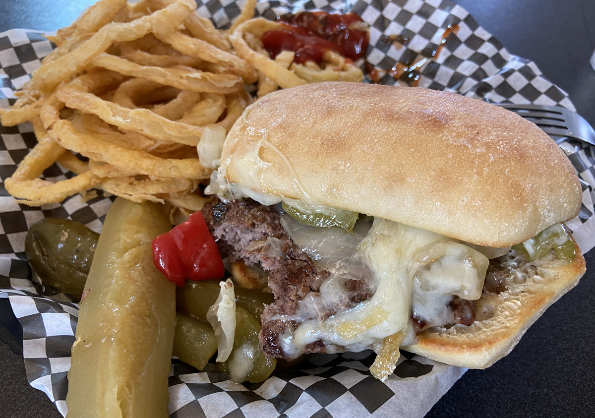
Heading up to Bristol I found the great antique shop I stopped at a few years back vacant, but since it was after 12 PM I decided to go to the Bristol Diner for lunch – you should by now know me and old diners. WELL – STOP. My Philly Style Hamburger and onion rings was $10.95, AND three times the food and less cost than the lunch I had with a friend at “Fathers” across the river from home on Tuesday. I had only been at “Fathers” once before for breakfast, and not impressed. I told the fellow I was with I have for decades judged a place by their Western Sandwich. Not sure if I would grade my lunch 2 or 3 on a scale of 10, but do not plan to try again. The drive to Bristol Diner better.
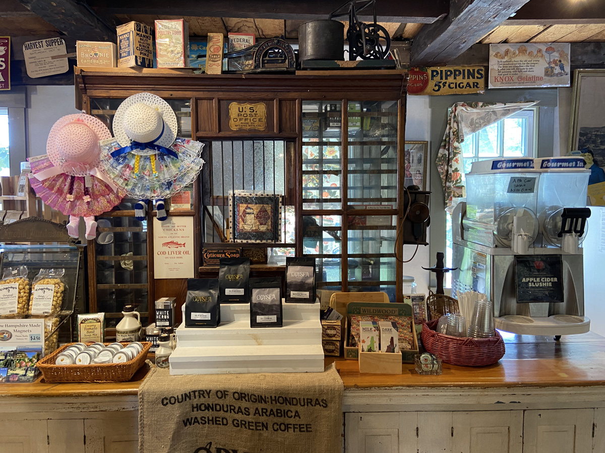
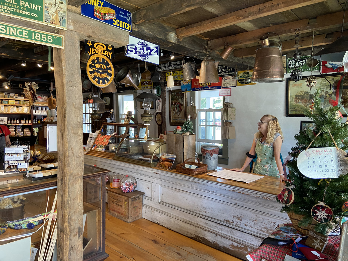
My planned route from Bristol to Polar Caves was up the west shore of Newfound Lake, first stopping at Sculptured Rocks Geological Site and Natural Area State Park. You may know that I have become fascinated with geology in the area. But first I stumbled (again) into the Cardigan Country Store – and you know I love old general stories, so stopped again.
I loved the drive up along Newfound Lake which reaches a depth of 183 feet, one of the deepest lakes in New Hampshire, and considered by some to be among the cleanest lakes in the world, My image here does not do it justice.
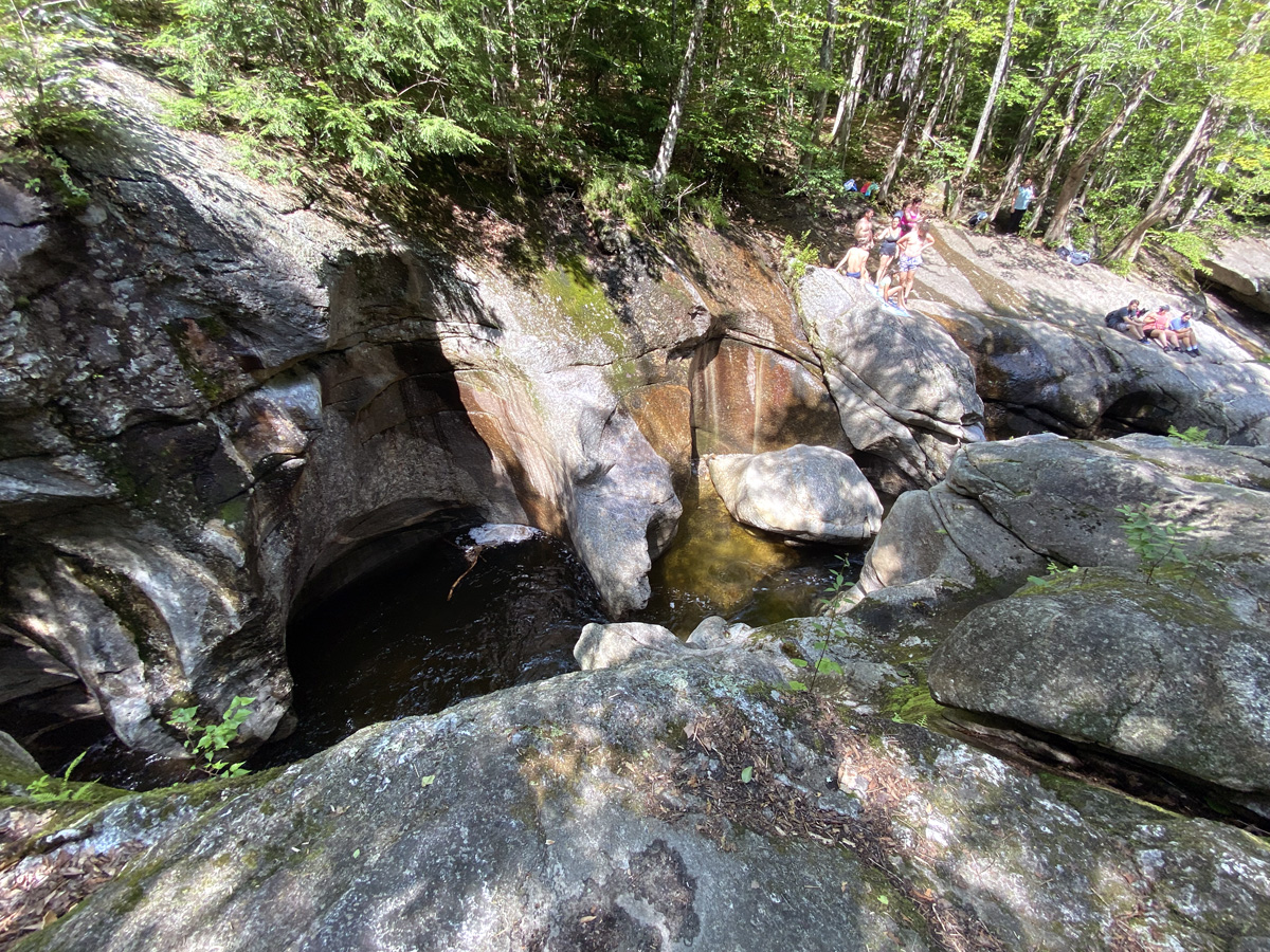
I arrived at Sculptured Rocks Natural Area in Groton. It is a 272-acre geology-oriented nature preserve featuring its namesake, the Sculptured Rocks, which are a series of narrow, sharply carved rock formations that are a popular local swimming hole. Worth a visit, but this balance challenged lad will not be found scrambling down and plunging into the water as you can see below some folks were doing.
Well over six hours drive into my original destination – Polar Caves, only an hour and a half drive – I arrived. I had been rethinking the rocky hikes, particularly after just visiting Sculpture Rocks, and in a lovely chat with the lady at the Country Store, she reaffirmed the challenges. So, I visited the gift shop (not impressed), and to prove I made it took this image of a family taking an obligatory family outing picture – I think it tells a nice story.
Sorry, this is getting to be a long post of maybe 24 waking hours. I arrived at my B&B, and in the course of conversation with Kevin, the owner, ends up thirty years after I left my home town for college, he lived around the corner from my childhood home. SMALL WORLD and we had fun. Remember that lunch? I never even went out to eat – Kevin laid out some great cookies – I had three. My room below was quite comfortable.
Do you think I had a great day? I did. Think I can top it? I did. Hope you continue on with me for discovery and a “new love.”
In the evening I spent three hours in the library reflecting on the day, reading, and son, David, Face-Timed me. I visited with Kevin and another couple – such fun. How many times have you received an advance breakfast menu at a B&B? Never, I bet, I haven’t. Amazing breakfast, and worth the trip back. I think Kevin substituted a crab cake under the lobster for the muffin. Could be wrong, but think that is what he said.
Not wanting to “miss the boat” I departed at 10AM for my 11AM cruise on Squam Lake.
I am again “in love” – this time with Squam Lake. Think “On Golden Pond” – time to watch the movie again. The cruises are offered by the Squam Lakes Natural Science Center and I now “highly recommend” this outing. I will have to return to tour the center. I arrived about a half hour early, chatted with folks, and went to board. First below, looking down at the tour boat, and then back to the “office.”
a map of the 90 minute tour (not three hours, and no MaryAnn). Dock is in Little Squam Lake (lower left corner) which we entered before turning back and touring Squam Lake.
Casting off we first headed under the Route 113 bridge into Little Squam Lake passing these boathouses.
Then looking back to the bridge and few shops, on the right is a boat business. During the filming of On Golden Pond some actors had a fight, one took off and smashed a boat into the brown building in the center of the image. It was captured on film by the crew on the bridge and worked into the movie, Tony our driver and guide told us. Tony was great and I wish I could remember all he shared during the trip.
Then it was off to enter Squam Lake, passing these boat houses.
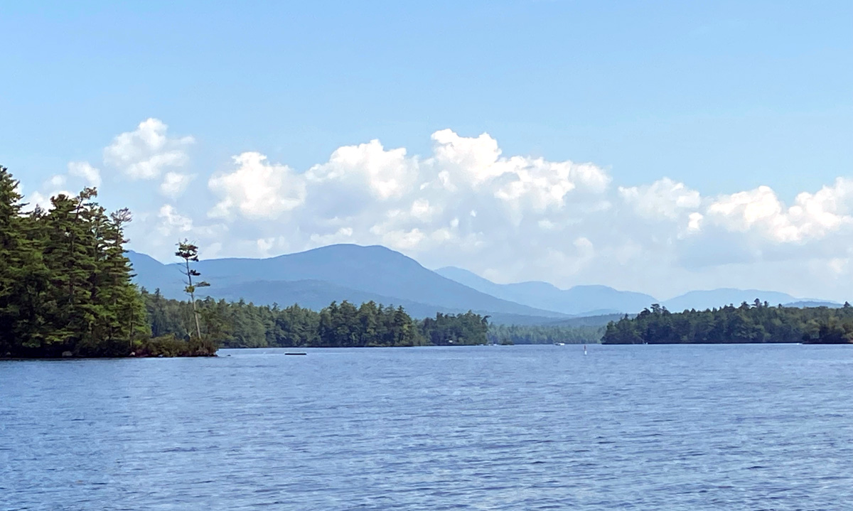
As I recall this is the Squam Mountain Range – amazing in all 360 degrees.
Church Island – Sunday services, weddings, and peaceful outing location.
Tony pulled up to a comic canoe race (below) that was about to begin. I believe it was another spot along the shoreline, but he pointed out a bucolic “camp” – ROCKYWOLD DEEPHAVEN CAMPS, established in 1897. Now ON MY LIST, and hopefully I will be able to experience in September.
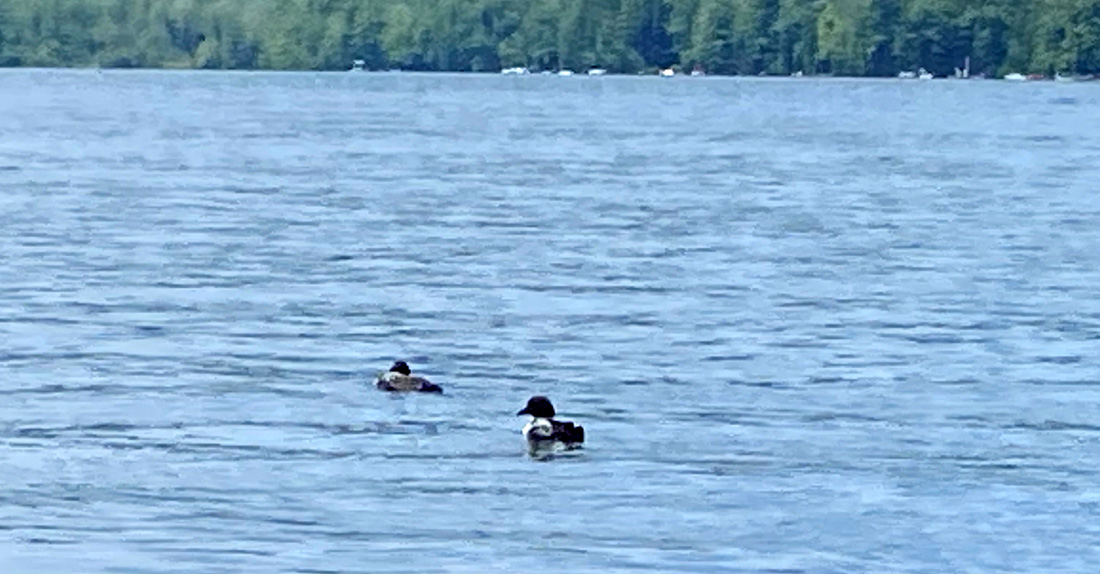
another island, and we were lucky to see a pair of the famous loons.
Did I say I was “in love” again? YES – and I look forward to booking a cabin at ROCKYWOLD DEEPHAVEN CAMPS, and taking another Squam Lake Cruise. Just over an hour ago I received an email from the Squam Lakes Natural Science Center asking me how I liked the cruise, and to please fill out the survey or send an email. Well, you know that I will email with praise, and a link to this post. I will be back.
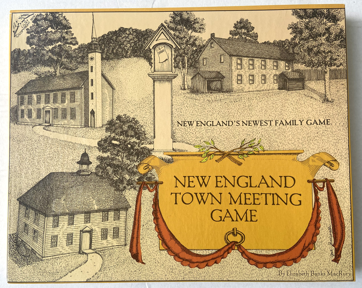
But then it was off home, but not directly, of course. Stops for antiquing, but sadly even more places I used to visit are now closed. But I discovered one on a road I had not been to before, and the owner “made me buy” (remember my 1957 RCA Victor Art Deco TV last week?) a Pennsylvania Railroad Torch lamp. Not sure if a signal, or to heat and thaw frozen equipment, but now a memory and treasure of this trip. And then at the Laconia Antique Center I had to buy (since never saw before) the 1979 game NEW ENGLAND TOWN MEETING GAME. Looks like fun, another treasured memory. I will play the game, but it may be useful in one of my upcoming projects, or as a town official training aid. Click the image to see the full box cover.
The Laconia Antique Center is in an old department store building and they have preserved the lunch counter, which I must share below.
I forgot how much fun, and how much I can accomplish in 33 hours away (and almost eight of those hours were sleeping)
My last planned stop for this overnight was based upon a New York Times article from June 16, 2003 – year correct – yes twenty years ago, not two months ago. I have another project in the works, hopefully to be accomplished in March 2024, but at worst April 2024. Something had happened in Northfield, New Hampshire, in 1995, and I needed to find the location.
While at Northwestern, high school friend, Leland, visited me one weekend in 1966. His quest – find the grave of Al Capone. Where do you start in Chicago pre-internet days? Well, you walk into the Field Museum of Natural History, go to the information counter and ask. Not only did the gentleman know which cemetery, he told us where to find the grave itself. Since then I have always had the good fortune when asking my offbeat questions to obtain the answer to my query from the first person approached. Again, it did not fail.
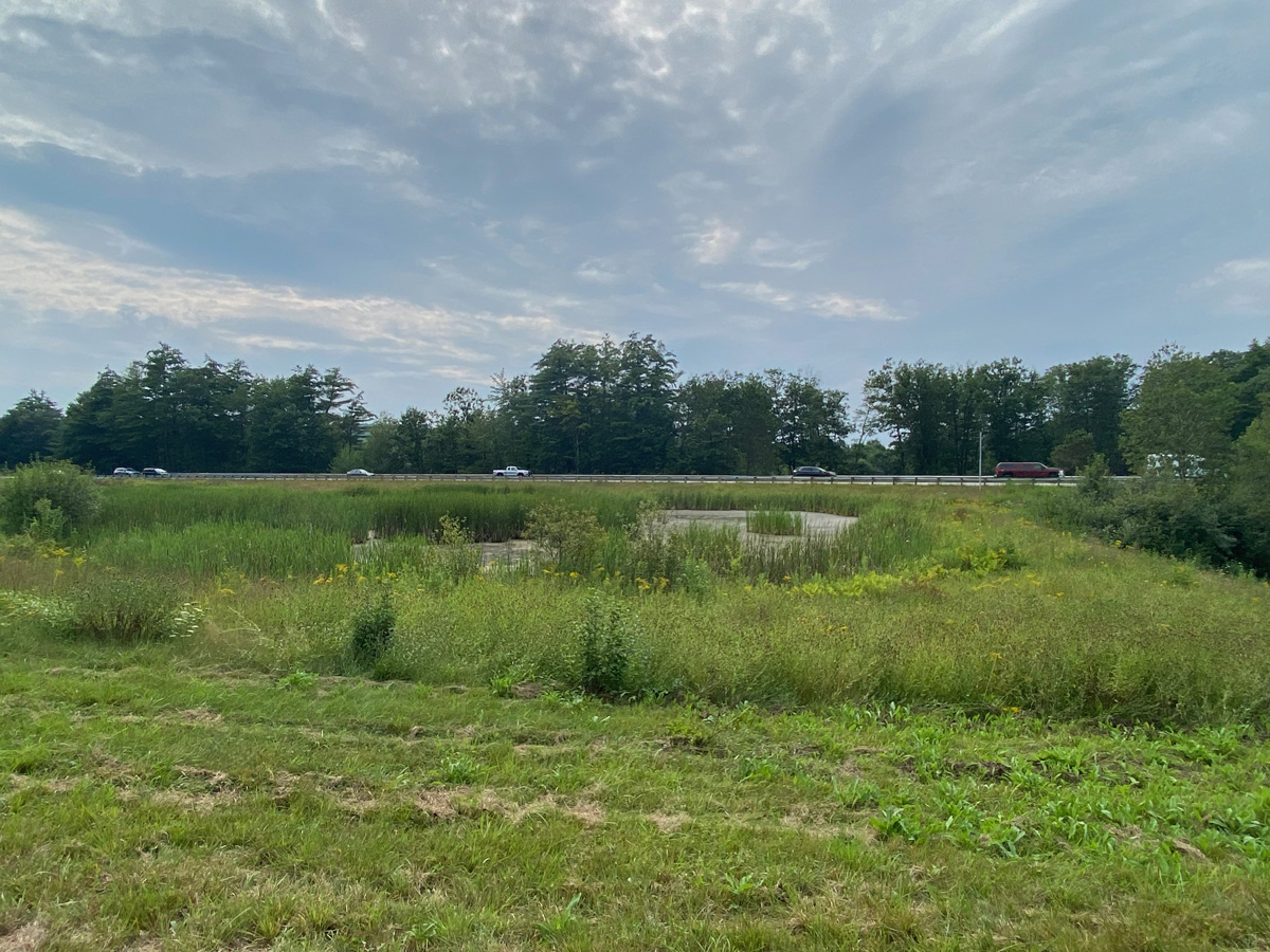
Arriving in Northfield, I was looking for the Town Hall, but seeing a police car, followed it to the station (remember, besides Town Halls, Police Stations and Post Offices are great sources of information). But the officer got to the door before I had parked. The sign there said, public entrance around front. I get there, sign says hours are until 3PM – it is about 3:20, I peer in the window glass, dark and see no one. Walking away I hear the door open, and a voice call out, “May I help you?”
I explained my quest to Officer Harris. Happening long before she was probably on the force, the event did spark a memory, and she suggested where I look – just down the road in fact. She said if she found out otherwise she would be happy to call me. I gave her my phone number, but also email address – you know me “email person.” Well, below is the spot – Exit 19 northbound ramp off I-93. I was hoping there would be a plaque commemorating the importance of this man-made marsh; but, alas, there was not, nor any “wildlife” present. Here is the marsh.
Well, bless her, Officer Holly Harris (Detective Sergeant / Juvenile Officer) emailed me confirming she had directed me to the right spot. Thanking her, I said I would send a link to this post when done, to which she replied, “Awesome, thank you!” And the fun, and nice times with others continue. Update 14 August – Holly just emailed me saying, “… I didn’t know about the boat tour on Squam Lake. I will have to check it out someday. … [and] Thanks for the shout out in your article!”
Well – hope you got this far – I am off in 45 minutes for a tour of Scott Farm, then home “to work” and later share this with you – stay safe and well, as always, luv, RAY
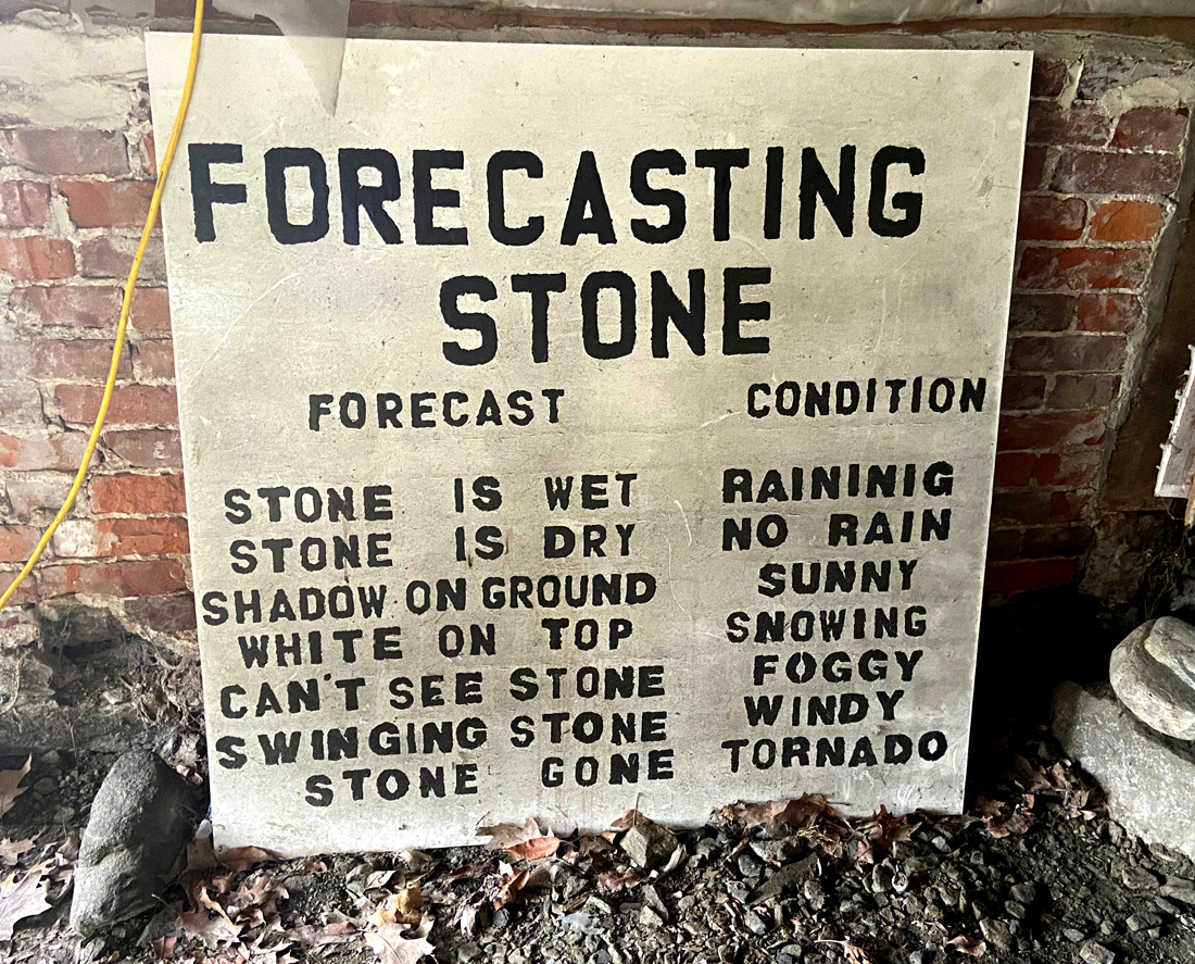
Quick PS — enjoyed my tour of Scott Farm given by Jeremy. Scott Farm is owned by Landmark Trust USA, which you know owns five amazing properties that I have stayed at multiple times. I learned a great deal about the farm. The Stone Trust (a separate group) is located on the farm, and in their class space under the old cow barn I saw this helpful sign. I have seen these helpful points elsewhere before, but being able to capture an image felt that in my quest to educate you, I must share – ENJOY
Not two weeks ago I told you how my explorations in Chesterfield, NH, came about from a 1976 booklet. Today’s four plus hour exploration came about from a TV news piece. But the genesis came earlier, and I will explain later on below. Today’s destination – Goshen, New Hampshire – population 800.
Look at your NH maps — all back roads (throw me in that “briar patch”) – and I decided to head to Alstead then 123A to the turn up the hill to Acworth. I need to again spend time relaxing at Vilas Pool, but I knew the recent rains again were not kind to the area.
the spillway and bridge again held, but immediately downstream, not so good – remember you can “click my galleries” for larger views.
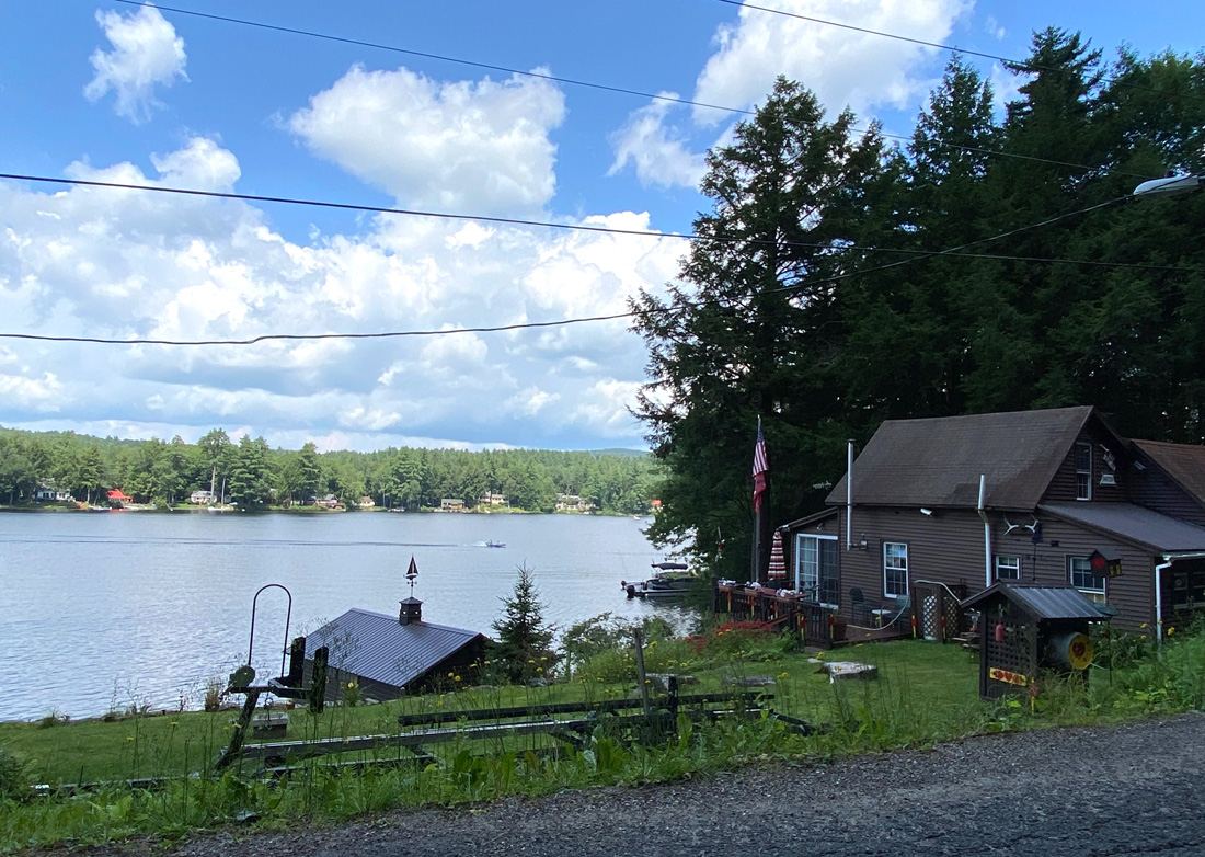
Route 123A had many side washouts with pylons marking temporary repairs. I turned left to climb the hill to Acworth Common, only to find my planned route “Road Closed.” So, took the adjoining route – well, was in general direction I desired. Ended up traversing the southern shore of Crescent Lake in Acworth and Unity. Here is the lake – many nice possible views on the south road.
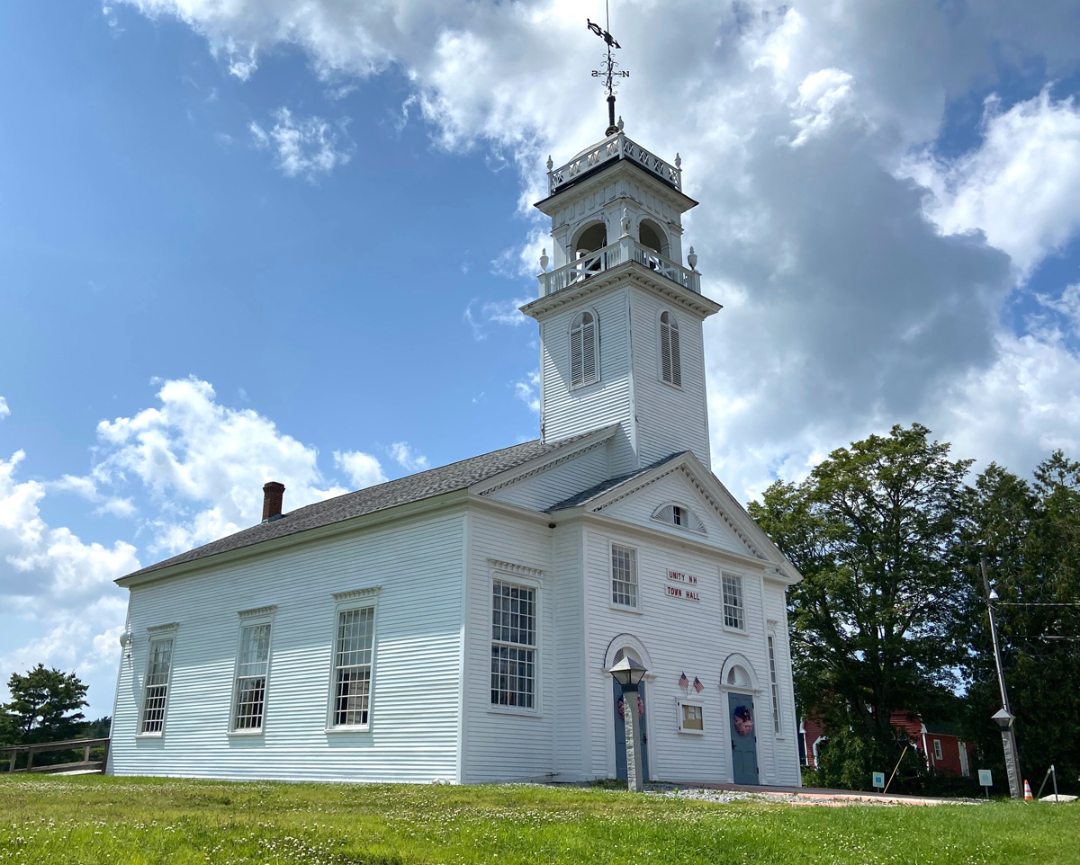
I never was a Boy Scout, but know usually where the sun’s location is a help, so guessing the correct turns, and ended up in Unity – don’t think I had been there before. Perfect Meeting House.
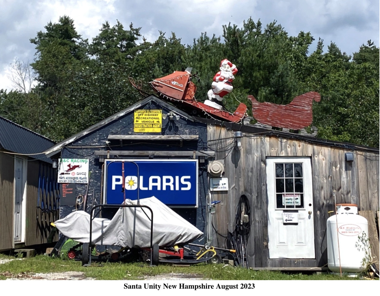
You may realize (and should) that in the last almost year I have become fascinated with “Blow Molds” and have acquired a few special ones. Well, fortunately when turning around to capture the above image I saw a small snow-mobile shop. I have posted this image on the Facebook page “Blow Mold Nation” and expect it to go viral.
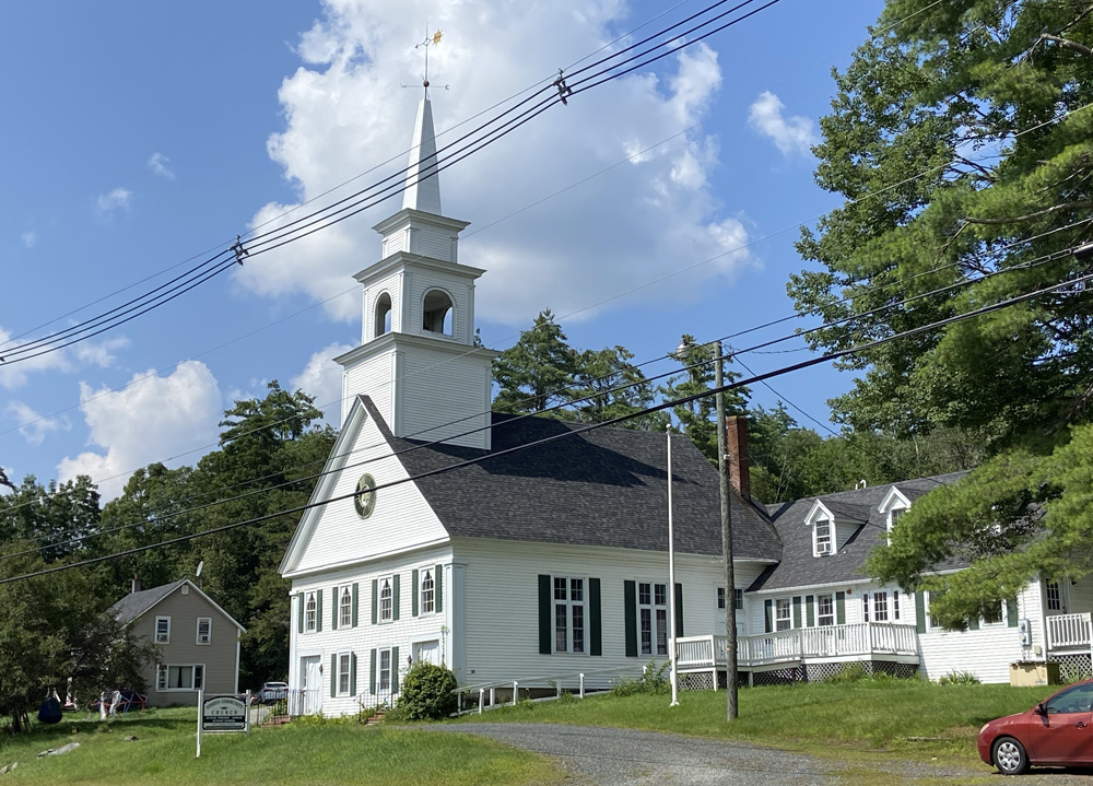
Finally I ended up at an intersection with Route 10 in Goshen (never have been totally lost), which is a tad south of Newport (New Hampshire not Rhode Island). Another perfect meeting house, and mill river spot — yes Route 10 here is known as Mill Village Road.
And, my destination – The Old Man’s Junk – and in the parking lot an Airstream. I sent the Airstream image immediately to Scott and Betty suggesting a NH retirement plan.
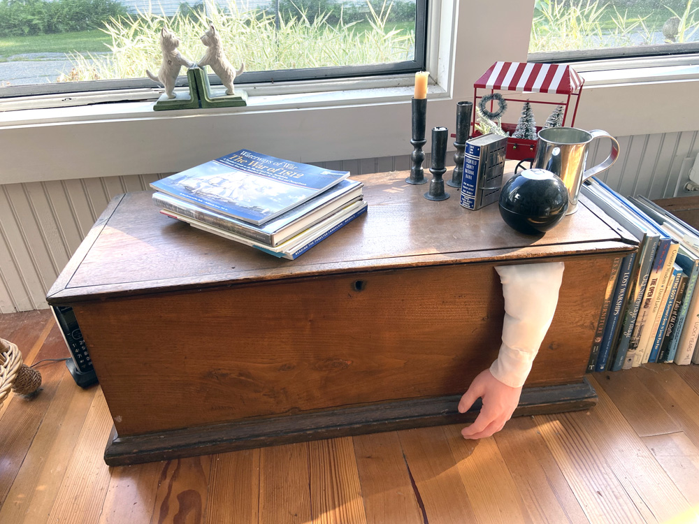
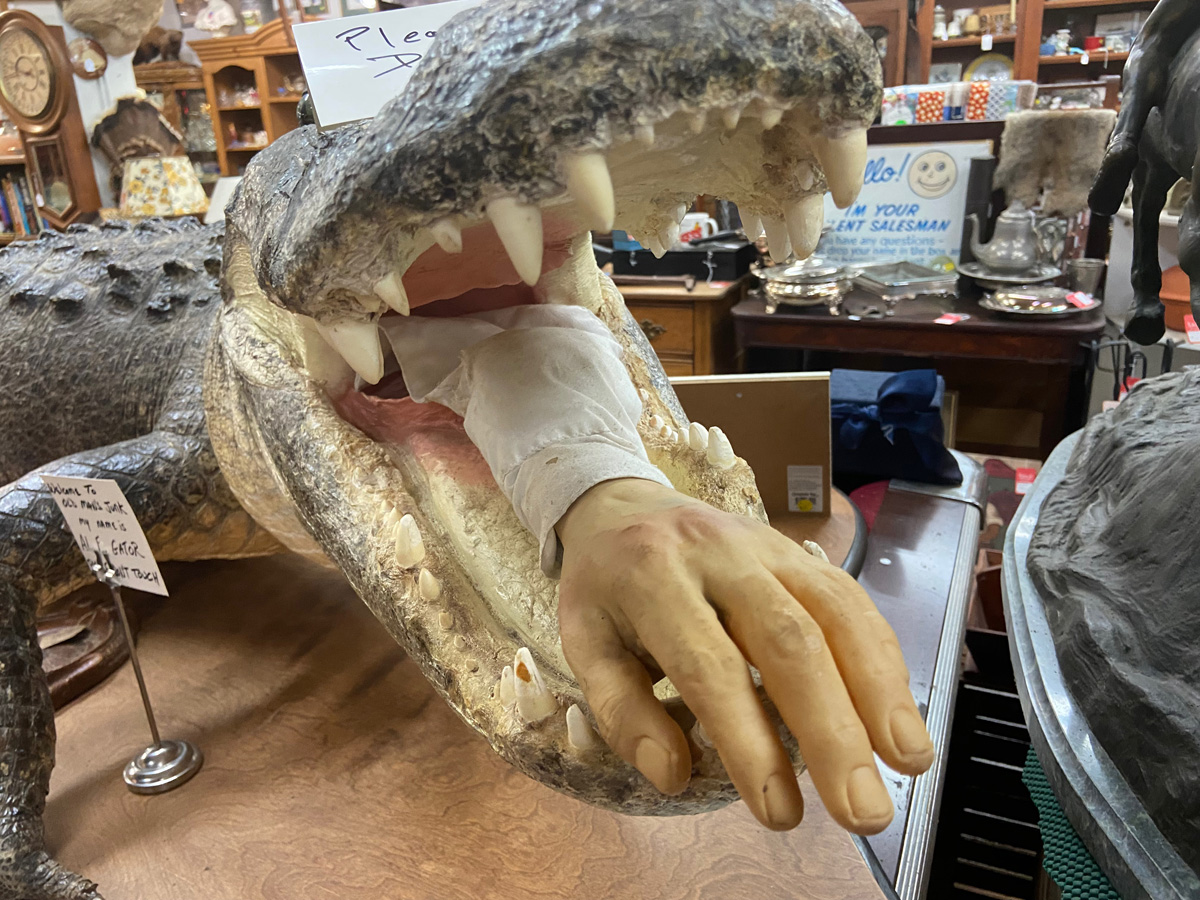
Now THE BACKSTORY to today’s outing. A couple weeks ago my 11 year old grandson visited with my daughter on their way back to NJ. Chatting on the porch, only an 11 year old would ask what I am hiding in a chest. No one has ever asked before – maybe fortunately. If the truth were known there could be incarceration.
Well, a week later my grandson received a package with a body part – I will stop there. He was thrilled. Then, earlier this week a news brief on WMUR said Goshen would be profiled. I usually never watch those pieces, but did this time, and The Old Man’s Junk was mentioned. Checking their Facebook site there was an image of a “crock” devouring a body. I sent that image to my grandson, but had to visit to see “for real.” Here is “for real.”
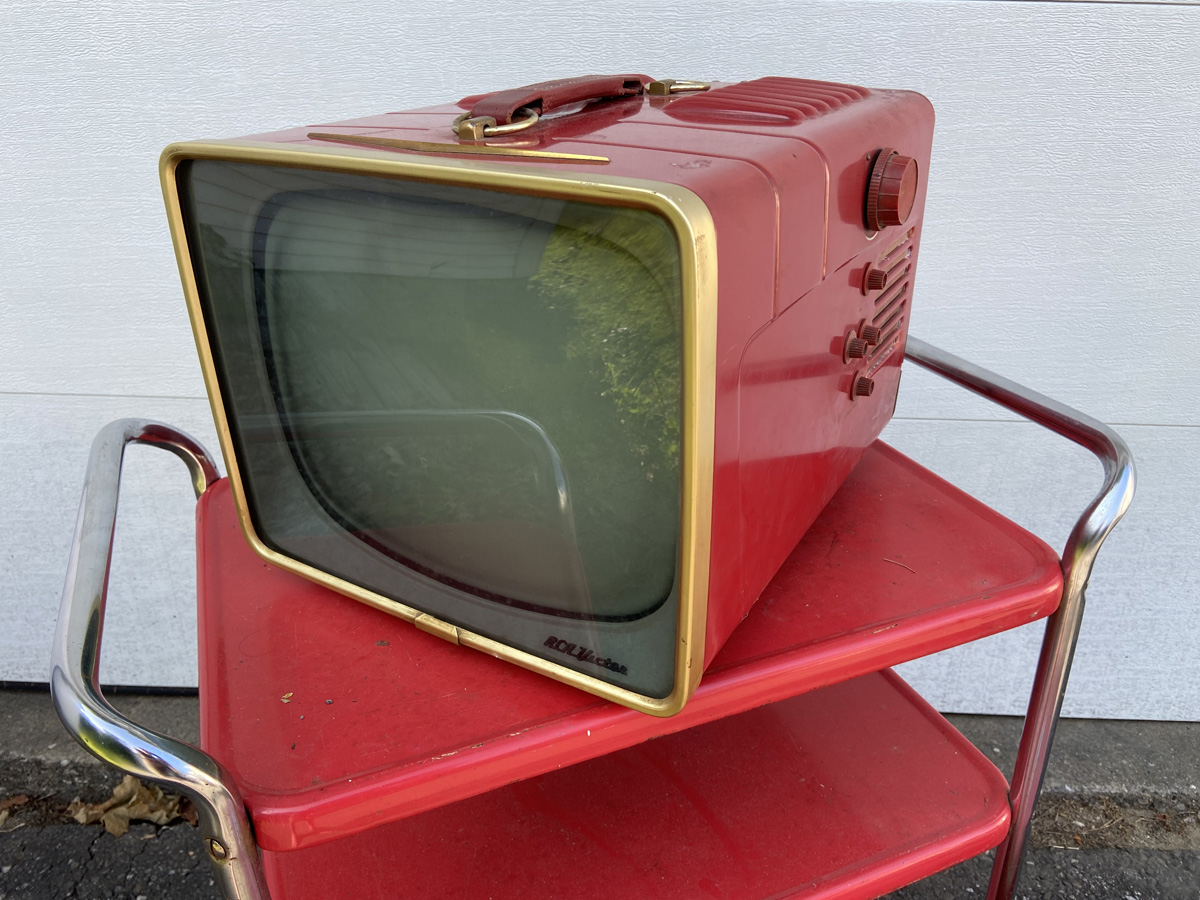
But, I “flipped out” in the back building. You know the last couple years thanks to COVID, I have pursued vintage “canned ham” camping trailers, and collected the appropriate accessories – strangely all RED. There it was – a vintage RED portable RCA Victor TV – price $55. The shop owner was nearby and I asked him about it. He said, “how about $40?” — HE MADE ME BUY IT. But I asked him to load it into BLUE BELLE.
Fortunately a friend “begged off” on joining in on this adventure. Good for her, because she would have had to walk home.
Getting home the research began, and I now own a 1957 RCA Victor Model 14-S 7070 portable TV. Paid a good price, a wide range, but could be yours for a six-hundred dollar bill. I have found working models for around $1500, and will see if I can get this checked out and working. Another thought is to pull out and save the “guts” and install a screen to feed video into. You see, I am giving up on living with a vintage “canned ham” (LADYRAB III Currently is for sale), but planning a vintage 1950s decor (and mostly red) addition to the bookshop. Below some of my “vintage retro red pieces” for your enjoyment, and my new “prize”.
I love doing these short posts to share – a four hour trip, and four hours reliving in writing and illustrating – “too much fun.” But I owe you posts on longer trips, and just do not get to them due to the number of images and experiences. One of my “RAYISMS” – “IF I CREATED THE PRESSURE I CAN ELIMINATE IT.” So, I have to stop beating myself up not completing:
July 2023 – St. Lawrence Seaway stops and locks 2019 – trip by ship from Chicago to NYC – still owe you Hudson River and on 2019 – left you hanging on returning on Amtrak from the west coast a great time in Pittsburgh and, possibly more – I have files of notes to share.
Thank you so much for “hanging in there with me,” I truly hope you enjoy what I share, and possibly plan your own adventures as a result. Stay safe and well, luv, RAY
Extreme heat; mass shootings; and destructive weather events, including flooding, most recently again in Vermont, cause me concern for the well-being of our children and grandchildren – we are leaving them a world unlike, and worse, than the world we entered. Hopefully you share the same concerns.
But from my little, hopefully “relatively safe” corner of the world, I am always sharing one thing my Dad taught me, “there is always someone worse off.” Thus we must always remember to be thankful for, and count our blessings. I have many such “Rayism’s,” as I call them, sharing this, and my other thoughts about life with others.
As I have mentioned, I have not traveled as much the past couple years – tad afraid to considering world conditions, and my back – but, remember “there is always someone worse off.” I made a short trip yesterday, 30 July, just to see an area that is now “worse off.”
Proctorsville, VT – Crows Bakery and Cafe – April 10, 2011
then, 16 May 2015 “Approaching the side road to Proctorsville, BLUE BELLE, in tears cried, “you always take BLACK BEAUTY’s picture at Crows. I want my picture there too.” I listen to the ladies, so here she is on that day.
Proctorsville, VT – Crows Bakery and Cafe – May 16, 2015
Sadly a few years back ownership and format changed at Crows, and it closed completely within the last year or more. Now, 30 July, looking across the torn up street, while I was sitting in BLUE BELLE, here is Crows’ building – fate unknown due to recent flooding.
Proctorsville, VT – Former Crows Bakery and Cafe – July 30, 2023
actually, I was surprised to find Proctorsville’s Main Street open and passable. The bridge had held, but train tracks were torn up. Rubbish circled the old church to the right of the former Crows’ building, and the next several houses appear to no longer be habitable.
This week I should take an overnight or two, but most likely will not. I am enjoying planning trips, and not quite sure why I am not taking off on the “drop of a hat” as I used to. But I have ideas and notes spread about, so who knows. I do have to finish touring you along the St Lawrence Seaway and River and through the locks, so I do travel reliving my adventures writing about them to share.
Just my thoughts, concerns and comments. I welcome your comments on our “changing world.” Stay safe and well, and send me some short trip temptation ideas. Yours, luv, RAB
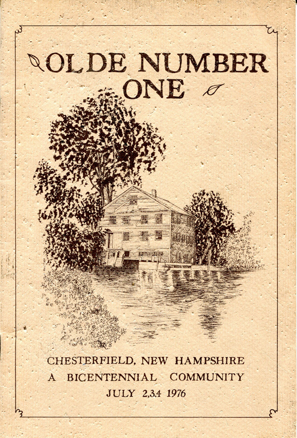
Ever wonder where I come up with some adventures? An idea can come from anywhere, and this week I purchased a booklet, OLDE NUMBER ONE – CHESTERFIELD, New Hampshire – A BICENTENNIAL COMMUNITY – JULY 2, 3, 4, 1976. Why not? As grants were given along the Connecticut River, they were numbered 1 to 4. Chesterfield is Number One, Walpole Number Three. Sadly, but 15 miles away, I have not really explored Chesterfield, only driven through on Route 63. With the centerfold map in this booklet (all guide or travel or history booklets should or must have center-fold maps) I knew I had to explore there. BLUE BELLE agreed, and off we went for 54 miles in 2 1/2 hours today.
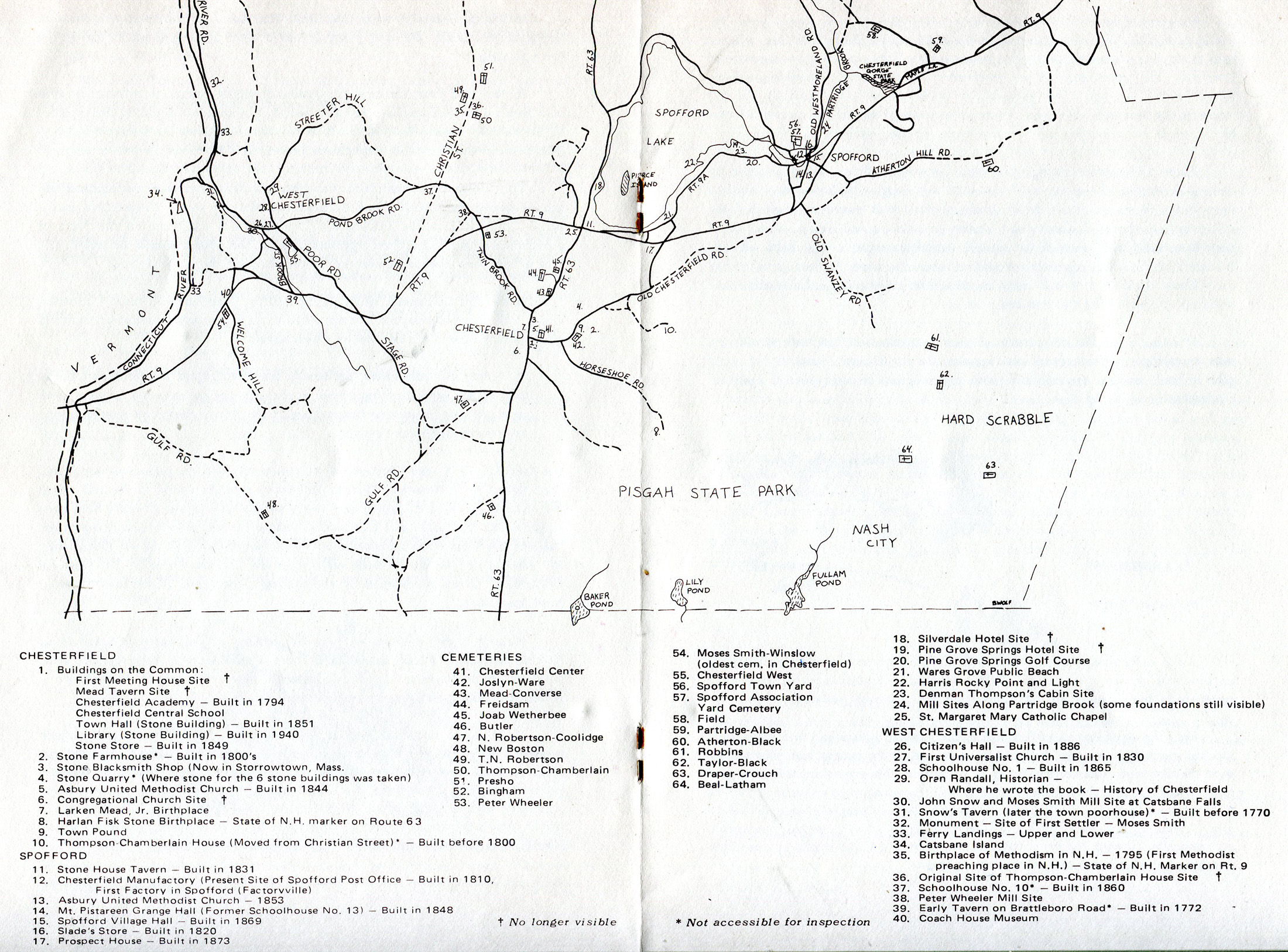
the center-fold map that prompted today – click to enlarge.
Founded in 1752 (same year as Walpole) Chesterfield’s population was 3,552 at the 2020 census. It includes the villages of Spofford and West Chesterfield, but appears even more rural than Walpole as I can attest after today’s partial explorations. Of interest, and I always enjoy exploring them, there are 24 cemeteries in the Town. And the Historical Society has a great website that you should visit.
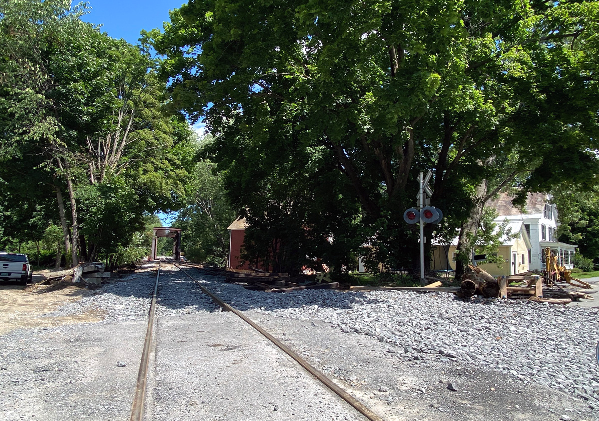
For this visit I drove down River Road along the Connecticut River, and turned west on Route 9 towards Vermont. But just before crossing the river, for the first time I turned south at a small business building with the Riverside Hotel behind it on what I believe is Mountain Road, following the Connecticut River, muddy after the recent flooding. I knew the road eventually ended, and when it did with a bar across the path in the woods, I turned around. And then, coming back, I saw the Route 9 bridges, and the hotel — I had no idea of its size and view on the river.
The plan (and BLUE BELLE approved) was to head off on Gulf Road (DIRT) from the hotel. Cannot wait to get back – yeah dirt with a stream off to the side (careful you do not fall off to the side). Remember to click my images for a larger view.
Did I say 24 cemeteries? I turned onto Herrick Road to get to Welcome Hill Road that comes off Route 9 (Keene to Brattleboro). Herrrick Road had been washed out in many places with the recent rains, but BB2 and I could squeeze by. At the intersection of Welcome Hill Road and Route 9 (barely visible to the rear below) is the oldest cemetery in town – West Burying-Ground, also known as the Moses Smith, which was deeded in 1772 – 251 years ago.
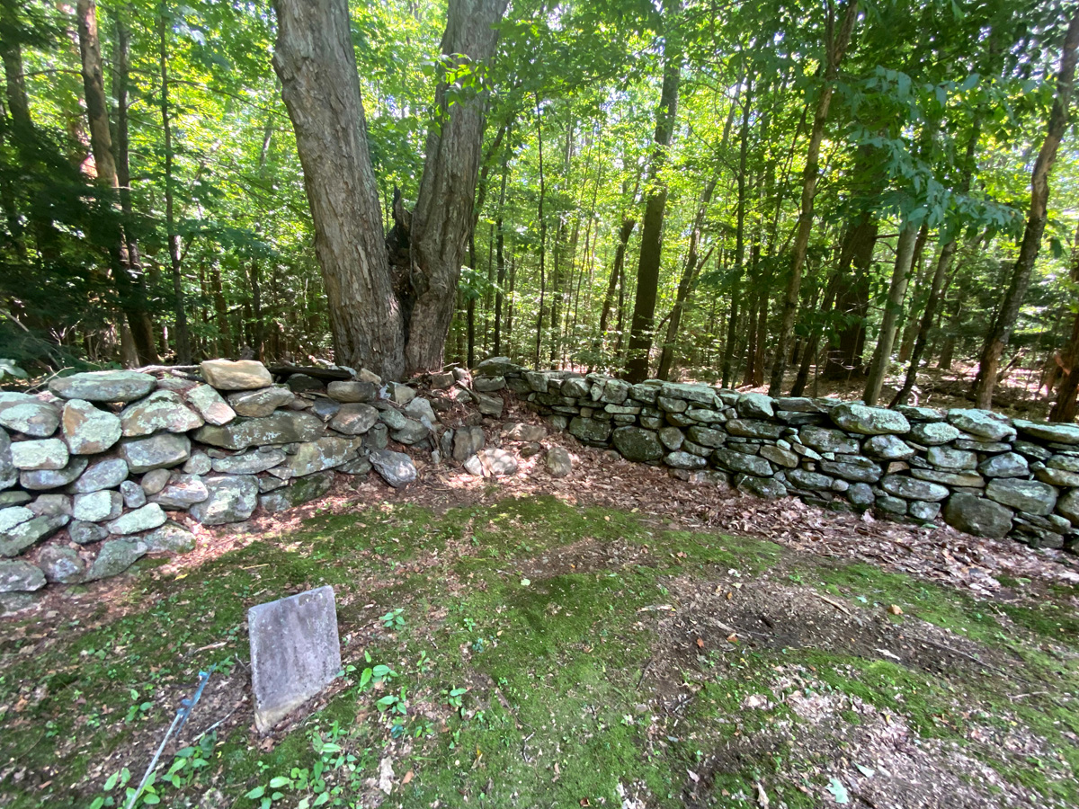
We turned back down Welcome Hill Road to Herrick Road, and then continued on Gulf Road, cutting over to Stage Road (need to re-explore here), and then to Route 9 turning east until coming up to Twin Brook Road to find the Wheeler Burying-Ground whichcontains 19 known graves, ranging from 1821 – 1921. I believe I have told you I am studying stone walls. The stone wall enclosure here is absolutely amazing.
We continued on Twin Brook Road to Route 63, just north of Chesterfield’s Common with its stone buildings.
Turning left at the Common, I never realized that it was a through road – Old Chesterfield Road, and yes off to another cemetery, the Town Pound and the site of the quarry for the stones for these buildings. Passing the cemetery I found the old Town Pound, but according to the 1976 map the quarry is “not accessible for inspection” and I saw no evidence. Here is the Town Pound – next trip I will dis-mount BLUE BELLE and inspect more closely.
I crossed Route 9 to Spofford Lake, into Spofford itself, and then a back road to Westmoreland, connecting with Route 63 and home. Once home, and looking at many maps, I see I missed some roads. I WILL GO BACK FOR MORE EXPLORATIONS HERE – you should do the same, and are welcome to join me. Let me know if you wish a clear PDF of the 1976 map and points of interest.
Remember, even in your own back yard there is much to discover and learn about – get out and explore, luv, RAY
PS – waking on Monday I realized I should tell you about two Chesterfield features that cover much of its southern land area: PISGAH STATE PARK and its trails, and MADAME SHERRIE’S CASTLE and forest. In June 2015, I visited the castle’s remains and the area, and you can click here to read that report.
I have not physically traveled much in the past three years, but have certainly read and planned future adventures. This February, when entering Lisai’s in Bellows Falls, on the shelf where newspapers are left was a copy of the March 2023 SMITHSONIAN MAGAZINE. The subscriber had clipped the address label and left it to share – most likely for me. Once home, on page 82, I read a small ad from the St. Lawrence Cruises Lines. Having never heard of them before, I immediately went on line and read about their small ship and trips. Next day some emails back and forth, and the next day my check was “in the mail” for their Canadian Connection Cruise from 6-12 July.
The planning fun began, but soon, so did extreme pain in walking return. Figuring that again I had nerves cut off in my spine, I was able to get an appointment with my back surgeon who said I eventually will need a third lumbar fusion. But, my MRI showed a cyst on my spine that most likely was cutting off the nerves causing the pain and walking problems. I was offered a “temporary fix” – rupture the cyst, and that is what I had done on 21 June. Hours later walking without pain, and two weeks later in the car to Canada to sail the St. Lawrence Seaway and River from Kingston, Ontario, to Quebec City. Once done I will have been through all locks on the Seaway, and have traveled completely by water from Chicago to Southampton, England.
This adventure I will write about in three segments to remember and share. This post will be my positioning on 5 July on the Canadian border, and my return home after the cruise. The cruise itself I am going to split into two segments: 1-the stops along the river; and 2-traversing the seven locks of the St. Lawrence Seaway. I had several options to drive and stay close to the Thousand Islands bridge to Ivy Lea. I decided to find a B&B in Sackets Harbor. Here goes.
NY Thruway to Utica (sorry) and back roads working over to Route 3 along the shore of Lake Ontario. I have now driven just about the complete shoreline. In this area there are many creeks emptying into the lake, and the surroundings are dotted with fishing camps and businesses to support those sportsmen. I had selected an overnight in Sackets Harbor because I need to learn more about the War of 1812, and this was a key spot.
This monument in the center of the battlefield park reads “In memory of the officers in men who served on this frontier during the war of 1812 and to mark the battlefield of Sackets Harbor May 29, 1813.”
Looking from the park north to Canada.
This is the commandant’s house and now a museum.
Of course, the day I arrived, village founder Augustus Sacket’s historic home, now the Sackets Harbor Visitor Center, was closed. Reason for a return visit.
The main street is amazing with inviting restaurants and shops.
I did not realize when booking that my B&B was right downtown. Located just across the street from the building with a red roof, I will continue to carry my drone with me.
For all of $95 – yes $95 USD — best B&B I have had – THE SACKETS HARBOR B&B, Mary and her husband were great. Plan a visit soon. I will be going back. Remember you can click on an image in my galleries for larger views.
On July 6th I crossed the border, drove to the Kingston, Ontario, Via Rail station to park my car for a week. Five hours later I was aboard the Canadian Empress and leaving the dock. But I will separate the next six days into two tales, soon to be linked below:
SAILING the ST. LAWRENCE SEAWAY and RIVER from KINGSTON TO QUEBEC CITY SAILING THROUGH THE LOCKS ON THE ST. LAWRENCE SEAWAY
So, now to 12 July, and heading back to Kingston from Quebec City by Via Rail. I had several train schedule options. A 3PM train could be tight (ends up I could have made it), and the 8 or 9 AM the next day would mean overnight in Quebec City (I have visited four times), but a later arrival to Kingston and home. The 5PM train to Montreal staying overnight there seemed the best plan, and best option to travel business class and be “wined and dined.” A short cab ride to the station, I checked in and then headed to the business class lounge. Here is the main station room, and then a gallery (which you can click) showing my train and business class car – this is my single seat on the right.
Goodbye QC – I will be back. Below looking east over the harbor.
On the Canadian Empress I should have documented all my amazing meals including soups, salads, and deserts with a photo essay. Sadly I did not – next time. VIA RAIL meals alright, institutional, and I chose the pasta over the fish. Wine and drinks flow, and time nicely passes for three plus hours.
scenery not like out west, but I had fun following the route on the VIA RAIL website, tracking location, time between stations, and speed – up to 160 KM/H (100 MPH). Outside QC the tracks cross the St. Lawrence, and run along the southern shore (inland) until crossing back into downtown Montreal and the central station. I captured the sun setting.
Arriving in Montreal after 9PM, and with a 9AM departure to Kingston, I decided to stay close to the station. My best option was the Hotel Bonadventure. Most I have ever paid (I think) for a room ($285 USD), but a six minute walk away, so no cab rides and lost time. Hey, I was only “buying” the room to sleep in for about ten hours.
I walk in and find the elevator – it says to lobby, but: Lobby on 10th floor – elevator only goes there Confused, arriving there someone on the floor says I was in the right place, go that way I check in, and am told my room is on the first floor. “But wait,” I say, “the elevator did not stop on a first floor “No,” the receptionist says, “the next floor down is the first floor with a different elevator.” I find the elevator and push 1 to go down one floor – intuitively it should be the 9th floor Addition to confusion, the room numbers on the “first floor” which I think should be the 9th, are in the 1100s and 1400s My room, 1434 at furthest end – and you would think should be on the 14th floor starting with 14.
You still with me? Getting up hours later, here is the view outside my 1st, 9th or 14th floor window. I Guess to justify $285 — “GO FIGURE.”
Less than eleven hours after arrival in Montreal I was back at the station at 8:16 AM.
this time riding “economy class” since not meal time, and what should have been just under three hours. Seats smaller, tray table in armrest and smaller. but I did have the space to myself the whole way.
The train was a half hour late, and it took almost a half hour in line at the border. That did not happen on the way up. I encourage you to study a NY state map and learn about the area bordering Lake Ontario and routes to get there. So many fun roads for me through Vermont. But while I had no rain on this holiday, Vermont was devastated, and watching websites of road closures I had to come up with new ideas for the journey home. I decided to visit Alexandria Bay, and then back road down to Utica, and cheat the rest of the way across NY state to Vermont. Glad I did. Alexandria Bay is a vacation spot, on the Lake, but unlike classier Sackets Bay is full of younger crowd restaurants and shops. And, then I saw this on the water — the Cornwall Brothers Store Museum – 1866 stone building housing a museum focusing on local settlers, early trade and commerce – you know I stopped.
I feel qualified to judge small museums, and this is one of the best I have visited – well maybe since it had so many of my interests including summer resorts, early commerce, vacation souvenirs, a Western Town amusement park, defunct, but I did not know of it, and more. And, the museum looks out to the BOLDT CASTLE in this gateway area to the Thousand Islands – another stellar reason to return.
the above is the castle through the museum’s back window. When cruising on the river, you are so focused on the castle – check out the story and history of it – you do not even realize Alexandria Bay is on the south shore – well it is small. Road trip anyone?
And, this area also saw War of 1812 action. You do not have to click and enlarge these panels, remember I do this so I can remember, and these are for me, and the books I have ordered on the war since I returned home. But you may wish to see this YouTube video I found of the Battle of Cranberry Creek. The narrator says this is the only instance of US soldiers killed on US soil during battle.
Two interesting remaining features in this 1866 store are the elevator and the bank vault which was built into the bedrock below the building serving as an anchor for the structure. At times the store also served as the local bank.
This display was fun. Here are two panels (remember you can click to enlarge). Shared here for Mr. Wrench (or Mr. Spanner depending upon which side of the pond – (aka David C.) to plan a similar event at “West West.”
and some views around the museum.
I complimented the docent, left a donation, but liking to “vote with my dollars” should join the historical society there — I shall return.
I then followed NY 12 to Utica – new to me route, and not much along the way. BUT WAIT, and curses I did not have time to turn around. The road above Boonville divided around a flight of locks. Thank you Google for the image.
well, this has been a to and from tale, and the first long adventure in years. Do stop back for the rest of this adventure which will be linked from the below — stay safe and well, luv, RAY
COMING SOONEST
SAILING the ST. LAWRENCE SEAWAY and RIVER from KINGSTON TO QUEBEC CITY SAILING THROUGH THE LOCKS ON THE ST. LAWRENCE SEAWAY
I know, I know. First off I have reported getting to this adventure, and home, but not the field trip itself; and, I know, I know, it is two months late. But never too late to show you my time again exploring with the Canal Society of NY State. The plus for me is to “relive” the experience, remember “I write to remember, but love to share.”
But, first, on Wednesday afternoon, 21 June I had my CT Guided Synovial Cyst Rupture, and all went smoothly again at Dartmouth Hitchcock Medical Center. Quick outpatient procedure, even though “put out of it” albeit for a short time. By Thursday morning pain gone in the back of my legs while trying to walk, and strength and stamina returning while standing and walking. Just came in from some yard work, and Thursday spent over an hour on my feet touring a garden with a group. No guarantee this “fix” will last long before another cyst moves into my spine, but “here is hoping.” I now feel confident about my next adventure, and the last two days completed arrangements.
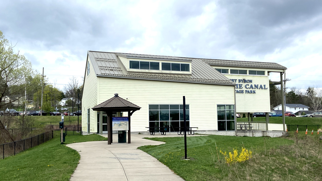
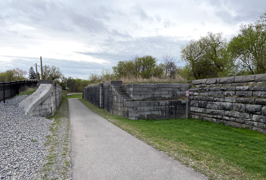
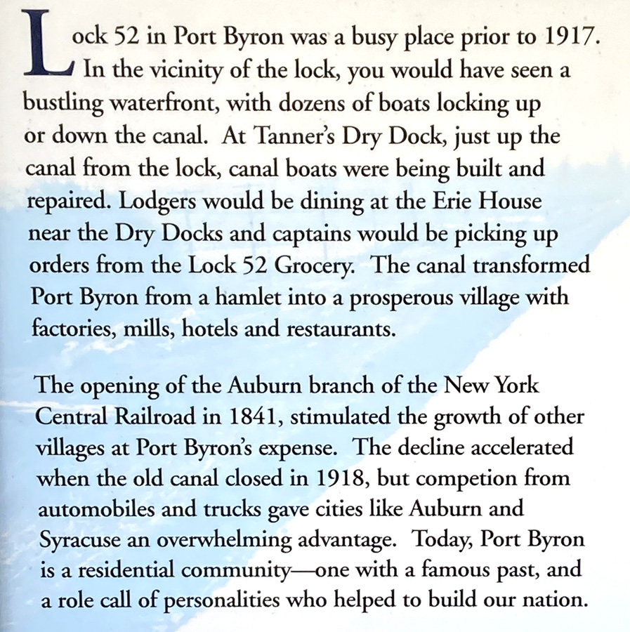
In preparing this post I finished relating the full day tour on Monday, and then realized that I left you hanging on Sunday 23 April pending my arrival for the afternoon with the group. Remember I ran hard in the morning turning over many rocks. So, Monday is below, and I will be brief with some fun images taken Sunday afternoon starting at the Port Byron Old Erie Canal Heritage Park. Remember, if heading east on the NY Thruway – STOP IN, or if on back roads in the Port Byron area, park, walk down the path, and STOP IN. This first image is the museum, looking back from the park walk from the lock.
heading down the path to the original remaining buildings at this lock site, you pass the lock that parallels the NY State Thruway.
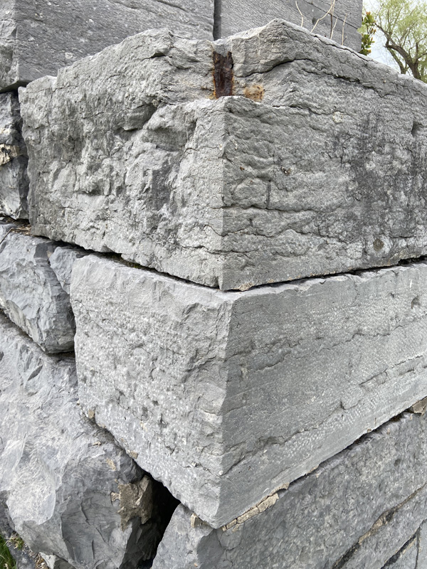
you may know one of the things I enjoy with images is texture – here is a corner of the lock.
below looking west, and yes, the Thruway with the truck heading east.
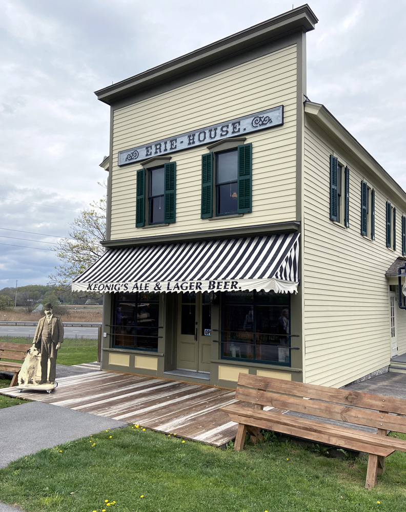
The Erie House was built in 1894 and it served as a canalside tavern and hotel. As a remaining treasure of canal days, it deserves a visit.
Below is a lamp in the Erie House. Since you should know I love old country stores, I will now share I have had two identical antique lamps like this hanging in my country store decorated book shop for now twenty-five years.
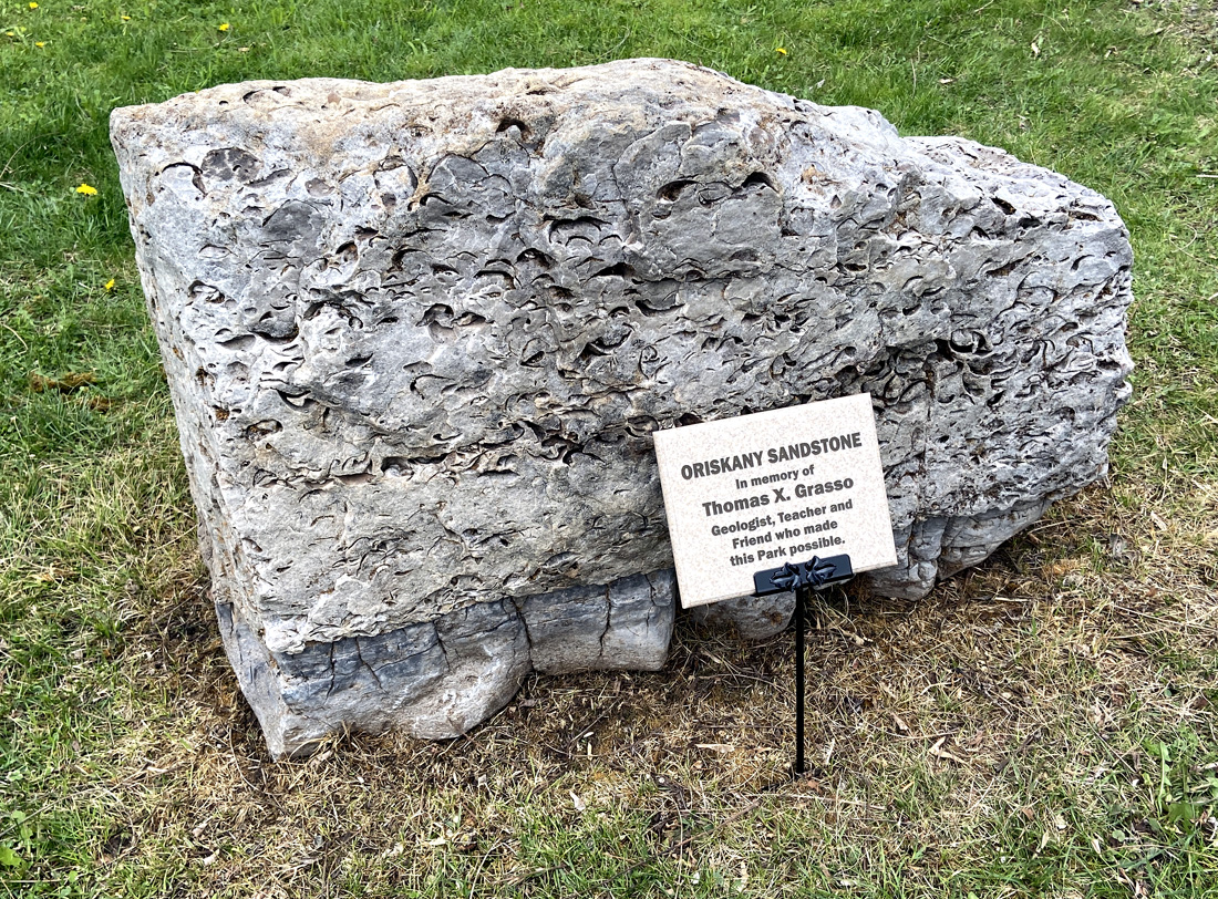
today the society was here to pay tribute to Tom Grasso for his years of dedication to the society, which was founded in 1956. This stone, packed with fossils was dedicated in tribute to Tom.
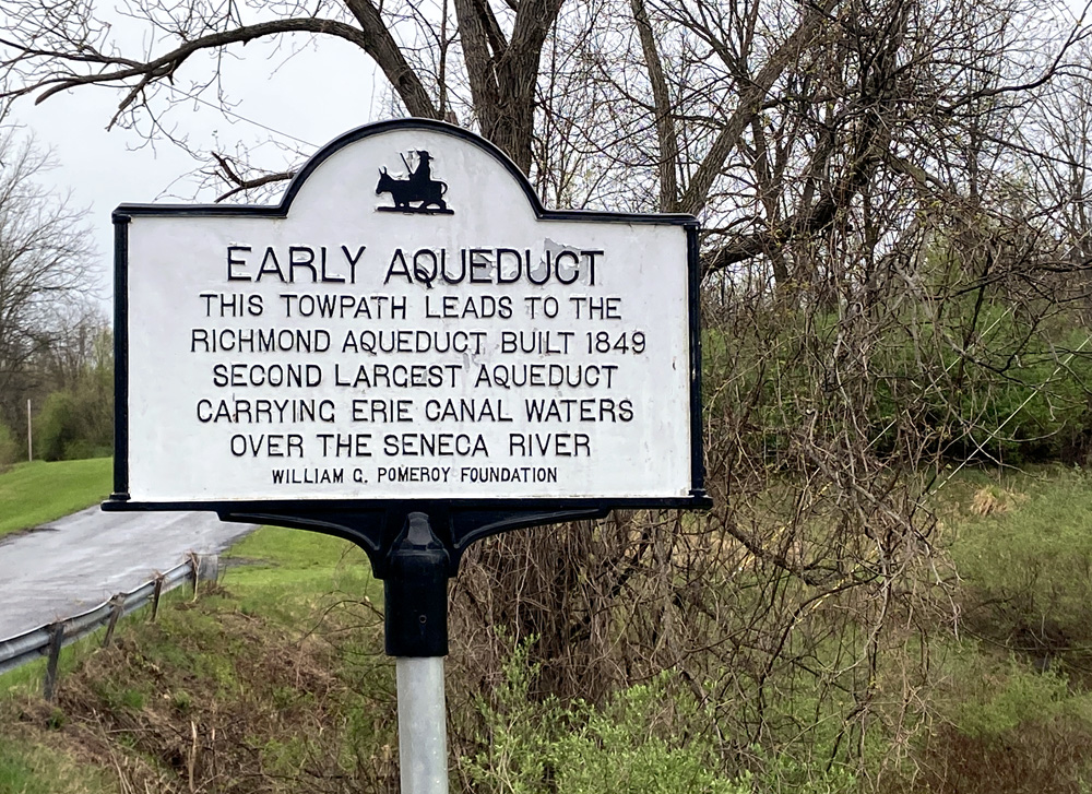
The society recently was able to establish a permanent site as a museum, library and meeting site for the society and community. We next assembled there at The Samuel Center for Canal History for a talk, and tour the grounds. The original canal towpath would have been right under the pulpit of this former church, and outside you can see the remains to a stone arch of the 1819 aqueduct. Below you see the former church, river, and next the stone remains along the bank (center of image directly below).l
amazing what still remains to be seen if you know where to look.
————————————— now to the full day
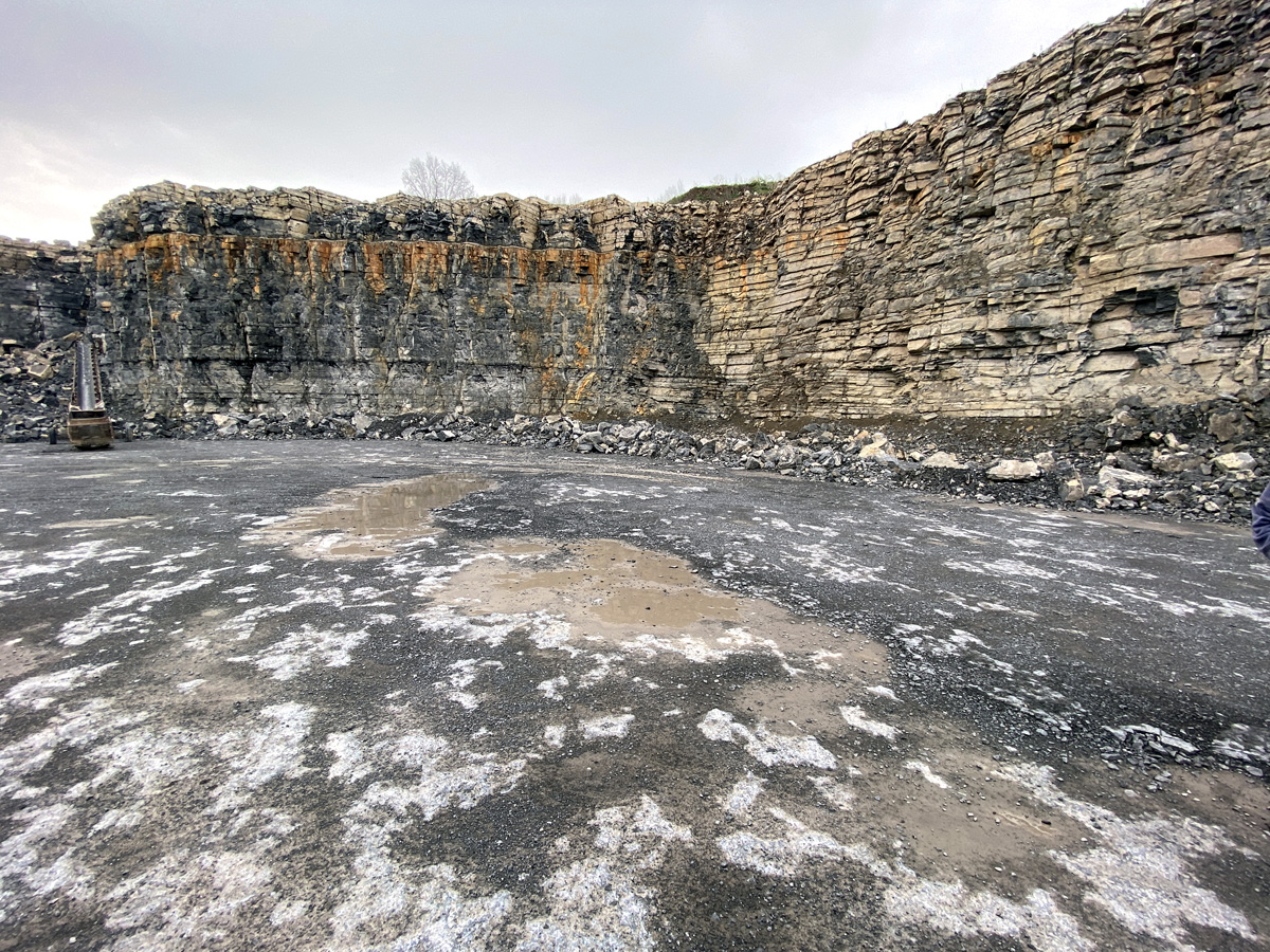
Monday, 24 April, was a full bus tour of Erie Canal sites in the Auburn and Port Byron area. We began at the Oakwood Quarry, opened in 1975. DeWitt Clinton explored this area while searching routes for the Erie Canal. Unique geology, and I want to learn more. Fossils abound – note the orange layer which is the result of ash buildup 390 million years ago – humbling and hard to comprehend.
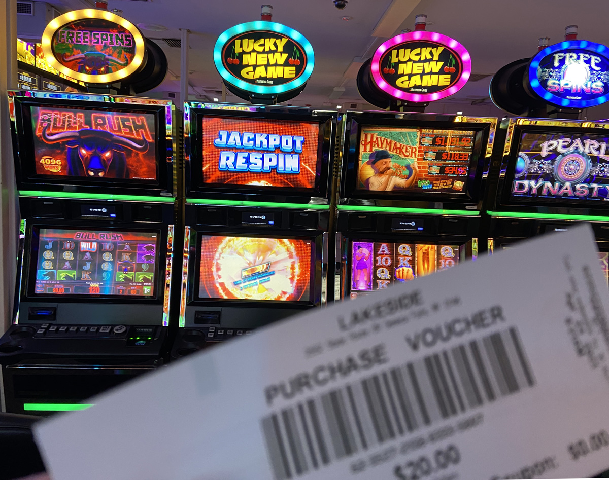
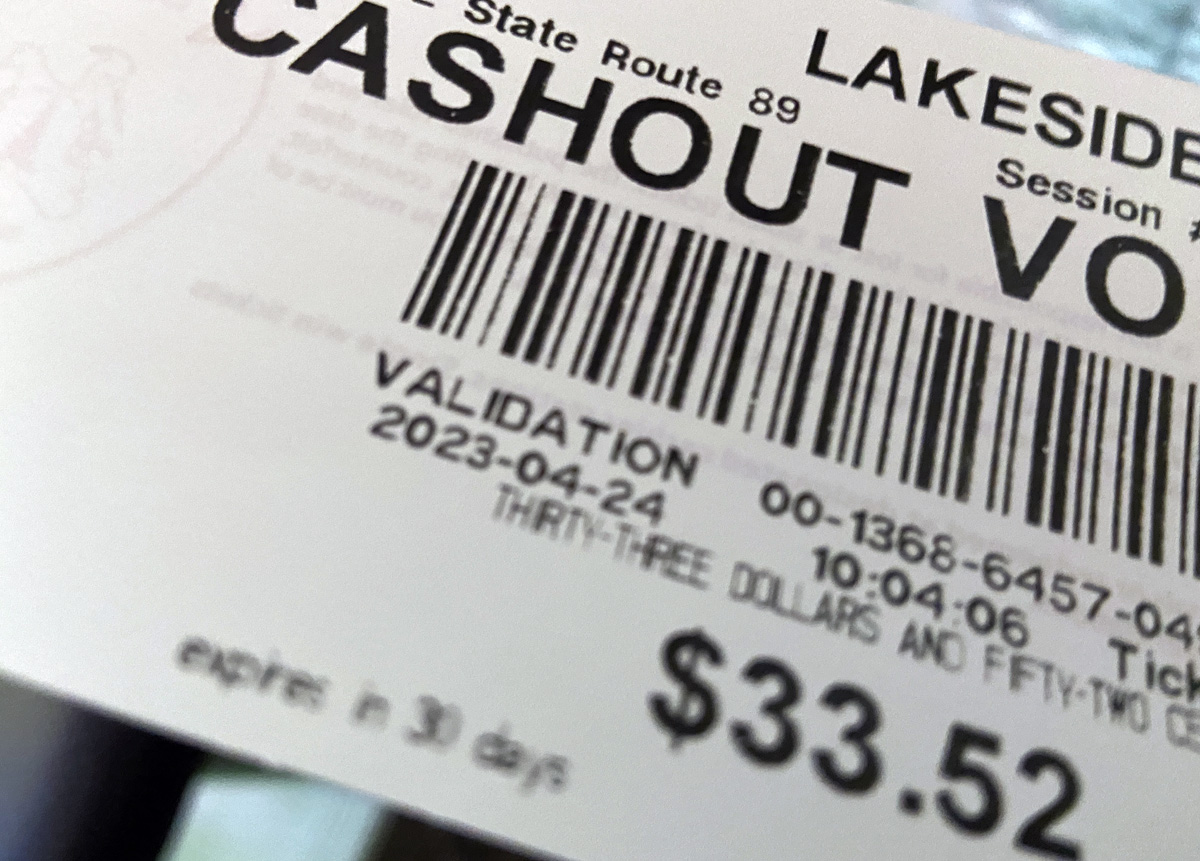
The area we are exploring is within the ancestral lands of the Cayuga Nation. We drove through the lovely landscape, and stopped and were welcomed at Lake Side Entertainment in Union Springs. A new building is being constructed, but the current entertainment (casino) is in a former auto parts store in a “butler building.” We were each kindly given a $20 voucher to “play.” I had no idea what to do, but figured out you put the voucher in the machine and push a button and watch the points and dollars go up or down. Push stop and a new paper voucher spits out with your “current monies.” In time I went to a machine in the corner, put my voucher in, pushed play, and the machine played for maybe ten minutes. Even pushing stop did not work, I thought I had broken the machine. Finally, wearing itself out, it stopped. The screen read $33.52. I figured, let me print the voucher, and cash out. THANK YOU.
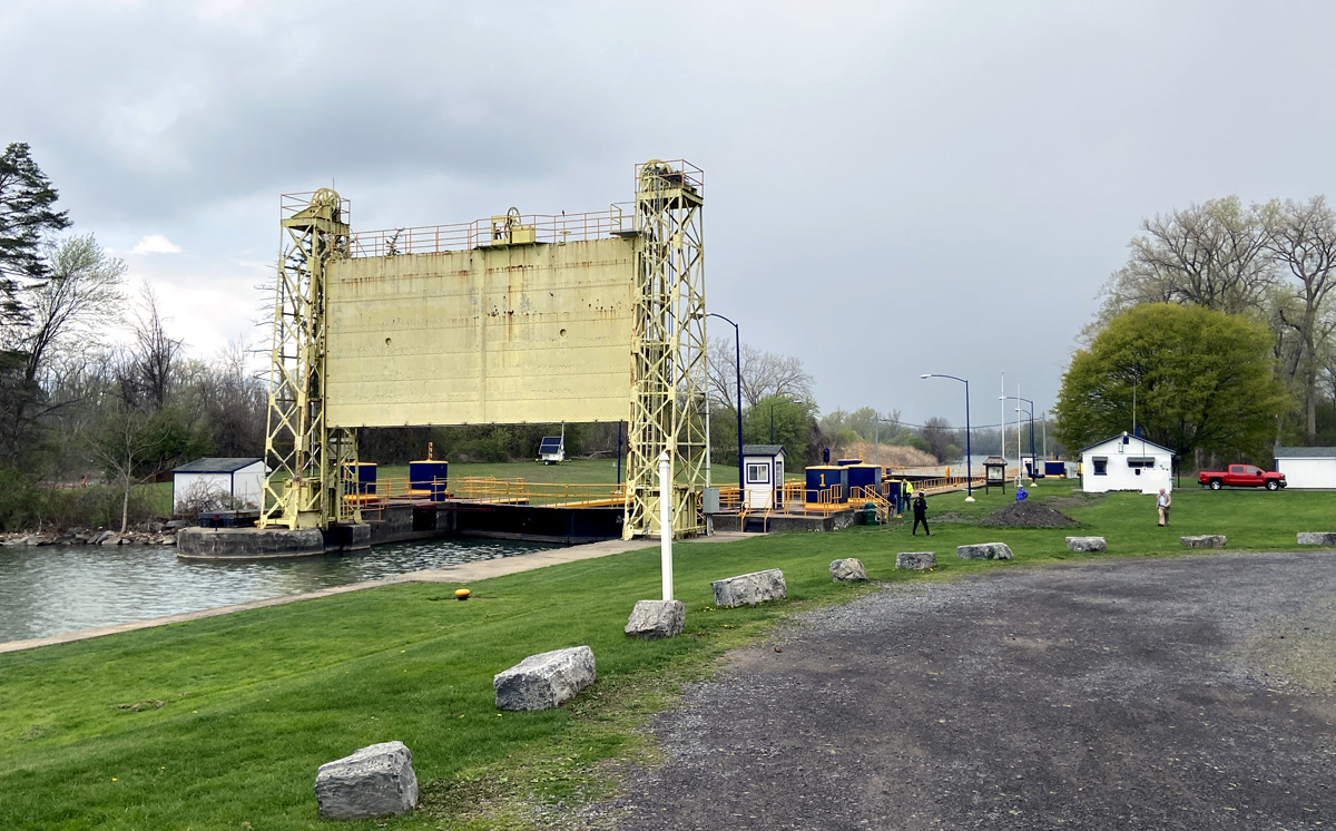
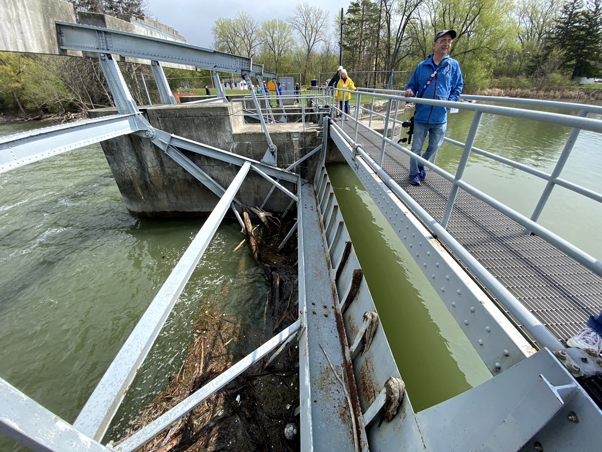
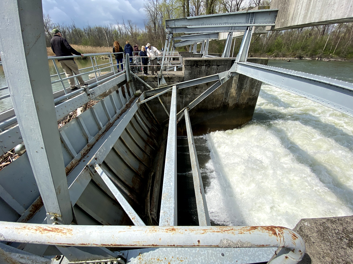
Below is the Cayuga-Seneca Barge Canal Lock, largely completed in 1916. This canal connects these two Finger Lakes, and flows north into the New York State Barge Canal just to the west of the Richmond Aqueduct ruins. You may recall on my way out I traveled again to Seneca Falls, and visited lock 2 and 3 on the canal. According to my notes on the tour, this Tainter Gate controls the level of the lakes and their flow, eventually to the Oswego River and Lake Ontario.
Here are images of Lock 1, and the gates that control the flow of waters.
close-ups of the flow control mechanisms.
below looking south towards Seneca Falls and he lakes.
After lunch we headed to Port Byron, and Schasel Park (I had stopped there on the way out).
Looking east from the park, this is the enlarged canal from the 1850s, albeit blocked off. Efforts are underway to restore it for recreational use. The original canal was built to the south (to right of image) and into a hillside. When able to build into a hillside construction was only needed to one half of the excavation effort, building up on only one side – smart. Draining of canals in the winter kills plant life that if allowed to grow would clog the canals.
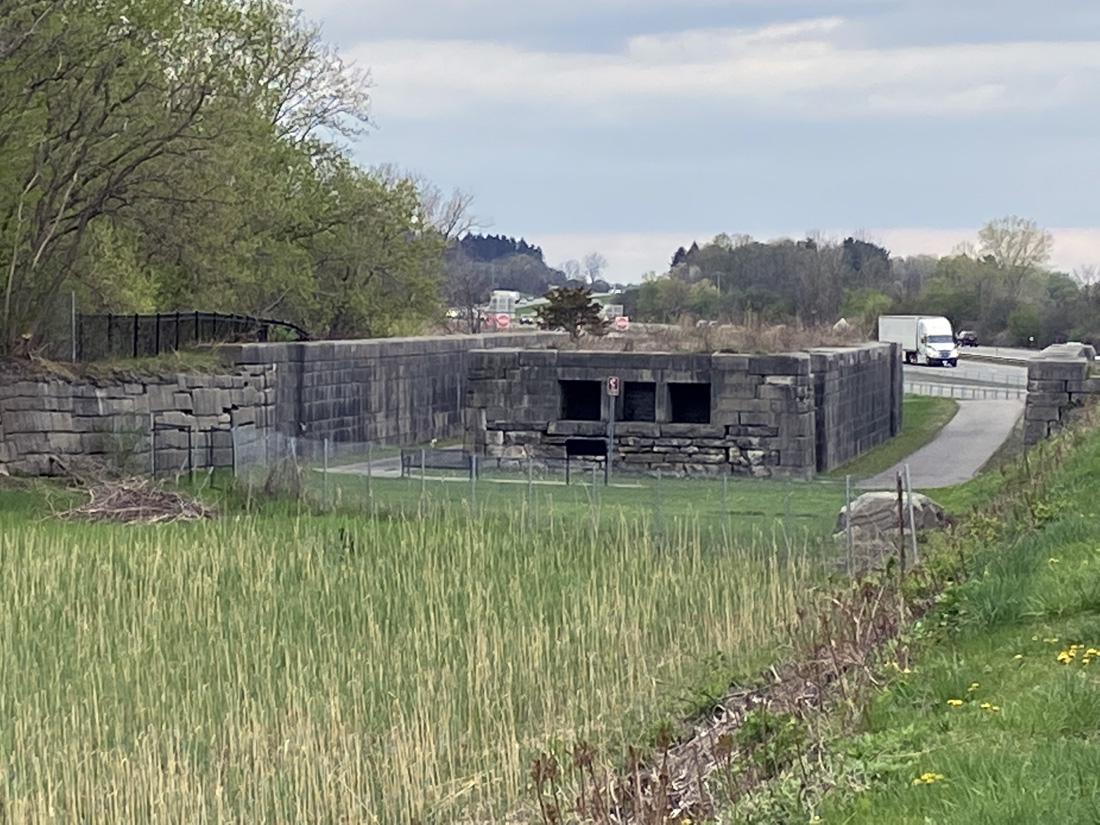
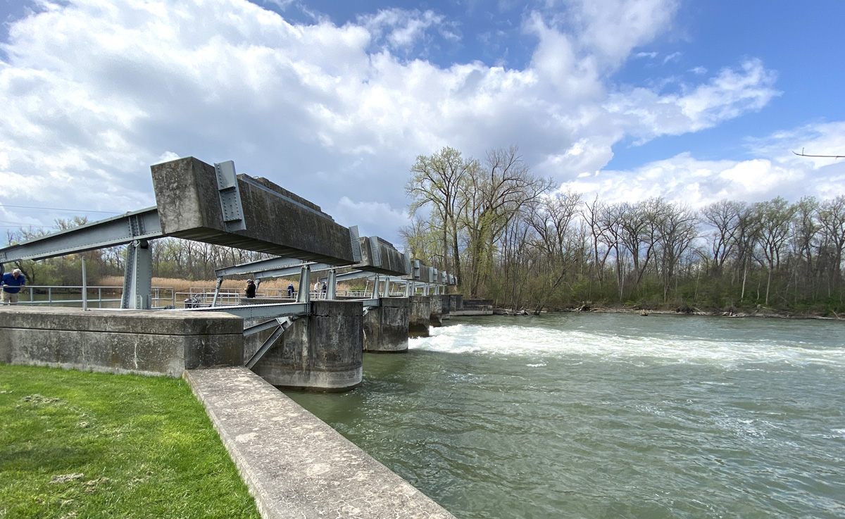
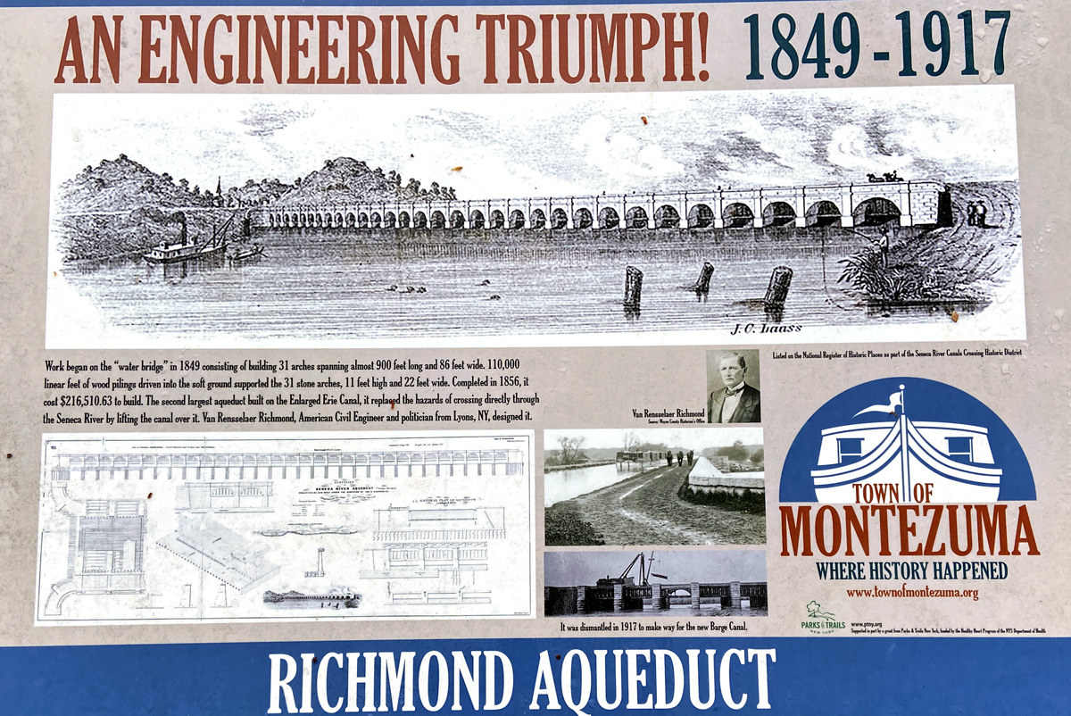
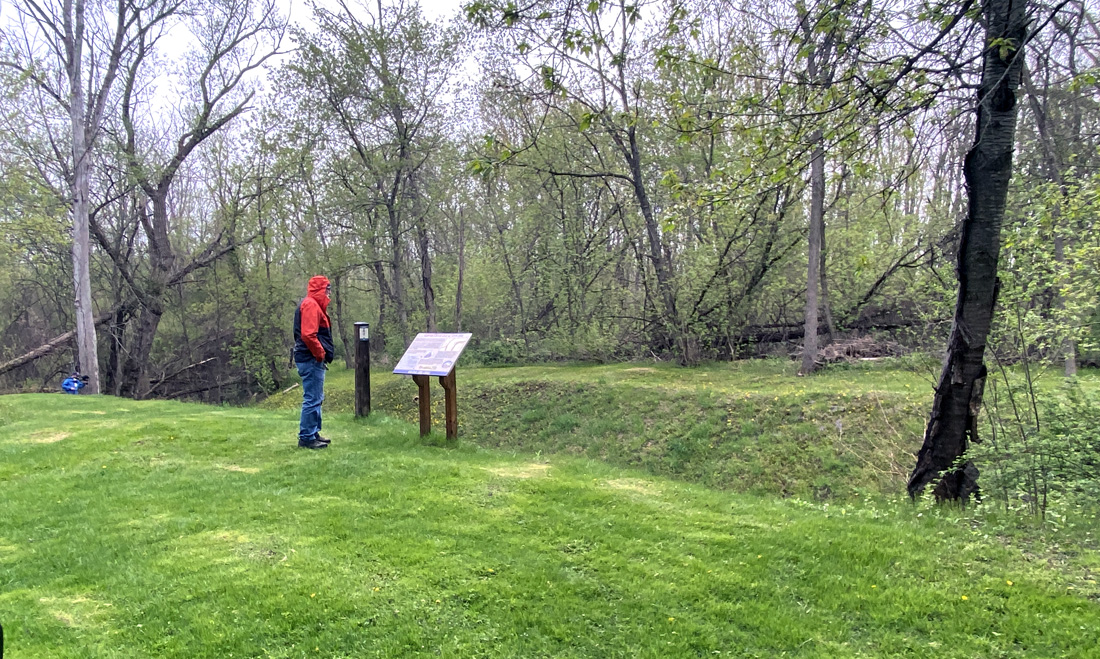
Next, the real highlight of the day – the Richmond Aqueduct over the Seneca River, and the original Clinton’s Ditch Lock 62 alongside the 1850s enlargement. We headed up to the entranceway for a hike down. There were golf carts, and with the leg pain I opted for a ride with my cane for rough ground. You may click on the sign to the left for a larger image.
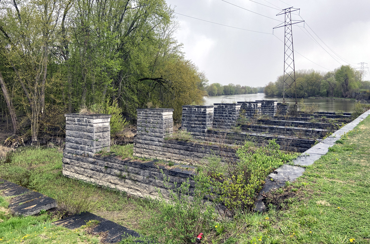
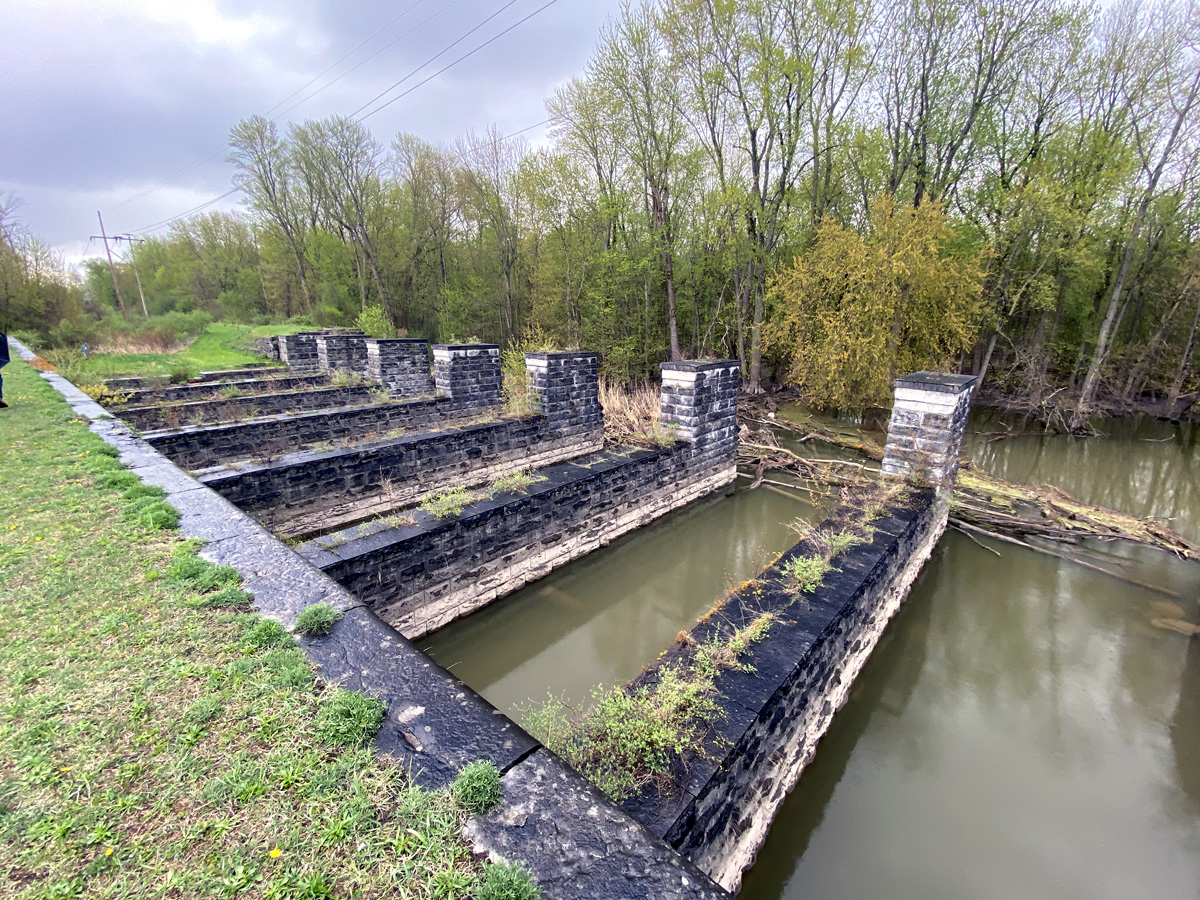
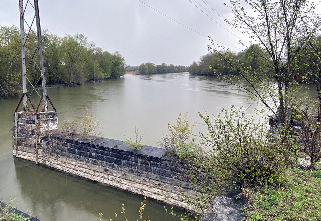
The site below of the lock on the original canal which emptied into the river. Canal boats then were pulled across the river to continue on in the original “ditch.” To correct that, the enlarged canal with the aqueduct was completed in 1856 becoming, “…one of the largest and most important structures on the Erie Canal.”
above and below you see the stone structure for the trough of the canal, and to the side the towpath which we could walk to the end. The structure complete across the river was removed ages ago for navigation.
below looking west
and here below looking east up the river.
sadly some miscreants decided this was a spot for their “art.”
and, below, RAB in the ATV getting a ride.
What’s Next? — Yes, what’s next. Thank you for getting this far – stay safe and well, as always, luv, RAY