Alright – setting the scene – I have been enjoying planning outings, but recently not always executing those plans. I will have an outing in mind, then change my mind wanting to just stay home. Tuesday 3 October, I had a plan when I woke up, but by 11:30 decided to stay home. That changed, “what are you thinking Ray, too nice out,” I heard BLUE BELLE crying from her stable. We backed out together about 1:30 for over three absolutely amazing hours.
This exploration came from my Train Trek on September 23. I really was not cognizant of the train track route from Gassetts, Vermont, to Ludlow, Vermont – shame on me. I knew there was a road off Route 103 as you climb the hill out of Gassetts past the quarry, once turned down, but now had to follow as it was along here we travelled on the train as it passed under Route 103 — RAY RECOMMENDS – MAKE THIS JOURNEY – NOW AS LEAVES ARE TURNING and again and again. I have tried to create a map of today’s 101 Kilometers (63 miles for those of you who drive American vehicles), and it is at the end of this post. A large version attempt did not work, but something small to put you in place is below.
here is the backside of the remaining Gassetts freight station, the other side is on Route 103 where the stone company is – yes the tracks on the right.

watch carefully for the turn after you climb out of the pass, and as you go down Cavendish Road this is your view approaching the Williams River.
I have tried to find when this road was built, and when Route 103 was built. No dates I can find, but analyzing maps, aerial topography, this was probably the least grade to build a road, and then in the 1840s the railroad. Route 103 to the west of Cavendish Road and the mountain is a greater incline and rugged as you drive up that hill, and built more recently. Hopefully correct reasoning, I am satisfied now with this explanation.

and looking down the river towards the train bridge.

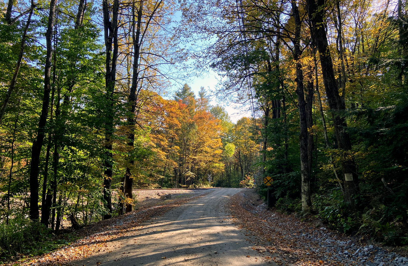
lets talk rural, dirt roads, seldom travelled, and grade crossings – little used tracks, but DO “Stop Look and Listen” Remember “to click” my galleries for larger views.


I bet there are very few people who have found this off the beaten path, but so close a scenic route. Did I say BB2 prefers dirt roads?

This rail line was completed in 1849, and I will bet this underpass dates from that time.

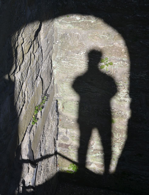
and, once through, and looking back, using “selfie mode” here is what I captured —

arriving in Cavendish proper on Route 131, I also recommend you take some time to look at the amazing architecture in Cavendish on Route 131. Found this link for some examples and photos.
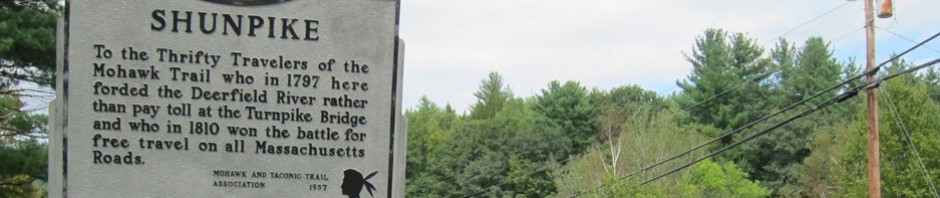
I then turned left towards Proctorsville – a village in Cavendish, and the site of my first “on-the-road shunpiking post” April 10, 2011. In Proctorsville, I crossed the tracks, and made the first left on Pratt Hill Road. I did not turn left on a dead end towards the tracks, but continued on – OPPS – “Not a Through Road.” You should know that does not stop me, I need to know the end. I knew there was a state forest in the area, and soon saw a gate – BUT OPEN. I start climbing, and climbing a mountain . BLUE BELLE in second gear is loving it, never such an incline. It has to end somewhere, then I will turn around. Well finally a spot I could turn around – yes I find roads – or in this case unmarked paths – not big enough for two cars to pass, even if one is a little MGA. I open the WAZE app on my phone, and amazingly have a connection – I should have taken a screen shot to share – but alas, you would have seen my location and white space (no roads) all around. Now, that only happens for Ray, a couple appears hiking up the mountain. We chat – they are from San Francisco, but did not walk across country but on an “inn to inn” hike.

fun chatting, they had come up the mountain from an open gate. They said eventually I would see Densmore Road to civilization – remember “civilization” is a relative term in God’s Country here. “Oh,” they continue, “we have friends behind us a ways, tell them we are all right.” Saying goodbye, and heading down hill, I saw their friends, and passed on their message.
Well, for the railroad to get to Ludlow, I now know why it went this route to Cavendish first (many mills there) but mainly because of the mountain which is now Proctor – Piper State Forest covering 1,513 Acres of steep to moderate terrain. Various websites say – Remnants of extensive Civilian Conservation Camp (CCC) picnic sites and trails and the original CCC camp can be found throughout the forest – that means more trips, albeit with walking stick (cane). Just found on the Town’s website – “In 1914, an important asset for the town was created, Proctor Piper State Forest, with the donation of 424 acres. A second gift from Leon S. Gay in the mid-30s added 300 acres, and additional purchases of property added another 700 acres. The property today is host to a wide variety of wildlife and recreational activities including fishing, snowmobiling, hunting, and trapping.”
Soon, “the main road” – again a relative term.
we came the other way before, but in this direction, the “grade crossing has a grade” Yes, YIELD to trains.

and, heading now in the opposite direction on Cavendish Road approaching the river and Route 103.

and, again crossing the Williams River.

I tried to recreate a detailed map for you, but alas, failed. Below is however an image from the Vermont State map to put you in the correct locale. You can see the train tracks out of Gassetts, and remember to look for the hidden sharp right onto Cavendish Road. I have given the route above, and you will be fine. But, if getting lost, that is part of SHUNPIKING, and I have never not gotten home – always eventually find a familiar intersection — enjoy, and get out there – luv, RAY

and do not forget to enjoy — PUMPKIN PURSUIT – PLASTIC PREFERRED