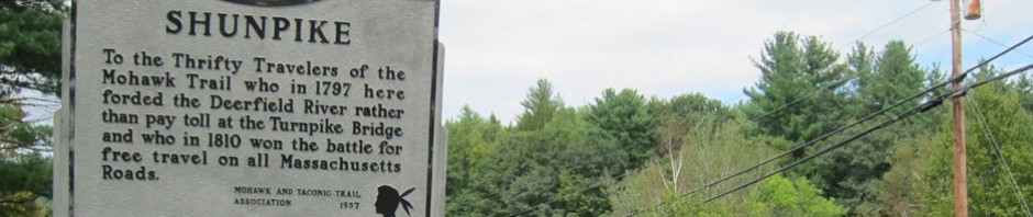
BLUE BELLE knew that I had just worked out a day’s jaunt and begged me to go out yesterday. But I finally convinced her that “Tex the Weatherman” (she can relate to that time period) suggested that today, Sunday would be the perfect day for exploring — and it was.
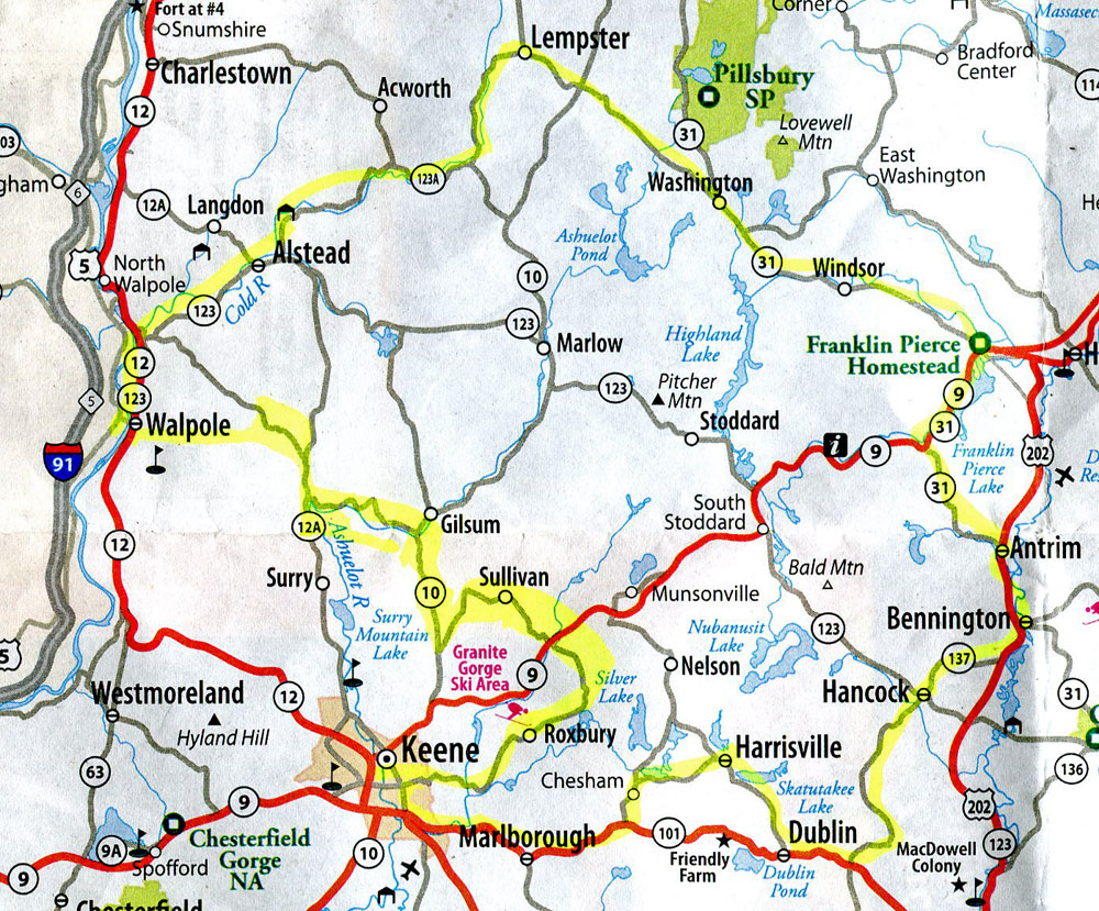
The plan was simple, and I had highlighted it on the map. Sullivan and Roxbury I had never seen, BLACK BEAUTY has had lunch in Harrisville, but not BLUE BELLE. And, Franklin Pierce’s Homestead in Hillsborough has been “on the list.” LADY RAB backed out to allow BLUE BELLE to exit (she is jealous), and off we headed at 10AM. In case you did not get your map out, here is my marked up map (click to enlarge) but there were some diversions. You will want to take this trip — or join me for a redux.
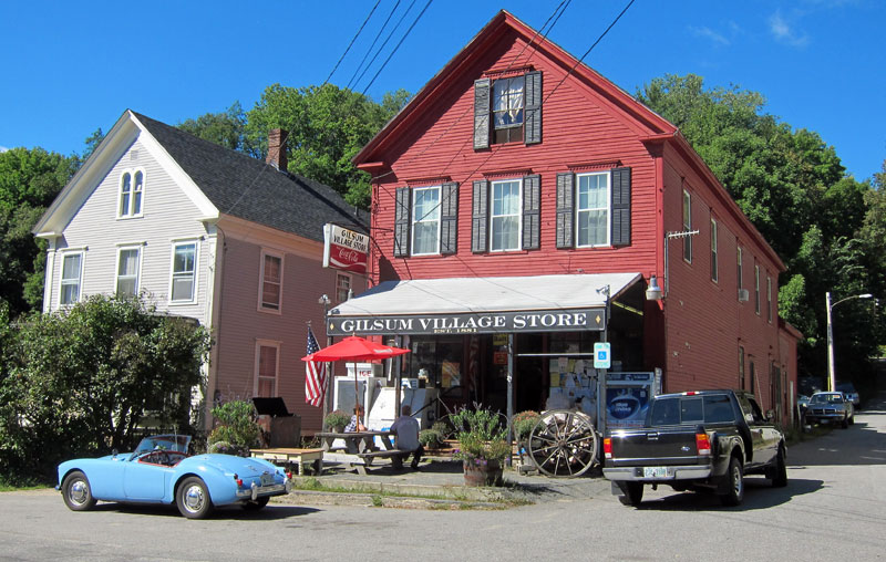
I first headed over the hills of Walpole, then down 12A to Surry for the cutoff along a fantastic river (no guard rails, no speeding here) to Gilsum. Knowing I like country stores, BLUE BELLE wanted to stop at the Gilsum store for a “selfie” (a pattern she demanded for the day).
We asked the folks at the table where the turn for Sullivan was. 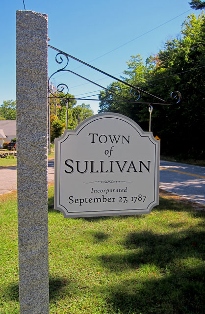 “Head south on Route 10,” I was told, “and turn left at the log cabin.” Sullivan is one of those towns that you will never see unless you go there. It is not on the way to anywhere, you can get there from here, but there is no need to. So, since you have never been there, and probably never will, here is what we discovered.
Here is the Civil War monument in the “center” of town. The residents lost were engraved in the monument with the battle they were lost in and age and date.
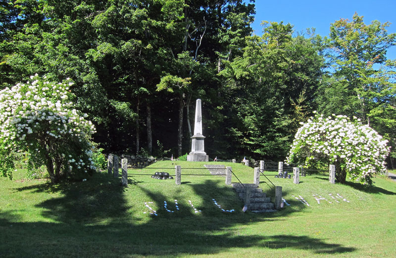
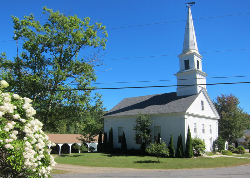
The Congregational Church and the horse and buggy sheds that still exist.
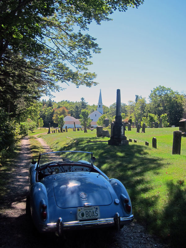
I could not resist touring the cemetery. A great picnic spot (hint).
As I mentioned, Roxbury (population about 220) was one goal, but hard to find on my maps believe it or not. When I got to Route 9 I turned left to Concord, and took my first right towards the Apple Hill Center for Chamber Music. I had never been down that road, and hoped it would get me close to Roxbury Center. Well, fantastic isolated dirt road requiring 2nd gear, and once 1st gear to get over a hill. Great views, and all of a sudden I ended up in Nelson. Toured the cemetery – getting to be a habit – and once in the village (no country store) went back to Route 9 to head back towards Keene and the road (hopefully) to Roxbury Center.
Must confess, I turned on my iPhone to use the maps app to find out where I was and which road to take. Alas, I arrived in Roxbury.

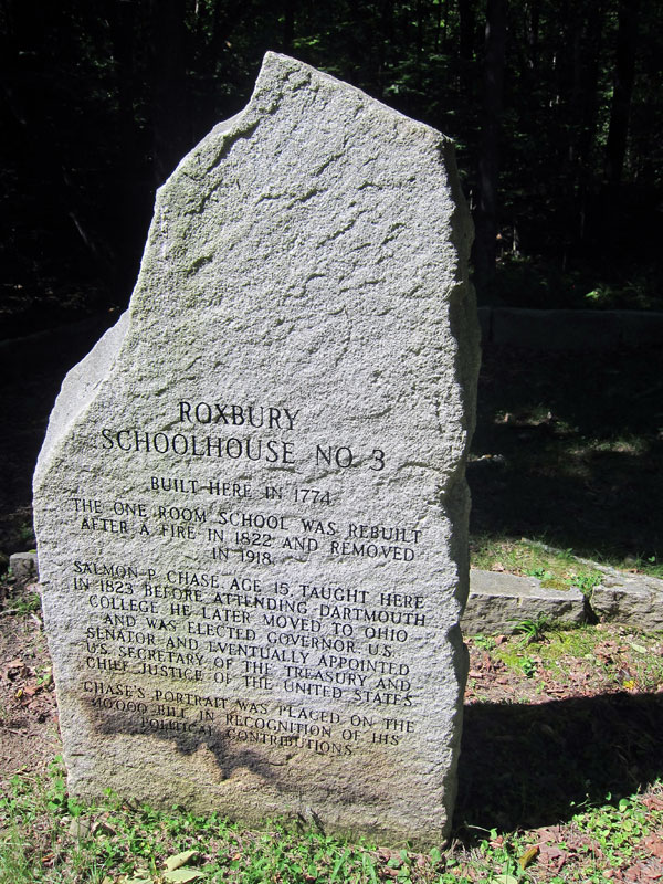
But I wanted to see Roxbury Center which I saw on the maps app, and I figured must be the center of Roxbury civilization (BLUE BELLE was hoping for another country store selfie). Following the route we first came upon the marker for the old school house and its importance since Salmon Chase (check him out) taught there.
Then I came upon the site of the old church.
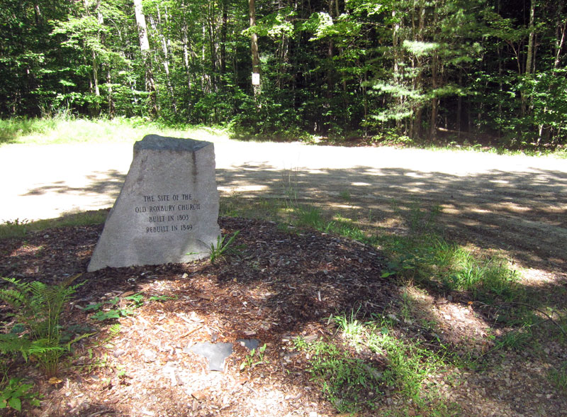
But, where is the village itself? I did read that Roxbury was a ghost town – read this website – yes, click on this link I have for you.
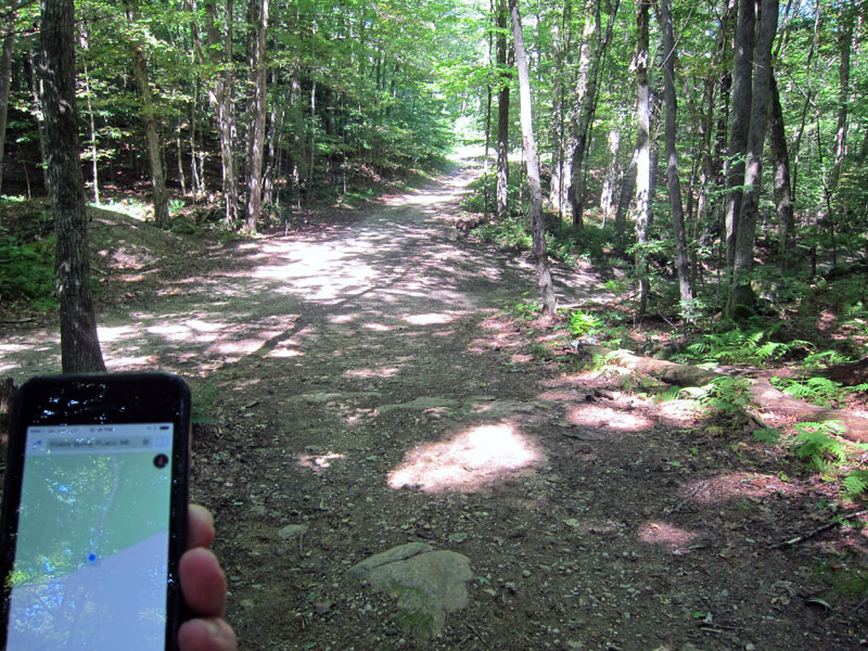
The road sort of ended at the church site and was posted. BLUE BELLE was worried about her low slung exhaust system, so she stayed back as I hiked along the path that the maps app indicated was a road. Soon, according to the maps app on my iPhone coordinated with GPS — I was at Roxbury Center at the junction of five “roads.”
Other than stone walls through the woods, here is the only remnants of a village that I saw.

Well, checking iPhone maps I found I was a short distance back to pick up Route 101 in Marlborough, so off I went to pick up 101 and head east to the western most turn towards Harrisville – the lunch destination. Yes, BLUE BELLE demanded another “selfie.”
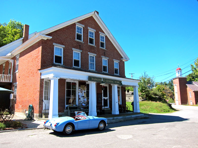
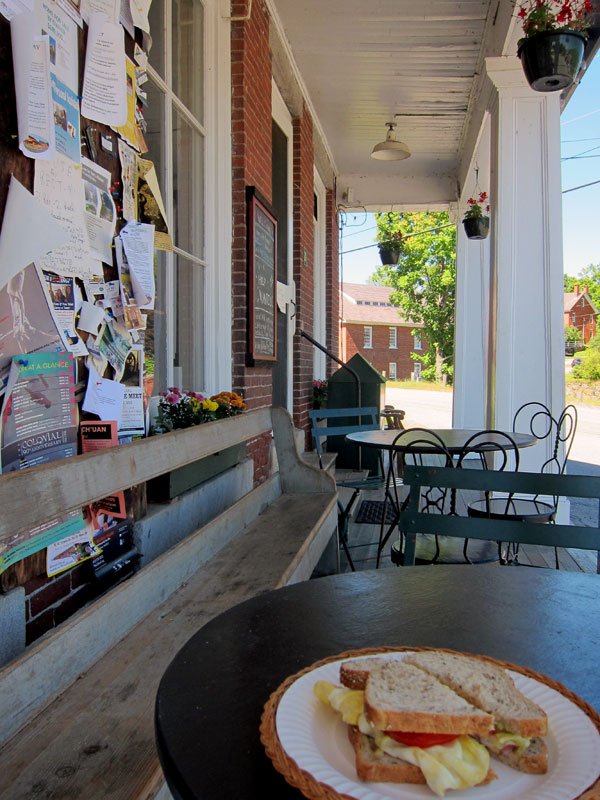
And, as planned, I had lunch on the porch.
Harrisville has been “on the list” for detailed exploration (with my cameras) of its old brick factories and buildings and ponds. This is NOTHING — I need to spend hours to do Harrisville justice.

Heading out on the eastern entrance to Harrisville we got back to Route 101 in Dublin and headed east to turn north on Route 137. Sadly never been on this road before towards Hancock and Bennington. RAY RECOMMENDS – follow this route, in fact all of this day’s route.
In Hancock BLUE BELLE insisted on another “selfie” and turning around we could see the Hancock Inn. The inn has original Rufus Porter murals, and Cathy and I visited there when Dutchie was painting Rufus Porter-esk murals in a renovated suite. You cannot see on the sign that there is a Sunday buffet (another hint).
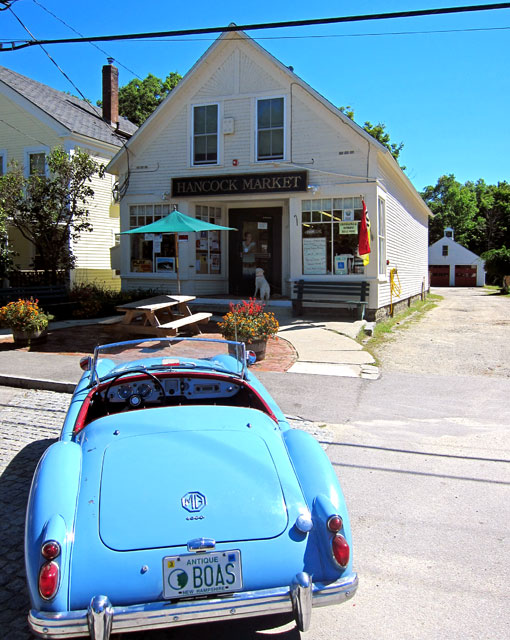
The Hancock Inn. Who wants to go when?

Route 137 dead ends on US Route 202 where I headed north (been a long time since on this stretch of 202). Bennington is just off 202, and of course we had to head into the village. My “date” insisted on another “selfie” and a fellow asked what we were up to. He approved.

We headed north on 202 to Antrim to turn left on Route 31. May I say (even without images) Antrim is a MUST VISIT for its charm and architecture.
The next stop on the day’s agenda was the Franklin Pierce Homestead, just off US 202 on Route 31. I am not even going to begin to discuss this site – it was fantastic. Brian, again age was a factor, and my admission was free, but this is not a case that you “get what you pay for.” Given to the state in 1925 and restored at that time, just hope you get Sara for your guide as she is absolutely fantastic with history of an 1804 home and the Pierce family. I learned so much, and could go again in a couple weeks and still be amazed. RAY RECOMMENDS – take in Franklin Pierce’s Homestead.

No cameras inside, so I bought this postcard to scan. The stenciling duplicates the original which is shown in many spots.

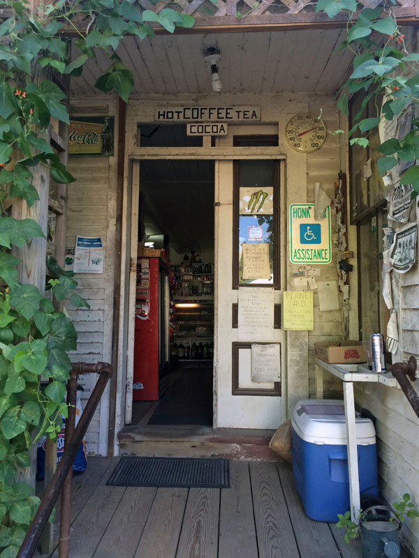
Alright, an hour and a half fantastic tour of this home, and it was 4 o’clock. Time to sadly head home (but I do love home). And, I headed out Route 31, first getting to the high Hillsborough village and its “country store.” BLUE BELLE again yelled, “stop!”

The entrance
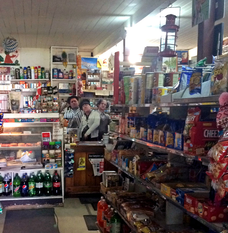
And, we were greeted only by Moe, Larry, and Curley.
I continue on Route 31 to Route 10 passing through Washington – a most beautiful (but isolated) hill town.
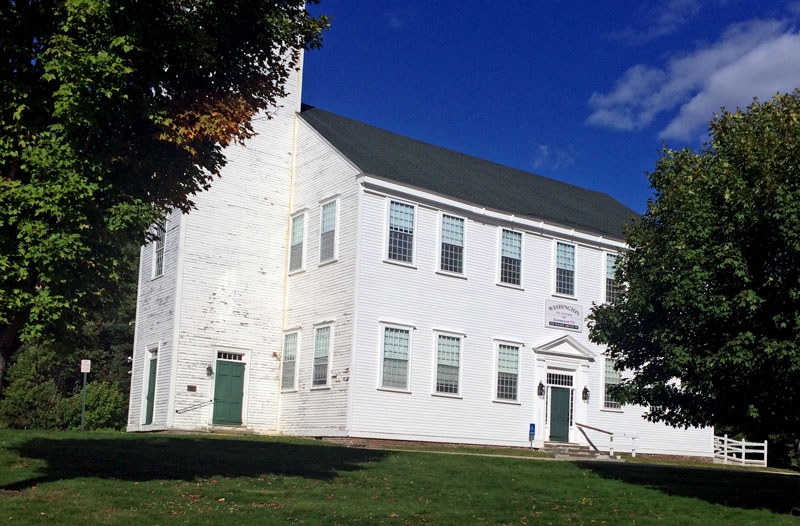
Washington, NH meeting house.
but when I got to Route 10 I realized that I had highlighted on the map a back road that I had not taken – bummer – and had not found. So, I just continued south on Route 10 but decided not to cut over on Route 123A that you hopefully saw I had highlighted. A couple years ago BLACK BEAUTY said, “never again, my bolts are hurting.” So, at Marlow I turned right on Route 123 (not much better, but not as far as wash-board) to head back home.
A very great day – 7 and 1/2 hours and 106 miles. And, I would happily do it again next weekend. So,
RAY RECOMMENDS:
1) Follow the route I just outlined
2) Have lunch at the Harrisville, NH Country Store and explore the village
3) Visit the Franklin Pierce Homestead – immediately


The Harrisville mill building is or was Filtrine Corporation which also ran the Elm Research Institute where they developed a fungicide to treat the Dutch Elm disease. I injected my big elms but they all died anyway, too little too late.
Great trou Ray, beautiful day for it. Picnic ir Hancock Inn for dinner anytime.
Carolyh
Hi Ray You sure do get around!
I am off to Saint-Gaudens today for the tour.
Roberta
.
Yet another wonderful commentary complete with photos of your beloved Blue Belle driving the highways and byways of America. Thanks for taking me along, Ray. Carol