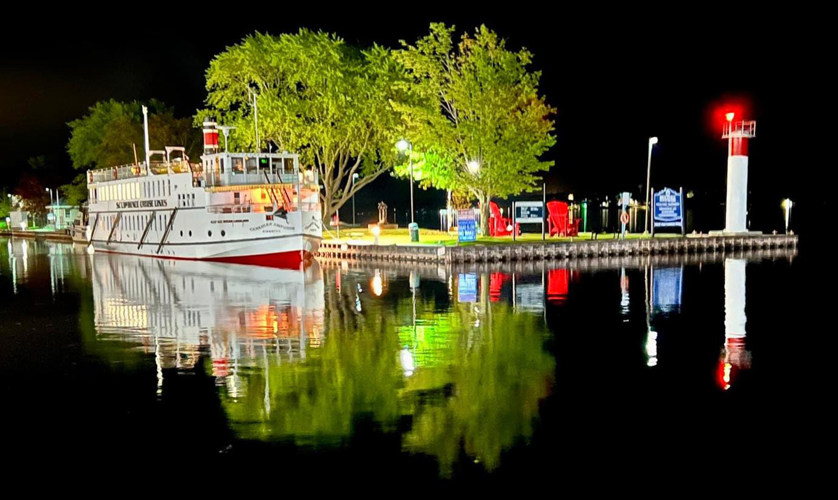
I know, I know. First off I have reported getting to this adventure, and home, but not the field trip itself; and, I know, I know, it is two months late. But never too late to show you my time again exploring with the Canal Society of NY State. The plus for me is to “relive” the experience, remember “I write to remember, but love to share.”
But, first, on Wednesday afternoon, 21 June I had my CT Guided Synovial Cyst Rupture, and all went smoothly again at Dartmouth Hitchcock Medical Center. Quick outpatient procedure, even though “put out of it” albeit for a short time. By Thursday morning pain gone in the back of my legs while trying to walk, and strength and stamina returning while standing and walking. Just came in from some yard work, and Thursday spent over an hour on my feet touring a garden with a group. No guarantee this “fix” will last long before another cyst moves into my spine, but “here is hoping.” I now feel confident about my next adventure, and the last two days completed arrangements.
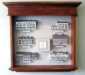
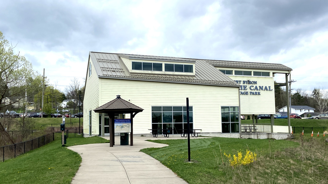
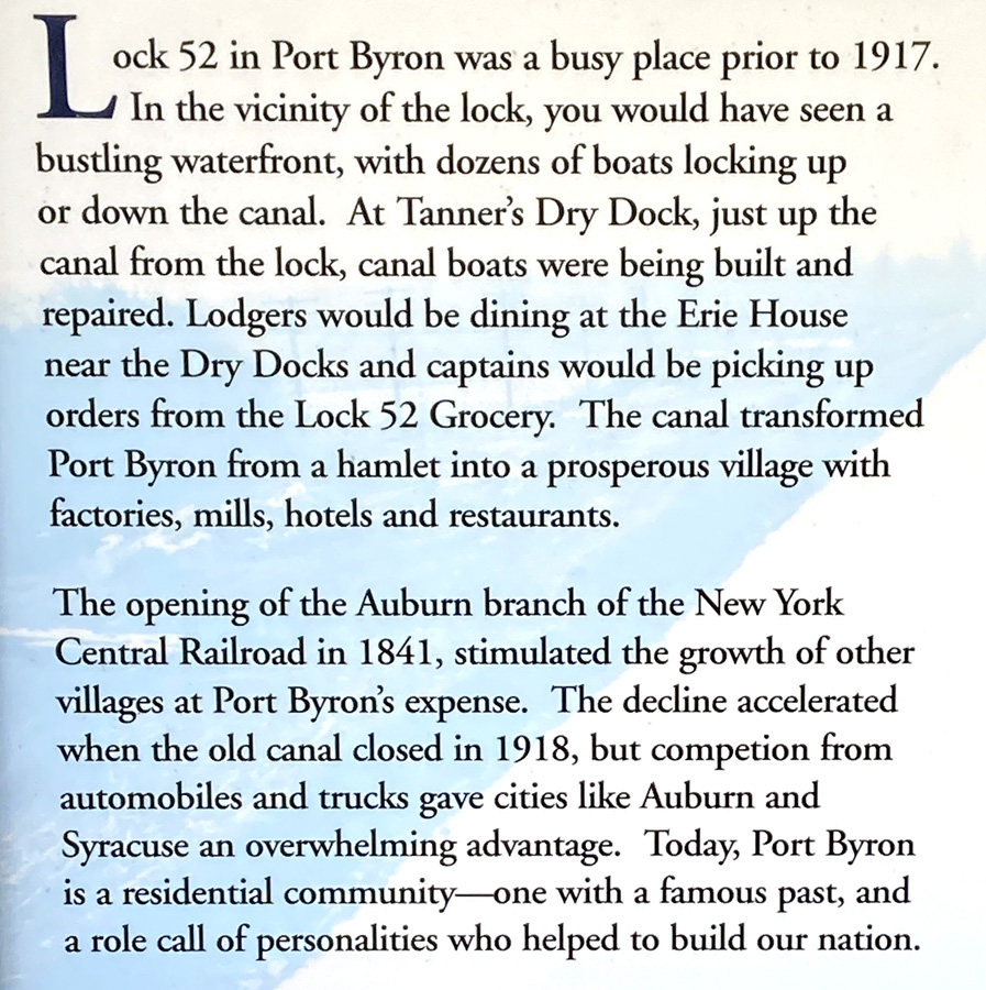
In preparing this post I finished relating the full day tour on Monday, and then realized that I left you hanging on Sunday 23 April pending my arrival for the afternoon with the group. Remember I ran hard in the morning turning over many rocks. So, Monday is below, and I will be brief with some fun images taken Sunday afternoon starting at the Port Byron Old Erie Canal Heritage Park. Remember, if heading east on the NY Thruway – STOP IN, or if on back roads in the Port Byron area, park, walk down the path, and STOP IN. This first image is the museum, looking back from the park walk from the lock.
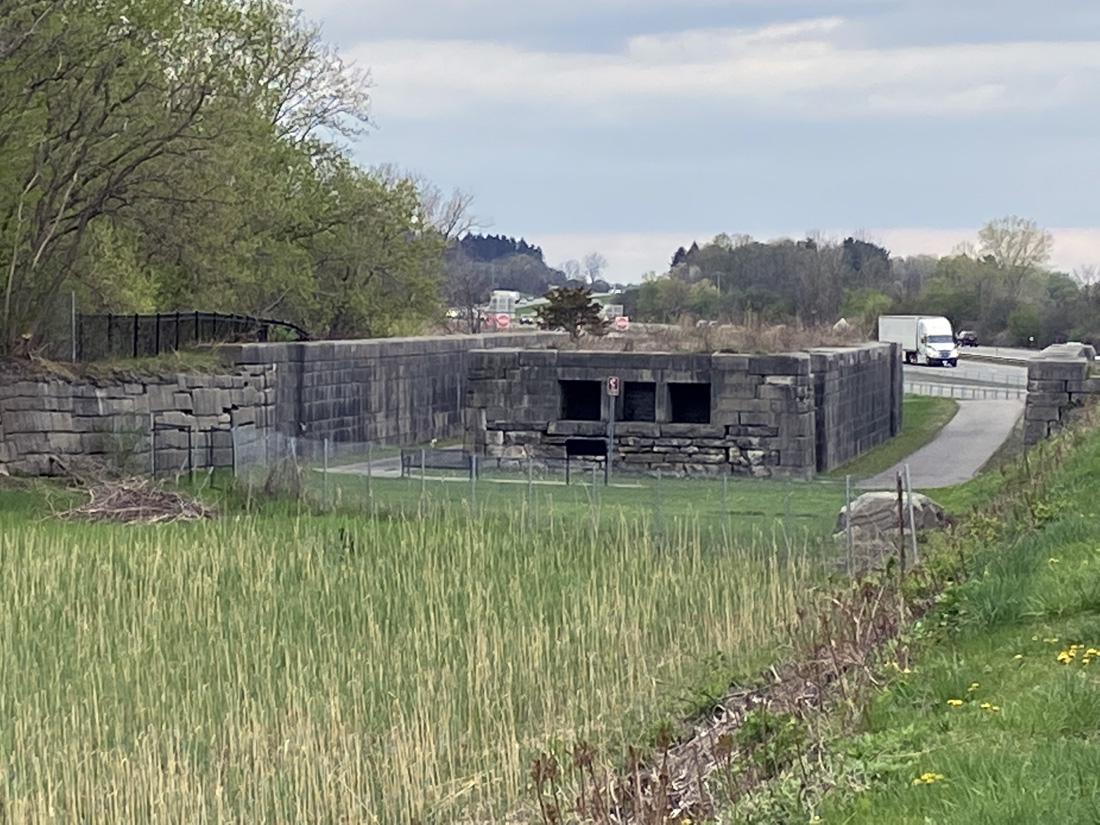
heading down the path to the original remaining buildings at this lock site, you pass the lock that parallels the NY State Thruway.

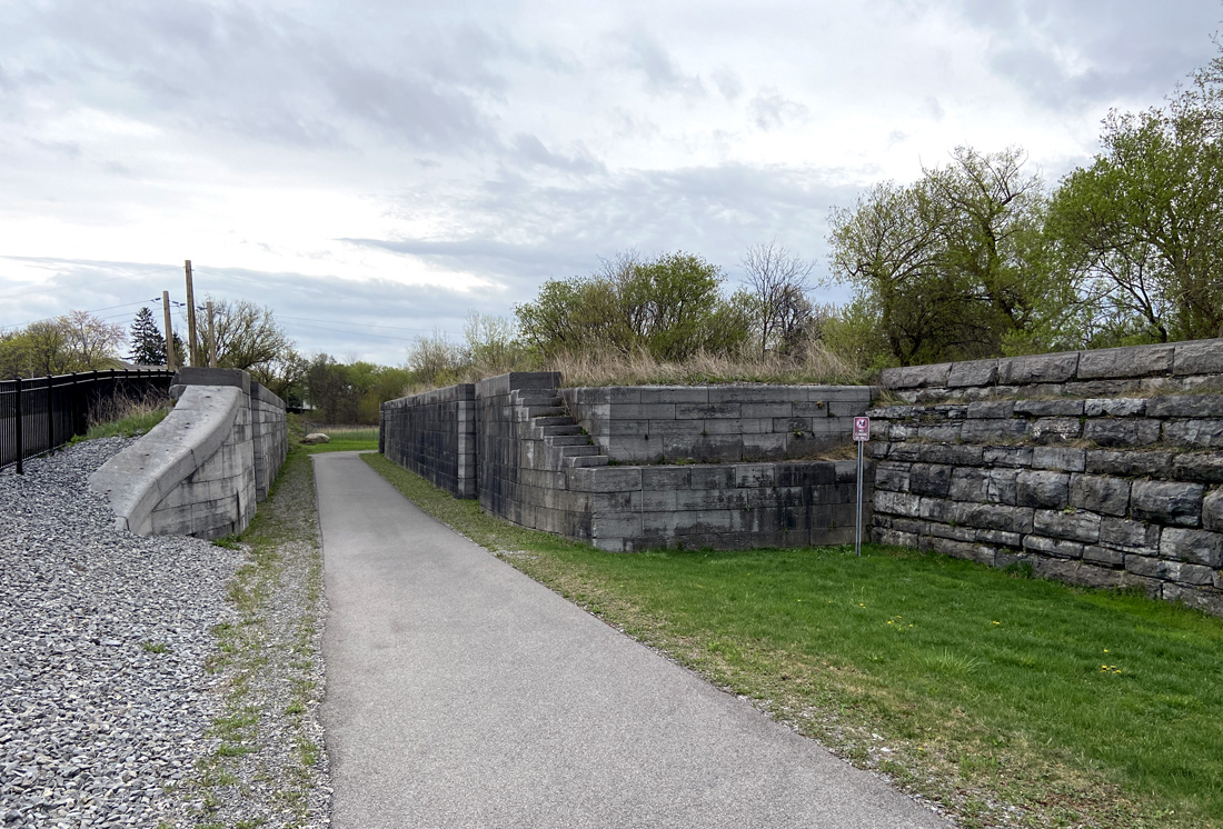
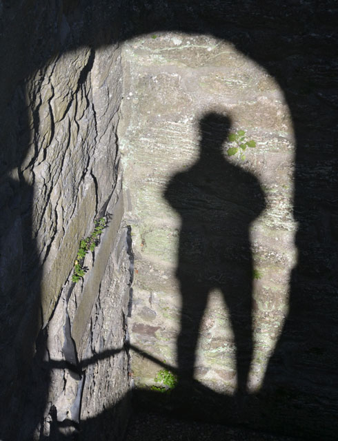
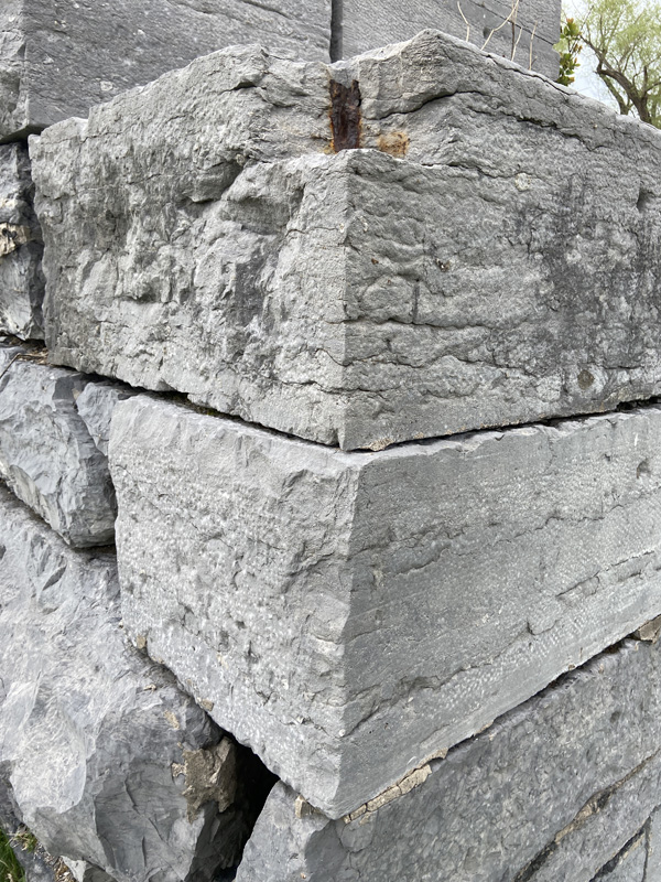
you may know one of the things I enjoy with images is texture – here is a corner of the lock.
below looking west, and yes, the Thruway with the truck heading east.
The Erie House was built in 1894 and it served as a canalside tavern and hotel. As a remaining treasure of canal days, it deserves a visit.
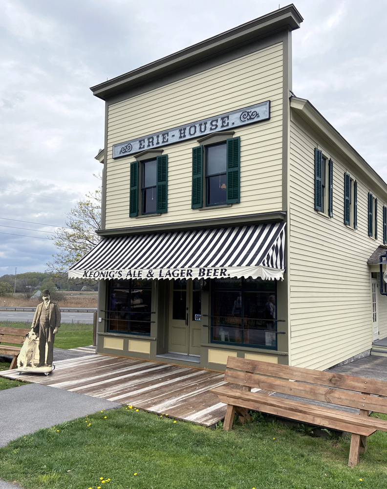
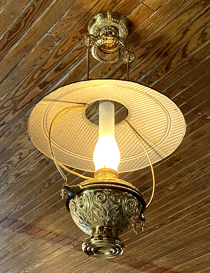
Below is a lamp in the Erie House. Since you should know I love old country stores, I will now share I have had two identical antique lamps like this hanging in my country store decorated book shop for now twenty-five years.
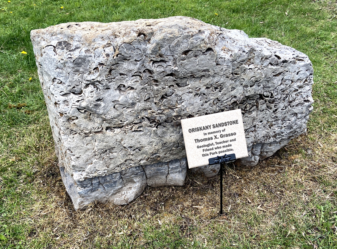
today the society was here to pay tribute to Tom Grasso for his years of dedication to the society, which was founded in 1956. This stone, packed with fossils was dedicated in tribute to Tom.

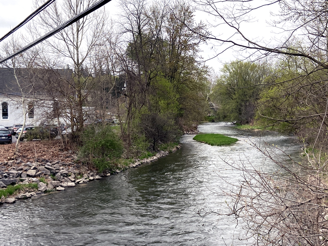
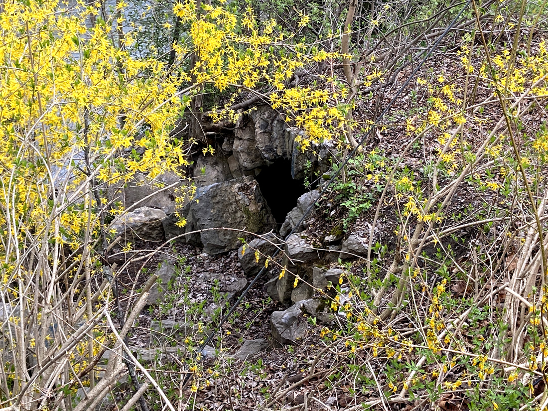
The society recently was able to establish a permanent site as a museum, library and meeting site for the society and community. We next assembled there at The Samuel Center for Canal History for a talk, and tour the grounds. The original canal towpath would have been right under the pulpit of this former church, and outside you can see the remains to a stone arch of the 1819 aqueduct. Below you see the former church, river, and next the stone remains along the bank (center of image directly below).l
amazing what still remains to be seen if you know where to look.
————————————— now to the full day
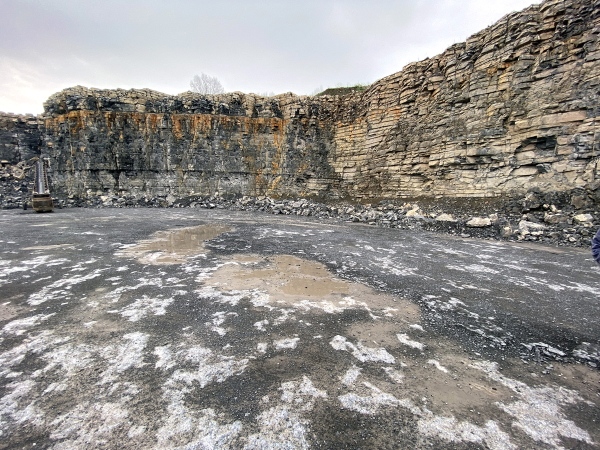
Monday, 24 April, was a full bus tour of Erie Canal sites in the Auburn and Port Byron area. We began at the Oakwood Quarry, opened in 1975. DeWitt Clinton explored this area while searching routes for the Erie Canal. Unique geology, and I want to learn more. Fossils abound – note the orange layer which is the result of ash buildup 390 million years ago – humbling and hard to comprehend.
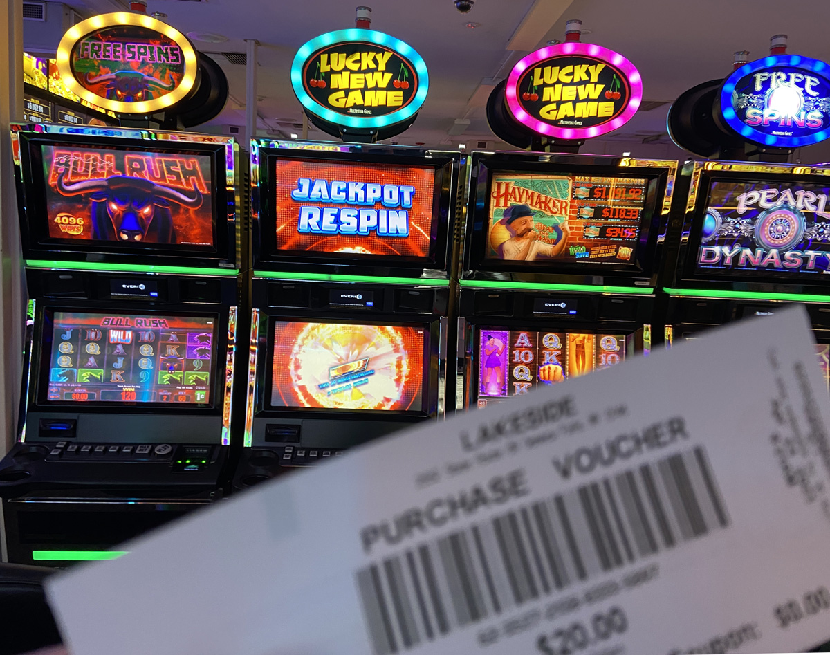
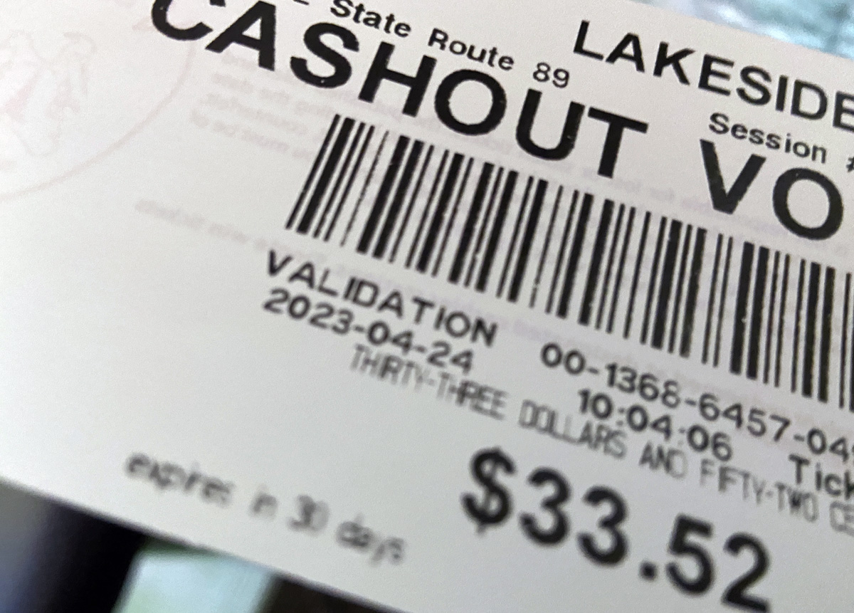
The area we are exploring is within the ancestral lands of the Cayuga Nation. We drove through the lovely landscape, and stopped and were welcomed at Lake Side Entertainment in Union Springs. A new building is being constructed, but the current entertainment (casino) is in a former auto parts store in a “butler building.” We were each kindly given a $20 voucher to “play.” I had no idea what to do, but figured out you put the voucher in the machine and push a button and watch the points and dollars go up or down. Push stop and a new paper voucher spits out with your “current monies.” In time I went to a machine in the corner, put my voucher in, pushed play, and the machine played for maybe ten minutes. Even pushing stop did not work, I thought I had broken the machine. Finally, wearing itself out, it stopped. The screen read $33.52. I figured, let me print the voucher, and cash out. THANK YOU.
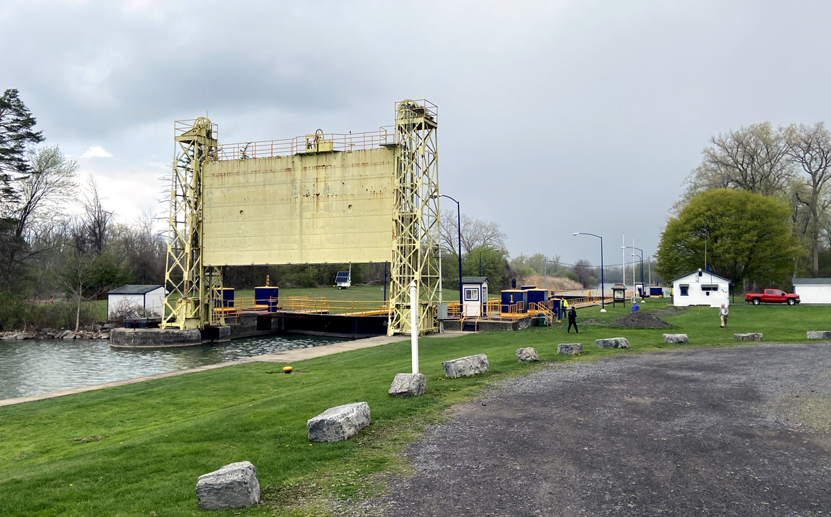
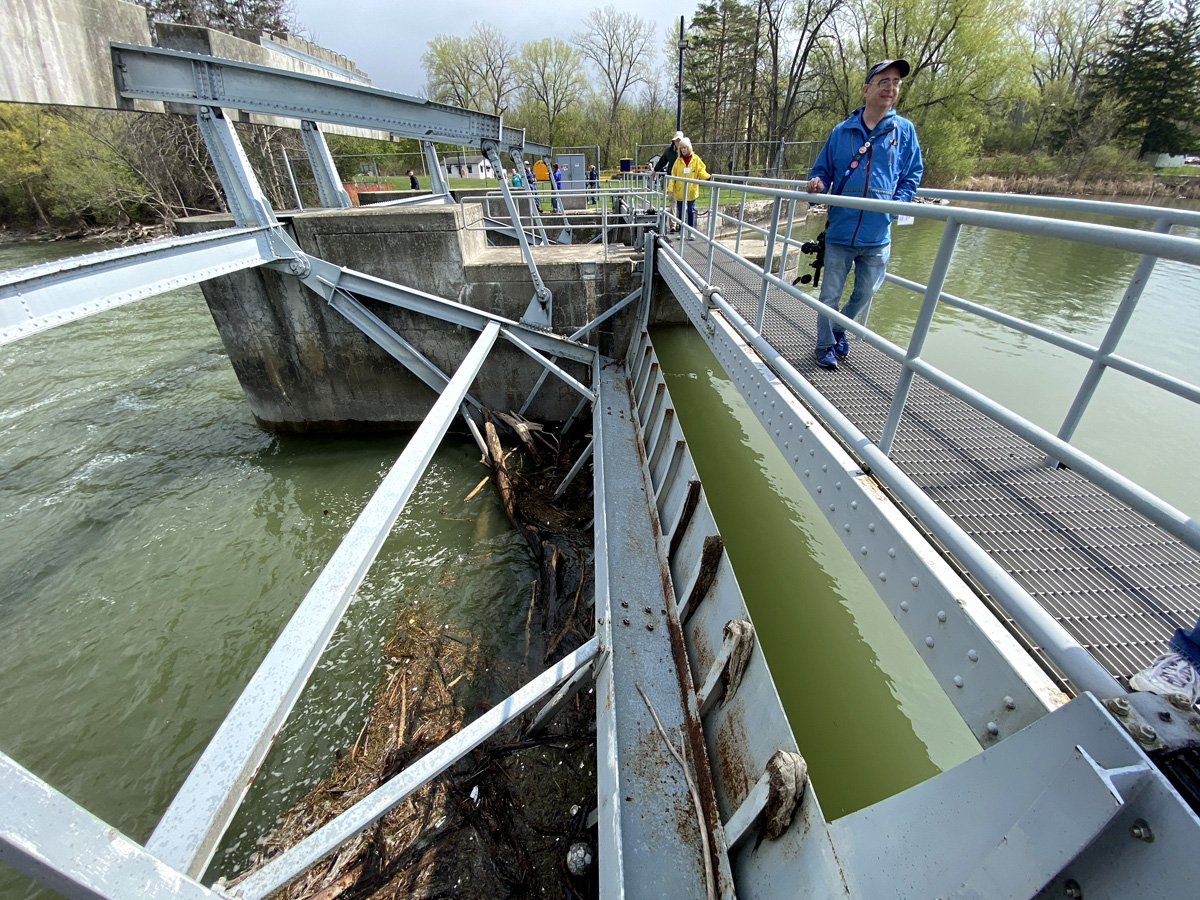
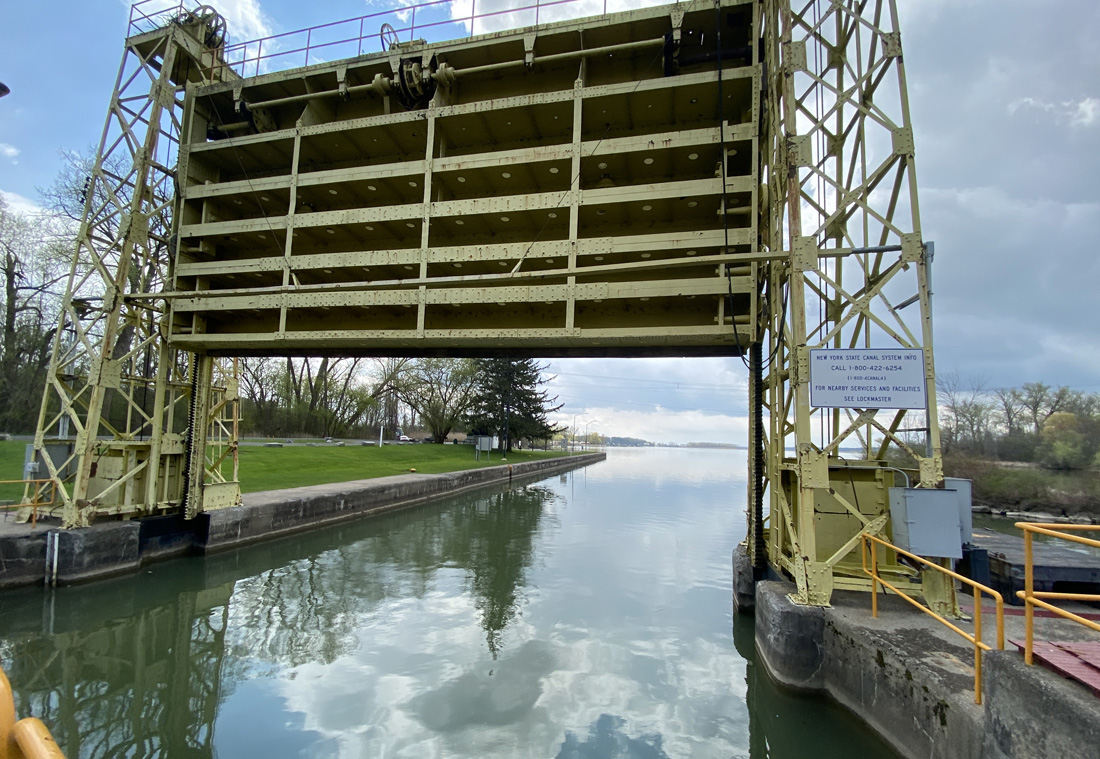
Below is the Cayuga-Seneca Barge Canal Lock, largely completed in 1916. This canal connects these two Finger Lakes, and flows north into the New York State Barge Canal just to the west of the Richmond Aqueduct ruins. You may recall on my way out I traveled again to Seneca Falls, and visited lock 2 and 3 on the canal. According to my notes on the tour, this Tainter Gate controls the level of the lakes and their flow, eventually to the Oswego River and Lake Ontario.
Here are images of Lock 1, and the gates that control the flow of waters.
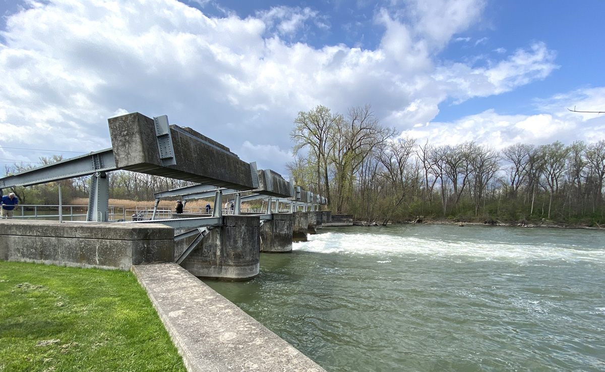
close-ups of the flow control mechanisms.
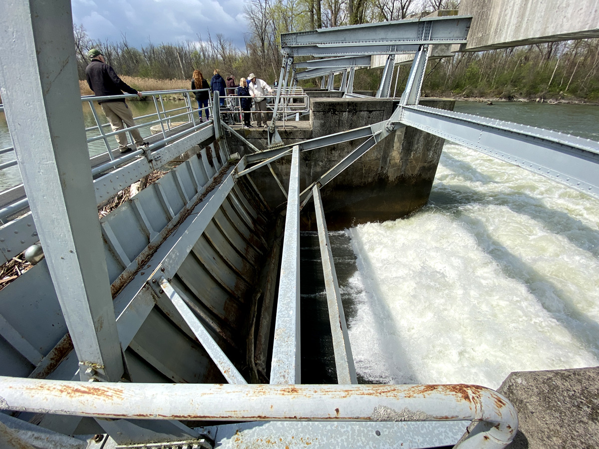
below looking south towards Seneca Falls and he lakes.
After lunch we headed to Port Byron, and Schasel Park (I had stopped there on the way out).
Looking east from the park, this is the enlarged canal from the 1850s, albeit blocked off. Efforts are underway to restore it for recreational use. The original canal was built to the south (to right of image) and into a hillside. When able to build into a hillside construction was only needed to one half of the excavation effort, building up on only one side – smart. Draining of canals in the winter kills plant life that if allowed to grow would clog the canals.

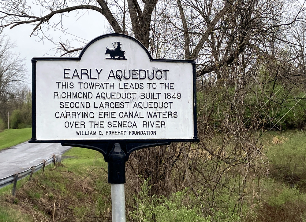
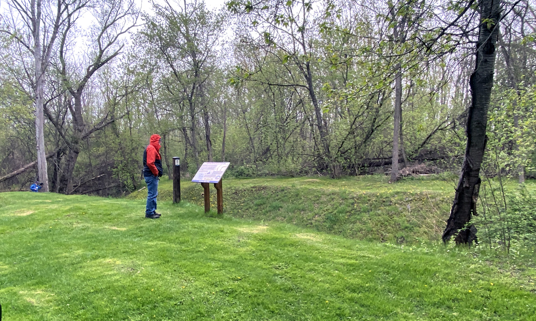
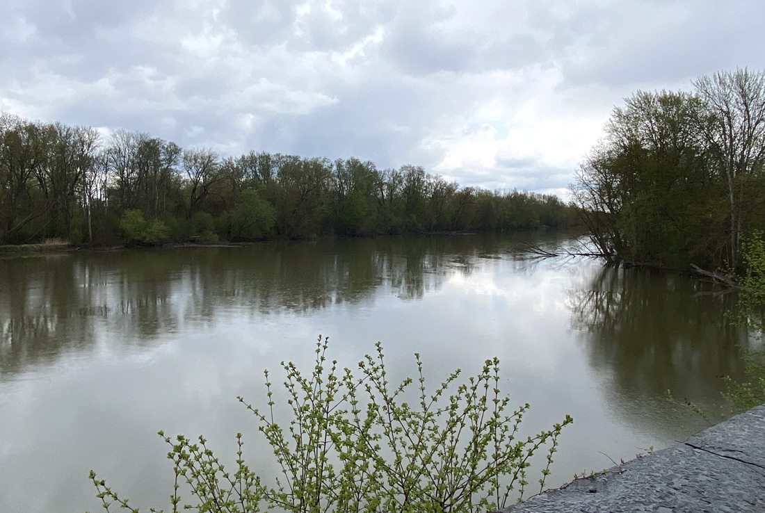
Next, the real highlight of the day – the Richmond Aqueduct over the Seneca River, and the original Clinton’s Ditch Lock 62 alongside the 1850s enlargement. We headed up to the entranceway for a hike down. There were golf carts, and with the leg pain I opted for a ride with my cane for rough ground. You may click on the sign to the left for a larger image.
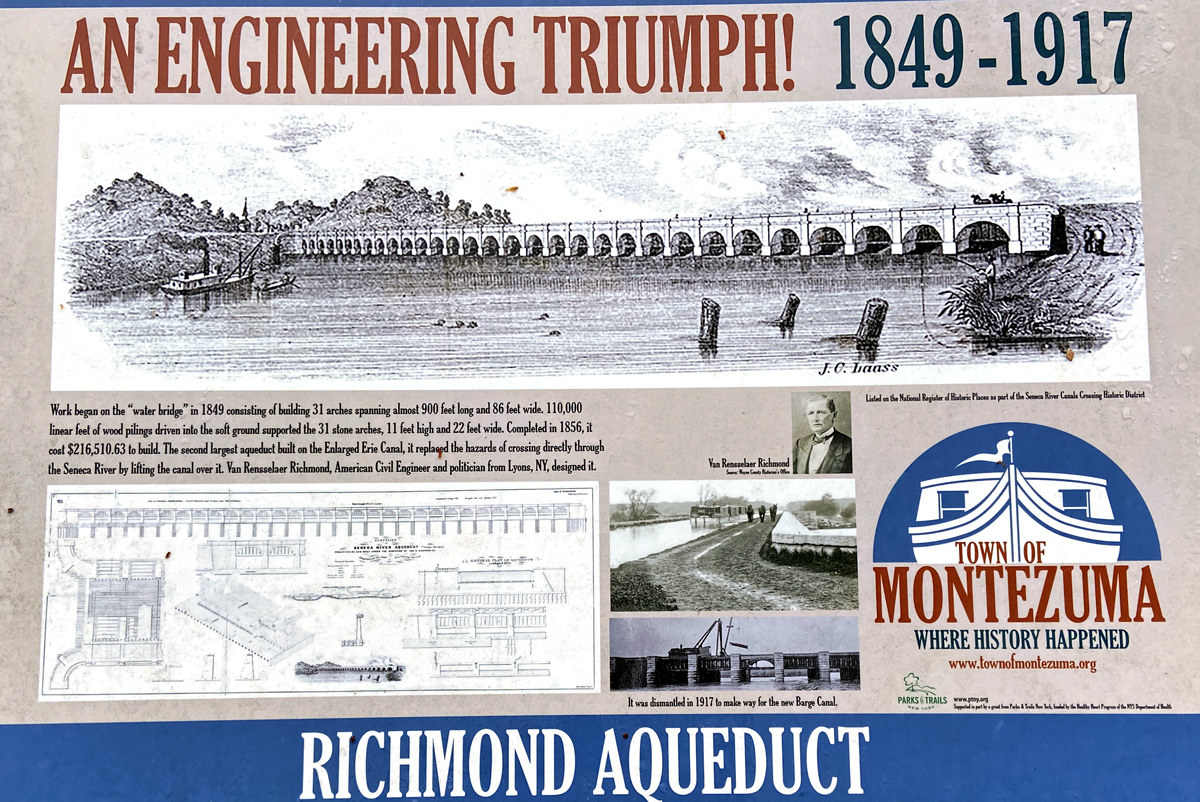
The site below of the lock on the original canal which emptied into the river. Canal boats then were pulled across the river to continue on in the original “ditch.” To correct that, the enlarged canal with the aqueduct was completed in 1856 becoming, “…one of the largest and most important structures on the Erie Canal.”
The images below of the Richmond Aqueduct give you a better idea of what I was trying to explain at the Nine-Mile Creek Aqueduct on 22 April.
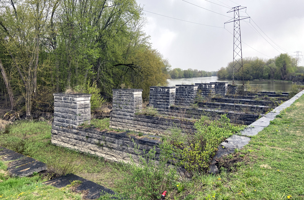
above and below you see the stone structure for the trough of the canal, and to the side the towpath which we could walk to the end. The structure complete across the river was removed ages ago for navigation.
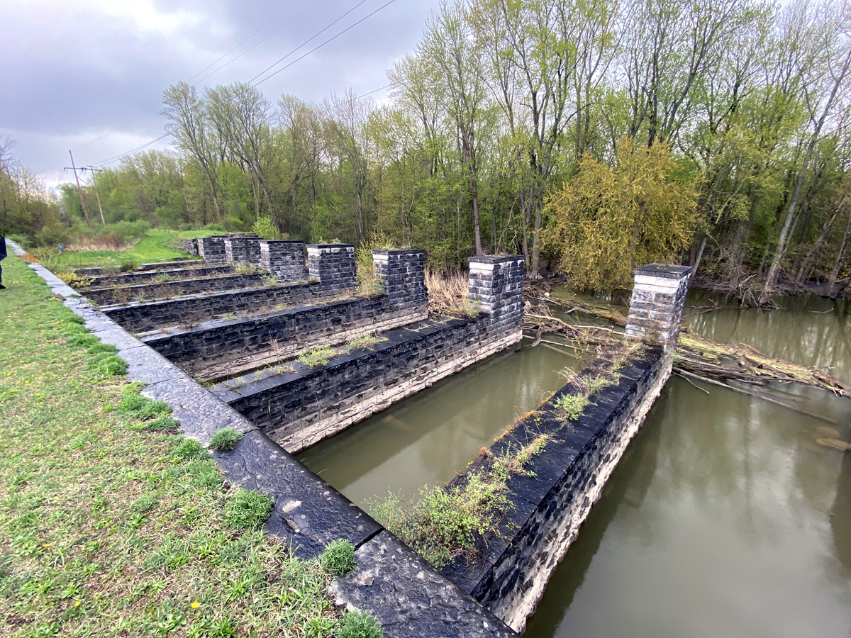
below looking west
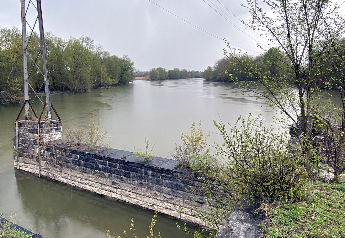
and here below looking east up the river.
sadly some miscreants decided this was a spot for their “art.”
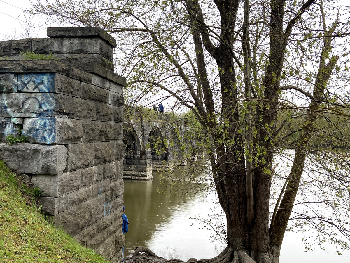
and, below, RAB in the ATV getting a ride.

What’s Next? — Yes, what’s next. Thank you for getting this far – stay safe and well, as always, luv, RAY